Basecamp
Sankri
Duration
7 Days
Max. Altitude
16,240 ft.
Distance
65 Kms
Grade
Difficult
Pickup/Drop
Dehradun
Bali Pass Overview
Bali Pass Trek – An Untouched High-Altitude Himalayan Expedition in Uttarakhand
The Bali Pass Trek is one of the most thrilling, scenic, and lesser-explored high-altitude treks in Uttarakhand, perfect for seasoned trekkers seeking raw adventure. Nestled in the Govind Pashu Vihar National Park of the Garhwal Himalayas, this incredible trail connects the majestic Har Ki Dun Valley to the sacred Yamunotri Dham, offering a unique combination of breathtaking landscapes, alpine meadows, glacial lakes, and spiritual experiences.
At an altitude of 4,940 meters (16,207 feet), Bali Pass is not just a trek—it’s a high-altitude adventure that challenges your endurance and rewards you with views of legendary Himalayan peaks such as Swargarohini (I, II, III), Bandarpunch, Kala Nag (Black Peak), and Yamunotri Glacier.
What Makes Bali Pass Trek Special?
Unlike popular commercial treks, Bali Pass retains a sense of remoteness and raw Himalayan charm. The trail winds through dense pine and oak forests, grazing meadows, Himalayan villages, and glacial valleys, making it one of the most picturesque and untouched treks in India.
Cross a high-altitude Himalayan pass at 16,207 ft—an achievement for any serious trekker.
Camp near Ruinsara Tal, a magical glacial lake reflecting the surrounding snow-capped peaks.
Experience the culture of remote Himalayan villages like Taluka, Seema, and Osla.
Visit Yamunotri, one of the Char Dhams, at the end of your trek—blending adventure and spirituality.
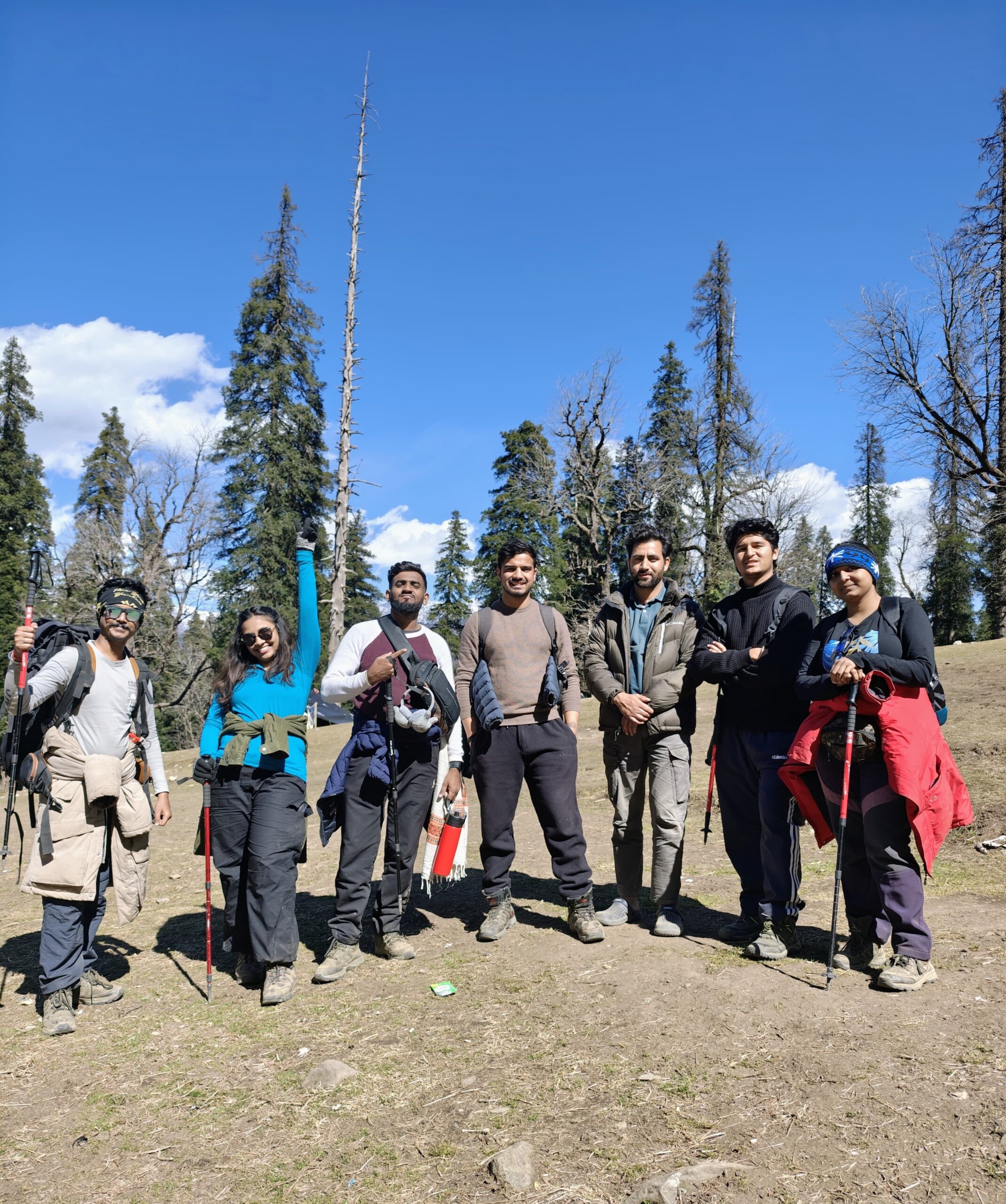
This trek is ideal for experienced trekkers, photographers, Himalayan explorers, and nature lovers who want to escape the crowds and immerse themselves in pristine mountain landscapes.
Bali Pass Trek Route
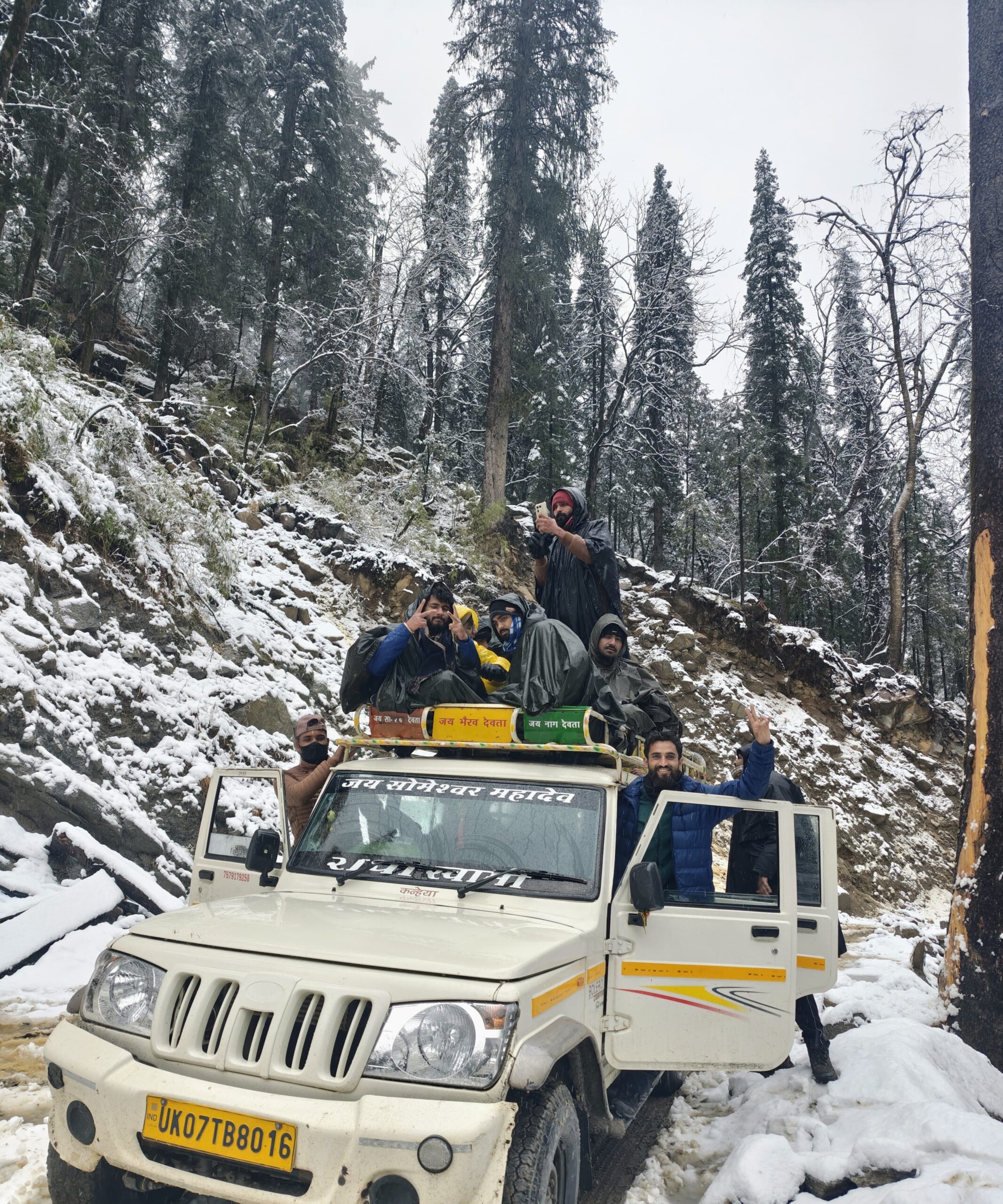
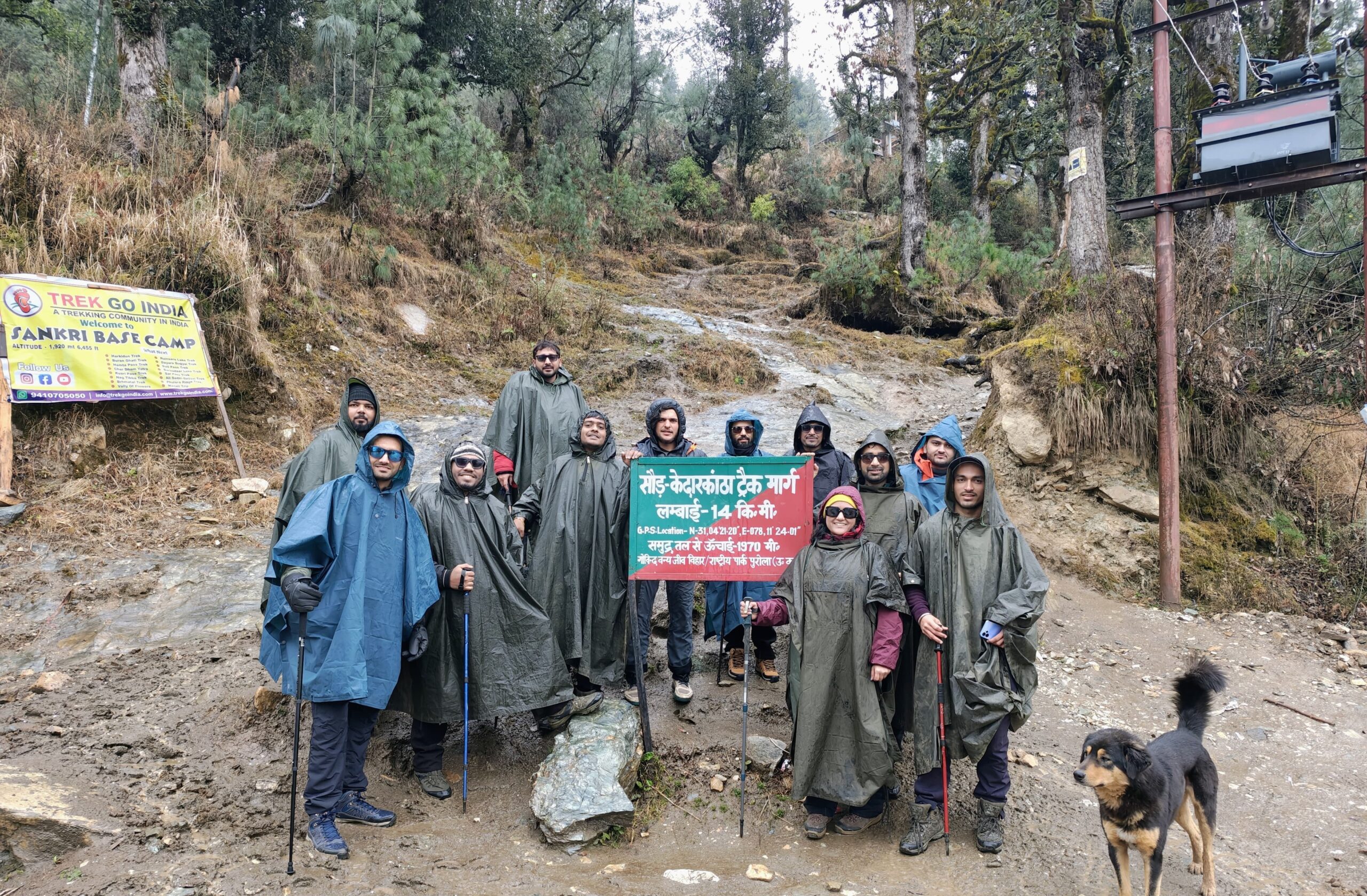
The journey begins from Sankri, a small scenic hamlet in Uttarkashi district, which serves as the base camp for many popular treks like Har Ki Dun, Kedarkantha, and Phulara Ridge. From Sankri, you drive to Taluka and begin the trek through the river valley of Tons, passing through Seema, Rainbasera, and finally reaching the stunning Ruinsara Tal.
From there, the trail climbs steeply to Odari campsite and finally to the Bali Pass summit. The descent is steep and technical, eventually reaching Lower Dhamni, from where you trek to Janki Chatti, close to Yamunotri.
Trek Facts at a Glance
| Detail | Info |
|---|---|
| Altitude | 4,940 m / 16,207 ft (Bali Pass Summit) |
| Total Trek Distance | ~66–70 km (round trip) |
| Trek Duration | 8–9 Days |
| Starting Point | Sankri (via Dehradun) |
| Ending Point | Janki Chatti (near Yamunotri) |
| Trek Difficulty | Difficult |
| Best Season | May to June & September to October |
| Trek Type | Crossover (starts and ends at different locations) |
| Trail Type | Forests, rivers, alpine meadows, glaciers, high passes |
The ideal time to do the Bali Pass Trek is during the pre-monsoon season (May–June) and the post-monsoon season (September–October). These months offer:
Clear skies and excellent visibility of Himalayan peaks
Manageable snow levels at the pass
Blooming alpine flora around Ruinsara Tal
Safer trail conditions compared to the monsoon
Bali Pass Short Itinerary
Day 1: Dehradun to Sankri (Drive)
Distance: ~200 km
Drive Time: 8–9 hours
Altitude: ~1,920 m
Highlights: Scenic journey through Mussoorie, Yamuna & Tons valleys
Stay: Guesthouse / Homestay at Sankri
2: Sankri to Taluka (Drive) → Trek to Seema
Drive Distance: 12 km | Trek Distance: ~12 km
Trek Time: 5–6 hours
Altitude: ~2,560 m
Highlights: River-side trail through forests and local settlements
Stay: Campsite at Seema
Day 3: Seema to Ruinsara Tal (via Rainbasera)
Trek Distance: ~18 km
Trek Time: 7–8 hours
Altitude: ~3,600 m
Highlights: Trek past Rainbasera to the alpine lake of Ruinsara Tal
Stay: Campsite near Ruinsara Tal
Day 4: Ruinsara Tal to Odari
Trek Distance: ~4–5 km
Trek Time: 4–5 hours
Altitude: ~4,100 m
Highlights: Steep ascent, moraine section, pre-summit campsite
Stay: Campsite at Odari
Day 5: Odari to Bali Pass Summit → Lower Dhamni
Trek Distance: ~12 km
Trek Time: 8–9 hours
Altitude: 4,940 m (Summit) → ~3,600 m (Descent)
Highlights: Bali Pass summit, glacier and snow traverse, 360° views of Swargarohini, Black Peak
Stay: Campsite at Lower Dhamni
Day 6: Lower Dhamni to Janki Chatti (via Yamunotri)
Trek Distance: ~6–7 km
Trek Time: 3–4 hours
Altitude: ~2,650 m
Highlights: Forest trail descent, optional visit to Yamunotri Temple, hot spring bath
Stay: Guesthouse / lodge at Janki Chatti
Day 7: Janki Chatti to Dehradun (Drive)
Drive Distance: ~180 km
Drive Time: 7–8 hours
Highlights: Return journey through Barkot and Mussoorie
Trip Ends at: Dehradun by evening
Bali Pass Detailed Itinerary
Distance: 210 km
Time: 8–10 hours
Altitude Gain: 640 m (Dehradun) → 1,950 m (Sankri)
Route: Dehradun → Mussoorie → Nainbagh → Damta → Purola → Mori → Netwar → Sankri
The journey kicks off from Dehradun Railway Station early in the morning. As you leave the city, the road climbs toward Mussoorie via Rajpur Road, offering glimpses of the misty Doon Valley below. This scenic mountain drive sets the tone for the Himalayan adventure ahead.
Beyond Mussoorie, the route winds through forested ridges and hillside hamlets. Passing through Nainbagh, a key junction on the route to Yamunotri, you continue through Damta and arrive at Purola, a bustling town and the last major stop with full mobile connectivity and ATMs.
From Damta onward, the landscape transforms. The air grows cooler, and the slopes steeper as you enter the culturally rich Jaunsar-Bawar region, known for its wood-carved houses, ancient customs, and tribal heritage. Past Purola, mobile networks disappear, offering a digital detox as you head deeper into the Garhwal Himalayas.
The road descends toward the emerald-green Tons River, and you cross Mori, a quiet riverside village famous for white-water rafting. This entire valley is part of the upper Tons watershed, one of the least explored and most picturesque regions in Uttarakhand.
Shortly after Mori, you reach Netwar, home to the ancient Pokhu Devta temple and the official entry point to the Govind Pashu Vihar National Park—a protected Himalayan sanctuary teeming with rare alpine flora and fauna.
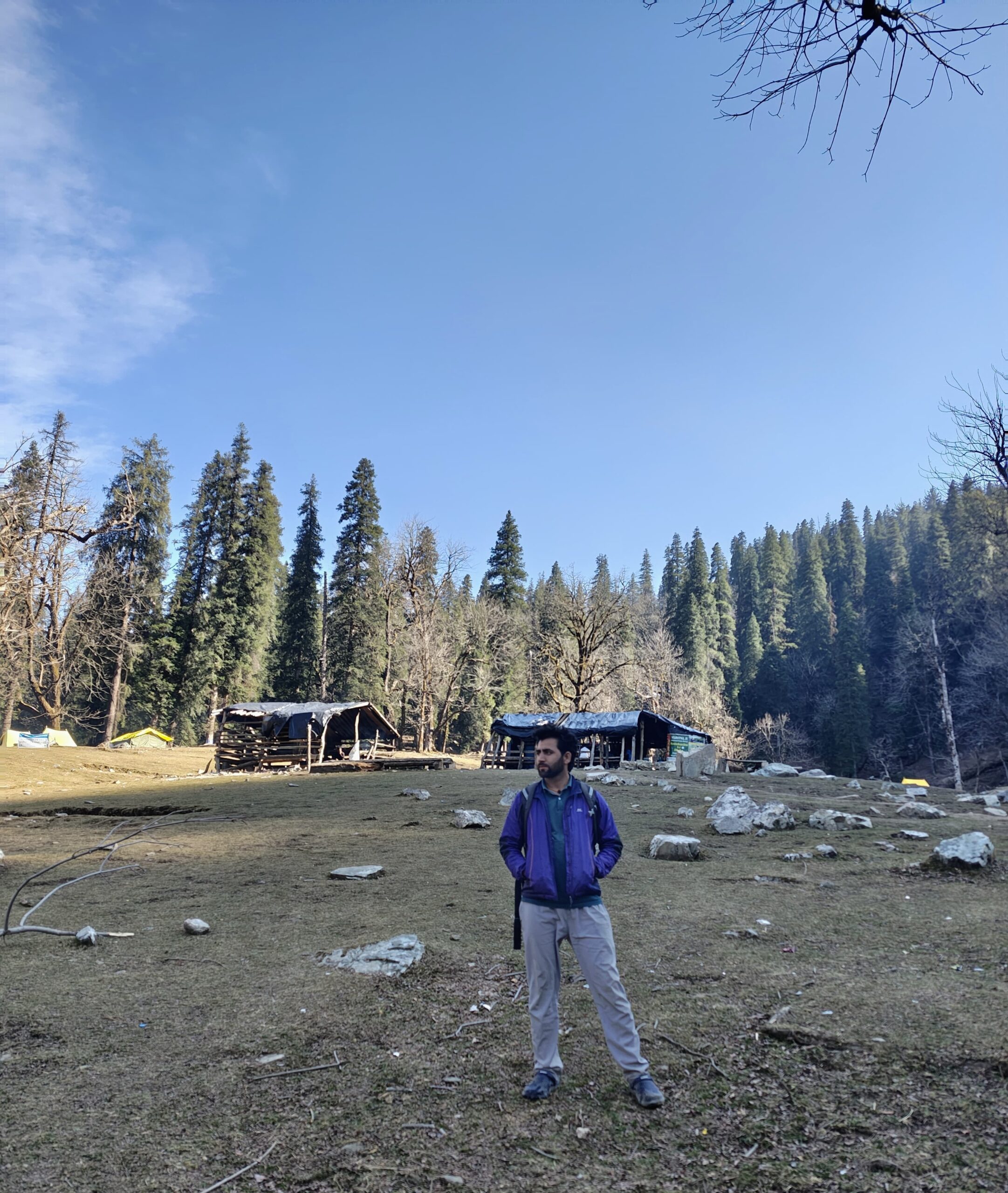
The final ascent is through dense pine and oak forests. As you approach Sankri, perched at an altitude of ~1,950 meters, the landscape opens up to snow-capped mountain views, terraced fields, and rustic wooden houses. This tranquil village marks the starting point of the Bali Pass Trek, as well as popular trails like Kedarkantha, Har Ki Dun, and Phulara Ridge.
Distance: 12 km (trek)
Time: 5–6 hours
Altitude Gain: 1,950 m → 2,560 m
Route: Sankri → Taluka (Drive) → Supin River Trail → Datmir → Seema
After breakfast in Sankri, you begin the day with a scenic 12 km jeep ride to Taluka, a small forest village and the starting point of the Bali Pass Trek. The route is narrow and bumpy but filled with Himalayan charm — pine trees, waterfalls, and the ever-flowing Tons River by your side. At Taluka, you’ll start your trek, entering the serene Govind National Park.
The trail to Seema is well-defined and mostly flat with gentle ascents. It runs alongside the Supin River and passes through dense deodar, walnut, and chestnut forests. On the way, you’ll come across the remote settlements of Ghangad and Datmir, where traditional Garhwali homes reflect the culture of the Jaunsar region. Locals often pass with mules and firewood, giving the trail a touch of everyday mountain life.
Birdsong fills the air as you cross small wooden bridges and moss-covered rocks. In spring and summer, the trail blooms with wildflowers and occasional langur sightings are common. You’ll find flat spots mid-way ideal for rest and lunch by the river.
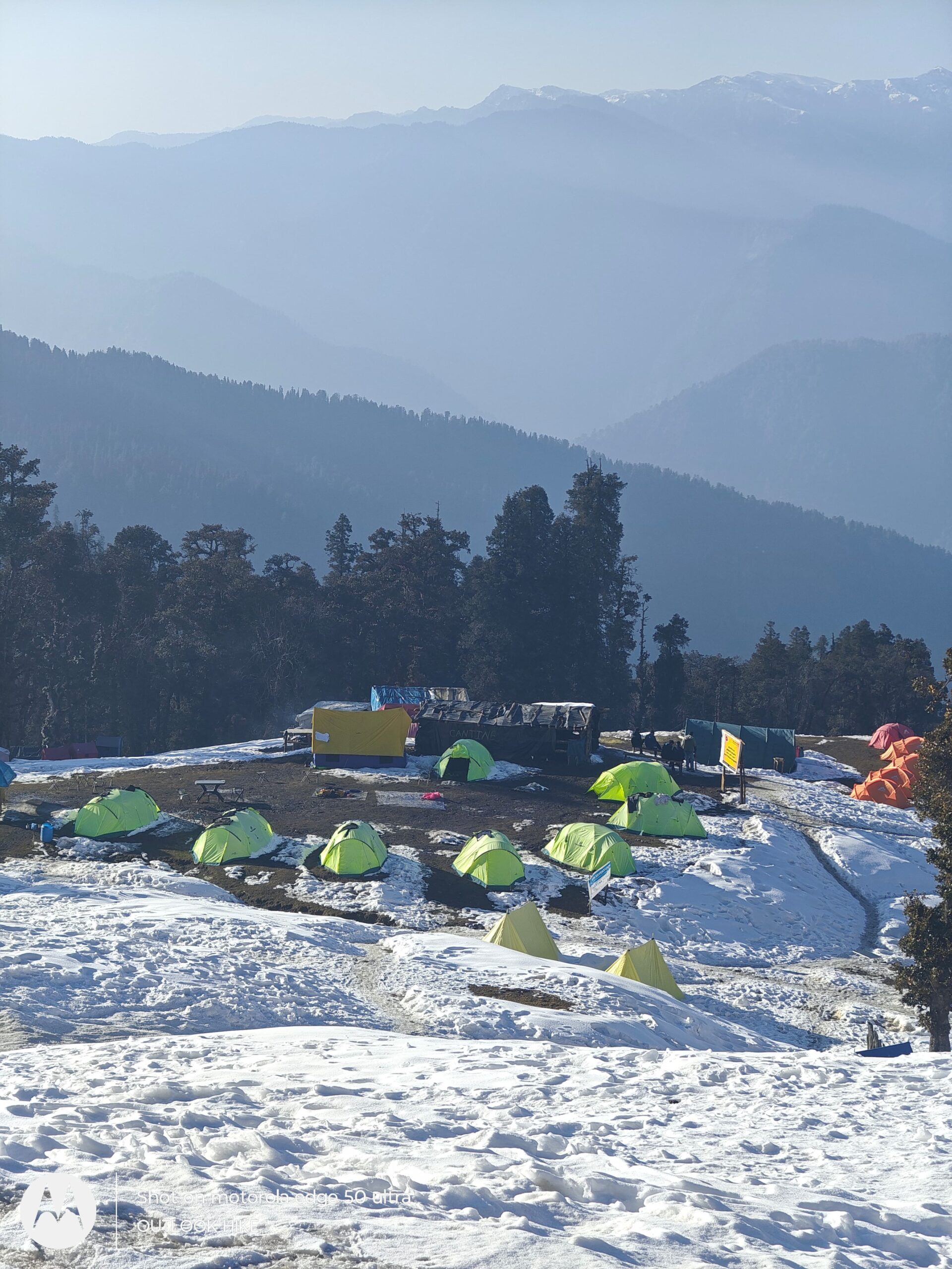
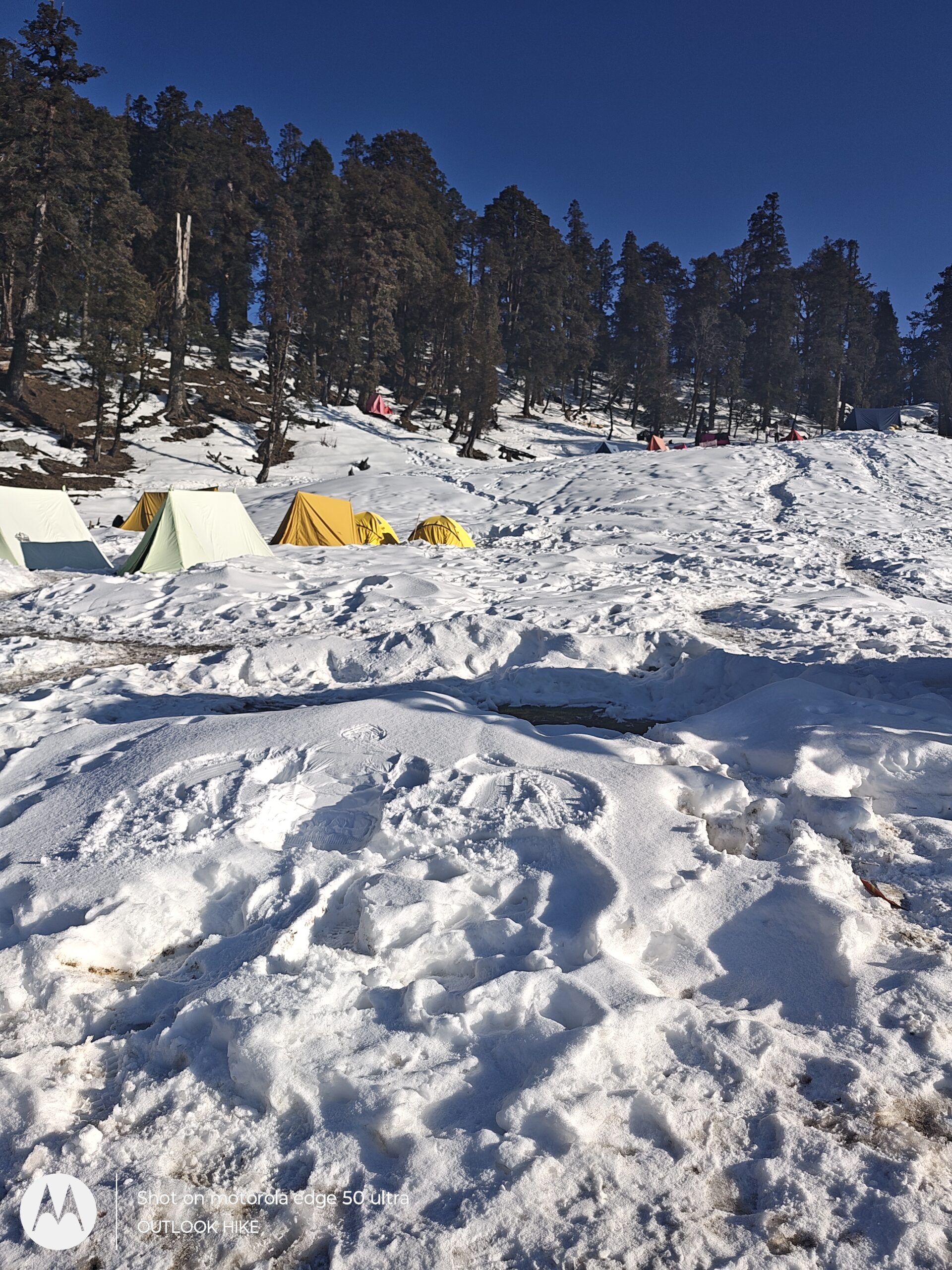
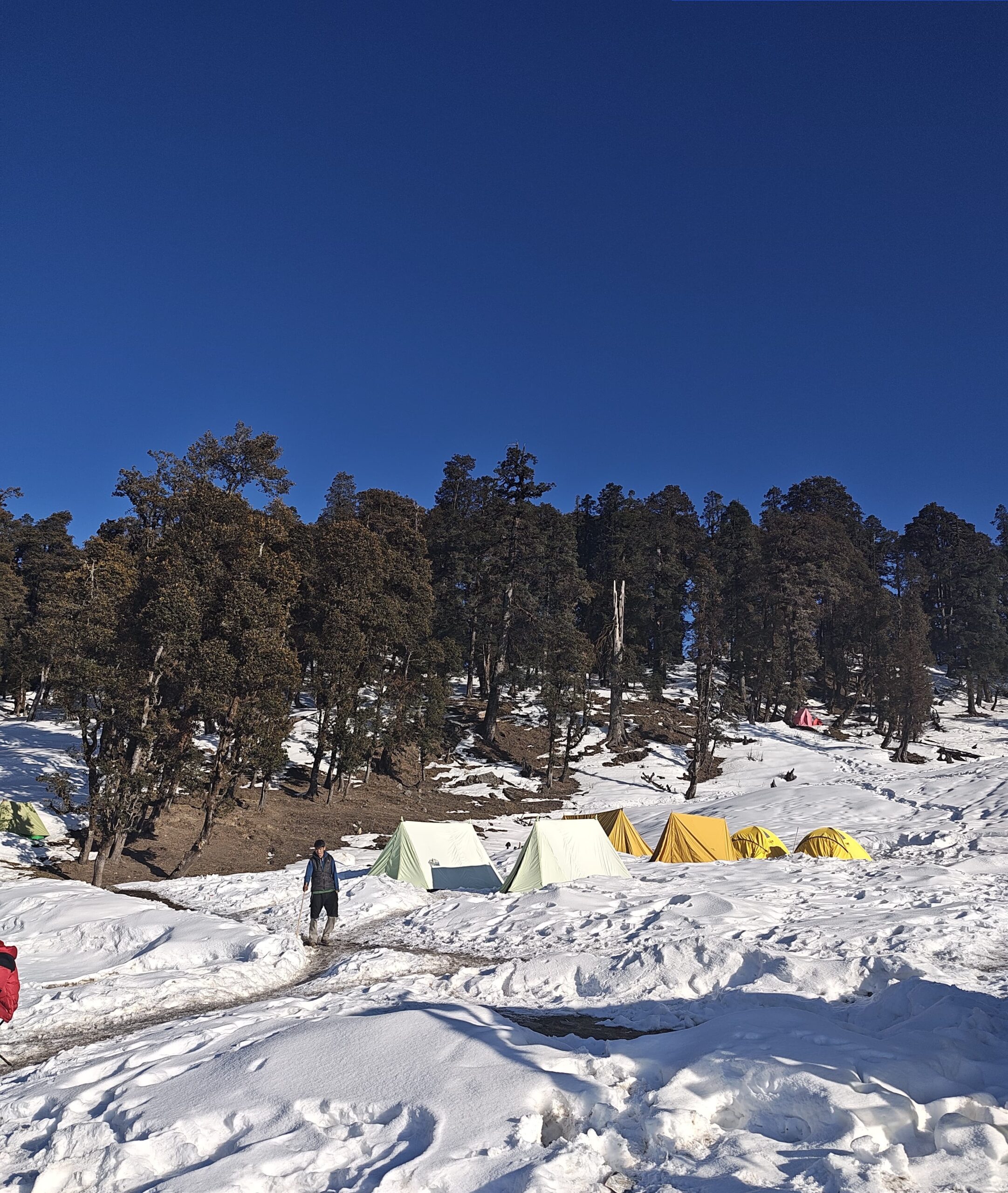
The final stretch climbs slightly through open terrain as you approach Seema, a quiet camping zone just opposite the famed village of Osla. Tents are pitched near the forest line, with views of snow-covered ridges and the river below. Seema is a perfect introduction to high-altitude trekking life — peaceful, pure, and scenic.
Distance: 17–18 km
Time: 7–8 hours
Altitude Gain: 2,560 m → 3,600 m
Route: Seema → Rainbasera → Ruinsara Tal
After an early breakfast at Seema, you begin one of the longest and most scenic days of the Bali Pass Trek. The trail today leads deep into the valley, gradually ascending through mixed forests and alpine meadows. Leaving the pine-covered trail behind, you trek through open landscapes with panoramic views of the Swargarohini range.
The first stretch to Rainbasera is moderate and mostly follows the Supin River. You’ll walk through boulder-strewn paths, and in several sections, the trail narrows with steep drops on one side. Rainbasera is a small rocky campsite with a stone shelter often used by shepherds. It’s a good spot for rest and water refill.
Beyond Rainbasera, the forest thins out, and the terrain becomes more alpine. The air gets noticeably colder, and the scenery turns majestic with glacier-fed streams, wildflowers, and views of towering snow peaks. As you climb higher, the trail becomes more isolated, enhancing the wilderness feel of the trek.
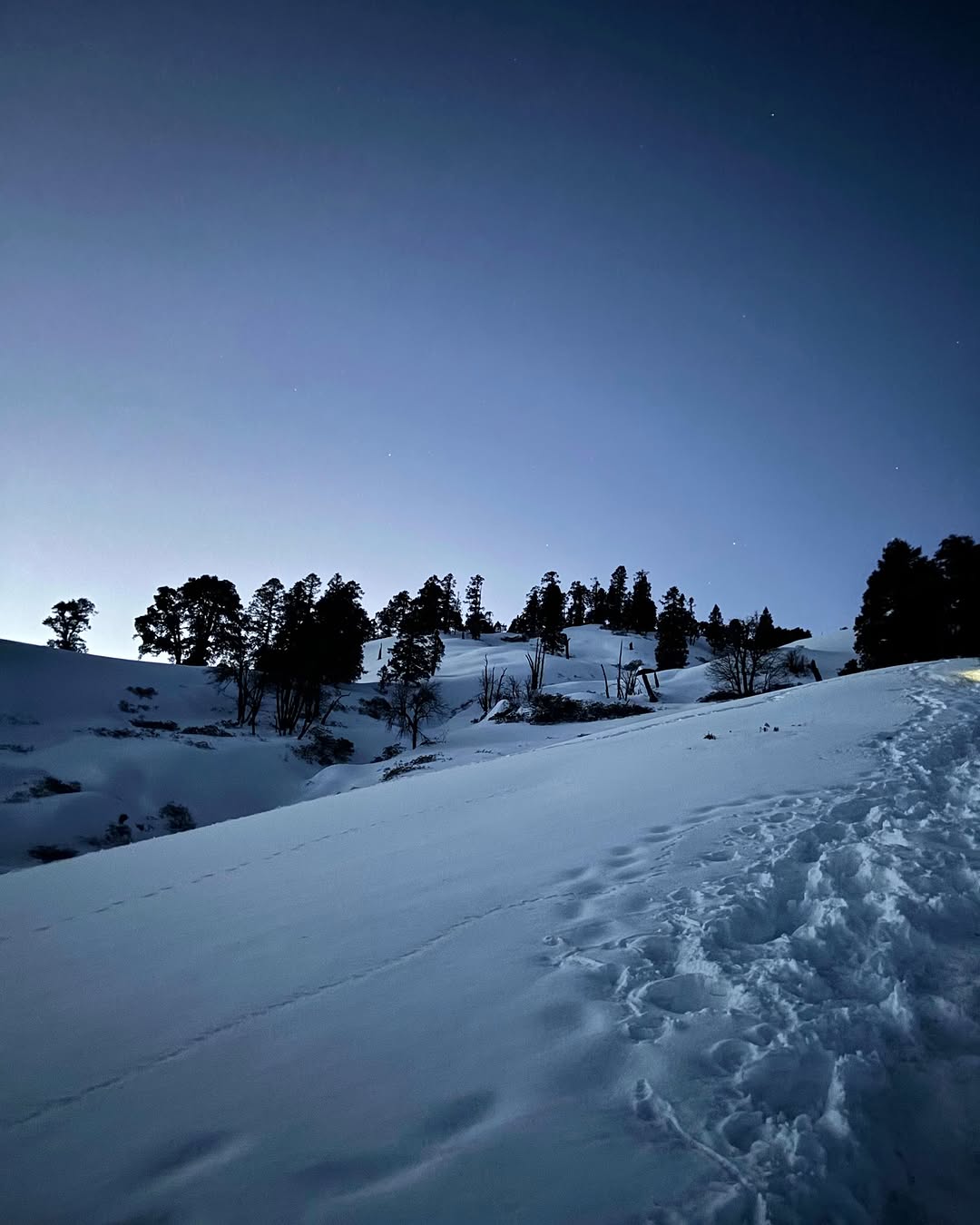
Soon, the serene alpine lake Ruinsara Tal comes into view — a glacial lake surrounded by grassy meadows and backed by tall cliffs and snowfields. Located at 3,600 meters, Ruinsara Tal is one of the most beautiful high-altitude lakes in Uttarakhand, revered by locals and trekkers alike. You’ll camp near the lake, with breathtaking views of Swargarohini I–IV, Black Peak (Kala Nag), and Bandarpunch. This is a perfect place to rest, explore nearby trails, and prepare for the higher altitudes ahead.
Distance: 4–5 km
Time: 4–5 hours
Altitude Gain: 3,600 m → 4,100 m
Route: Ruinsara Tal → Alpine Meadows → Glacial Terrain → Odari
The day begins with a crisp morning near Ruinsara Lake, where reflections of snow-capped peaks dance on the still water. After breakfast, you leave the calm of the lake behind and set off towards Odari, the base camp for the Bali Pass summit. Though short in distance, the trail today gains significant altitude and crosses increasingly rugged terrain.
You’ll trek through high-altitude alpine meadows where few trees grow and the vegetation is limited to hardy shrubs and wildflowers. The trail becomes steeper and rockier, weaving through glacial moraines and loose scree. With every step, the environment becomes more raw and dramatic — you’re now in the higher reaches of the Garhwal Himalayas.
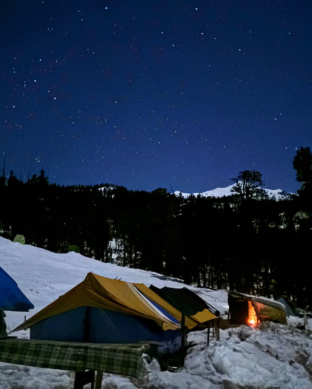
Odari, meaning “cave” in the local language, is located just below the final ascent to Bali Pass. According to legend, Lord Hanuman took shelter here during his search for the Sanjeevani herb. The campsite is set against a backdrop of glaciers and jagged peaks, offering spectacular views of Black Peak, Swargarohini, and Bandarpunch ranges.
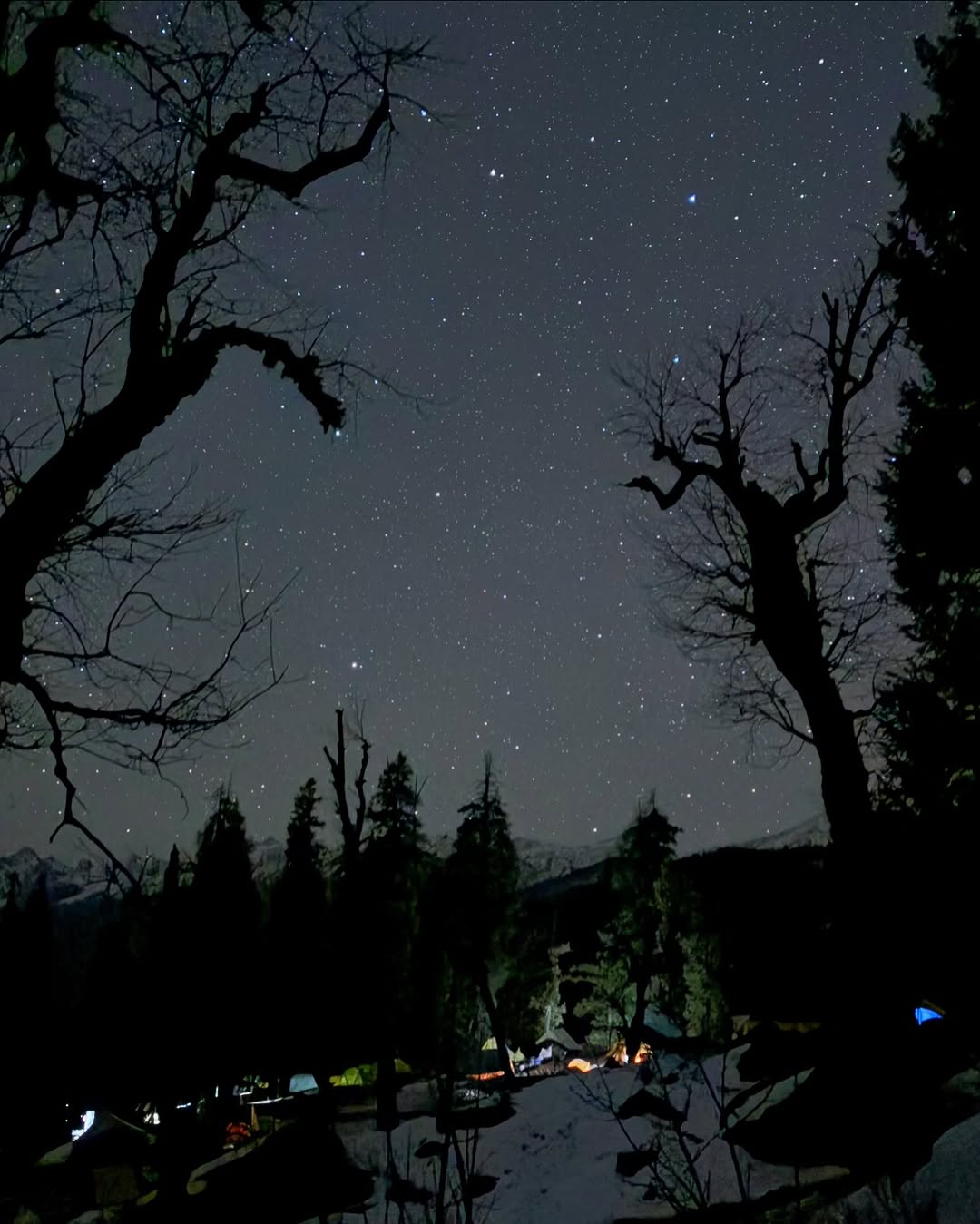
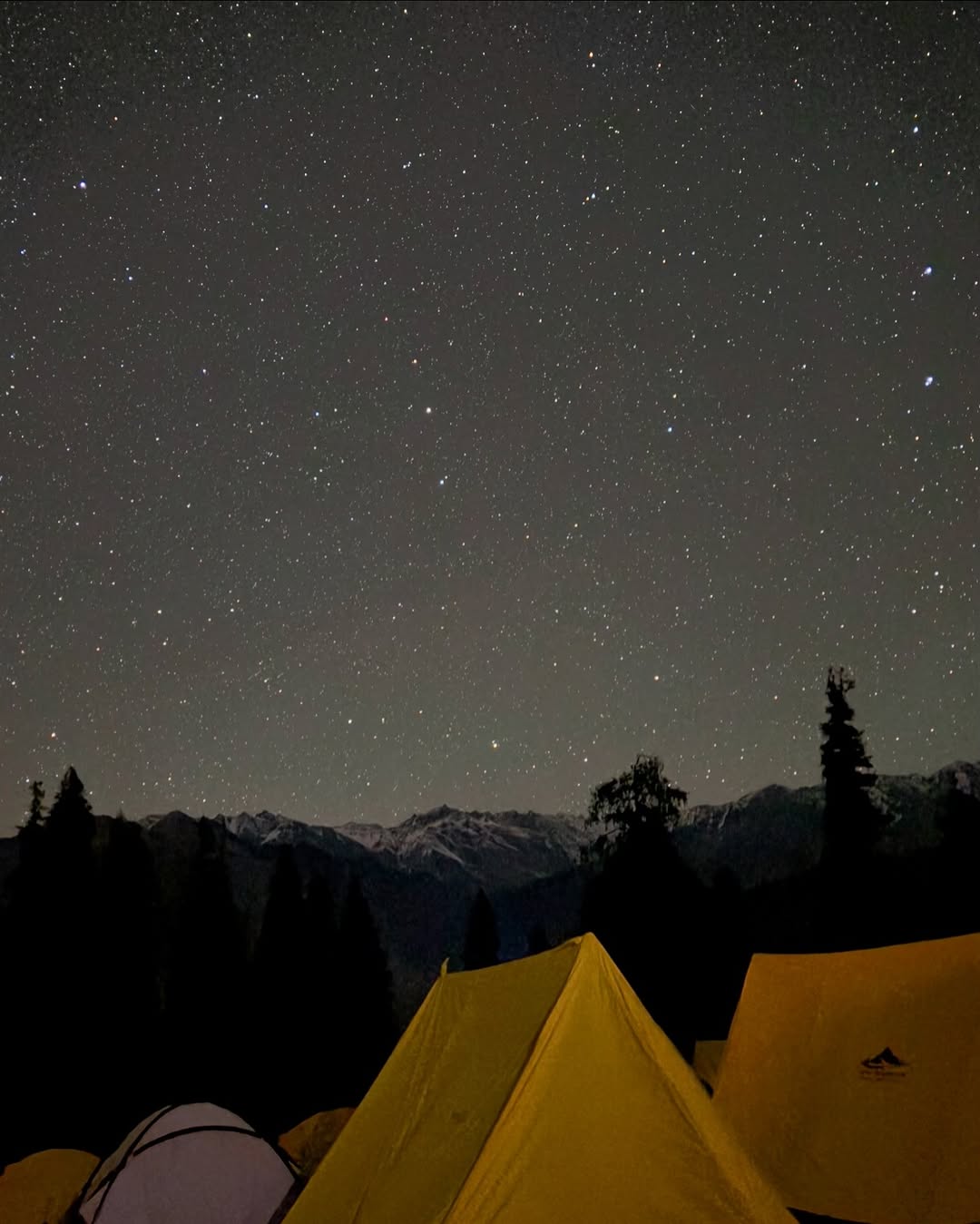
The evening is reserved for rest and acclimatization. Your trek leader will brief you about the summit push the next day, and you’ll go to bed early to prepare for an alpine start. This night at Odari Base Camp, surrounded by silence and starlight, is one of the most surreal moments of the entire trek.
Distance: 12 km
Time: 8–9 hours
Altitude Gain: 4,100 m → 4,950 m (Bali Pass) → 3,600 m (Lower Dhamni)
Route: Odari → Bali Pass Summit → Snowfield Descent → Upper Dhamni → Lower Dhamni
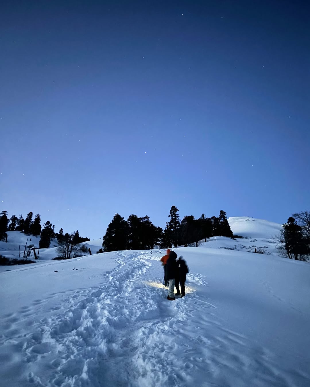
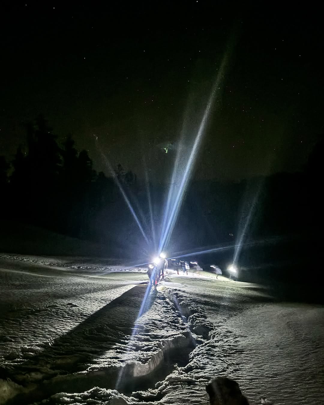
This is the most challenging and exhilarating day of the entire Bali Pass Trek. You start well before sunrise, usually around 4:00 AM, to make the summit push while the snow is still firm. The climb from Odari to Bali Pass summit involves steep ascents through loose scree, ice patches, and often a snow-covered ridge depending on the season. The final approach may require crampons or microspikes, especially in spring and early summer.
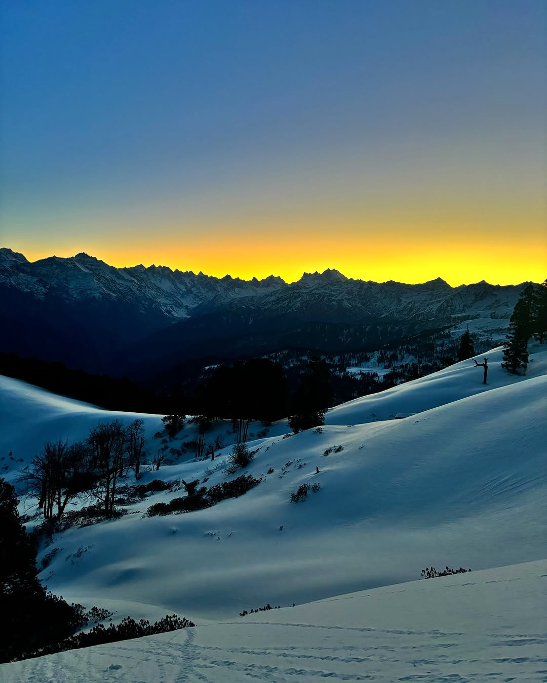
As you ascend, the first light hits the snow-covered peaks, lighting up Swargarohini, Bandarpunch, Black Peak, and the Yamunotri Glacier — a view worth every ounce of effort. At 4,950 meters, the Bali Pass summit stands tall with a narrow ridgeline and 360-degree panoramic views of the high Garhwal Himalayas. This point marks the high point of your expedition.
After soaking in the moment and capturing photographs, the descent begins on the other side — and it’s steep. You descend through a snow gully or scree slope toward the meadows of Upper Dhamni, and further down to Lower Dhamni, where you camp for the night. The descent can be tough on the knees and requires careful footing, especially in slippery sections.
Lower Dhamni is a forested campsite nestled between cliffs and alpine woods. After the long day, you’ll enjoy hot food and well-earned rest. The oxygen-rich air and warmer temperatures make it a comfortable night after the harsh high-altitude terrain.
Distance: 6–7 km (trek)
Time: 3–4 hours
Altitude Loss: 3,600 m → 2,650 m
Route: Lower Dhamni → Yamunotri Temple → Janki Chatti
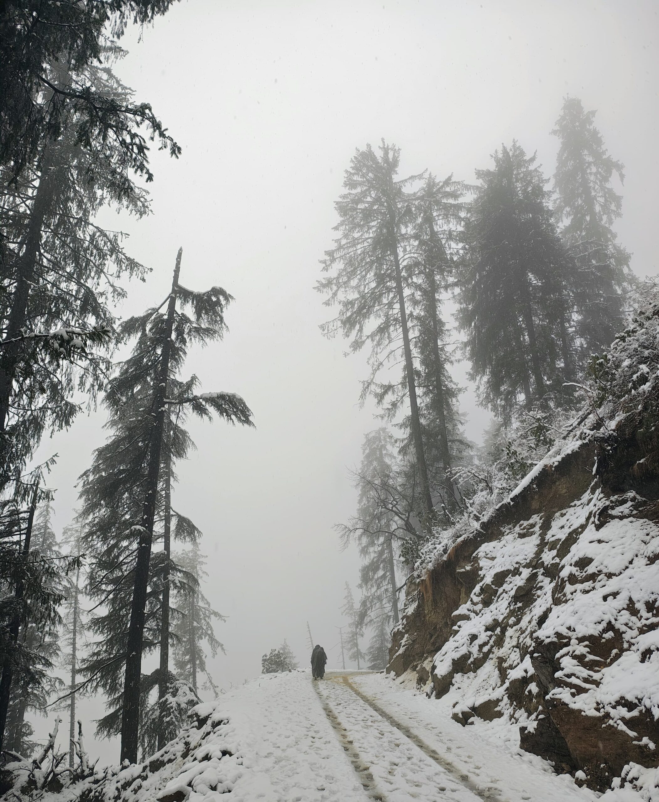
After a restful night at Lower Dhamni, you begin the final trekking day of the Bali Pass Trek. The trail descends gently at first and then steeply as you move through lush alpine forest and narrow ridgelines. The terrain can be slippery, especially if it has rained recently, so a steady pace and trekking poles are helpful.
As you descend, the forest opens up and soon you start seeing pilgrims and foot traffic on the stone-paved path leading to Yamunotri Temple, one of the sacred sites of the Char Dham Yatra. Reaching the Yamunotri temple feels like a spiritual arrival — the sudden presence of people, incense, and temple bells contrasts beautifully with the solitude of the last few days in the high mountains.
You may take some time to explore the Yamunotri hot springs, where trekkers and pilgrims often soak their feet in the naturally heated Surya Kund. If time allows, you can visit the origin point of the Yamuna River, revered in Hindu mythology.
From the temple, a short downhill walk takes you to Janki Chatti, a bustling pilgrim town and the endpoint of the trek. The roads reconnect here, mobile network returns, and you get a warm meal in a proper guesthouse. This marks the conclusion of your adventurous crossover from the Supin Valley to the Yamunotri Valley.
Distance: ~180 km
Time: 7–8 hours
Altitude Loss: 2,650 m → 640 m
Route: Janki Chatti → Barkot → Naugaon → Mussoorie → Dehradun
Your final day of the Bali Pass journey begins with a road trip from Janki Chatti to Dehradun. After breakfast, you board your vehicle and drive along winding mountain roads that slowly descend from the higher Himalayas back to the plains of Uttarakhand. The route is scenic, tracing the Yamuna River as it flows downstream past pine forests, apple orchards, and quiet Garhwali hamlets.
You’ll cross the town of Barkot, known for its views of Bandarpoonch and apple orchards. Continuing through Naugaon and Nainbagh, the road meets the main highway near Mussoorie, offering glimpses of the Doon Valley as you approach Dehradun.
This drive back gives you plenty of time to reflect on the incredible week-long adventure—crossing rivers, glaciers, remote valleys, and a 4,950-meter pass in the heart of the Garhwal Himalayas. Expect to reach Dehradun by evening, where you can board your train, bus, or flight back home with memories of a lifetime.
Bali Pass Package Cost Includes
Transportation
Shared private vehicle (Tempo Traveller/Bolero) from Dehradun to Sankri and return
Pick-up and drop at Dehradun Railway Station / ISBT
Accommodation
Day 1: Homestay/guesthouse in Sankri (twin/triple sharing)
Day 2 to Day 6: Alpine tents (2/3 person sharing) during the trek
High-quality sleeping bags, foam mattresses, and snowproof tents provided
Meals (Vegetarian & Nutritious)
All meals from Day 1 dinner to Day 7 breakfast
Breakfast, Lunch, Evening Snacks, Dinner + Hot Soup
Tea/Coffee served twice daily
Simple, hygienic, and energy-rich food: dal, rice, roti, vegetables, khichdi, pasta, upma, poha
Trekking Equipment
Waterproof alpine tents
-10°C sleeping bags
Thick foam sleeping mats
Gaiters and crampons (provided during snow conditions)
Trekking poles and headlamps (limited, available on request)
Experienced Trek Team
Certified trek leader (Wilderness First Aid trained)
Experienced local guides familiar with terrain and weather
Trained support staff and porters/mules for carrying common equipment
Safety & First Aid
Pulse oximeter and daily health monitoring
Basic first-aid kit
Oxygen cylinder (for emergency use only)
Backup support for emergency evacuation (helicopter/mule – extra charges apply)
Permits & Forest Fees
Entry fee for Govind Pashu Vihar National Park
All applicable local forest permits, camping charges, and government taxes
Bali Pass Package Cost Excludes
Transportation from your hometown to Dehradun and return
Meals during transit (before Day 1 lunch and after Day 7 breakfast)
Personal trekking gear (backpacks, trekking shoes, jackets, walking stick, etc.)
Any personal expenses: bottled water, soft drinks, snacks, or mineral water
Offloading of personal backpack (available at extra cost)
Any expenses arising out of unforeseen situations: weather conditions, landslides, roadblocks, natural calamities, or medical emergencies
Cost of emergency evacuation (mule/helicopter/vehicle – if required)
Tips for trek staff and guide (optional but appreciated)
Any medical or travel insurance
Anything not mentioned under the “Package Cost Includes” section
Bali Pass Package Cost
Sankri To Sankri
₹ 16,500/- PP
₹ 14,999/- PP
- 6 Nights Stay
- Breakfast, Lunch, Dinner
- Forest Fees & Permit
- Trek Guide
- Safety & First Aid
Dehradun To Dehradun
₹ 18,500/- PP
₹16,999/- PP
- Pickup/Drop Ex- Dehradun
- 6 Nights Stay
- Breakfast, Lunch, Dinner
- Forest Fees & Permit
- Trek Guide
- Safety & First Aid
Delhi To Delhi
₹ 21,500/- PP
₹ 19,999/- PP
- Pickup/Drop Ex- Delhi
- 6 Nights Stay
- Breakfast, Lunch, Dinner
- Forest Fees & Permit
- Trek Guide
- Safety & First Aid
Bali Pass Fix Departures
May
10 May - 16 May
15 May - 21 May
18 May - 24 May
24 May - 30 May
Closed
Closed
Closed
Closed
June
5 Jun - 11 Jun
10 Jun - 16 Jun
15 Jun - 21 Jun
22 Jun - 28 Jun
25 Jun - 31 Jun
Closed
Closed
Closed
Closed
Closed
September
1 Sept - 6 Sept
5 Sept - 11 Sept
10 Sept - 16 Sept
12 Sept - 18 Sept
15 Sept - 21 Sept
18 Sept - 24 Sept
19 Sept - 26 Sept
20 Sept - 27 Sept
21 Sept - 28 Sept
25 Sept - 1 Oct
27 Sept - 3 Oct
29 Sept - 5 Oct
30 Sept - 6 Oct
Available
Available
Available
Available
Available
Available
Available
Available
Available
Available
Available
Available
Available
October
2 Oct - 8 Oct
4 Oct - 10 Oct
6 Oct - 12 Oct
7 Oct - 13 Oct
9 Oct - 15 Oct
10 Oct - 16 Oct
12 Oct - 18 Oct
15 Oct - 21 Oct
16 Oct - 22 Oct
19 Oct - 25 Oct
20 Oct - 26 Oct
22 Oct - 28 Oct
Available
Available
Available
Available
Available
Available
Available
Available
Available
Available
Available
Available
How To Reach Bali Pass
Step-by-Step Guide to Reach Bali Pass Trek
1. Reach Dehradun (Uttarakhand) – The Nearest Major City
By Air:
Jolly Grant Airport (DED), Dehradun is the nearest airport.
Well-connected to Delhi, Mumbai, Bangalore, Hyderabad, and Kolkata
From the airport, take a taxi to Dehradun Railway Station or ISBT for onward travel to Sankri
By Train:
Dehradun Railway Station is well-connected to major Indian cities
Popular trains: Nanda Devi Express, Mussoorie Express, Dehradun Shatabdi
Direct trains from Delhi, Kolkata, Mumbai, Lucknow, Haridwar, and Varanasi
By Bus/Car:
Overnight Volvo and government buses operate from Delhi (ISBT Kashmere Gate) to Dehradun
Travel time: 6–8 hours from Delhi
Private taxis and self-drives are also viable options
2. Dehradun to Sankri (Base Village)
Distance: 210 km
Travel Time: 8–10 hours
Options:
Private cabs (₹5,000–6,000 per vehicle)
Shared taxis available from Dehradun Railway Station or Parade Ground (₹700–800 per person)
Limited GMOU bus service from Mussoorie Bus Stand (early morning departure)
3. Final Stretch: Sankri to Trek Starting Point (Taluka)
The trek to Bali Pass officially begins after a short 12 km jeep ride from Sankri to Taluka
Taluka is the roadhead and starting point of the trek
Transport from Sankri to Taluka is typically arranged by the trek operator
All camping gear and permits are also provided from Sankri onward
Summary – How to Reach Bali Pass Trek
| Route | Mode | Distance & Travel Time |
|---|---|---|
| Delhi to Dehradun | Train / Flight / Bus | ~250 km – 6 to 8 hours |
| Dehradun to Sankri | Road (cab / bus) | 210 km – 8 to 10 hours |
| Sankri to Taluka | Jeep Ride | 12 km – 1 hour |
| Taluka to Trek Start | On foot | 0 km – Trek begins from here |
From Delhi to Bali Pass:
Delhi → Dehradun (overnight train or bus) → Sankri (shared/private cab) → Taluka
From Mumbai to Bali Pass:
Mumbai → Dehradun (flight or train via Delhi) → Sankri → Taluka
From Bangalore to Bali Pass:
Bangalore → Dehradun (flight via Delhi) → Sankri → Taluka
Bali Pass Booking Policy
- Booking is confirmed only after receiving a minimum 30% advance payment
Balance amount to be paid at pickup time.
Payment Options
Online payment via UPI / Bank Transfer / Net Banking / Debit & Credit Cards
Payment receipt will be shared via email or WhatsApp for confirmation
Bali Pass Cancellation Policy
- 90% refund if cancelled 30+ days before trek date
- 70% refund if cancelled 15–29 days before trek
- 50% refund if cancelled 7–14 days before trek
- No refund if cancelled less than 7 days before trek or no-show
Bali Pass Essentials
The Bali Pass Trek is a high-altitude Himalayan expedition reaching up to 4,950 meters, involving challenging terrain, snow crossings, and remote campsites. To ensure safety and comfort, you must carry the right trekking gear, clothing layers, and personal essentials.
Weather on the trail can be unpredictable — with cold winds, rain, and sub-zero temperatures near the Bali Pass summit and Odari Base Camp. Having the correct equipment like thermal wear, down jackets, waterproof shoes, and headlamps is crucial for survival and performance.
Most trek operators provide tents, sleeping bags, and kitchen gear. However, trekkers are required to bring their own backpacks, rain gear, medications, and winter wear. Your backpack should be lightweight (8–10 kg max) and well-organized.
A properly packed kit enhances your safety, keeps you warm in harsh weather, and ensures a successful completion of the Bali Pass Trek through the Govind Pashu Vihar National Park.
Base Layer (thermal innerwear – top and bottom)
2–3 Full sleeve quick-dry T-shirts (avoid cotton)
2 Insulating Layers (fleece/wool sweaters or light down jacket)
1 Heavy Feather Jacket / Padded Jacket (for summit day)
2 Trek Pants (quick-dry; avoid jeans)
1 Windproof & Waterproof Jacket/Poncho
Thermal Track Pants (for nights)
Warm Innerwear & Undergarments (at least 2–3 pairs)
1 pair of high-ankle trekking shoes (snow/water-resistant)
1 pair of slippers / sandals for campsite use
Optional: Gaiters (for heavy snow)
Trekking backpack (40–50L) with rain cover
Daypack (10–15L) for summit day
Trekking pole (highly recommended)
Headlamp / torch with spare batteries
Water bottles (2 x 1L) or hydration bladder
Sunglasses (UV-protected)
Power bank
Ziplock / dry bags for organizing
Optional: Camera or GoPro
Toothbrush + toothpaste
Biodegradable soap / face wash
Lip balm (essential for cold cracks)
Cold cream / moisturizer
Sunscreen (SPF 50+)
Quick-dry towel
Toilet paper / tissues
Hand sanitizer
Menstrual hygiene products (as required)
Wet wipes (optional but useful)
Paracetamol / Ibuprofen
Diamox (only after doctor’s advice)
Band-aids / blister patches
Antiseptic cream
Crepe bandage
Personal medication
ORS / Glucose / Electrolyte powder
Original Government ID proof (Aadhar, Passport, Voter ID)
Medical fitness certificate (if required by trek operator)
Trek disclaimer form (provided by operator)
Trek booking confirmation / permit copy (if applicable)
Bali Pass Fitness
Fitness Required for Bali Pass Trek
The Bali Pass Trek is a challenging high-altitude trek that demands good physical endurance, stamina, and mental strength. With steep ascents, snow crossings, and altitudes reaching 4,950 meters, this trek is suitable for experienced trekkers or well-prepared first-timers.
You’ll cover 70+ km over 6 trekking days, walking 6–8 hours daily on varied terrain — from dense forests and alpine meadows to moraines, boulder sections, and snowfields. The summit day involves a steep pre-dawn climb and a sharp descent, which can be taxing without proper preparation.
Minimum Fitness Requirements:
Ability to jog 5 km in 30–35 minutes
Comfortably walk with a 6–8 kg backpack
Strong knees, core, and leg muscles for uphill/downhill
Good cardiovascular health (no asthma, severe BP issues)
Recommended Pre-Trek Routine (Start 4–6 Weeks Before):
Cardio Training: Jogging, cycling, stair climbing, brisk walking (5 days/week)
Strength Training: Squats, lunges, planks, core workouts
Flexibility: Stretching, yoga for muscle recovery
Practice Hikes: Weekend hikes with a backpack, if possible
Acclimatization:
Even with fitness, acclimatization is key. The trek is designed with gradual altitude gain and rest days (like at Ruinsara Tal), but your body must be fit to adapt.
Bali Pass FAQ's
How to reach Bali Pass Trek from Delhi?
Take a train, bus, or flight to Dehradun, then drive to Sankri (210 km, 8–10 hours). From Sankri, a jeep drops you at Taluka, the trek’s starting point.
What is the altitude of Bali Pass Trek?
The maximum altitude of the Bali Pass Trek is 4,950 meters at the summit. Other key altitudes include Sankri (1,950 m), Ruinsara Tal (3,600 m), and Odari (4,100 m).
What is the total distance of Bali Pass Trek?
The total trekking distance is approximately 70–75 km over 6 trekking days.
Is Bali Pass Trek safe?
Yes, the trek is safe if done with a certified trek operator. Proper acclimatization, fitness, and weather preparation are essential due to high altitude and remote terrain.
What is the best time to do Bali Pass Trek?
The best time is May–June (spring/summer) and mid-September to October (autumn). Avoid the monsoon and winter due to landslides and snow blockage.
Do I need experience for Bali Pass Trek?
es, it is a difficult trek and best suited for those who have done at least one moderate Himalayan trek before. Beginners should start with easier treks like Kedarkantha or Har Ki Dun.
What permits are required for Bali Pass Trek?
You need a Govind Pashu Vihar National Park permit, and all forest/camping fees, which are generally arranged by the trek operator.
How cold does it get during the Bali Pass Trek?
Temperatures can drop to -5°C to -10°C at night near Odari and the summit. Day temperatures range between 8°C and 18°C.
Are mobile networks available during Bali Pass Trek?
Mobile networks are available till Sankri or Purola. There is no signal during the trek from Taluka onwards
How many days is the Bali Pass Trek?
The Bali Pass trek takes 7 days including travel, with 6 trekking days from Taluka to Janki Chatti.
Can I do Bali Pass Trek solo?
No, the Bali Pass Trek is not recommended solo due to high altitude, glacier crossings, and lack of trail markers. It is best done with an experienced guide or registered trek operator.
Is there snow in Bali Pass Trek?
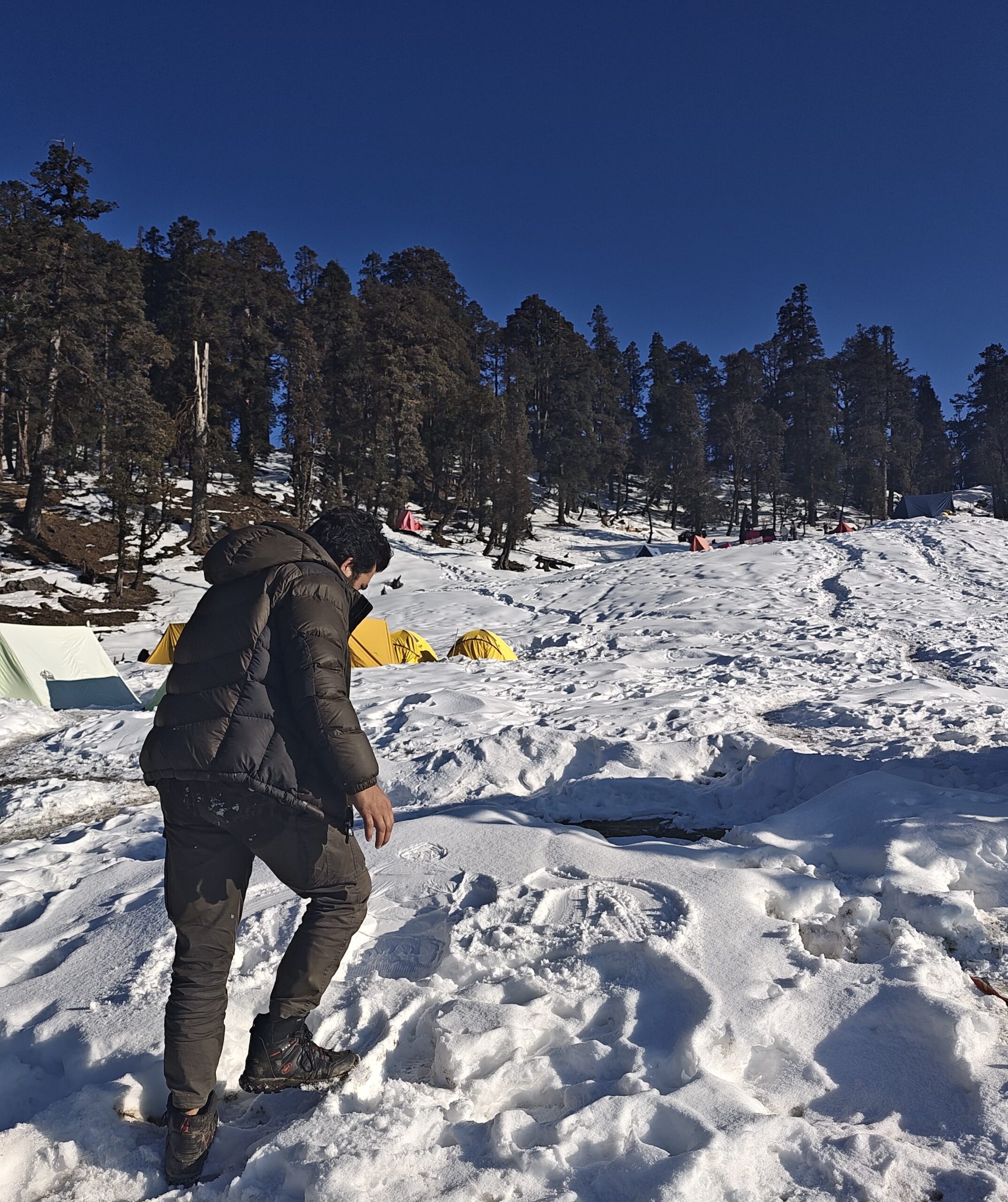
Yes, you will encounter snow patches and glaciers, especially in May, early June, and October, near Odari and the Bali Pass summit.
What is the age limit for Bali Pass Trek?
Recommended age: 16 to 50 years, provided the person is physically fit and has prior trekking experience. Trekking at such altitude is not suitable for children or elderly trekkers.
Are mules or porters available on the trek?
Yes, mules and porters are available from Sankri to carry personal backpacks (extra cost). Most group treks include support staff for equipment.
What gear is provided by trek operator for Bali Pass?
Trek operators usually provide tents, sleeping bags, mats, kitchen equipment, and microspikes/gaiters. Trekkers must carry their own backpacks, shoes, clothing, and personal items.
Which is best travel company for Bali Pass?
Solo Hike is one of the best trekking companies for the Bali Pass Trek. They offer small-group departures, certified trek leaders, local guides, and all-inclusive packages with safety and comfort. Ideal for those seeking a reliable and budget-friendly trekking experience.
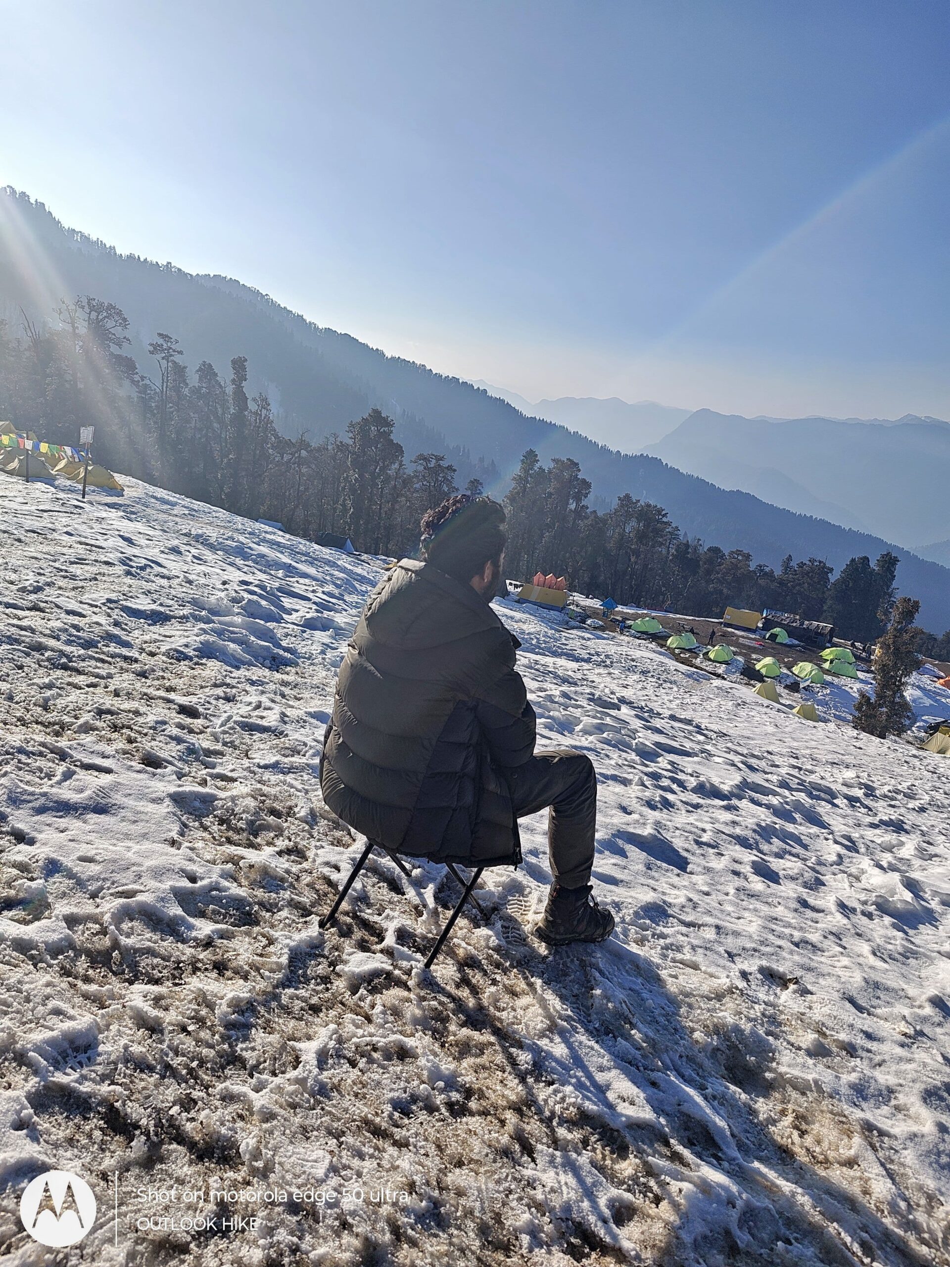
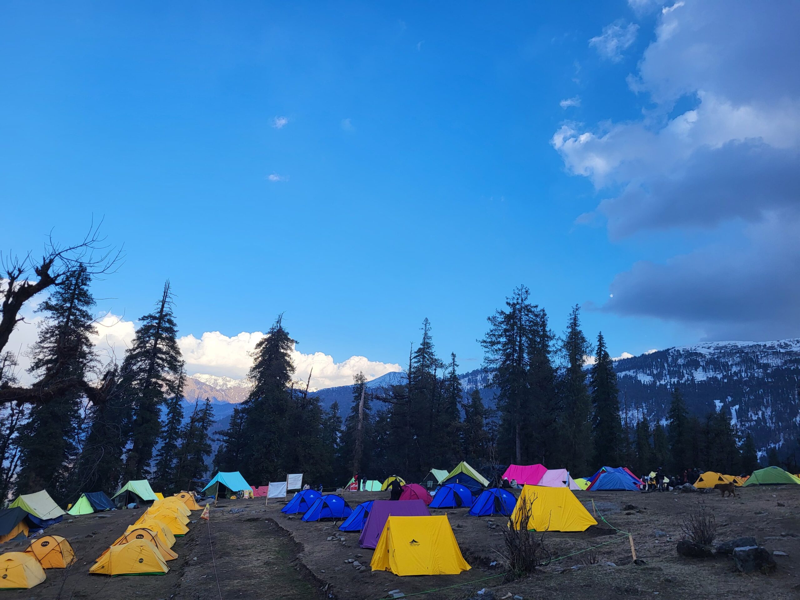
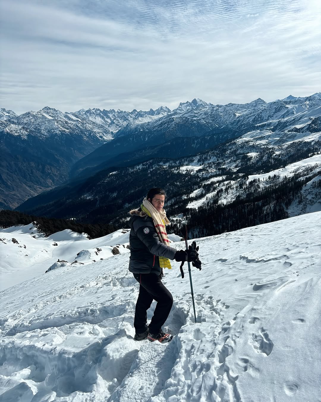
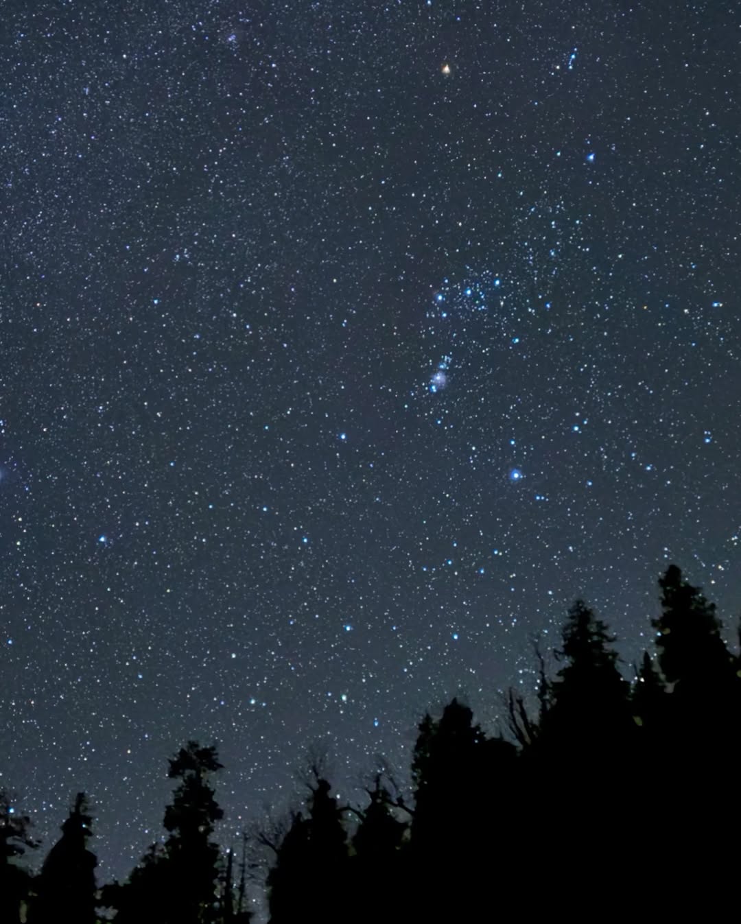
BALI PASS PHOTOS
Read More About Bali Pass
Best Time To Visit Bali Pass
Discover the best time to visit Bali Pass Trek for clear views, safe weather, and snow-covered landscapes. Ideal months are May–June and September–October for this high-altitude Himalayan adventure.
Best Time To Visit Bali Pass
Discover the best time to visit Bali Pass Trek for clear views, safe weather, and snow-covered landscapes. Ideal months are May–June and September–October for this high-altitude Himalayan adventure.
Best Time To Visit Bali Pass
Discover the best time to visit Bali Pass Trek for clear views, safe weather, and snow-covered landscapes. Ideal months are May–June and September–October for this high-altitude Himalayan adventure.
RELATED TREKS

