Basecamp
Sankri
Duration
14 Days
Max. Altitude
20,955 ft.
Distance
90 Kms
Grade
Difficult
Pickup/Drop
Dehradun
Trek Overview
Black Peak Expedition (Kalanag Peak) – The Ultimate 6000+ Meter Himalayan Climb
Introduction – Conquer the Mighty Black Peak (Kalanag)
The Black Peak Expedition, also known as the Kalanag Expedition, is one of the most iconic and technically challenging mountaineering adventures in the Indian Himalayas. Standing at a towering altitude of 6,387 meters (20,955 feet), Black Peak is the highest summit in the Bandarpunch massif, nestled deep within the Garhwal Himalayas of Uttarakhand.
The name Kalanag, meaning “Black Cobra” in Hindi, reflects the mountain’s distinctive summit ridge, which resembles the hood of a cobra. Known for its steep slopes, glaciated terrain, and demanding technical sections, this 6000-meter peak in Uttarakhand is an ideal choice for trekkers transitioning into technical high-altitude expeditions.
Starting from the picturesque village of Sankri, the route passes through dense pine forests, alpine meadows, glacial basins, and snow-covered ridgelines. The journey offers a blend of raw wilderness, spiritual energy from nearby mythological regions like Ruinsara Valley, and intense physical and mental challenges.
The Kalanag Peak Expedition is more than just a climb — it’s a gateway to technical Himalayan expeditions in India, offering mountaineers a chance to train, test, and triumph in one of the most rewarding high-altitude terrains in the country.
Overview – Black Peak Expedition at a Glance
Peak Name: Black Peak (Kalanag)
Altitude: 6,387 meters / 20,955 feet
Duration: 12 to 14 days (Ex-Dehradun)
Region: Govind Pashu Vihar National Park, Uttarkashi, Uttarakhand
Difficulty Level: Difficult (Technical)
Total Trekking Distance: Approximately 70–75 km
Start/End Point: Sankri Village
Best Time to Attempt: Mid-May to late June and September to early October
Permit Required: Yes (Forest entry and mountaineering permit)
Technical Gear Required: Yes (ice axe, harness, crampons, helmet, ropes, gaiters)
Why Choose the Black Peak (Kalanag) Expedition?
Black Peak is the highest peak in the Bandarpunch range, higher than Bandarpunch I and II, making it a major goal for aspiring climbers. The summit offers panoramic views of the Swargarohini range, Bandarpoonch peaks, Gangotri group, and other snow-bound Himalayan summits.
The expedition involves technical climbing on snow and ice, including ropework, use of crampons, and navigation through crevasses and ice slopes. This makes it an ideal expedition for those preparing for expeditions like Satopanth, Nun, or 7000-meter peaks.
You’ll trek through the culturally rich and scenic Govind National Park, home to the Ruinsara Valley, alpine bugyals (meadows), and native Himalayan wildlife. The route is relatively less crowded compared to other commercial treks, ensuring a truly immersive Himalayan experience.
It is perfect for experienced trekkers who have done high-altitude treks and are ready for a semi-alpine style expedition in India with fixed rope climbs and summit attempts.
Route Highlights
Sankri Village – Starting point of the expedition and gateway to multiple Himalayan treks.
Taluka to Seema/Osla – Forest trails and traditional Himalayan villages rich in folklore.
Ruinsara Tal – A sacred high-altitude glacial lake surrounded by lush alpine landscapes.
Base Camp (4,200 m) – Open terrain with views of Black Peak and nearby glaciers.
Advanced Base Camp (ABC) – Transition zone into steeper terrain and glacier approach.
Summit Camp (approx. 5,500 m) – Launch site for summit push.
Black Peak Summit Ridge – Steep ice ridges and snow-covered slopes leading to a narrow, cobra-shaped summit ridge.
Ideal For
Trekkers with experience in high-altitude Himalayan routes like Bali Pass, Kedartal, Pin Parvati Pass, Rupin Pass, etc.
Mountaineers aiming to prepare for 6,000–7,000 meter peaks in the Indian Himalayas.
Climbers looking to transition from trekking to technical mountaineering with ropework and snowcraft.
Black Peak Short Itinerary
Day 1: Dehradun → Sankri
Distance: ~200 km
Travel Time: 8–9 hours
Route: Dehradun → Mussoorie → Purola → Netwar → Sankri
Highlights: Picturesque mountain roads, pine forests, Yamuna and Tons river valleys
Stay: Guesthouse in Sankri
Day 2: Sankri → Taluka (Drive) → Seema (Trek)
Distance: 12 km drive + 12 km trek
Travel Time: 1 hr (drive) + 6–7 hrs (trek)
Route: Sankri → Taluka (drive) → Seema via Supin River trail
Highlights: Beautiful forest trail, waterfalls, and wooden bridges
Stay: Campsite at Seema
Day 3: Seema → Rainbasera
Distance: ~8 km
Travel Time: 5–6 hours
Route: Seema → Debshu Bugyal → Rainbasera
Highlights: Expansive meadows, boulder-strewn paths, river crossings
Stay: Campsite at Rainbasera
Day 4: Rainbasera → Ruinsara Tal
Distance: ~8 km
Travel Time: 5–6 hours
Route: Rainbasera → Thanga → Ruinsara Tal
Highlights: Glacier views, high-altitude lake, peaceful landscapes
Stay: Campsite near Ruinsara Tal
Day 5: Ruinsara Tal → Kyarkoti Base Camp
Distance: ~7 km
Travel Time: 5–6 hours
Route: Ruinsara Tal → Kyarkoti via moraine terrain
Highlights: Rugged Himalayan views, approach to expedition zone
Stay: Base camp at Kyarkoti
Day 6: Kyarkoti → Dharaon ki Odari
Distance: ~4 km
Travel Time: 4–5 hours
Route: Kyarkoti → Dharaon ki Odari (rock cave shelter zone)
Highlights: Snow slopes, glacier terrain, basic technical movement
Stay: Campsite near Odari (rock cave)
Day 7: Dharaon ki Odari → Arjun Chad
Distance: ~4 km
Travel Time: 4–5 hours
Route: Odari → Glacier traverse → Arjun Chad (summit base ridge)
Highlights: Roped glacier walks, high-altitude camp zone
Stay: Campsite at Arjun Chad
Day 8: Arjun Chad → ABC (Advance Base Camp)
Distance: ~3 km
Travel Time: 3–4 hours
Route: Arjun Chad → ABC (final summit launch camp)
Highlights: Sharp elevation gain, base of Kalanag summit ridge
Stay: ABC tents (~5,300 m)
Day 9: ABC → Summit (Kalanag Peak – 6,387 m) → Return to Arjun Chad
Distance: ~8–10 km round trip
Travel Time: 10–12 hours
Route: Midnight ascent → Black Peak Summit → descent to Arjun Chad
Highlights: Steep snow climb, panoramic views of Bandarpoonch, Swargarohini
Stay: Campsite at Arjun Chad
Day 10: Arjun Chad → Dharaon ki Odari
Distance: ~4 km
Travel Time: 4–5 hours
Route: Glacier descent to Odari
Highlights: Careful descent from high altitudes
Stay: Campsite at Odari
Day 11: Dharaon ki Odari → Kyarkoti Base Camp
Distance: ~4 km
Travel Time: 3–4 hours
Route: Odari → Kyarkoti
Highlights: Final glacier zone exit
Stay: Base Camp at Kyarkoti
Day 12: Kyarkoti → Ruinsara Tal
Distance: ~7 km
Travel Time: 5–6 hours
Route: Kyarkoti → Ruinsara Tal
Highlights: Return through familiar alpine terrain
Stay: Campsite at Ruinsara
Day 13: Ruinsara Tal → Seema → Sankri
Distance: ~20 km
Travel Time: 7–8 hours
Route: Ruinsara → Rainbasera → Seema → Taluka (trek) → Sankri (drive)
Highlights: Long descent day, cross meadows, forests, and rivers
Stay: Guesthouse in Sankri
Day 14: Sankri → Dehradun
Distance: ~200 km
Travel Time: 8–9 hours
Route: Sankri → Netwar → Purola → Dehradun
Highlights: Return journey through Uttarkashi forests and valleys
Stay: Tour ends on arrival at Dehradun
Black Peak Detailed Itinerary
- Distance: ~200 km
- Travel Time: 8–9 hours
- Route: Dehradun → Mussoorie → Nainbagh → Purola → Mori → Netwar → Sankri
- Altitude: ~1,920 m
Your thrilling Black Peak Expedition begins early morning from Dehradun, the capital of Uttarakhand and a popular entry point for Garhwal Himalayas. After assembling at the designated pickup point (usually ISBT Dehradun or Railway Station), you’ll begin your scenic drive towards Sankri, the base village for many legendary Himalayan treks like Kedarkantha, Har Ki Dun, Bali Pass, and Ruinsara Tal.
As you leave the city behind, the road ascends steadily through the lush foothills of the Shivalik range. You’ll soon cross Mussoorie, a charming hill station often called the “Queen of Hills”, and continue through pine-covered valleys toward Nainbagh. From here, the route winds through remote mountain roads surrounded by oak and deodar forests. You’ll pass the quaint towns of Purola and Mori, which offer stunning views of the Tons River, one of the major tributaries of the Yamuna.
A lunch stop is usually made at Purola, the last major town with ATMs and strong mobile network. As the journey continues beyond Mori, the landscape becomes wilder and more remote. You’ll enter the Govind Pashu Vihar National Park near Netwar, home to the Himalayan black bear, musk deer, and Monal pheasants.
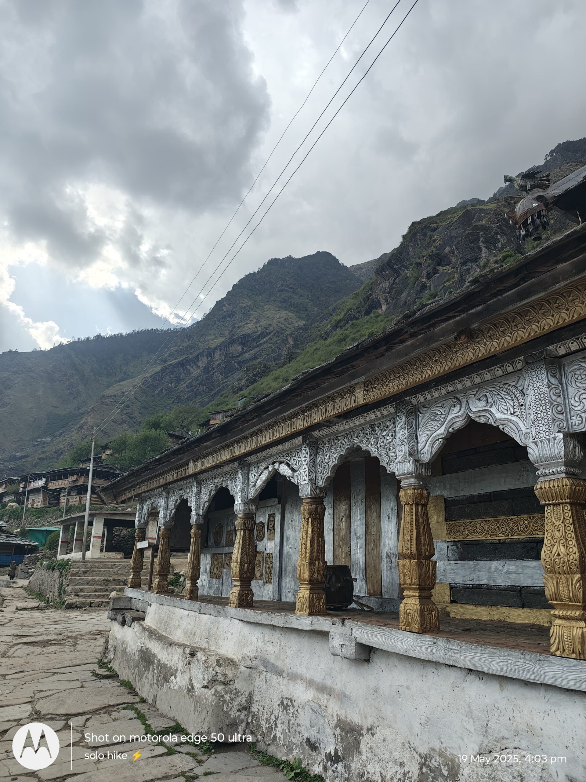
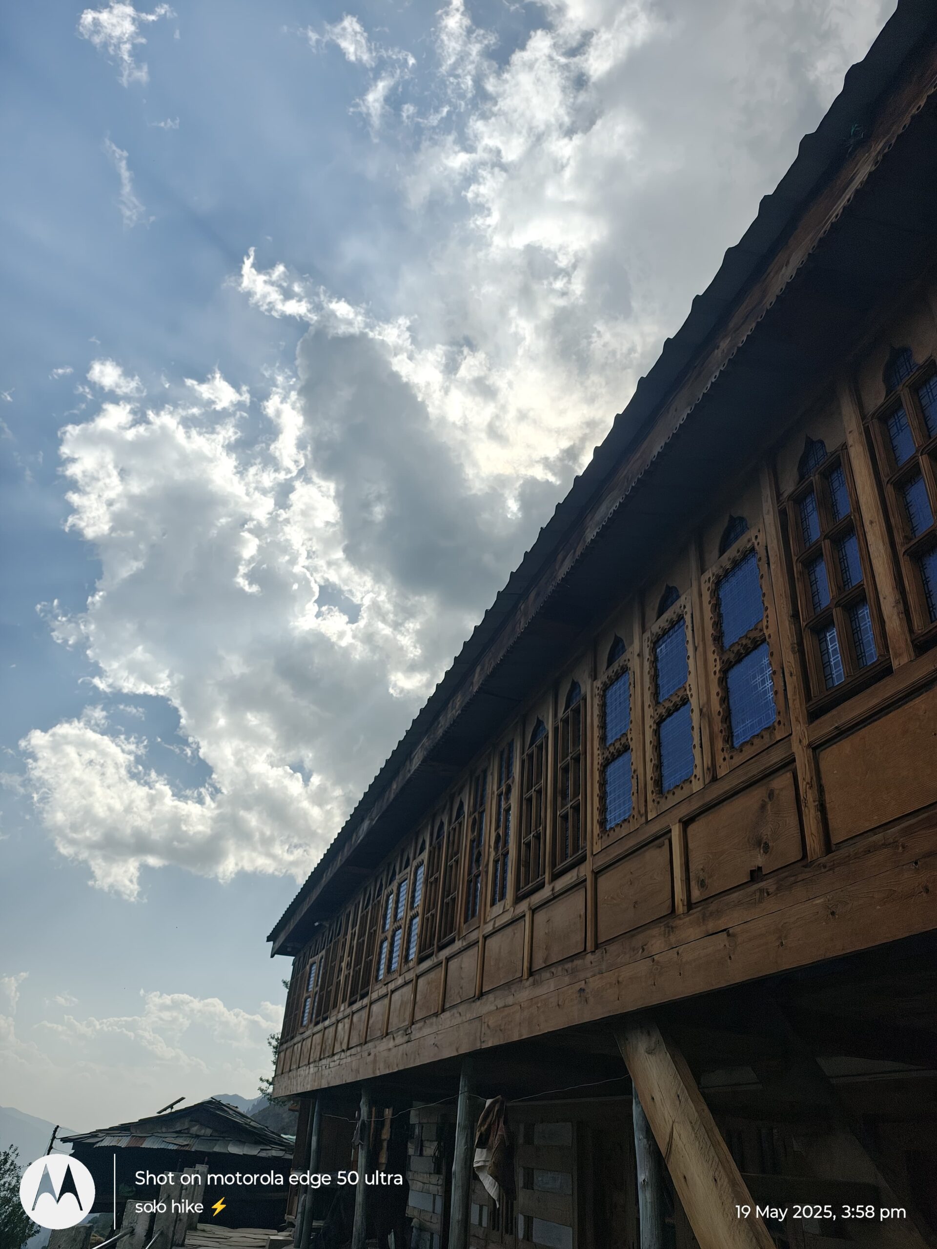
The final stretch is a narrow mountain road flanked by thick forest and deep gorges, eventually bringing you to Sankri, a serene Himalayan village perched at 1,920 meters. Nestled at the confluence of the Supin and Tons rivers, Sankri serves as the gateway to high-altitude expeditions and alpine treks in this region.
After checking into a cozy guesthouse or homestay, enjoy your first hot meal in the mountains and breathe in the fresh alpine air. This is your moment to unwind, acclimatize slightly, and mentally prepare for the challenging yet unforgettable trek ahead.
Drive Distance: ~12 km
Drive Time: 45 minutes to 1 hour
Trek Distance: ~12 km
Trek Duration: 5–6 hours
Route: Sankri → Taluka (by vehicle) → Ghangad → Seema
Altitude Gain: ~1,920 m (Sankri) → 2,600 m (Seema Campsite)
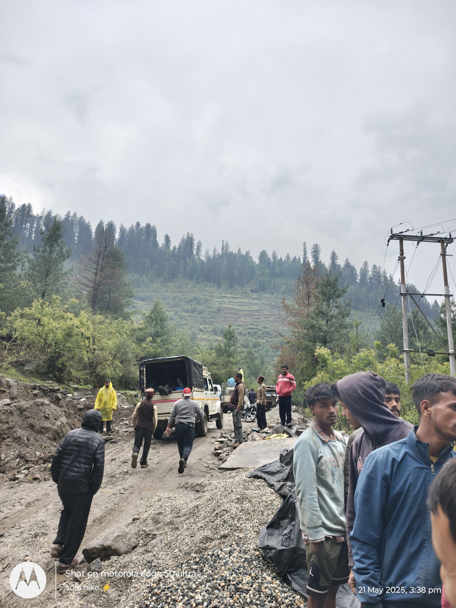
The second day of your Black Peak Expedition starts early with a light breakfast and final gear check. Post breakfast, you’ll board a jeep or Bolero for a short but adventurous 12-km drive from Sankri to Taluka, a small forest settlement and the official starting point of your trek.
The road to Taluka is narrow and rough, cutting through thick forest cover of deodar, oak, and walnut trees. The drive is both thrilling and scenic, with glimpses of cascading waterfalls and the rushing Tons River below.
At Taluka (2,100 m), your trek officially begins. Porters and mules are organized here to carry your load, and after a quick stretch, you’ll set out on foot. The trail from Taluka to Seema is a gradual ascent with a mix of flat walks and short climbs, running parallel to the Tons River.
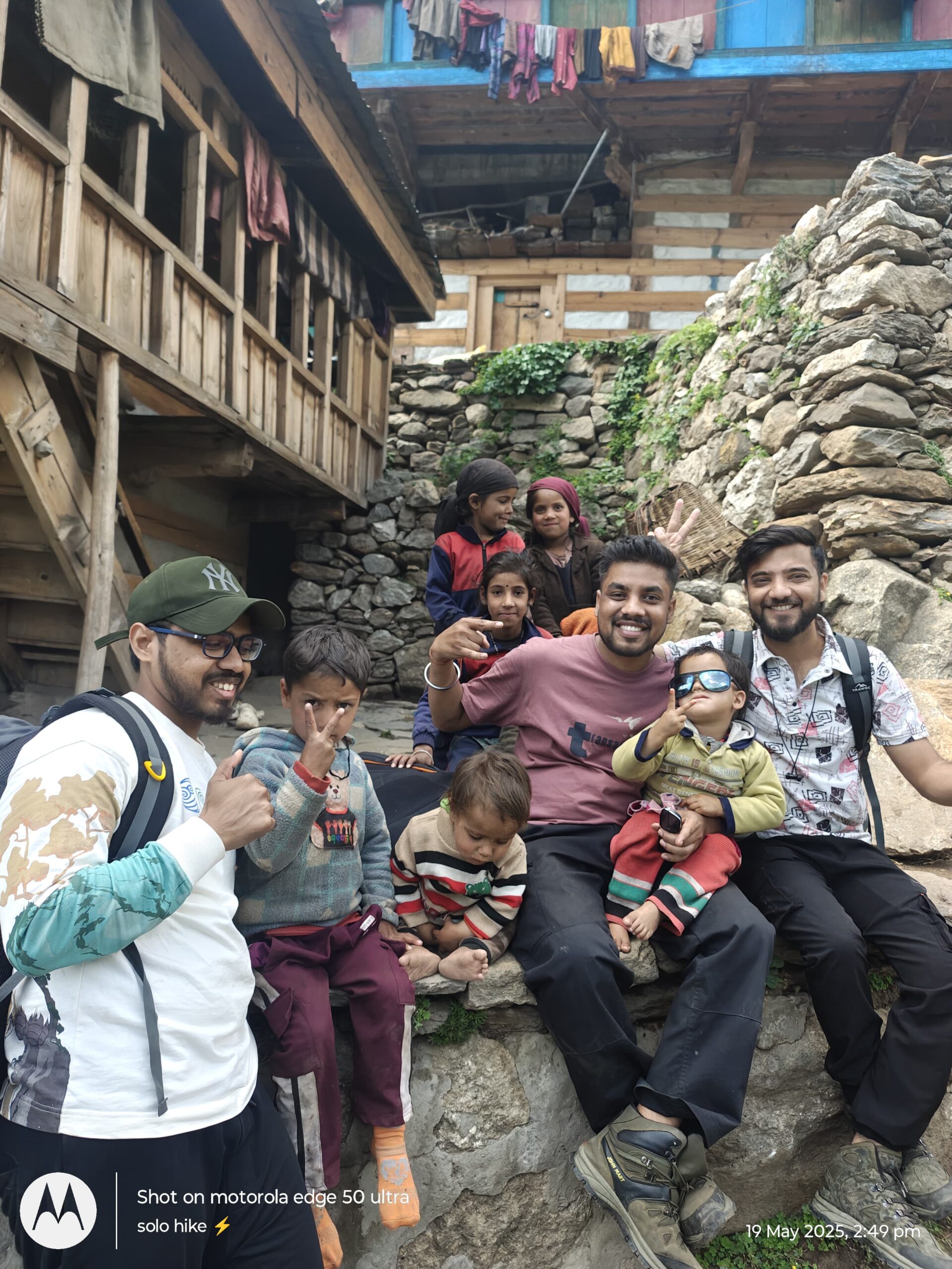
Along the way, you’ll cross wooden bridges, walk through charming Himalayan villages, and pass terraced fields where locals cultivate rajma (kidney beans), potatoes, and barley. After about 2–3 hours of trekking, you’ll reach Ghangad — a good place to rest and refill water bottles.
From Ghangad, the trail becomes slightly steeper but remains well-marked. You’ll trek through dense alpine forests, listening to the sounds of birds and spotting occasional langurs or barking deer. The river flows alongside almost the entire route, adding a refreshing soundtrack to your journey.
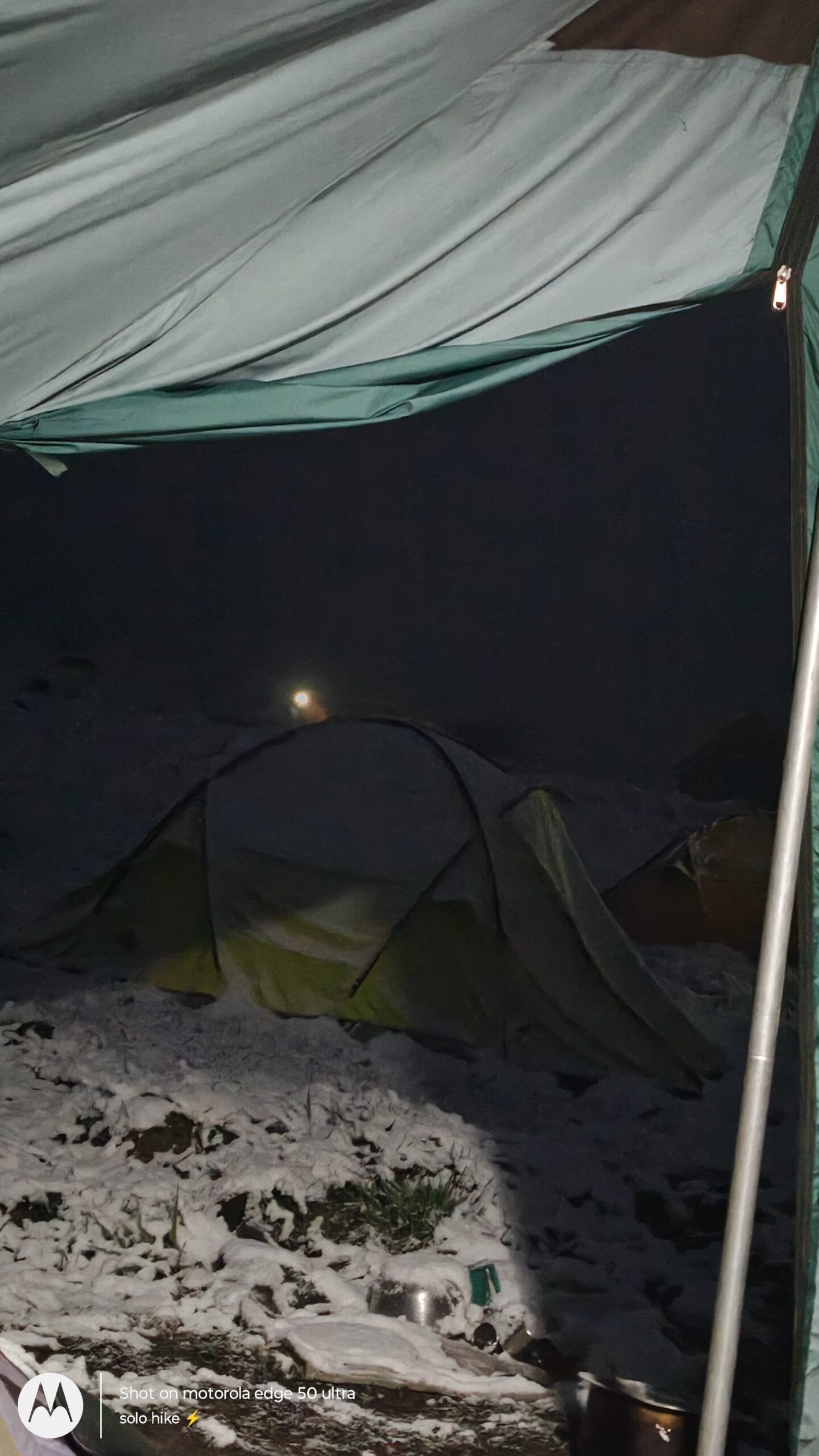
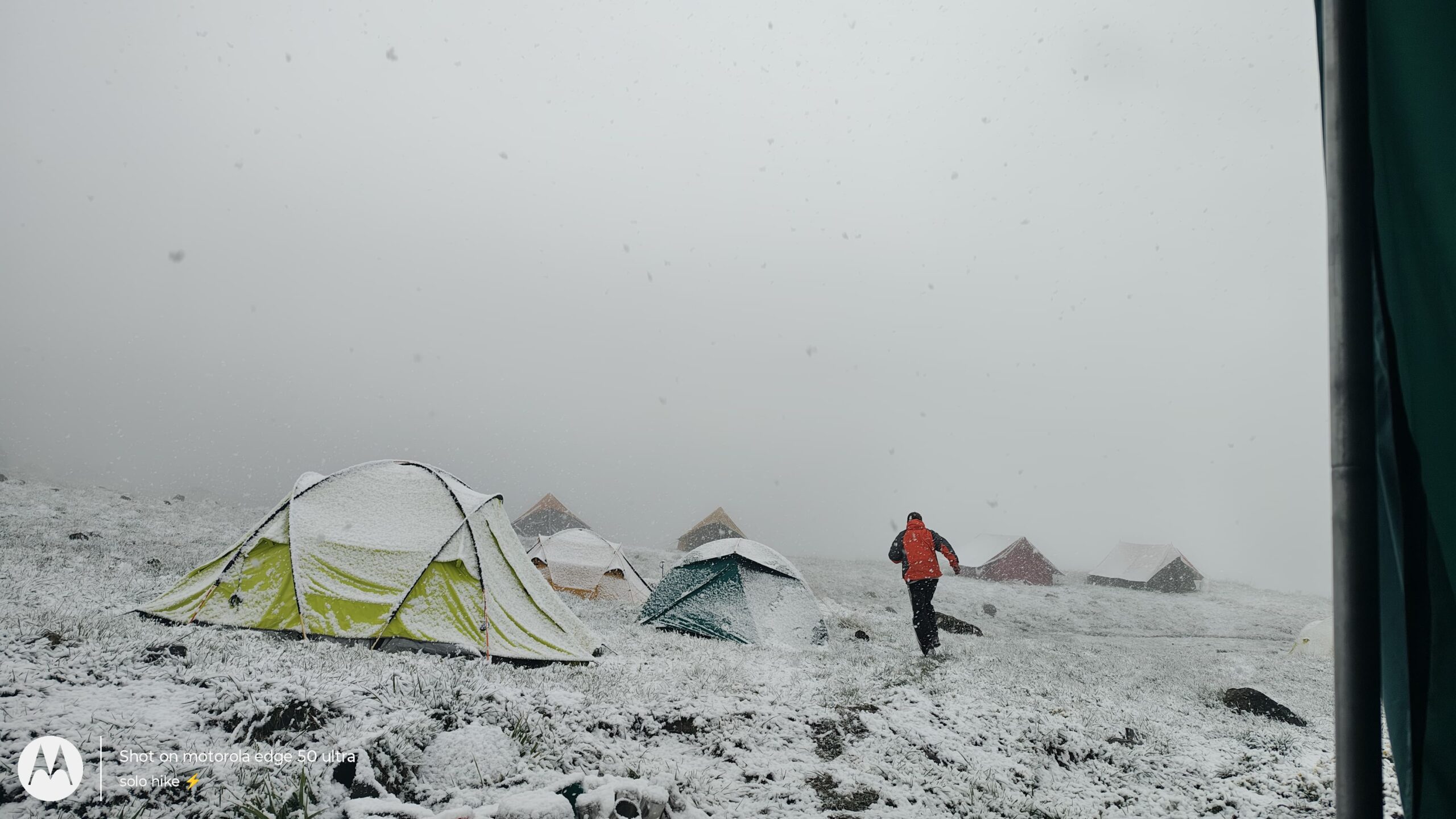
By late afternoon, you’ll reach the Seema Campsite (~2,600 m), located on the opposite side of the river from the famous Osla village (known for its ancient Someshwar Temple dedicated to Duryodhana). Your tents will be pitched in an open meadow surrounded by pine and rhododendron forests.
After settling in, you’ll be served hot tea and snacks, followed by some time to relax, explore the area, or chat with fellow trekkers. A hearty dinner will be served early as the temperature begins to drop, especially after sunset. Your camp leader will brief you about Day 3, and then it’s time to rest and acclimatize for the coming high-altitude days.
Trek Distance: ~9 km
Trek Duration: 4–5 hours
Altitude Gain: ~2,600 m (Seema) → ~3,200 m (Rainbasera)
Trail Type: Moderate ascent with rocky patches and forest trails
Campsite: Beside Supin River at Rainbasera
After a rejuvenating first night in tents and a warm Himalayan breakfast, the trek from Seema to Rainbasera begins. Today’s journey takes you deeper into the Govind Pashu Vihar National Park, transitioning from forested trails to more rugged terrain, surrounded by snow-capped peaks and glacier-fed rivers.
Leaving the Seema campsite, you’ll cross a hanging wooden bridge over the turquoise Supin River and begin your gradual ascent through a scenic trail lined with pine, maple, and walnut trees. The air gets noticeably cooler as you gain altitude, and the views become increasingly dramatic. Look out for birds like the Himalayan Monal, flycatchers, and occasionally, the elusive Himalayan Griffon circling above.
As you trek, the forest begins to thin, giving way to open alpine terrain with boulders and shrubs. The river flows beside you, crashing over rocks and creating a thunderous echo in the valleys. After around 2–3 hours of trekking, you’ll come across Debshu Bugyal, a small clearing often used by shepherds. It offers your first real view of the mighty Black Peak (Kalanag) far in the distance, standing tall and majestic amidst the surrounding mountains.
After a short rest and photo break here, you’ll continue toward Rainbasera, a rocky campsite near the river bank. This is one of the few places where trekkers camp so close to the Supin River. Surrounded by giant boulders and steep cliffs, Rainbasera offers a truly raw Himalayan camping experience.
Arriving by afternoon, you’ll find your tents already set up. After a hot lunch, spend your time exploring the boulder-laden riverside or simply soaking in the silence and power of nature. The gushing sound of the river here is constant — both soothing and humbling.
As evening sets in, temperatures can drop significantly. After a hot dinner, your trek leader will share important instructions and safety guidelines for the next leg of the journey, as we head closer to basecamp in the coming days.
Trek Distance: ~8 km
Trek Duration: 4–5 hours
Altitude Gain: ~3,200 m (Rainbasera) → ~3,600 m (Ruinsara Tal)
Trail Type: Gradual ascent with boulder crossings and open meadows
Campsite: Beside Ruinsara Tal, near a grassy alpine flatland
Today is one of the most scenic and spiritually enriching days of your Black Peak Expedition. You’ll be trekking to the stunning high-altitude lake Ruinsara Tal (3,600 m), a glacial lake deeply revered by locals and steeped in Mahabharata legends.
After morning tea and a warm breakfast at Rainbasera, you’ll pack up and set out for Ruinsara Tal. The trail initially follows the Supin River, weaving through rocky terrain, scree patches, and lush green meadows. As you climb higher, the landscape opens up dramatically — the dense forests are now replaced with alpine grasses, wildflowers, and vast open spaces flanked by snow-capped peaks.
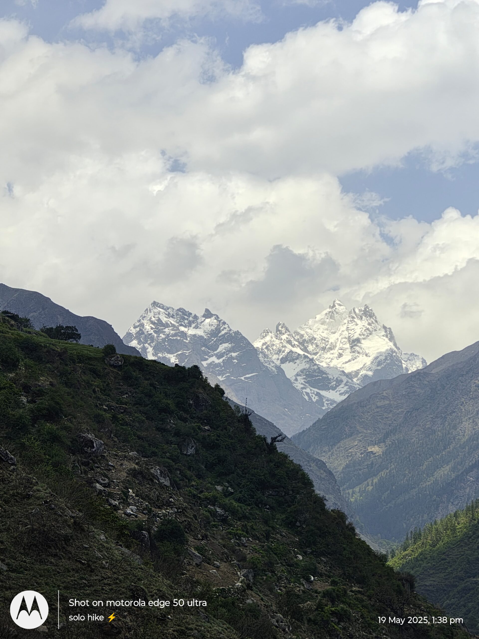
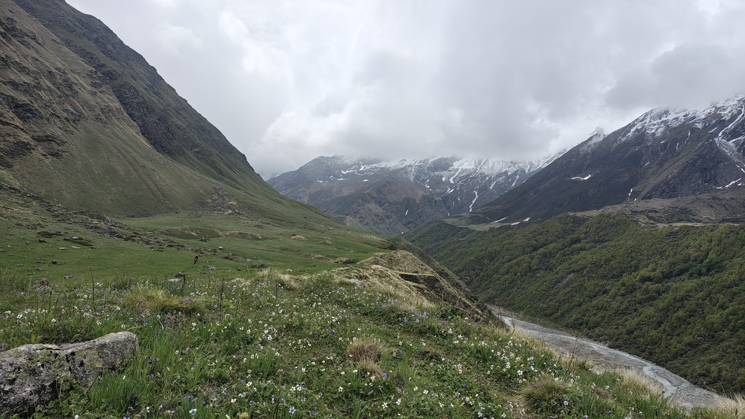
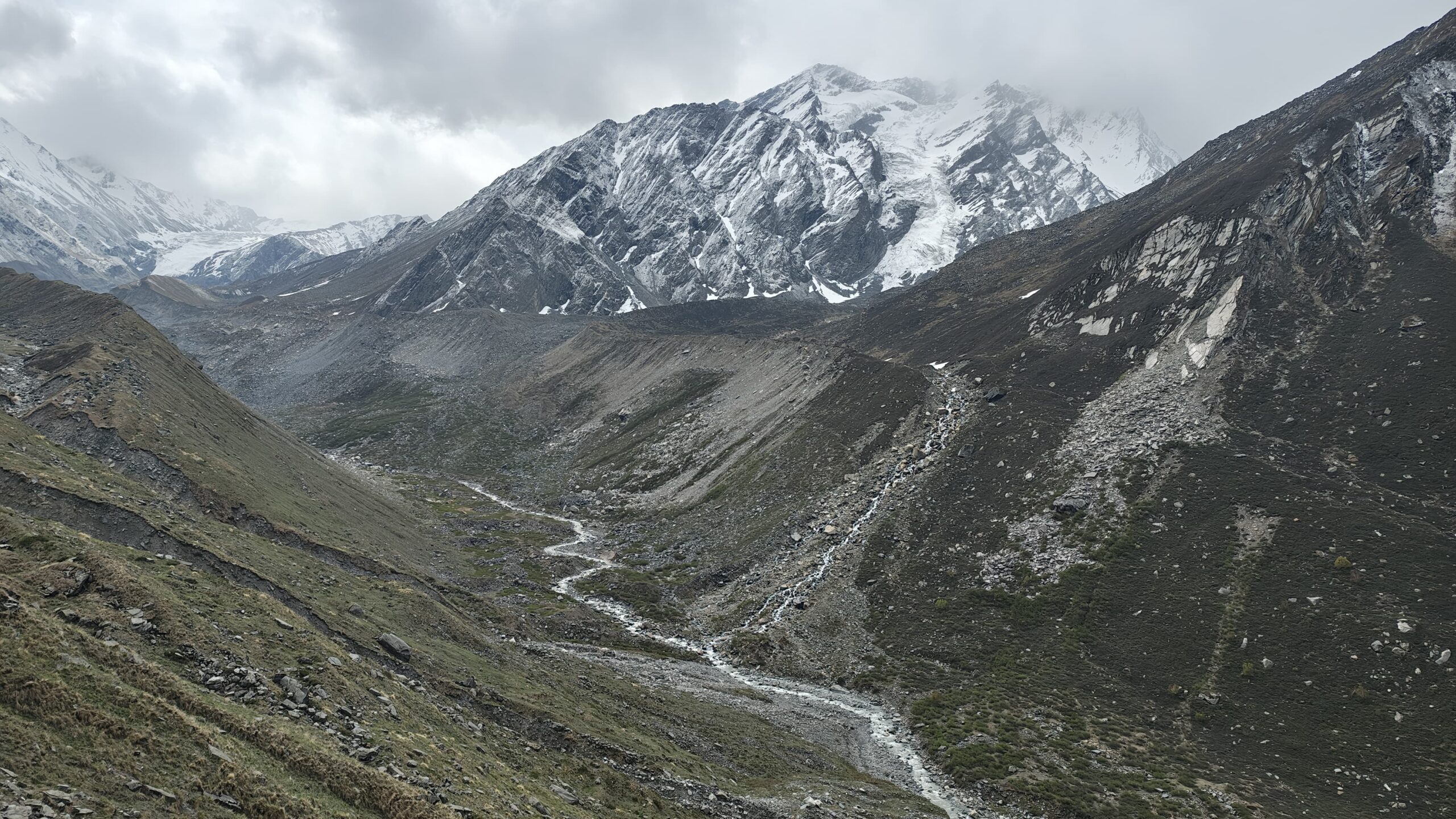
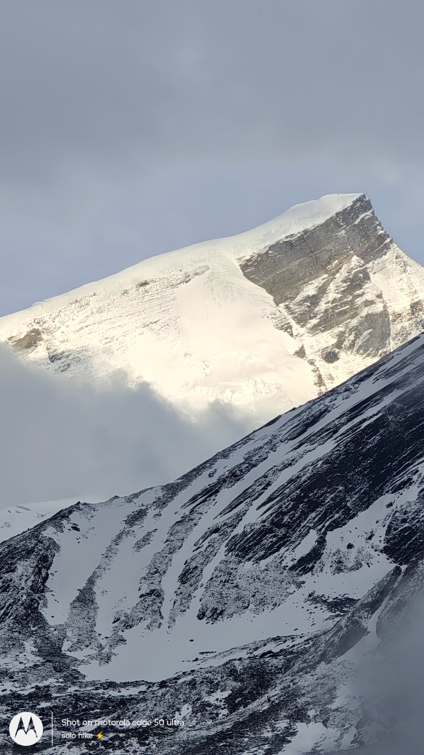
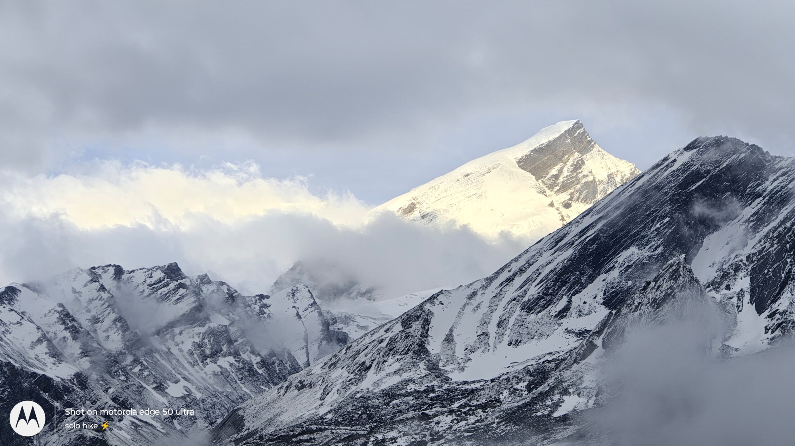
This stretch offers uninterrupted views of some of the most iconic peaks of the region, including Swargarohini (6,252 m), Black Peak (Kalanag – 6,387 m), and Bandarpunch Massif. If the skies are clear, these peaks dominate the skyline in all their glacial glory.
After about 3 hours of trekking, you’ll arrive at the shores of Ruinsara Tal, a small but serene glacial lake fed by mountain streams. The crystal-clear water reflects the surrounding peaks, and the silence is profound. The area around the lake is considered sacred by the locals, who believe the Pandavas visited this site during their exile. It’s also said that this is the path they took on their journey toward Swargarohini, the “Stairway to Heaven.”
Your campsite will be pitched a short distance away from the lake, in a wide alpine meadow that offers flat terrain and panoramic views. You’ll reach by early afternoon, giving you ample time to relax, explore, and acclimatize.
After a hot lunch and some rest, take a short acclimatization walk or simply enjoy quiet time by the lake. Evening tea and snacks will be served as the golden hour bathes the landscape in warm hues. As night falls, the temperature dips sharply, often reaching sub-zero in early summer or autumn.
A briefing session after dinner will prepare you for the next day’s trek to Black Peak Base Camp, which marks the start of more technical and challenging terrain.
Trek Distance: ~7 km
Trek Duration: 5–6 hours
Altitude Gain: ~3,600 m (Ruinsara Tal) → ~4,200 m (Kyarkoti Base Camp)
Trail Type: Gradual to steep ascent, with moraines and alpine ridgelines
Campsite: Kyarkoti Base Camp, surrounded by glaciers and rocky terrain
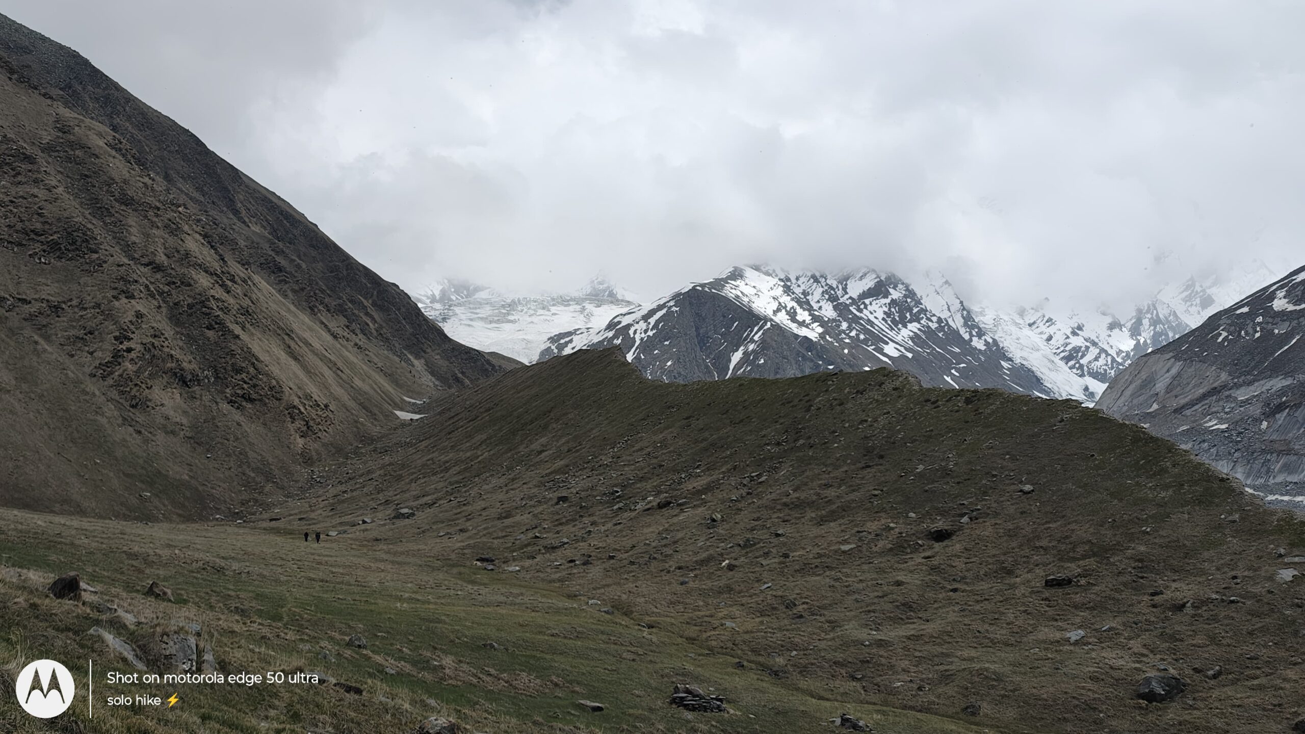
Today marks a major milestone in your Black Peak Expedition — the journey from Ruinsara Tal to Kyarkoti Base Camp will take you to 4,200 meters, entering the glacial basin where summit plans begin to take shape. This day’s trek is both physically demanding and visually spectacular.
After an early wake-up call and a warm breakfast by the lake, you’ll begin your ascent. The trail initially moves east from Ruinsara Tal, climbing gradually across open meadows and flower-strewn alpine ridges, with stunning views of Swargarohini, Kalanag, and Bandarpunch in the backdrop.
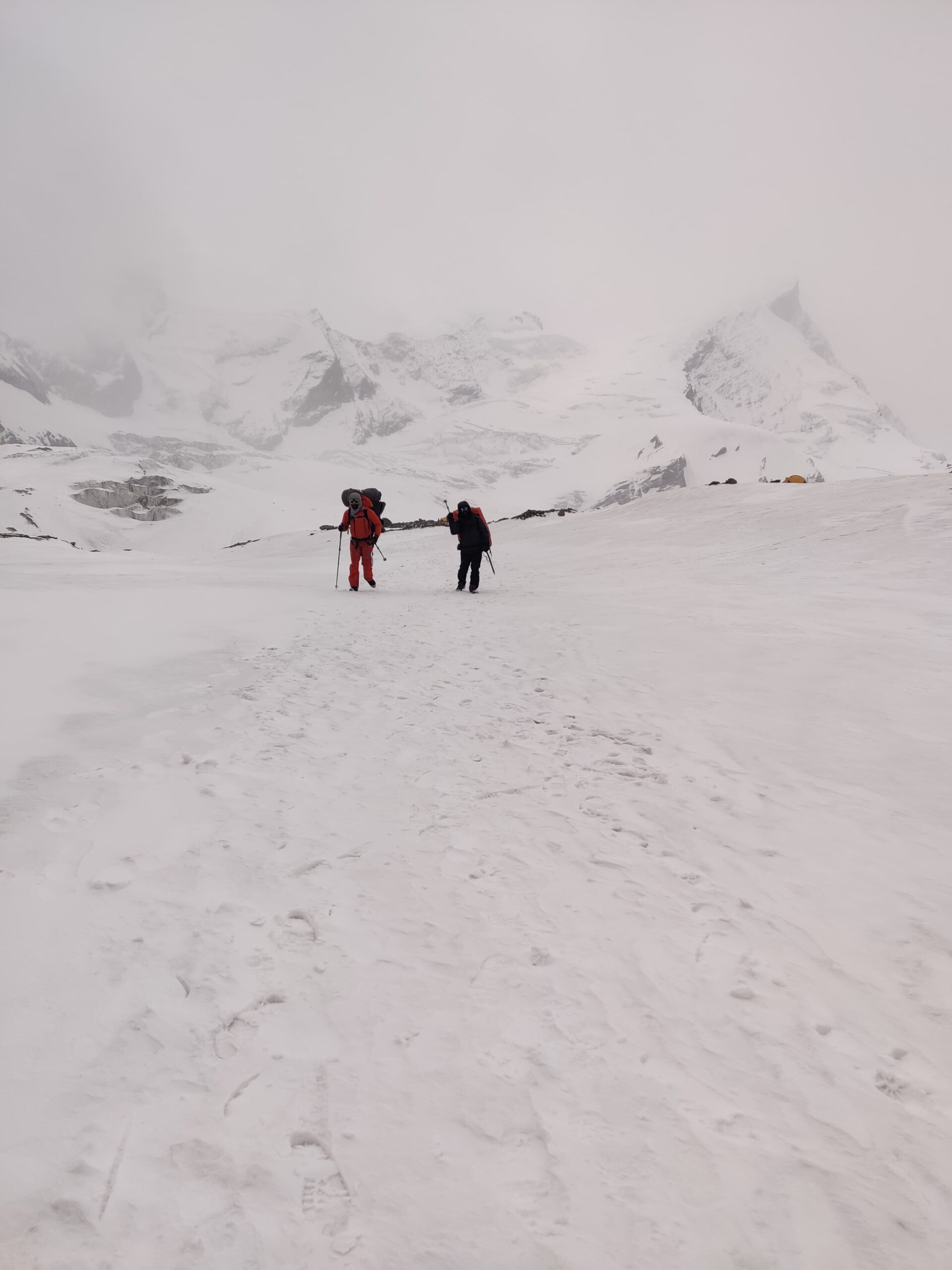
As you move farther, the lush greenery gives way to rock-strewn landscapes, glacial moraines, and scree zones. The oxygen level begins to dip noticeably, and every step feels heavier. This part of the trail requires careful footing as you cross loose rock, narrow ridges, and boulder zones. Trekking poles and proper boots are essential here.
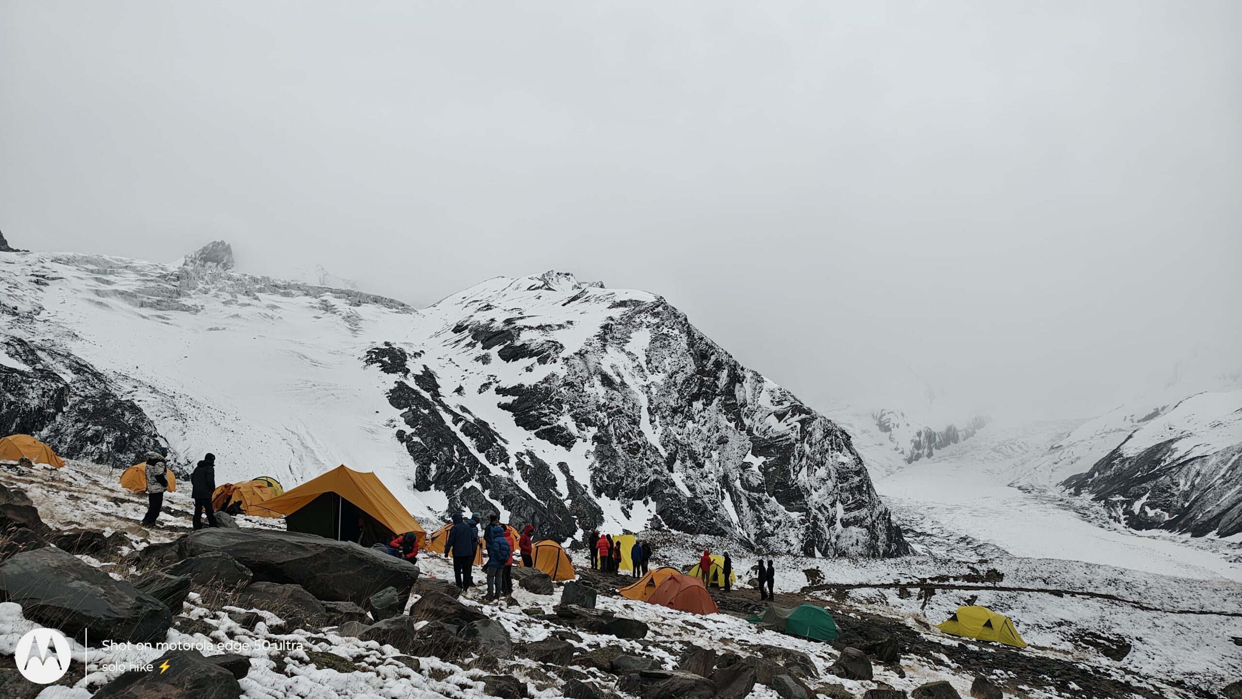
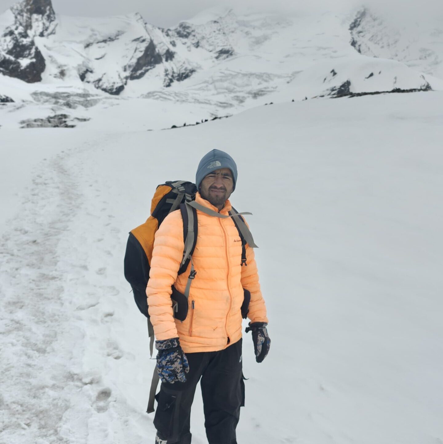
Kyarkoti — meaning “Valley of Boulders” in the local dialect — lives up to its name. It’s a broad alpine valley filled with massive rocks, glacial debris, and small streams from melting snow. Towering cliffs and snow-clad faces surround the base camp, offering a 360° amphitheater view of the Garhwal Himalayas.
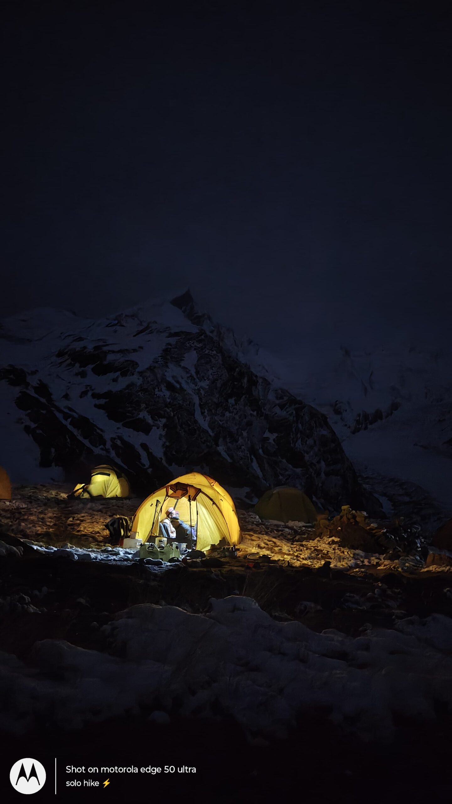
Reaching Kyarkoti Base Camp by early to mid-afternoon, you’ll find your tents already pitched on rocky but flat terrain. The air is thin, cold, and incredibly crisp. You may spot glacial ice patches nearby or even a few Himalayan ibexes or marmots in the surrounding cliffs.
The evening is for rest, acclimatization walks, and a detailed technical briefing by the expedition leader. This includes training on using ice axes, crampons, ropes, and harnesses, which will be required for the final summit push.
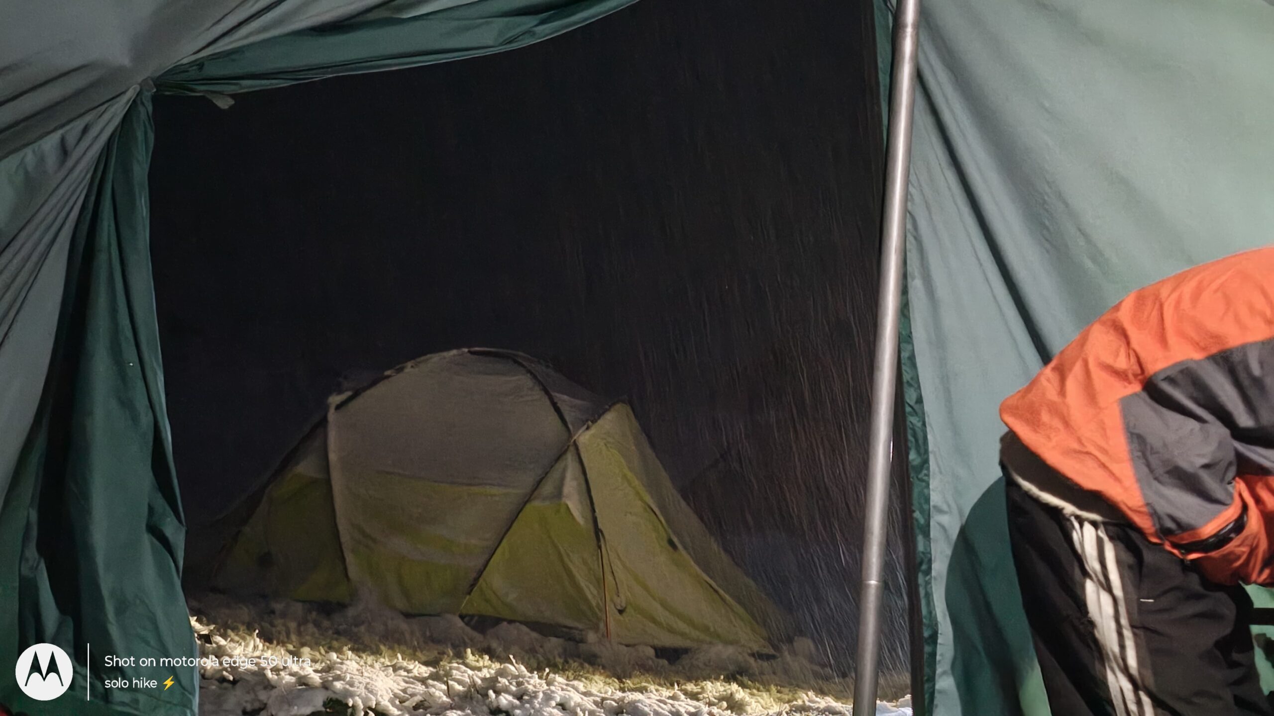
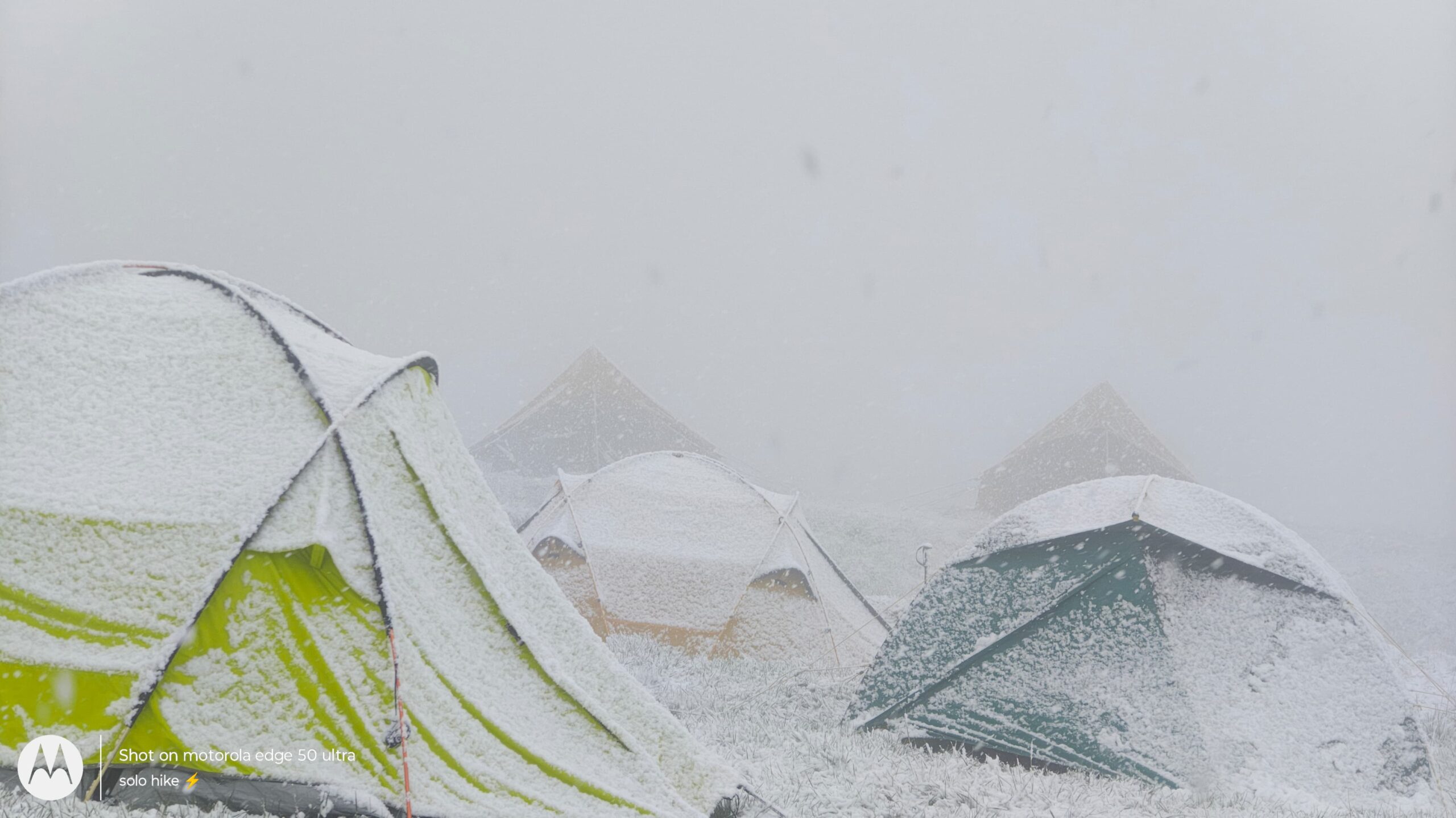
A hearty dinner will be served early, as temperatures plummet after sunset. Nights at Kyarkoti are usually freezing, often reaching -5°C or lower, especially in spring and autumn.
Trek Distance: ~4–5 km
Trek Duration: 4–5 hours
Altitude Gain: ~4,200 m (Kyarkoti) → ~4,550 m (Dharaon Ki Odari)
Trail Type: Steep ascent over glacial moraine, snow patches, and rocky ridges
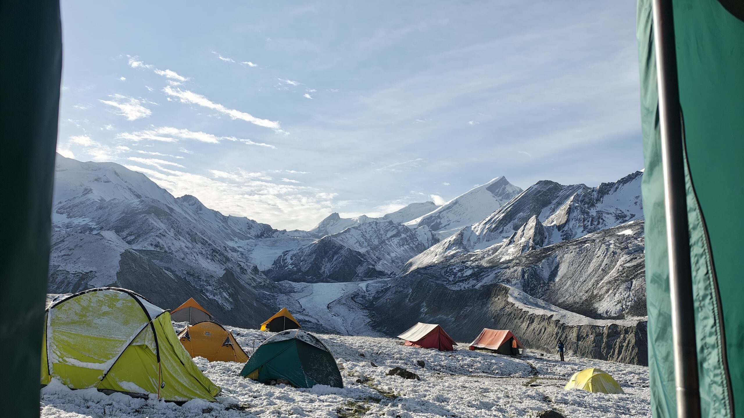
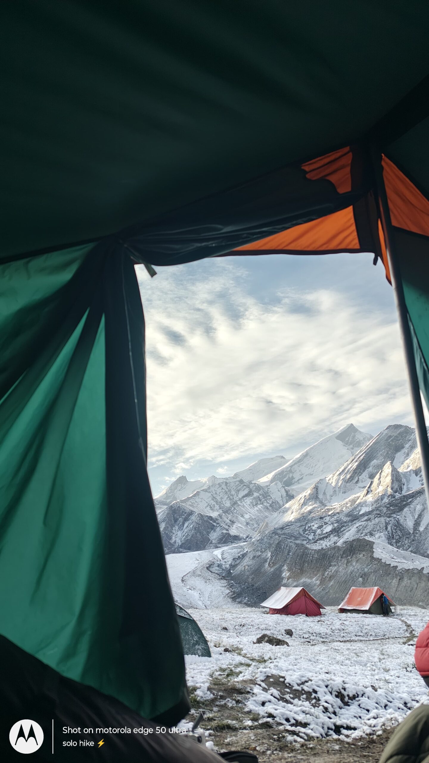
Campsite: Dharaon Ki Odari – Advanced Base Camp (ABC) beneath Black Peak
Today’s trek marks your progression into technical mountaineering territory, as you leave behind Kyarkoti Base Camp and ascend to Dharaon Ki Odari, the Advanced Base Camp (ABC) for your Black Peak summit attempt. This zone lies in the shadow of Kalanag (Black Peak – 6,387 m) and is used for acclimatization and preparation before the final summit camp.
After breakfast, the trek begins with a steep and strenuous ascent. The trail climbs over loose moraine, scree fields, and boulder-strewn ridgelines. Trekking here requires focus, coordination, and stamina as the terrain becomes more rugged and unpredictable. You’ll likely be wearing gaiters and carrying crampons, as you may encounter patches of snow and ice depending on the season.
The scenery is surreal — the valley narrows, snowfields widen, and massive rock faces rise steeply on both sides. You’ll pass glacial melt streams and ice shelves. By mid-morning, the entire Bandarpunch range becomes clearly visible behind you, while Black Peak looms ahead — imposing, jagged, and awe-inspiring.
After 4–5 hours of challenging trekking, you’ll reach Dharaon Ki Odari (~4,550 m) — which means “the cave of slopes” in the local Garhwali dialect. This site offers some shelter from winds, with scattered boulders and natural rock overhangs. It’s a traditional high-altitude shepherd shelter that now serves as ABC for mountaineering teams.
Upon reaching, your technical team will establish the camp, and you’ll have time to rest, rehydrate, and eat a hot high-calorie lunch. This is a critical acclimatization stop, and you’ll begin adjusting to thinner oxygen levels while preparing mentally and physically for the summit phase.
The evening is reserved for gear familiarization and glacier safety practice. You’ll receive hands-on training in:
Rope-up techniques
Walking in crampons on snow/ice
Handling ice axes
Self-arrest and crevasse safety
Weather conditions can change rapidly at this altitude. The night will be cold, windy, and temperatures may drop to -8°C to -10°C, so staying insulated and dry is crucial.
Trek Distance: ~3–4 km
Trek Duration: 4–5 hours (depending on snow conditions)
Altitude Gain: ~4,550 m (Dharaon Ki Odari) → ~5,100 m (Arjun Chhadd – Summit Camp)
Trail Type: Steep, glaciated route over snow, moraine, and crevasses
Campsite: Arjun Chhadd – Final summit camp at the glacier’s edge
Day 7 takes you one step closer to the summit of Black Peak (Kalanag) as you ascend from Dharaon Ki Odari to Arjun Chhadd, the final summit camp. This is the most technical and challenging trekking day so far, as you move deep into the glacial terrain of the upper Tons Valley.
The day begins very early — often before sunrise — as your team prepares for an intense push across a dangerous and dynamic alpine environment. After a high-calorie breakfast and full gear check, you’ll rope up with your climbing team and begin the ascent over steep moraine and glacial ice.
From this point forward, you’ll be using:
Crampons for snow/ice grip
Ice axes for balance and arrest
Ropes and harnesses for safe travel over glaciers and snow bridges
The route passes through complex crevasse fields, loose scree zones, and snow ridges. Your experienced guides will lead you in rope teams, navigating one of the most exposed sections of the expedition. Trekking at these altitudes (above 5,000 meters) is slow and physically exhausting due to thin air, strong UV, and frigid winds.
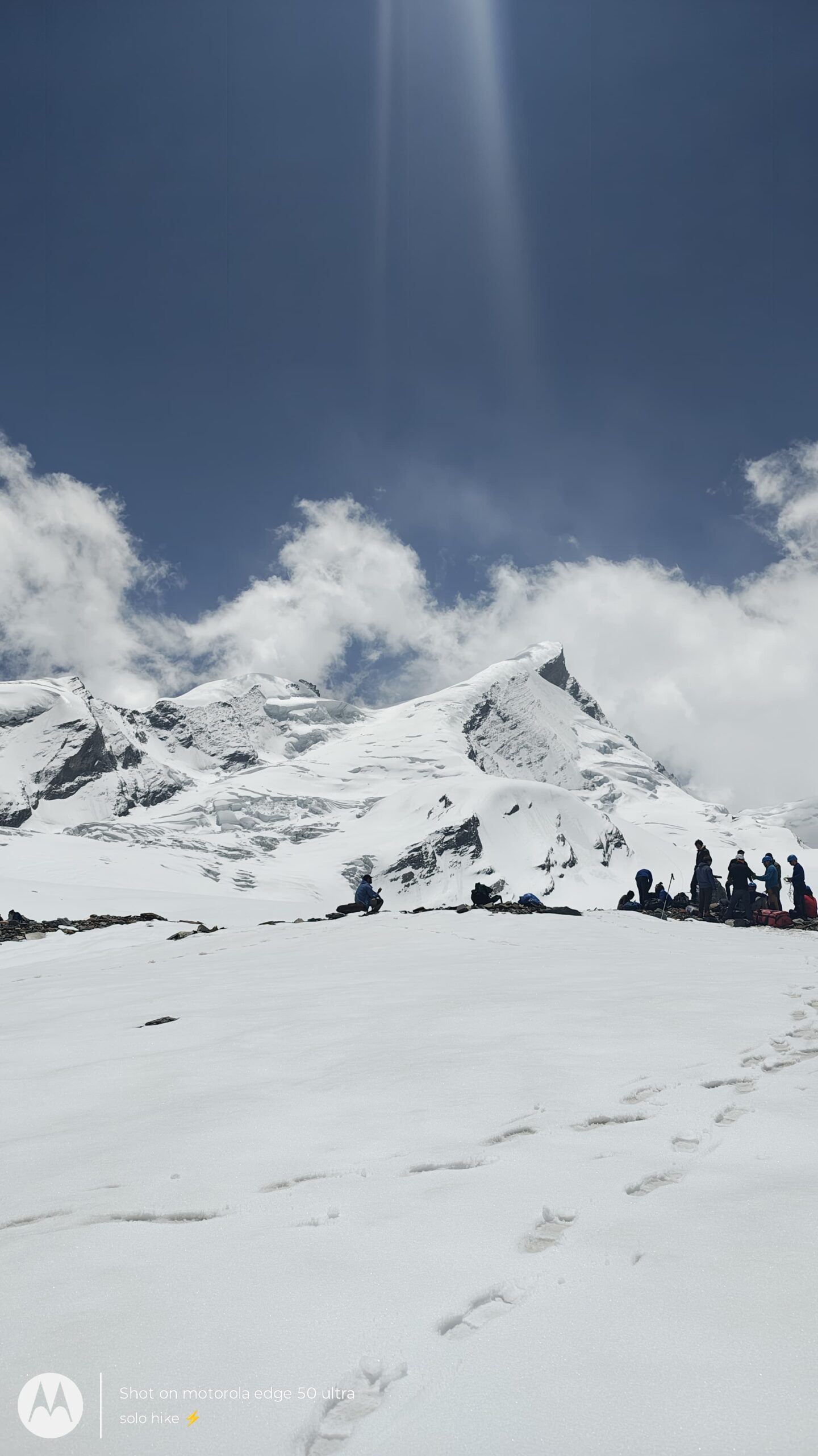
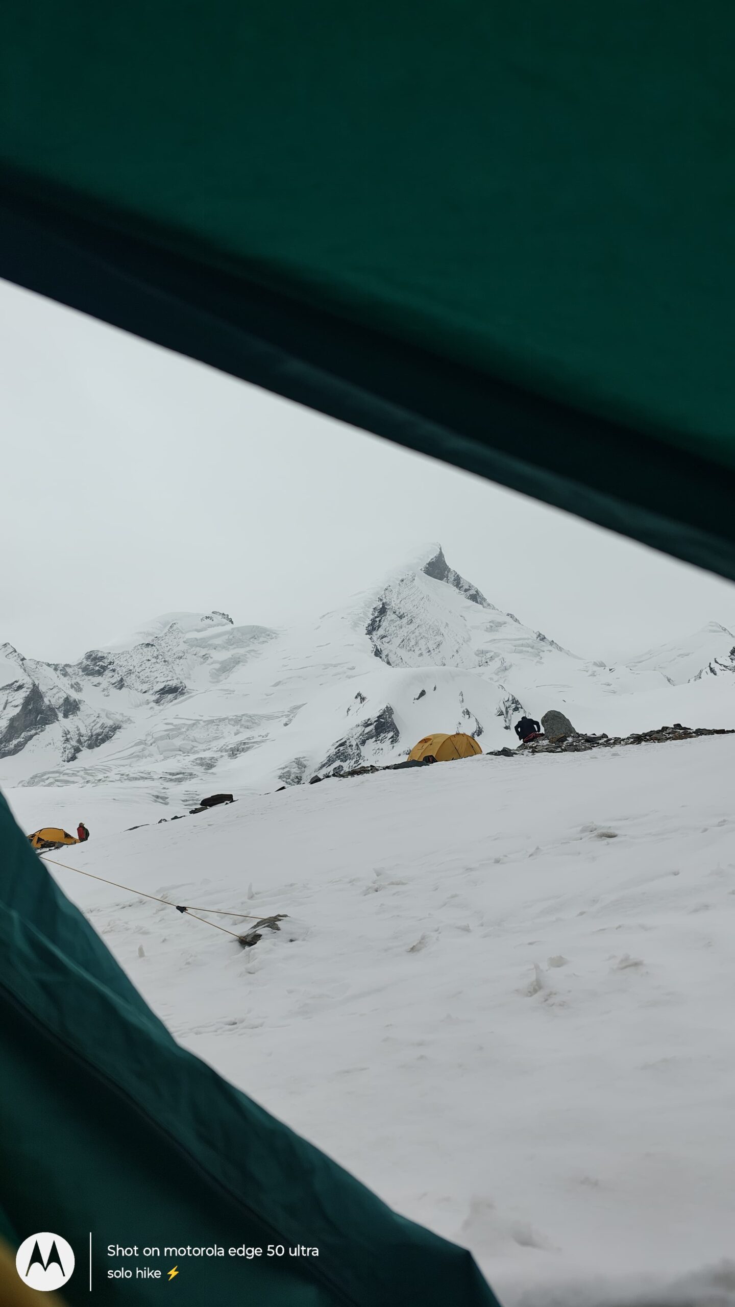
After 4–5 hours of steady movement, you’ll reach Arjun Chhadd (~5,100 m) — a rocky and snowy campsite located just below the summit face of Kalanag (Black Peak). This location serves as the launchpad for the summit attempt, typically planned for the next early morning.
Arjun Chhadd holds mythological significance as well — local lore says Arjuna from the Mahabharata meditated here before ascending Swargarohini with his brothers. Even today, locals revere this site as sacred ground.
The view from this altitude is phenomenal: you’re now staring directly at the snow-laden upper slopes of Black Peak, with Bandarpunch, Swargarohini, and White Peak forming a majestic background. Glacial winds blow cold and fast here — temperatures can dip to -10°C or lower, and every movement requires precision and awareness.
Once camp is set up, you’ll eat a light early dinner, hydrate heavily, and begin preparations for your summit push, which typically starts around midnight or 1 AM the following morning. Everyone is advised to rest early and gear up before sleeping — your summit window is small, and everything must be ready.
Trek Distance: ~3–4 km
Trek Duration: 3–4 hours
Altitude Loss: ~5,100 m (Arjun Chhadd) → ~4,550 m (Dharaon Ki Odari – ABC)
Trail Type: Steep descent over glacier, snow, and moraine
Difficulty: Moderate to challenging (technical descent)
After spending a freezing and high-altitude night at Arjun Chhadd (5,100 m) — the summit camp nestled below Black Peak — today is focused on descending safely back to Advance Base Camp (Dharaon Ki Odari). Whether due to weather conditions, acclimatization schedules, or a planned rest/reset day, today serves as a crucial transition back from extreme high altitude.
The day starts a bit later than usual compared to summit schedules, allowing you time to rest, warm up with a light breakfast, and slowly pack down the summit camp. As the sun rises over the Bandarpunch range, the surroundings look ethereal — glistening snowfields, rugged ridges, and glacial cliffs frame the campsite in silence.
The descent begins with a careful rope-down over steep ice and snow-covered slopes, using crampons, trekking poles, and support from your technical guides. The path retraces the glacial trail you climbed two days ago, crossing rocky terrain, snow ridges, and crevasse-prone areas. The pace is deliberate to ensure safety, especially on unstable or slippery snow bridges and moraines.
This stretch is a good opportunity to apply the technical skills you’ve learned — descending in rope teams, managing balance on steep slopes, and navigating loose terrain. You’ll likely cover the descent in 3 to 4 hours, with short hydration breaks.
By late morning or early afternoon, you’ll reach Dharaon Ki Odari (~4,550 m) — the Advance Base Camp nestled beside natural rock formations used historically by shepherds and trekkers. Your tents will be re-pitched or pre-arranged, and a hot lunch will be served to help you recover.
The afternoon is meant for rest and recovery — drink plenty of fluids, take a short acclimatization walk if recommended, and relax. Many teams use this day to regroup, assess weather forecasts, or prepare for another summit attempt if the schedule permits.
As evening sets in, the entire glacier valley is lit by alpenglow on Swargarohini and Black Peak — a reward in itself. The cold will return quickly after sunset, so early dinner and proper layering are advised.
Trek Distance: ~10–12 km (ascent + descent)
Ascent Time: 7–9 hours
Descent Time: 3–4 hours
Altitude Gain: ~4,550 m (ABC) → 6,387 m (Summit)
Altitude Loss: Summit → 5,100 m (Arjun Chhadd)
Trail Type: Steep glacier, snow slopes, crevasse navigation, technical climb
Start Time: Around 12:00 midnight (Alpine start)
Difficulty: Very Challenging | Technical | High Altitude
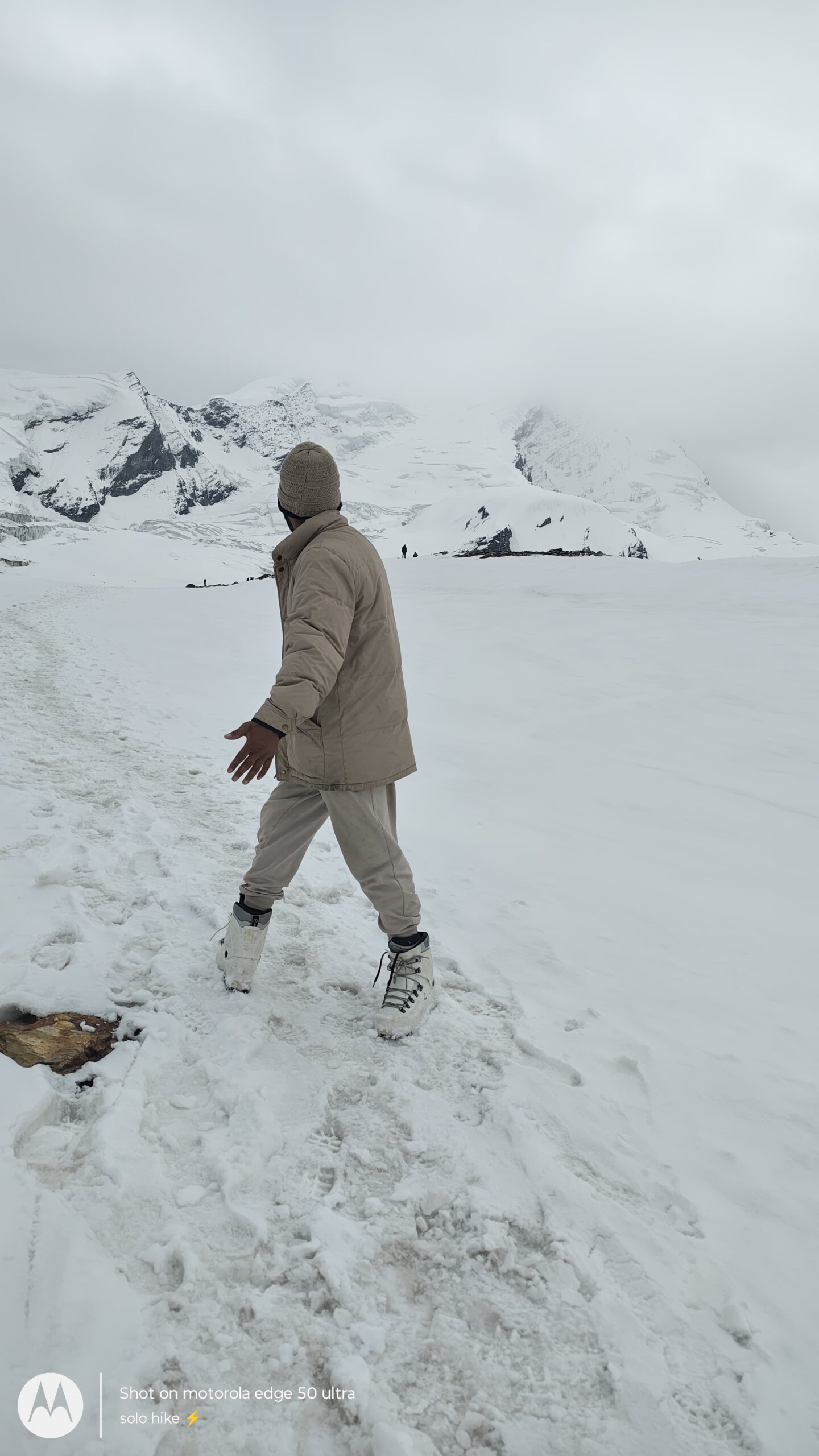
This is the most significant and challenging day of your Black Peak Expedition. You will attempt to summit Kalanag (Black Peak – 6,387 m), one of the highest and most technical trekking peaks in Uttarakhand. The day starts well before dawn, around midnight, under clear skies and freezing temperatures.
After a light but energy-rich meal at Advance Base Camp (ABC), you’ll rope up with your climbing team and begin the glacier traverse using crampons, harnesses, and headlamps. The initial section involves walking on ice and snow, crossing hidden crevasses, and navigating through gentle snow slopes.
As the climb progresses, you’ll encounter steep gradients (35°–45°) requiring the use of ice axes, fixed ropes, and ascending devices (like jumars). Your mountaineering guide will lead the team through these technical patches with great care. The cold intensifies with altitude, and winds often grow stronger near the summit ridge.
After 7–9 hours of steady effort, you’ll reach the summit of Black Peak (6,387 m). The final summit ridge is narrow and exposed, offering a breathtaking 360-degree view of the Swargarohini massif, Bandarpunch peaks, Gangotri glacier zone, and the far-off mountains of Himachal and Tibet.
You’ll spend just 10–15 minutes on the summit, enough to absorb the view, take photos, and reflect on the journey. Due to thin oxygen and unpredictable weather, longer stays at the top are not advised.
The descent begins immediately after the summit. You’ll carefully retrace your steps using the same ropes, snow anchors, and fixed lines. Instead of returning to ABC, you’ll descend to Arjun Chhadd (~5,100 m) — the higher summit camp, offering a shorter and more manageable descent on the same day.
Reaching Arjun Chhadd by late afternoon, you’ll be welcomed with hot fluids and snacks. The rest of the day is for hydration, recovery, and rest after this long and physically demanding achievement. Dinner will be served early, and you’ll sleep with the satisfaction of summiting one of Uttarakhand’s most iconic peaks.
Trek Distance: ~3–4 km
Trek Duration: 2.5–3.5 hours
Altitude Loss: ~5,100 m (Arjun Chhadd) → ~4,550 m (Dharaon Ki Odari – ABC)
Trail Type: Glacial descent with snow patches, loose moraine, and rocky terrain
Difficulty: Moderate | Slippery in parts | Requires focus on footing
After successfully summiting Kalanag (Black Peak – 6,387 m) or attempting the summit on Day 9, Day 10 is all about recovery and a safe descent from the extreme altitude zone. Today, you’ll descend from the exposed Arjun Chhadd Summit Camp (~5,100 m) back to the relatively sheltered Advance Base Camp at Dharaon Ki Odari (~4,550 m).
The day starts after a relaxed morning and warm breakfast. You’ll pack your gear slowly and begin the descent with care, as the terrain still involves snow patches, glacial ice, and loose rocks. The first hour will be a steep downhill walk, requiring proper use of crampons, trekking poles, and balance control.
The route retraces your path from a few days earlier. You’ll again cross glacial moraines, pass through boulder fields, and walk over ice-hard snow slabs. Visibility is usually good during the descent, offering clear views of the Bandarpunch and Swargarohini ranges, as well as the path you conquered toward the summit.
Though shorter than previous days, this descent requires caution — fatigue, dehydration, and loose footing are common at this stage. Take breaks as needed, sip water regularly, and follow your guide closely.
By mid-morning or early afternoon, you’ll reach Dharaon Ki Odari — your ABC camp near the natural rock shelter. The return to this site feels like stepping back into a comfort zone after a high-stakes summit night. You’ll be served hot lunch, and the rest of the day is reserved for rest, reflection, and slow walking to flush lactic acid and support recovery.
Evening at ABC is a mix of gratitude, storytelling, and well-earned rest. The cold here is still sharp, but more tolerable than the summit camp, and the psychological relief of descending makes for a good night’s sleep.
Trek Distance: ~5–6 km
Trek Duration: 4–5 hours
Altitude Loss: ~4,550 m (ABC – Dharaon Ki Odari) → ~4,200 m (Kyarkoti)
Trail Type: Steep moraine and boulder descent into alpine meadow
Difficulty: Moderate | Slippery zones | Demanding on knees and ankles
Today’s descent from Dharaon Ki Odari (4,550 m) to Kyarkoti Base Camp (4,200 m) marks your gradual exit from the high glacial zone and return to the gentler alpine meadows of the Garhwal Himalayas.
After a warm breakfast and morning views of the towering Black Peak face, you’ll begin your downhill trek over glacial moraine, rocky ridgelines, and loose scree sections. Although the distance isn’t long, each step requires focus due to the uneven and often slippery terrain, especially as you descend from snow to stone.
As you trek lower, you’ll begin to feel the shift in terrain and vegetation — from snow patches and hard rock to small alpine grasslands and trickling streams. The valley begins to open up again, revealing wider views of the Swargarohini range, the glacier basin, and the surrounding cliffs where you camped a few days ago.
You may spot familiar landmarks — crevasse lines, icy ledges, or ridge outcrops — that you crossed during your approach. The Bandarpunch and Kalanag summits will now appear more distant, allowing a reflective moment to look back at what you’ve achieved.
By early to mid-afternoon, you’ll reach Kyarkoti, a wide and scenic alpine meadow flanked by boulders, glacier-fed streams, and panoramic ridges. It’s a welcome shift after days of technical climbing and harsh high-altitude terrain.
Camp will be set up in a flat area where you can comfortably pitch tents, rest, and recover. Hot lunch is followed by plenty of downtime to soak in the crisp mountain air, stretch sore muscles, or journal your journey.
Evening tea will be served with the backdrop of golden sunlight dancing over snow-clad peaks. After dinner, gather with your team to share summit stories under a brilliant starry sky — often clearer and more vivid than anything visible from the plains.
Trek Distance: ~7 km
Trek Duration: 4–5 hours
Altitude Loss: ~4,200 m (Kyarkoti) → ~3,600 m (Ruinsara Tal)
Trail Type: Gradual to moderate descent over rocky, grassy, and forested terrain
Difficulty: Easy to moderate | Long walking day | Emphasis on controlled descent
On Day 12, you’ll continue your descent from the glacier-wrapped terrain of Kyarkoti Base Camp (~4,200 m) to the beautiful high-altitude lake of Ruinsara Tal (3,600 m) — a place steeped in mythology, alpine beauty, and calm serenity.
The day begins with a relaxed morning, surrounded by the majestic cliffs and rocky outcrops that dominated the past few days. After breakfast, you’ll begin descending southward along the Kyarkoti Valley, retracing parts of the trail taken earlier in the expedition. The route offers excellent views of the surrounding glaciers, hanging valleys, and distant peaks like Swargarohini and Bandarpunch.
As you move down, the terrain becomes more forgiving — transitioning from moraine and loose rock to lush alpine grasslands, dotted with wildflowers (especially in post-monsoon season). The meadows stretch along the narrow valley floor, making this one of the most scenic portions of the descent.
After about 3–4 hours of trekking, you’ll arrive once again at Ruinsara Tal, the pristine glacial lake revered by locals and trekkers alike. According to legend, this lake was visited by the Pandavas during their final journey to heaven (Mahaprasthan). Surrounded by birch and pine trees, and reflecting snowy peaks in its still waters, Ruinsara Tal is a peaceful haven after your long expedition.
Camp will be set up near the lake’s edge. After lunch, take time to rest, meditate, or journal beside the lake. Many trekkers choose to take a short walk around Ruinsara Tal, revisit the nearby meadows, or just lie back and absorb the tranquility.
Dinner is served under a clear Himalayan sky, and the night is usually peaceful — a stark contrast to the technical and intense days you’ve just completed.
Total Trek Distance: ~18–20 km
Trek Duration: 7–8 hours (including breaks)
Altitude Loss: ~3,600 m (Ruinsara Tal) → ~1,920 m (Sankri)
Trail Type: Gradual and steep descent through alpine meadows, forests, riversides, and village trails
Difficulty: Long but moderate | Gentle terrain with extended hours of walking
On the final day of your Black Peak Expedition, you’ll descend from the stunning high-altitude lake of Ruinsara Tal (3,600 m) all the way back to Sankri village (~1,920 m) — the trailhead where your adventure first began.
After an early breakfast beside the lake, you’ll start your descent through lush alpine meadows, retracing your steps toward Seema (2,560 m) — a familiar campsite along the Har Ki Dun route. The initial section of the trail descends gradually along the Ruinsara River, offering views of the valley’s full expanse, with snow-capped peaks rising behind you.
As you lose altitude, the terrain shifts dramatically: from open meadows and birch forests into dense pine and oak woodlands. After about 3–4 hours of trekking, you’ll reach Seema, a rest point and the junction for treks to Har Ki Dun, Bali Pass, and Black Peak.
From Seema, you’ll cross the iconic wooden bridge over the Supin River, and begin a long but rewarding descent through villages like Oslo, passing traditional wooden homes, terraced farms, and grazing cattle. The trail becomes well-paved toward the end, and after another 3–4 hours of scenic walking, you’ll finally reach Taluka (road head).
Depending on the time and conditions, you’ll either walk or drive the last 11 km from Taluka to Sankri in a shared jeep or tempo traveller (approx. 45 mins to 1 hour by road).
Upon reaching Sankri, you’ll check in at your homestay or guesthouse. Hot chai, warm food, and a celebratory dinner await. This evening is perfect for reflecting on the journey, sharing summit stories, exchanging contacts, and celebrating the completion of one of Uttarakhand’s most epic alpine expeditions.
Distance: ~200 km
Travel Time: 8–9 hours by road
Route: Sankri → Netwar → Mori → Purola → Nainbagh → Mussoorie → Dehradun
Altitude Loss: ~1,920 m (Sankri) → ~640 m (Dehradun)
Travel Mode: Private shared vehicle (Tempo Traveller/Bolero)
Drop-off Location: Dehradun Railway Station or ISBT by evening
Your Black Peak Expedition officially concludes today as you journey back from the peaceful mountain hamlet of Sankri (1,920 m) to the bustling city of Dehradun (~640 m). After breakfast and final goodbyes with your trek leaders, porters, and team members, you’ll board a shared private vehicle arranged by the operator.
The drive begins along the Supin River valley, passing traditional villages, apple orchards, and thick pine forests. You’ll descend through the charming towns of Netwar and Mori, then wind your way down through Purola and Nainbagh, where the terrain gradually transitions from high Himalayan ridges to lush foothills.
As you pass Mussoorie or Yamuna Bridge, mobile networks return, and so do the signs of urban life. The vehicle stops for lunch and tea breaks en route (usually at Purola or Kempty region).
You’ll reach Dehradun by 6:00–7:00 PM, depending on road and weather conditions. Most participants either take an overnight train/bus to Delhi, or stay the night in Dehradun to rest and travel the next day.
Your Himalayan journey ends here — but the impact of summiting Black Peak, walking through myth-laden valleys, and surviving the raw wild of Uttarakhand will stay with you forever.
Black Peak Trek Package Cost Includes
Transportation
Pick-up and drop from Dehradun Railway Station/ISBT to Sankri and back
All internal travel by private shared vehicle (Tempo Traveller/Bolero/Maxx)
Accommodation
Day 1 & Day 13 (Sankri): Stay in homestay/guesthouse on twin/triple sharing
Camping (Day 2 to Day 12): High-altitude tents on twin/triple sharing basis
Separate kitchen and dining tents in higher camps
Toilet tents (dry compost) at all major campsites
Meals
All veg nutritious meals from Day 1 Dinner to Day 14 Breakfast
3 meals per day: Breakfast, Lunch, Dinner + Evening Tea
High-altitude snacks & soups during climb days
Boiled drinking water provided during trek
Trek Staff & Experts
Qualified mountaineering expedition leader (NIM-certified or equivalent)
Experienced local guides, high-altitude porters, and support team
Dedicated cook and kitchen team
Base camp manager (for summit logistics and weather monitoring)
Equipment
Imported double-layer alpine tents
Sleeping bags (−15°C to −20°C rated) & insulated mattresses
Technical gear: ropes, anchors, carabiners, ice axe, jumar, helmet (shared use)
Microspikes/crampons and gaiters for snow sections
Safety & Permits
All forest entry fees, wildlife permits, IMF/State trek permits
Emergency first-aid medical kit, oxygen cylinder at base camps
Pulse oximeter monitoring daily (from Ruinsara onwards)
Trek insurance (optional) if offered as add-on
Other Inclusions
Briefing and orientation in Sankri before expedition
Team celebration dinner in Sankri post-expedition
Certificate of Completion for successful summit or participation
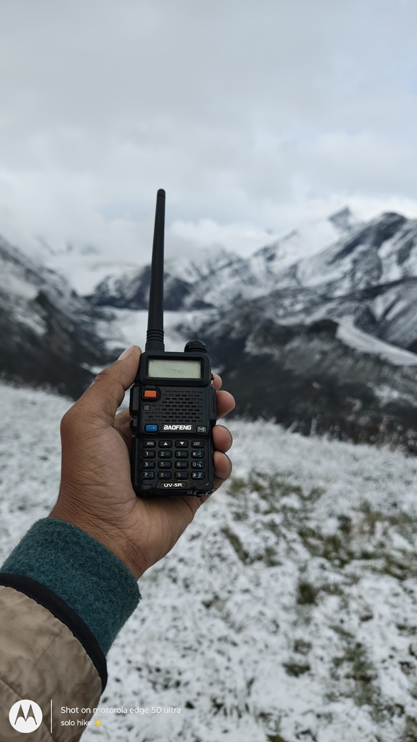
Radio/walkie system for guide-leader communication (above base camp)
Black Peak Trek Package Cost Excludes
Travel from your home city to Dehradun and back
Meals during transit between Dehradun and Sankri (Day 1 & Day 5)
Personal trekking gear (shoes, jackets, gloves, headlamps, ponchos, etc.)
Backpack offloading/mule charges (₹300–₹500 per day)
Tips and gratuities for trek leaders, guides, and staff
Bottled water, snacks, energy bars, and personal medicines
Hot water buckets and mobile charging at Sankri (if available)
Any extra stay or hotel in Dehradun before or after the trek
Travel or trek insurance (not included in package)
Emergency evacuation, medical costs, or ambulance service
Any expenses due to natural calamities, roadblocks, or bad weather
Anything not mentioned under the “Inclusions” section
Black Peak Trek Package Cost
Sankri To Sankri
₹ 60,500/- PP
₹ 54,999/- PP
- 13 Nights Stay
- Breakfast, Lunch, Dinner
- Forest Fees & Permit
- Trek Guide
- Safety & First Aid
Dehradun To Dehradun
₹ 68,500/- PP
₹ 64,999/- PP
- Pickup/Drop Ex- Dehradun
- 13 Nights Stay
- Breakfast, Lunch, Dinner
- Forest Fees & Permit
- Trek Guide
- Safety & First Aid
Delhi To Delhi
₹ 80,500/- PP
₹ 74,999/- PP
- Pickup/Drop Ex- Delhi
- 13 Nights Stay
- Breakfast, Lunch, Dinner
- Forest Fees & Permit
- Trek Guide
- Safety & First Aid
Black Peak Trek Fix Departures
September
10 Sep – 23 Sep
15 Sep – 28 Sep
20 Sep – 03 Oct
27 Sep – 10 Oct
30 Sep – 13 Oct
Available
Available
Available
Available
Available
October
04 Oct – 17 Oct
05 Oct – 18 Oct
10 Oct – 23 Oct
18 Oct – 31 Oct
Available
Available
Available
Available
May
01 May – 14 May
10 May – 23 May
16 May – 29 May
24 May – 06 Jun
25 May – 07 Jun
30 May – 12 Jun
Available
Available
Available
Available
Available
Available
How To Reach Black Peak
Step-by-Step Guide to Reach Black Peak Trek
1. Reach Dehradun (Uttarakhand) – The Nearest Major City
By Air:
Jolly Grant Airport (DED), Dehradun is the nearest airport.
Well-connected to Delhi, Mumbai, Bangalore, Kolkata, Jaipur
From the airport, you can hire a taxi to Sankri or reach ISBT Dehradun for a shared vehicle.
By Train:
Dehradun Railway Station is connected to major Indian cities.
Popular trains: Nanda Devi Express, Mussoorie Express, Dehradun Shatabdi
Direct trains available from Delhi, Kolkata, Mumbai, Lucknow, Varanasi, and Haridwar
By Bus/Car:
Overnight Volvo and government buses run from Delhi (Kashmere Gate ISBT) to Dehradun.
Travel time: 6–8 hours from Delhi
2. Dehradun to Sankri (Base Village)
Distance: 210 km
Travel Time: 8–10 hours
Options:
Private cabs (₹5,000–6,000 per vehicle)
Shared taxis from Dehradun Railway Station or Parade Ground (₹700–800/person)
Bus service from Mussoorie Bus Stand (early morning, limited seats)
3. Final Stretch: Sankri to Trek Starting Point
The trek starts right from Sankri village.
No further travel is needed once you reach here.
Accommodation and gear rental available in Sankri.
Summary – How to Reach Kedarkantha Trek
| Route | Mode | Distance & Travel Time |
|---|---|---|
| Delhi to Dehradun | Train / Flight / Bus | ~250 km – 6 to 8 hours |
| Dehradun to Sankri | Road (cab / bus) | 210 km – 8 to 10 hours |
| Sankri to Trek Start | On foot | 0 km – Trek begins from Sankri |
Recommended Route from Major Cities
From Delhi to Black Peak:
Delhi → Dehradun (overnight train/bus) → Sankri (shared cab)From Mumbai to Black Peak:
Mumbai → Dehradun (flight/train via Delhi) → SankriFrom Bangalore to Black Peak:
Bangalore → Dehradun (flight via Delhi) → Sankri
Black Peak Booking Policy
- Booking is confirmed only after receiving a minimum 30% advance payment
Balance amount to be paid at pickup time.
Payment Options
Online payment via UPI / Bank Transfer / Net Banking / Debit & Credit Cards
Payment receipt will be shared via email or WhatsApp for confirmation
Black Peak Cancellation Policy
- 90% refund if cancelled 30+ days before trek date
- 70% refund if cancelled 15–29 days before trek
- 50% refund if cancelled 7–14 days before trek
- No refund if cancelled less than 7 days before trek or no-show
Black Peak Trek Essentials
Get the complete Black Peak Expedition trek essentials list, including gear checklist, clothing layers, technical equipment, and high-altitude trekking gear. Stay prepared for the 6,387 m Kalanag Peak with this detailed guide to what to pack for Black Peak trek, including crampon-compatible boots, glacier gear, and extreme cold weather clothing.
2–3 moisture-wicking t-shirts (quick-dry)
1–2 pairs of thermal inners (top & bottom)
2 pairs of quick-dry trekking pants
1 fleece jacket or pullover
1 down or padded jacket (warm, lightweight)
1 waterproof/windproof jacket
1 rain poncho or raincoat
1 pair of thermal bottoms (for cold nights)
1 extra pair of trekking pants (backup)
3–4 pairs of trekking socks (quick-dry)
2 pairs of woolen socks (for camp & summit day)
3–4 pairs of breathable undergarments
1 woolen cap or beanie
1 sun cap or hat (wide brim preferred)
1 neck gaiter or balaclava
1 pair of fleece gloves (inner)
1 pair of waterproof gloves (outer)
Trekking shoes (ankle-high, waterproof, strong grip)
Camp sandals or floaters
(Optional) Gaiters – for snow/wet patches
Backpack (50–65L) with rain cover
Daypack (15–25L) for summit and side hikes
Rain cover for backpack
Trekking poles (highly recommended)
Headlamp with extra batteries
Water bottles (2 x 1L) or hydration pack
Thermos flask (optional for summit day)
Sunglasses (UV-protected, category 3/4)
Power bank
Energy snacks (chocolates, dry fruits, protein bars)
Toothbrush & small toothpaste
Biodegradable soap/face wash
Lip balm with SPF
Sunscreen SPF 50+
Moisturizer
Quick-dry towel
Toilet paper or biodegradable wipes
Hand sanitizer
Menstrual hygiene products (if applicable)
Diamox (for AMS – altitude sickness)
Paracetamol
Ibuprofen/Combiflam
Antiseptic cream (Betadine/Soframycin)
Band-aids
Pain relief spray (Volini or similar)
Antacids (Gelusil/Digene)
ORS/Electral packets
Motion sickness tablets (Avomine)
Prescribed medications (personal needs)
Original & photocopy of Government-issued ID (Aadhaar/Voter ID/Passport)
Passport-size photos (2–4)
Medical certificate (if required by trek operator)
Fitness certificate (signed by a doctor)
Travel insurance (recommended)
Black PeakTrek Fitness
Fitness for Black Peak Expedetion – Are You Trek-Ready?
The Black Peak Expedition (Kalanag Peak – 6,387 m) is classified as a difficult high-altitude trek and mountaineering expedition, best suited for experienced trekkers or those with prior high-altitude exposure. The trek demands excellent physical and mental fitness due to extreme altitude, glacier walks, steep snow slopes, technical climbing sections, and rapidly changing weather conditions.
Basic Fitness Requirements
Age Group: 18–55 years (physically fit and active individuals)
Ability to trek 8–12 km per day on steep inclines
Comfort with walking 8–10 hours/day in sub-zero conditions
No history of cardiac, respiratory, or major orthopedic conditions
Mental resilience for alpine camping, summit push, and tough terrains
Why Fitness Matters on Black Peak Expedetion
- Altitude: Summit at 6,387 meters (20,955 ft); risk of Acute Mountain Sickness (AMS)
- Weather: Temperatures can drop to -10°C to -20°C near summit
- Terrain: Steep ascents, moraines, glaciers, and snowfields with technical gear
- Summit Day: 10–12 hours of ascent and descent; requires full stamina, focus, and endurance
- Technical Load: Trekking with mountaineering equipment (ropes, crampons, ice axe)
Pre-Trek Fitness Preparation Plan (Start 3–4 Weeks Before)
1. Cardiovascular Endurance (4–5 days/week)
Brisk walking or jogging – 3–5 km
Stair climbing – 3–4 floors, 3 sets
Cycling or swimming (optional)
2. Strength Training (3–4 days/week)
Squats – 3 sets of 15
Lunges – 3 sets of 10 per leg
Planks – Hold for 30–60 seconds
Core exercises (leg raises, crunches)
3. Flexibility & Recovery
Daily stretching for legs, hips, back
10–15 mins yoga or foam rolling
Rest properly between sessions
Quick Tips for Trek Fitness
Practice walking with a loaded backpack (5–7 kg)
Try a day hike near your city before the trek
Hydrate well before and during the trek
Avoid alcohol/smoking 2 weeks before the trek
Consult a doctor if you have asthma, blood pressure, or altitude-related history
Who Should Avoid Black Peak Expedetion
- Individuals with heart disease, asthma, epilepsy, or severe altitude sickness history
- Those recovering from recent surgeries or major injuries
- People with uncontrolled diabetes or blood pressure
- Beginners with no multi-day high-altitude trek experience
Black Peak Trek FAQ's
What is the altitude of Black Peak (Kalanag)?
The altitude of Black Peak, also known as Kalanag, is 6,387 meters (20,955 feet).
Is Black Peak Expedition suitable for beginners?
No, the Black Peak Expedition is a challenging high-altitude trek suitable only for experienced trekkers or those with prior Himalayan trekking experience.
How difficult is the Black Peak trek?
The Black Peak trek is rated as difficult due to steep ascents, glacier walks, technical sections, and high altitude.
What is the best time to do the Black Peak Expedition?
The best time for the Black Peak Expedition is May to June and September to October, when the weather is stable and snow conditions are favorable.
How many days are required for the Black Peak Expedition?
The expedition typically takes 10 to 14 days from Dehradun to Dehradun, depending on acclimatization and weather conditions.
Where does the Black Peak Expedition start from?
The trek usually starts from Sankri village in Uttarakhand, which is accessible via Dehradun.
Do I need mountaineering skills for Black Peak?
Yes, basic mountaineering knowledge such as using crampons, ropes, and ice axe is required for the summit push.
What gear is required for the Black Peak Expedition?
Essential gear includes trekking boots, crampons, ice axe, gaiters, down jacket, gloves, headlamp, and high-altitude tents (usually provided by the trek operator).
How to prepare physically for Black Peak Expedition?
Start 8–10 weeks prior with cardio, strength training, stair climbing, and altitude practice. Focus on leg and core strength.
Is Black Peak and Kalanag the same trek?
Yes, Black Peak is also known as Kalanag, named for its resemblance to a serpent’s hood.
Do I need permission for Black Peak Expedition?
Yes, you need special permissions from forest and mountaineering authorities, typically arranged by your trek operator.
Can I do Black Peak solo without a guide?
No, it is not advisable. Due to technical difficulty and remote terrain, you must go with an experienced team or agency.
Is acclimatization necessary for Black Peak?
Absolutely. Proper acclimatization is crucial to prevent AMS (Acute Mountain Sickness) due to the trek’s high altitude.
What’s the cost of Black Peak Expedition?
The cost ranges from ₹30,000 to ₹60,000, depending on the operator, inclusions, and duration.
What are the risks involved in Black Peak Trek?
Risks include altitude sickness, frostbite, weather delays, and physical exhaustion, especially near the summit.
Which is best travel company for Black Peak Expedetion?
Solo Hike is one of the best and successful adventure company that conduct the Black Peak Expedetion.
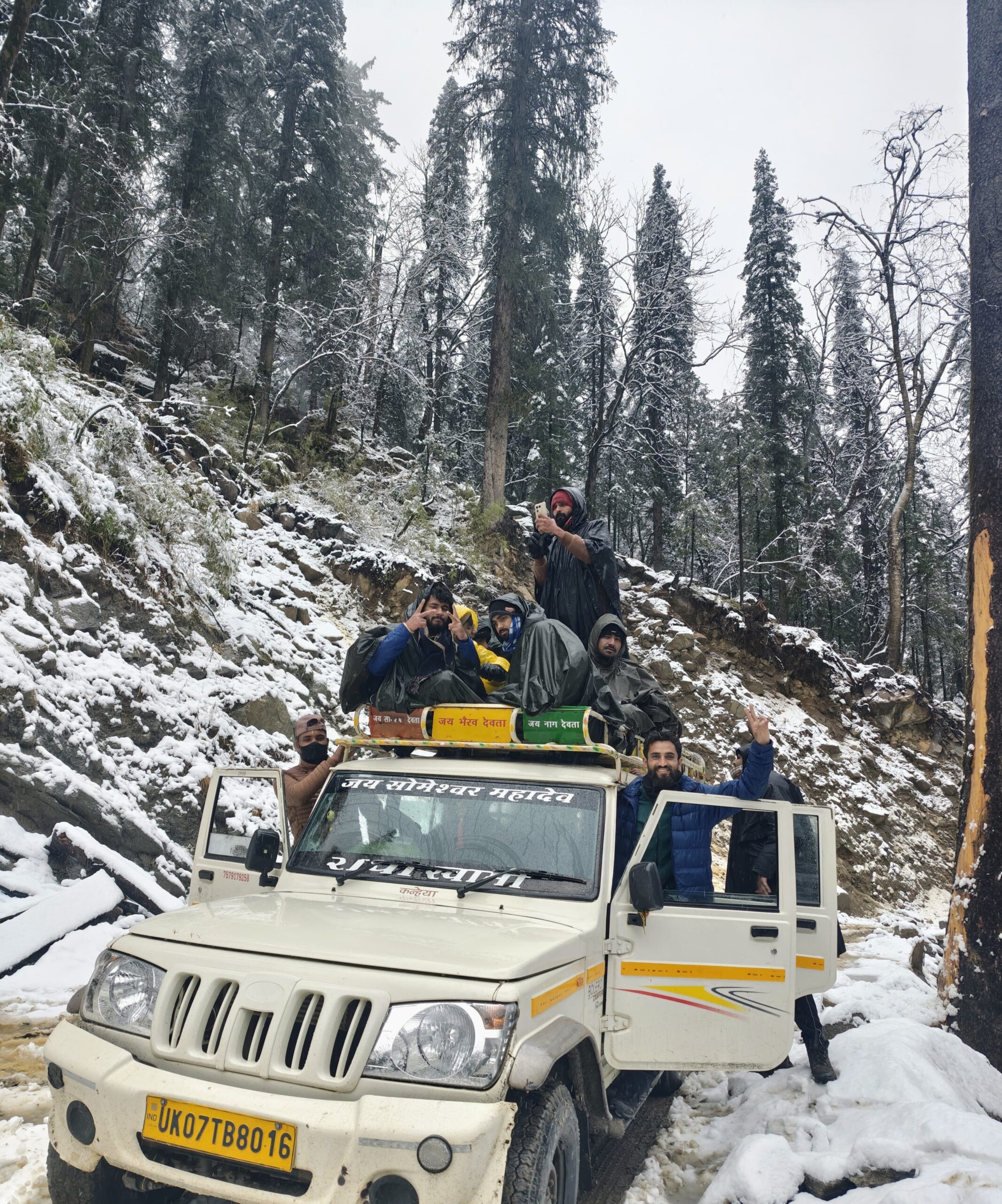
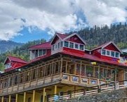
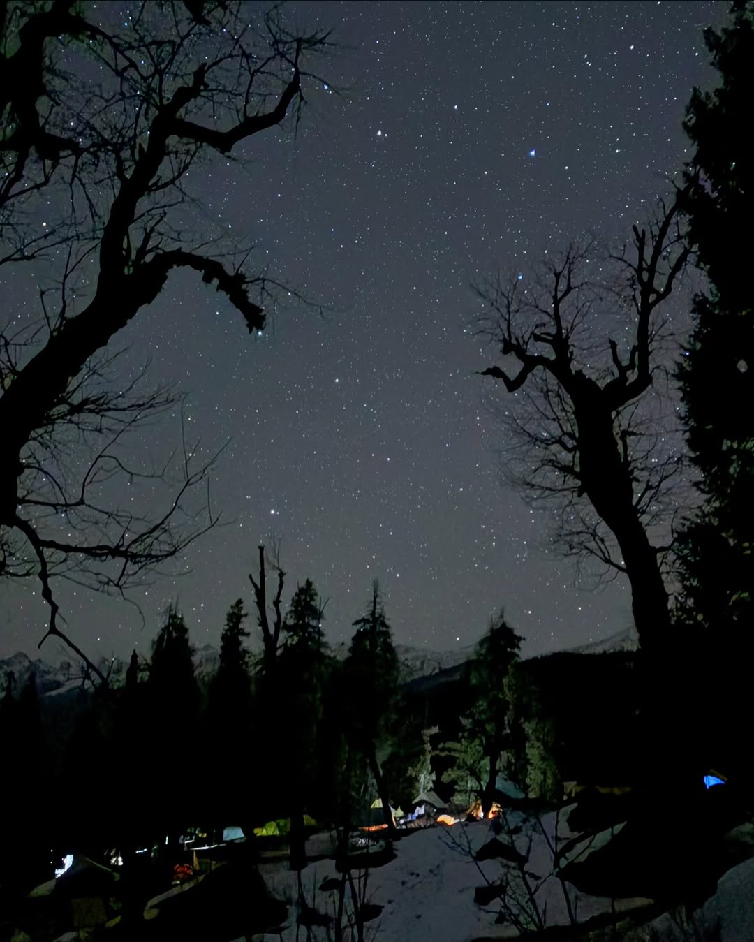
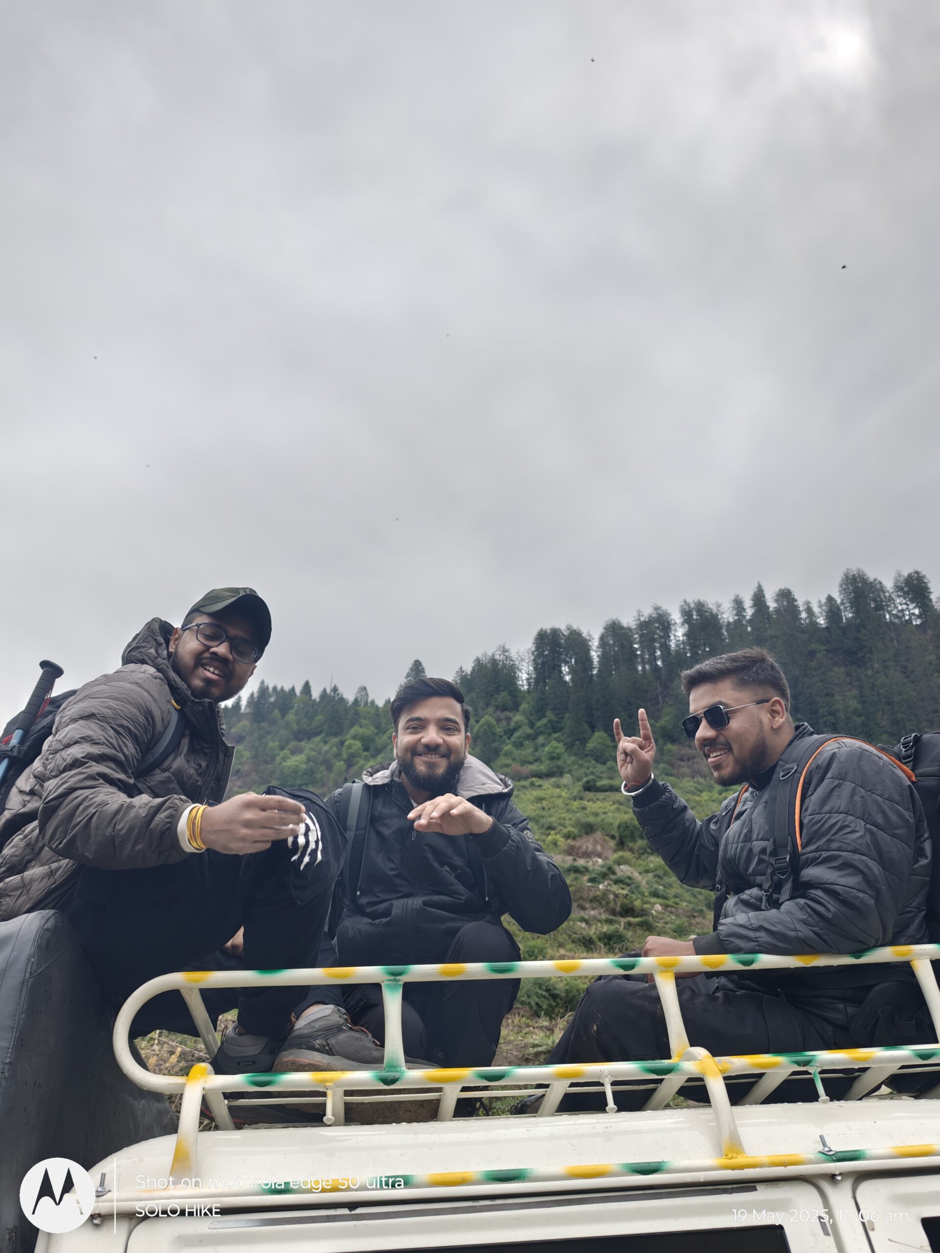
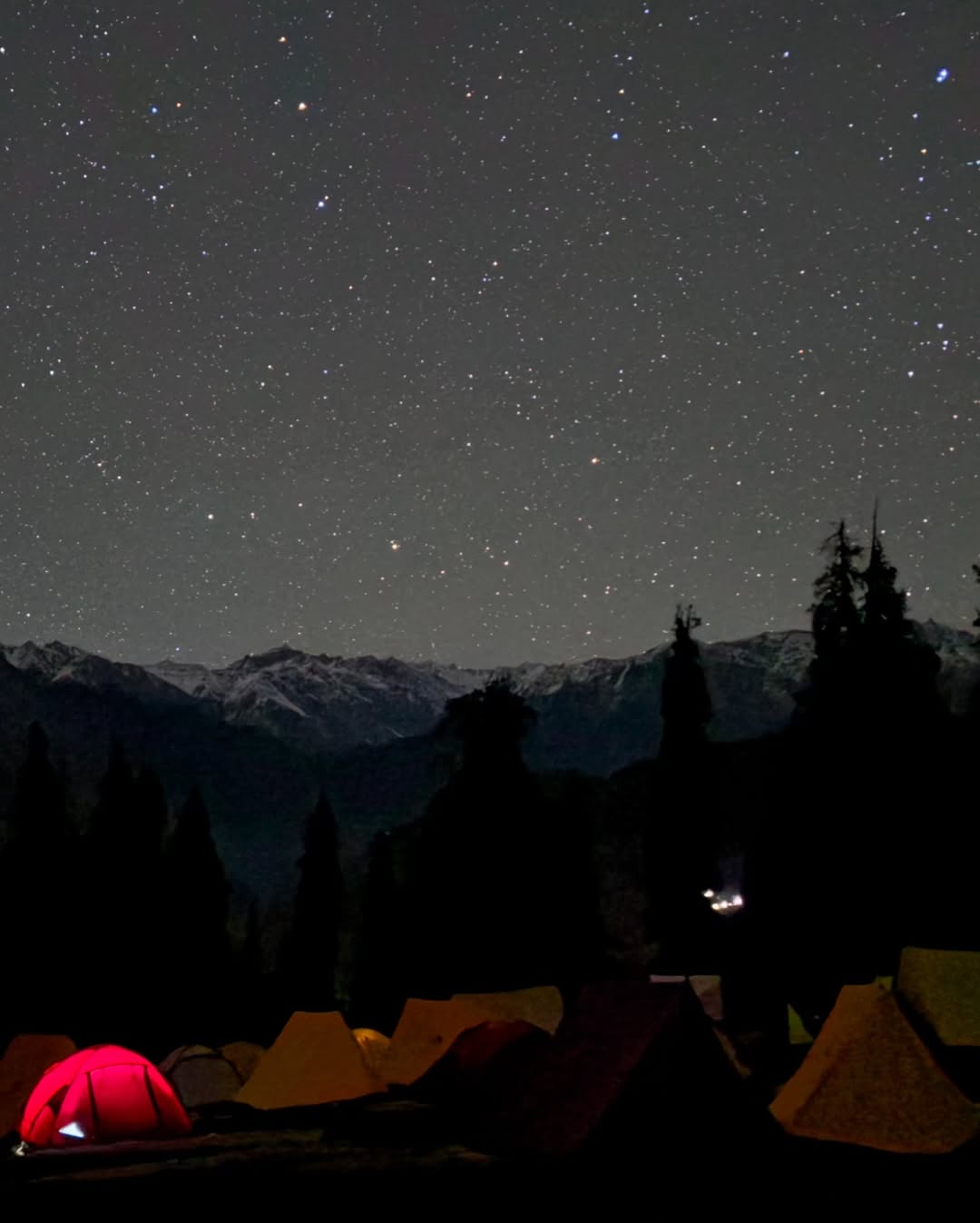
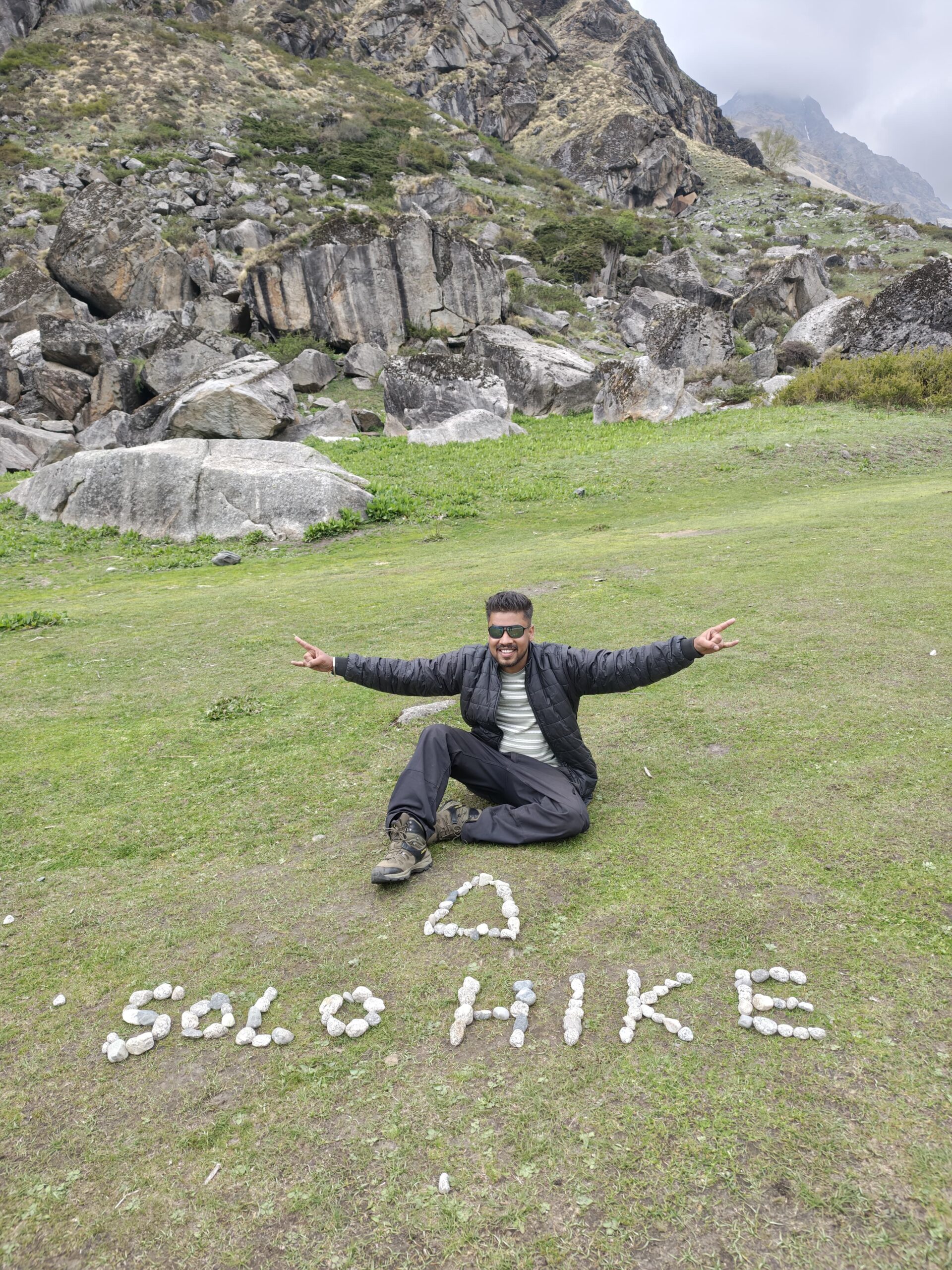
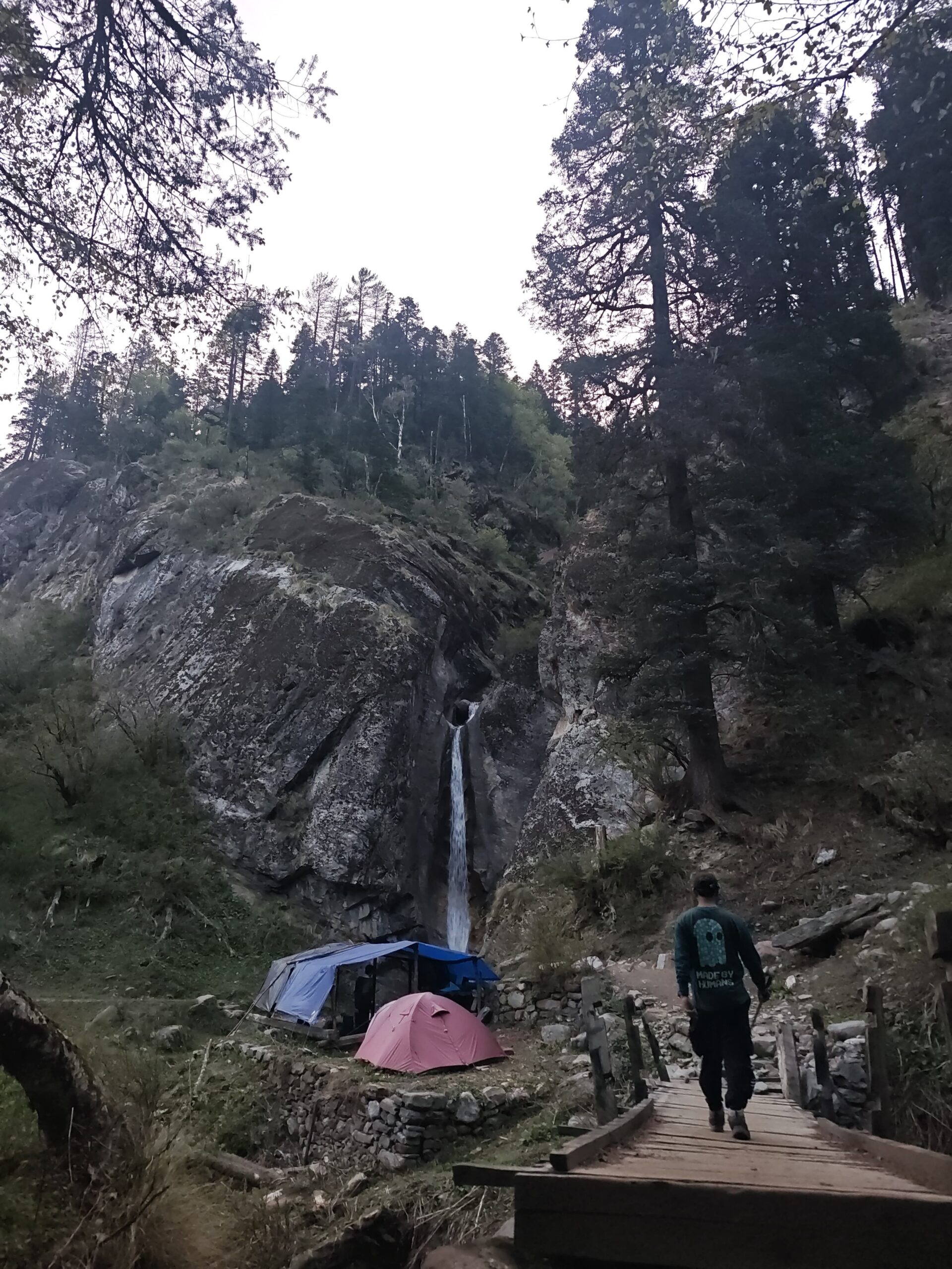
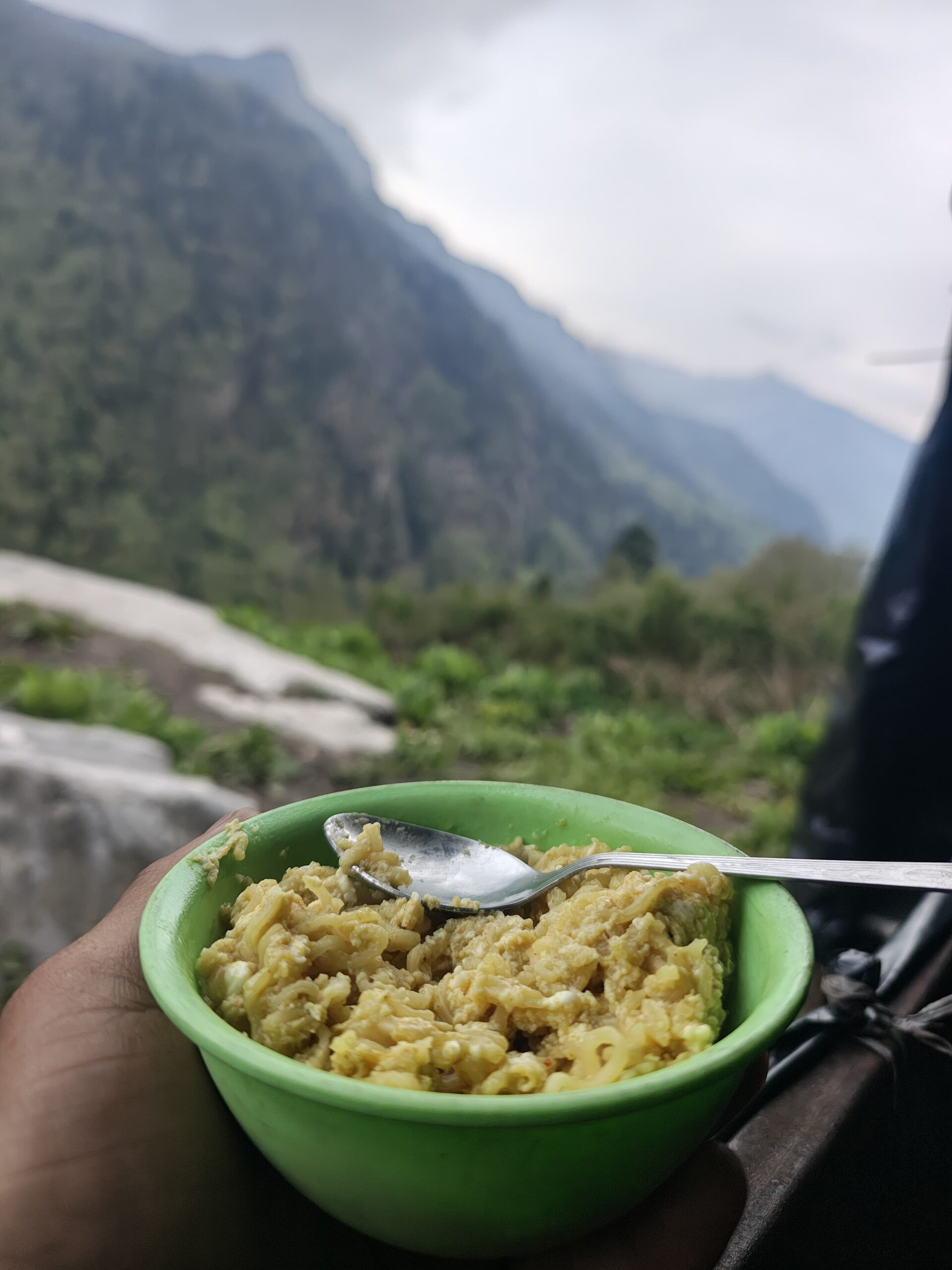
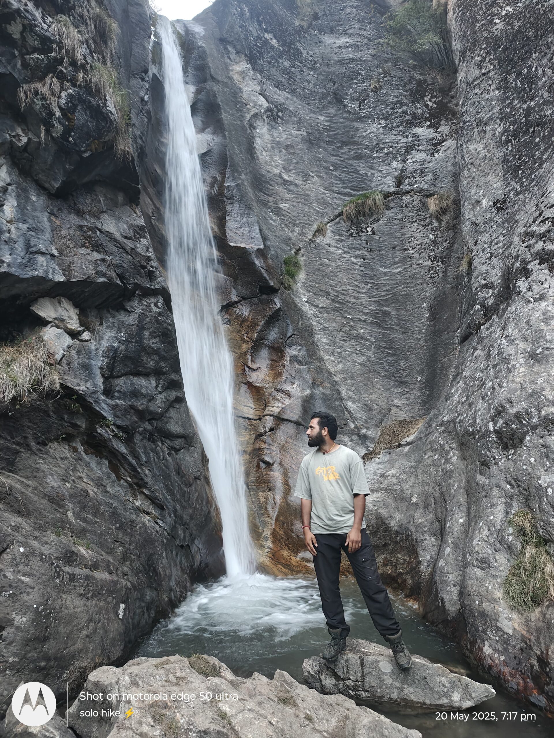
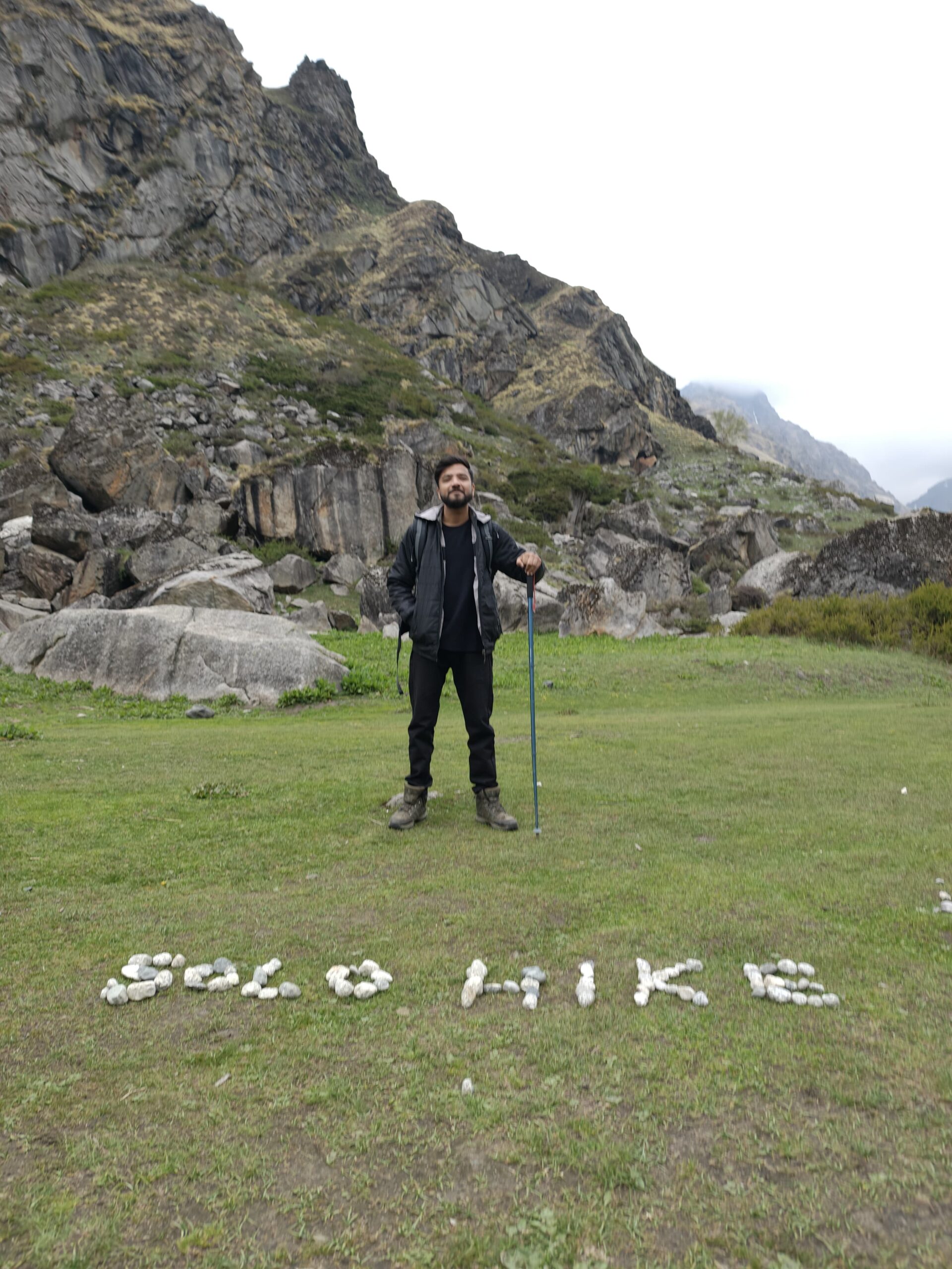
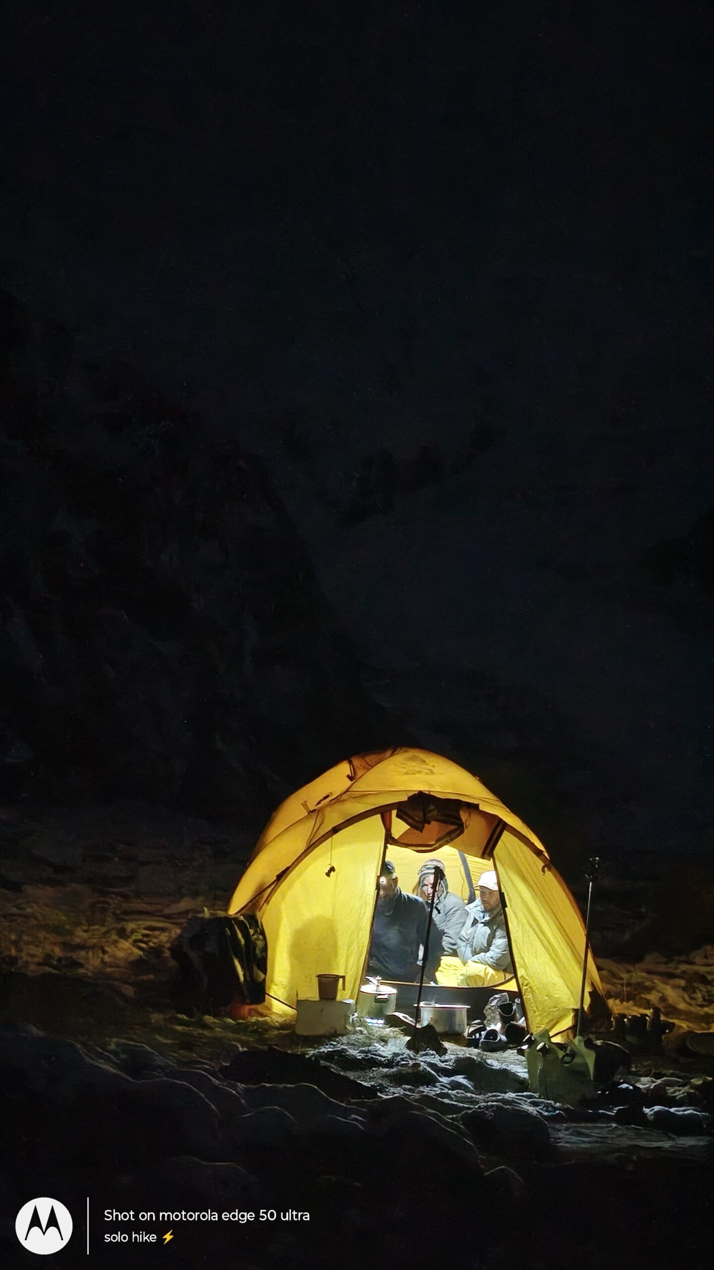
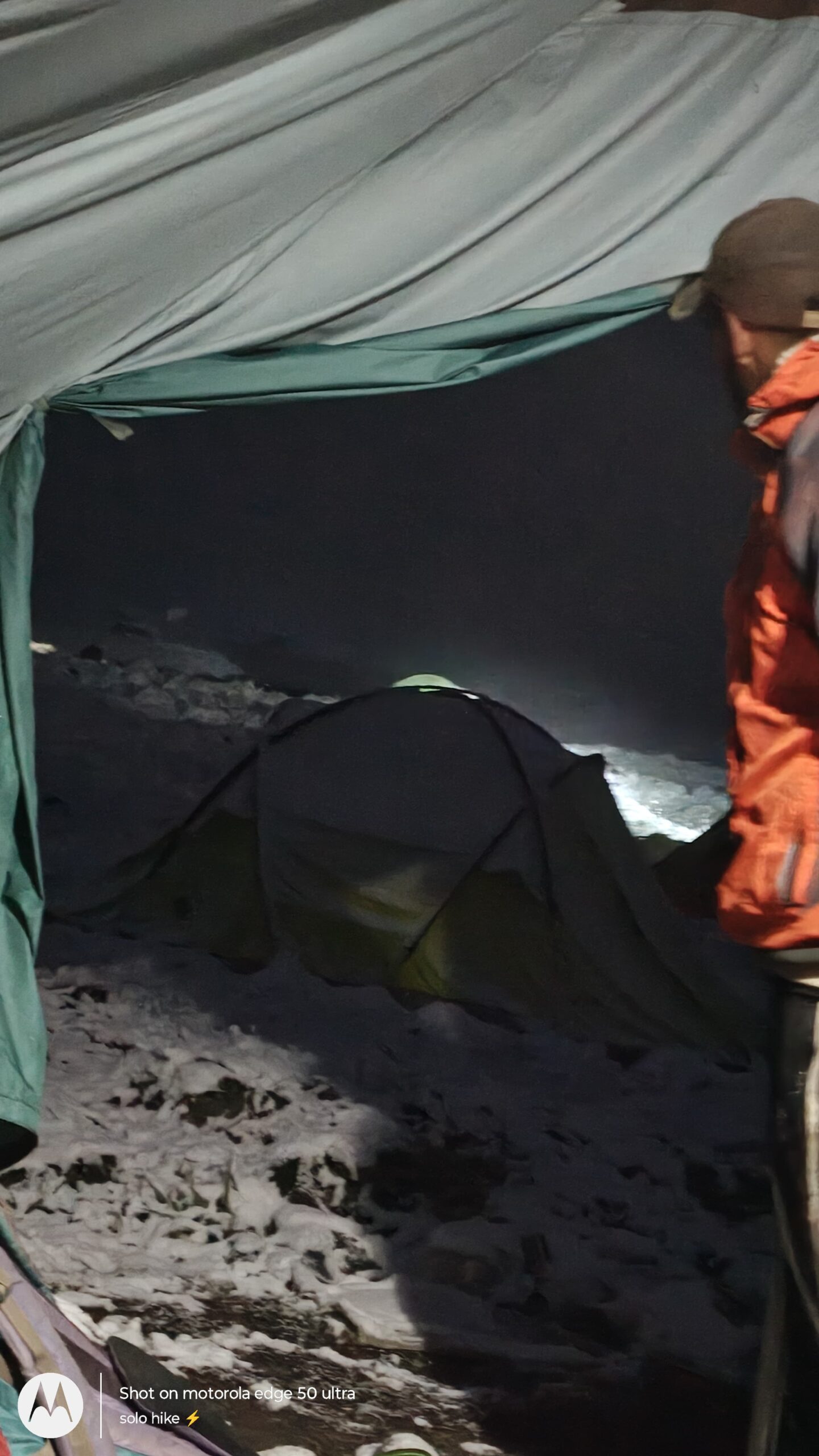
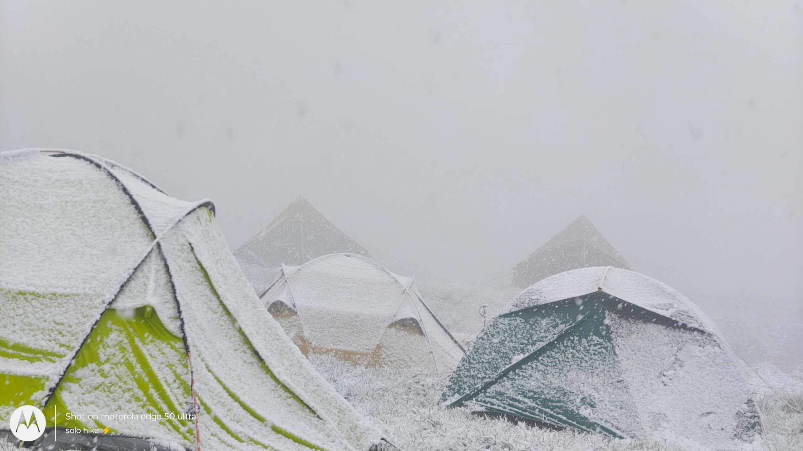
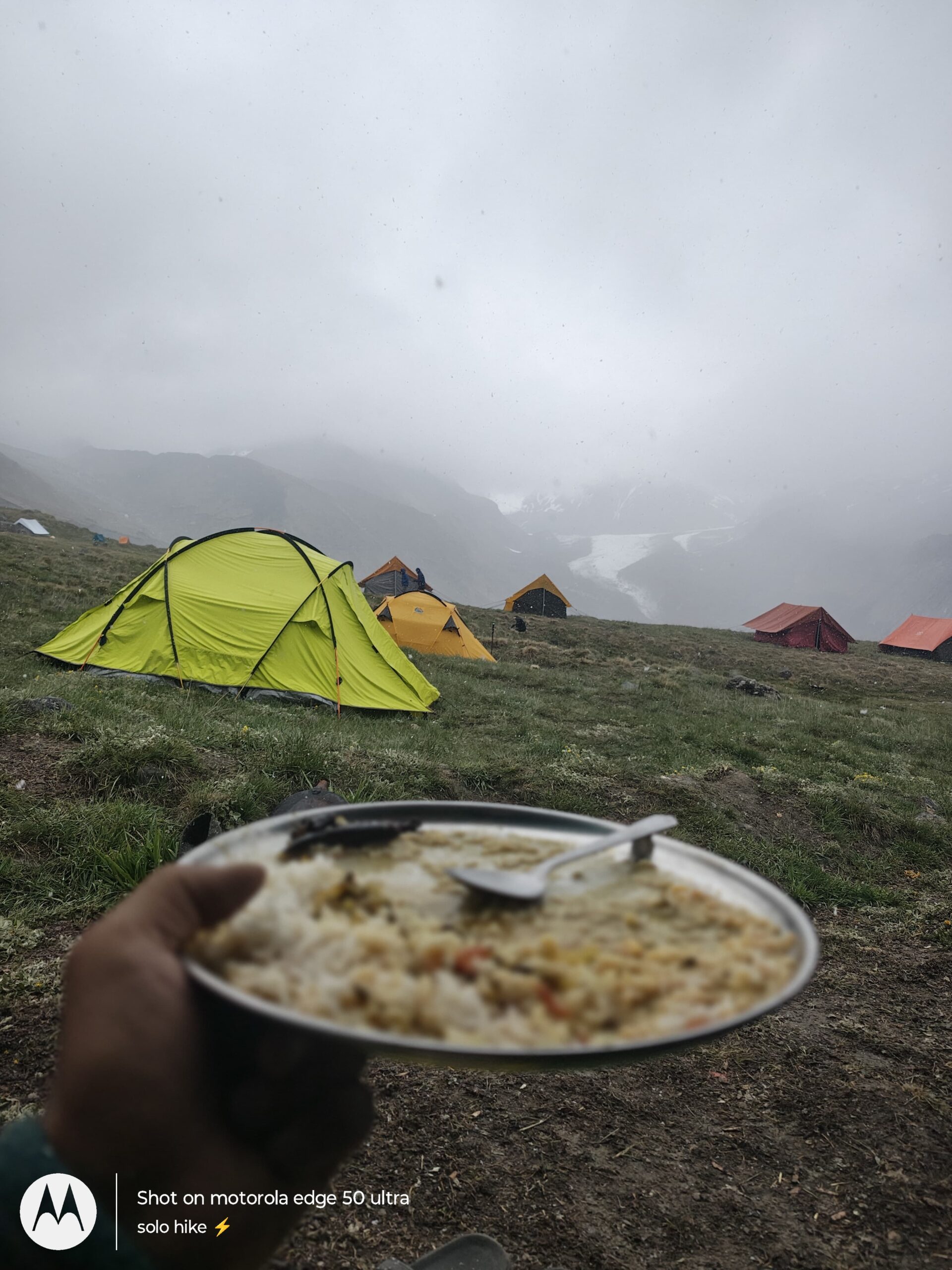
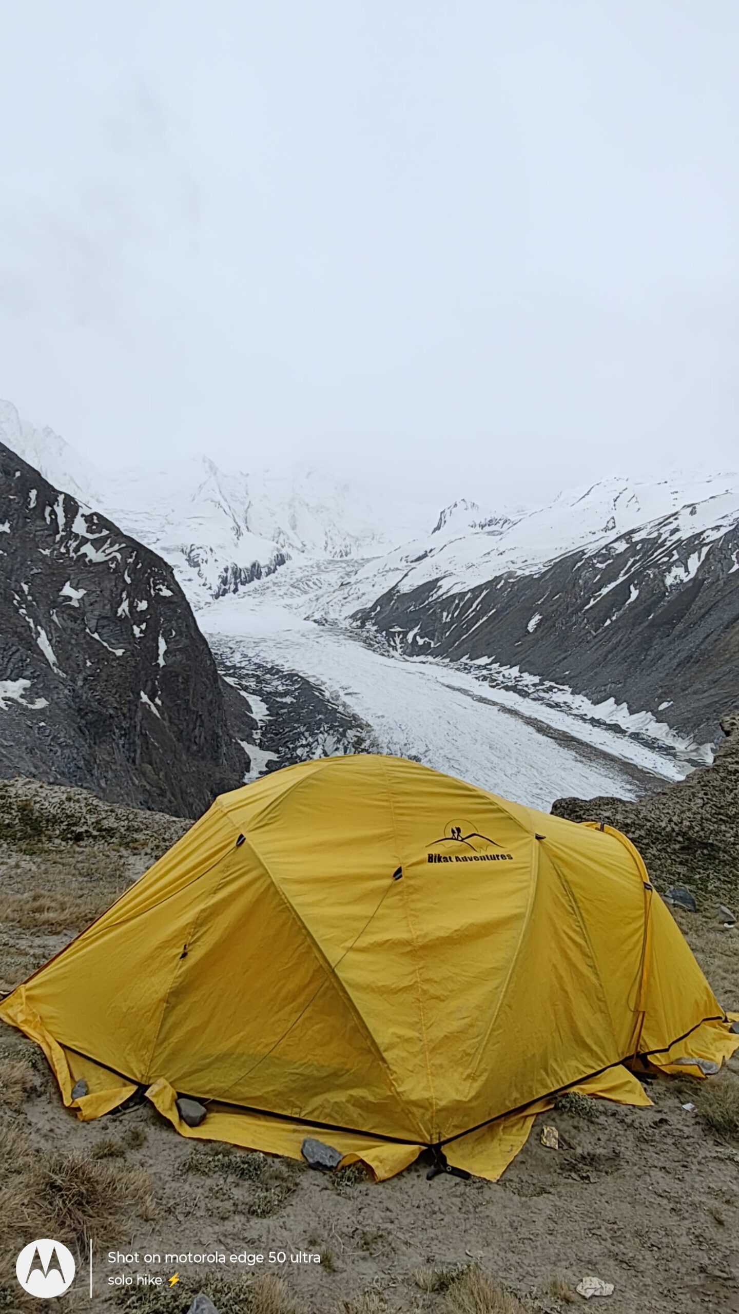
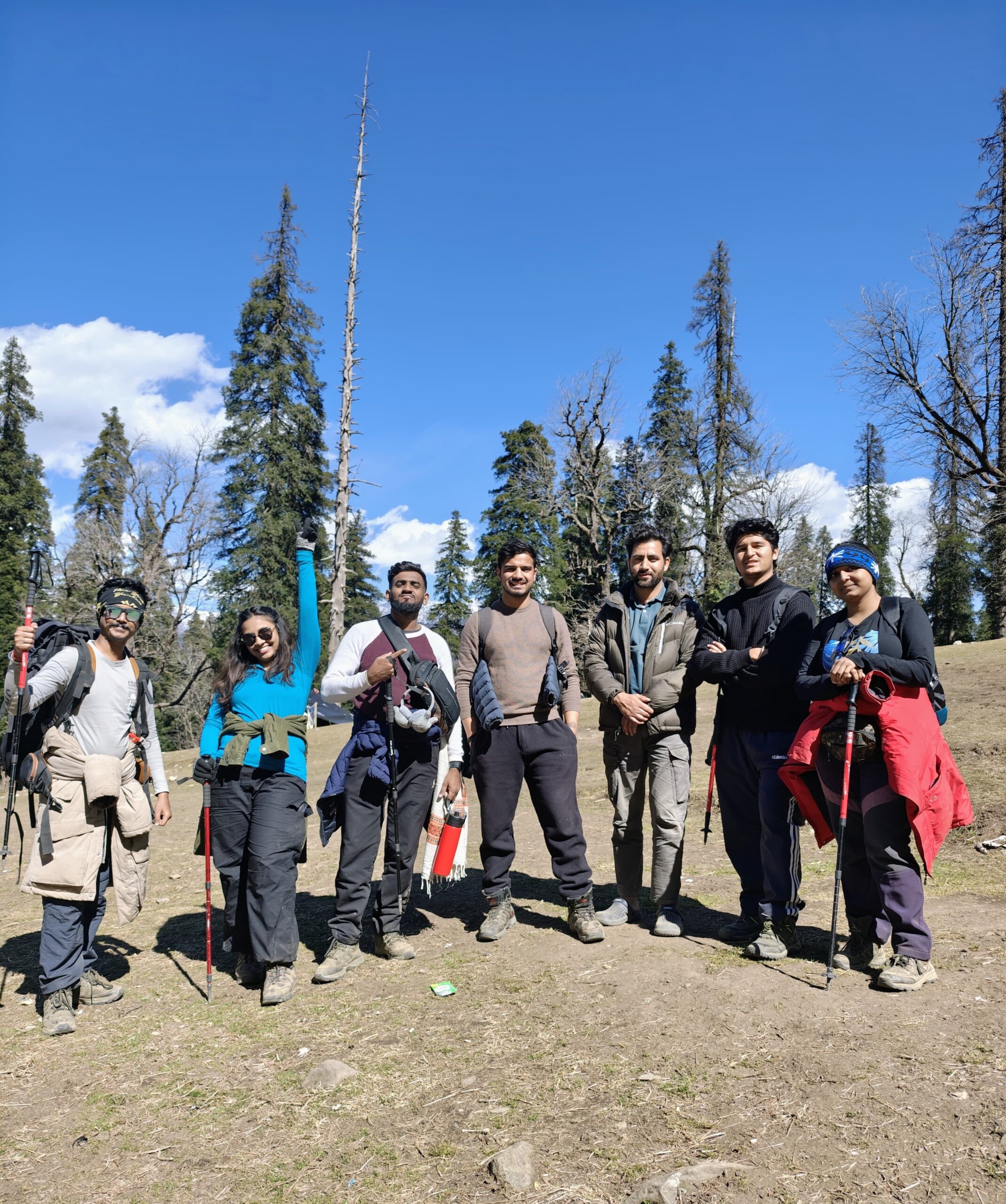
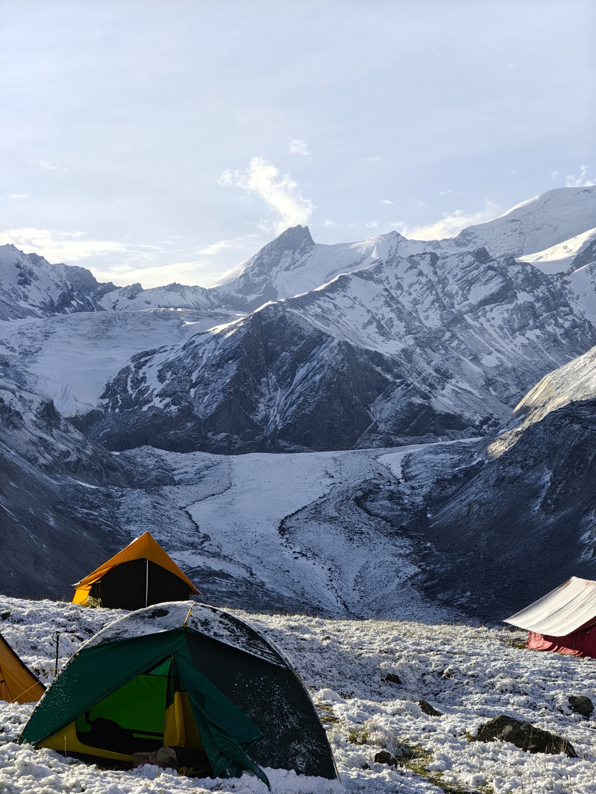
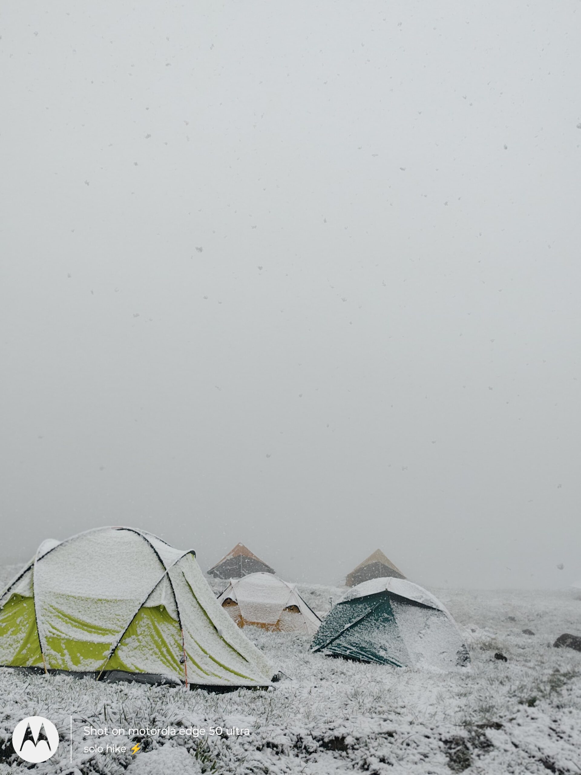
BLACK PEAK PHOTOS
Black Peak Expedition Trek 2025
Black Peak Expedition Trek 2025 to Kalanag Summit (6,387m), one of the most thrilling high-altitude treks in Uttarakhand. This detailed video covers the Black Peak trek itinerary, route map, difficulty level, best time to visit, cost & package details, gear checklist, fitness tips, and how to prepare. Ideal for experienced trekkers seeking a true alpine challenge in the Indian Himalayas. Start your journey from Sankri, and witness glaciers, alpine meadows, and snow-covered trails.
Read More About Black Peak Trek
Best Time To Visit Black Peak
Discover the best time to visit Black Peak (Kalanag) for trekking and mountaineering. Learn ideal months, weather conditions, snow availability, and summit safety for a successful expedition in Uttarakhand’s Garhwal Himalayas.
Best Time To Visit Black Peak
Discover the best time to visit Black Peak (Kalanag) for trekking and mountaineering. Learn ideal months, weather conditions, snow availability, and summit safety for a successful expedition in Uttarakhand’s Garhwal Himalayas.
Best Time To Visit Black Peak
Discover the best time to visit Black Peak (Kalanag) for trekking and mountaineering. Learn ideal months, weather conditions, snow availability, and summit safety for a successful expedition in Uttarakhand’s Garhwal Himalayas.
RELATED TREKS

