Basecamp
Joshimath
Duration
6 Days
Max. Altitude
15,070 ft.
Distance
32 Kms
Grade
Moderate
Pickup/Drop
Dehradun
Pangarchulla Trek Overview
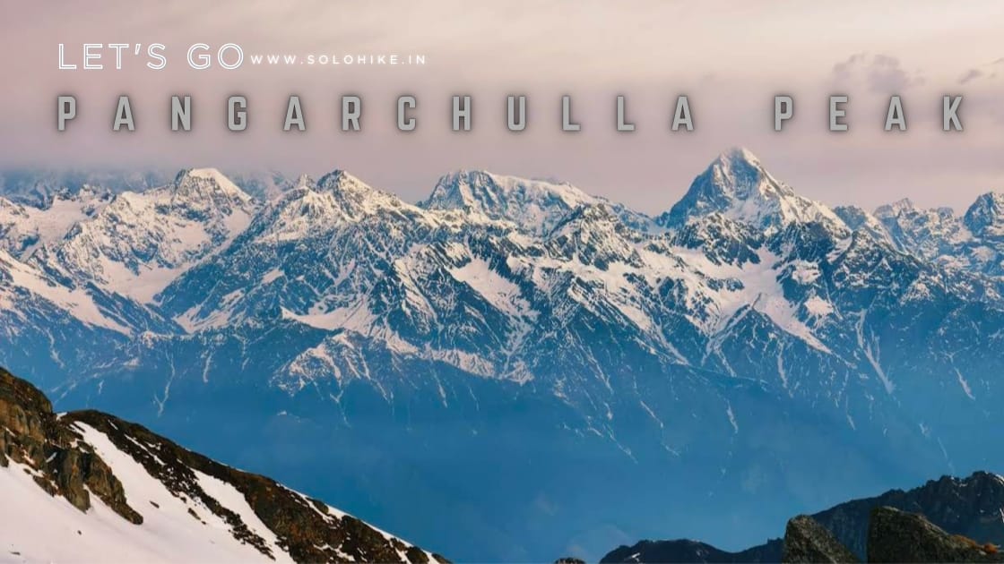
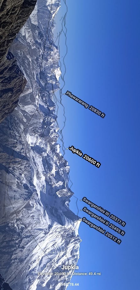
The Pangarchulla Trek is one of the most exhilarating summit climbs in the Indian Himalayas, nestled in the Chamoli district of Uttarakhand, close to the scenic town of Joshimath. Towering at an altitude of 15,069 feet, Pangarchulla offers trekkers a chance to summit a snow-clad Himalayan peak without needing technical mountaineering experience. With dramatic views of Nanda Devi, Dronagiri, Kamet, Chaukhamba, and Hathi-Ghoda, this trek is a dream come true for adventure lovers and mountain seekers.
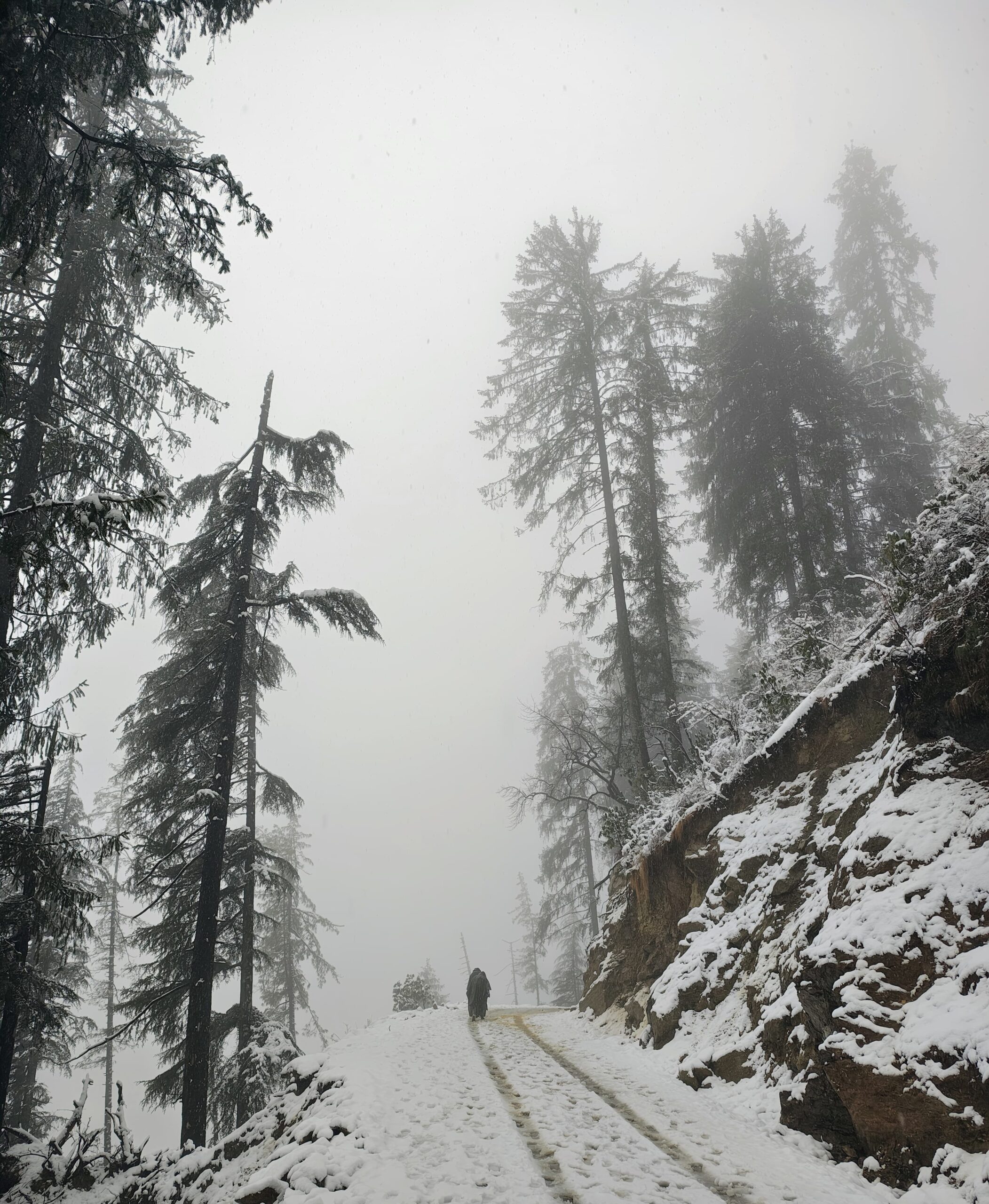
The trail begins from Dhak village, ascending gradually through traditional Himalayan villages like Tugasi and Gulling, dense forests of oak and rhododendron, and into high-altitude meadows that unfold into snow-covered ridges. Campgrounds like Khulara and the Kuari Pass base serve as perfect acclimatization spots, offering panoramic sunrises and open skies. The final summit day is the most demanding yet thrilling part of the trek — a long and steep ascent through snowfields, narrow ridgelines, and rocky sections that culminates at the mighty Pangarchulla Peak.
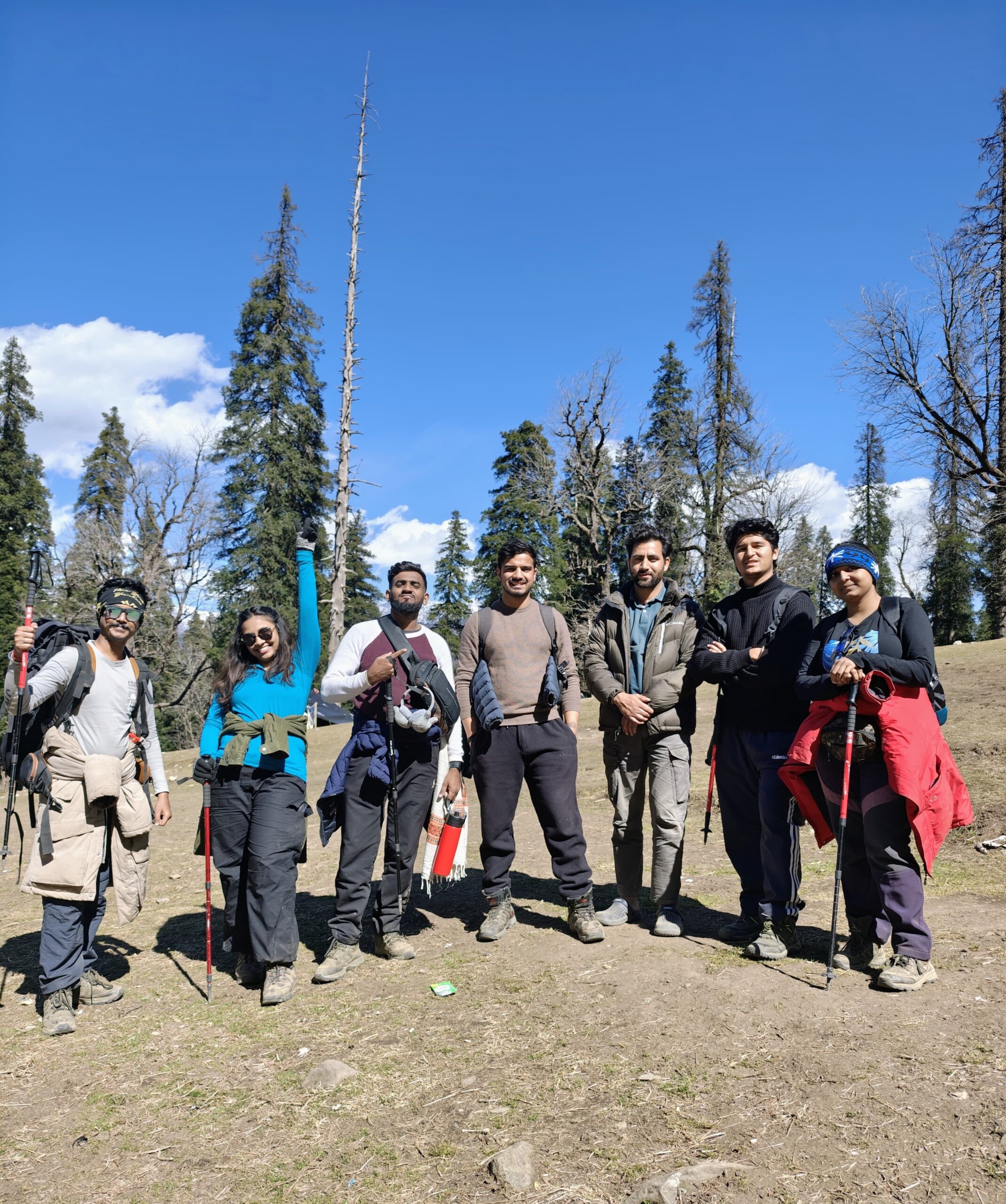
Perfect for fit beginners as well as seasoned trekkers, Pangarchulla strikes the right balance between physical challenge and scenic reward. Its accessible location near Joshimath and Auli, coupled with breathtaking views and diverse terrains, makes it one of the most memorable summit treks in India.
What to Expect on the Pangarchulla Trek
A diverse and evolving trail that begins in forested areas and transitions into alpine meadows and snow-laden highlands.
Peaceful Himalayan villages, offering glimpses into the local Garhwali culture and way of life.
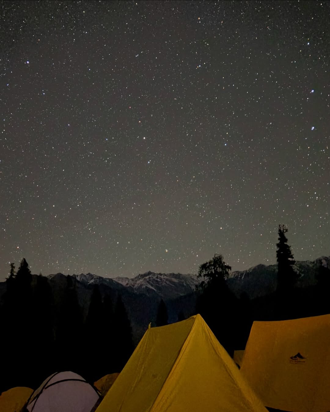
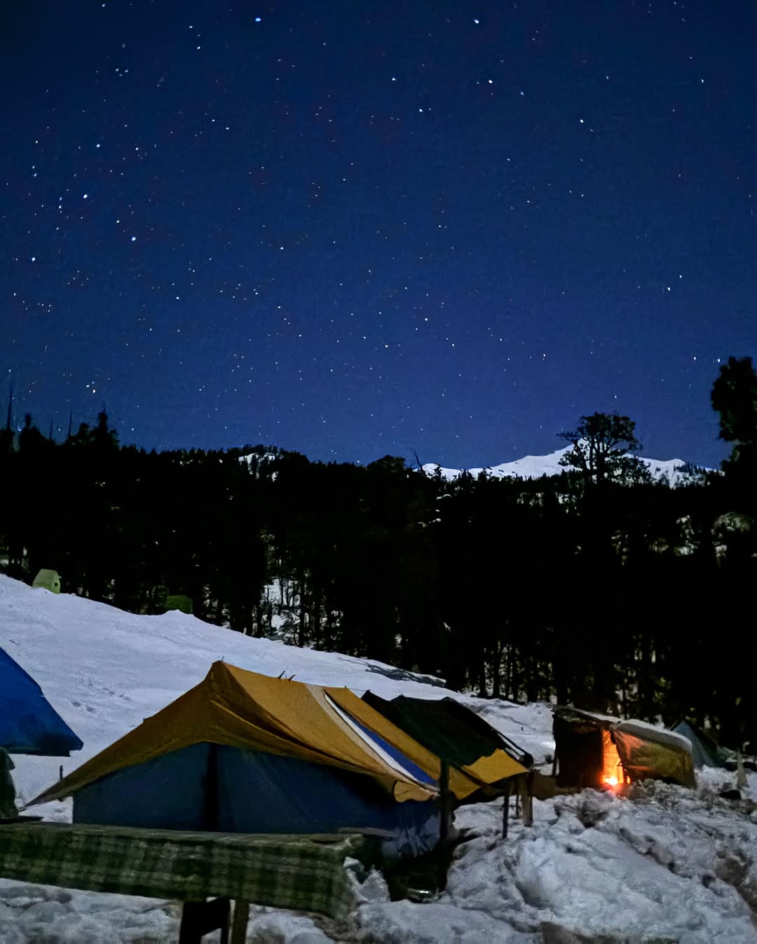
Stunning campsites with sunrise views of towering Himalayan peaks and pristine starry skies at night.
A thrilling and physically demanding summit day that requires an early start, strong endurance, and mental grit.
Deep snow in spring, especially between March and early May, making the summit push an adventure in itself.
Regular sightings of Himalayan birds, musk deer, and forest life along the lower trails.
Why Pangarchulla is One of the Best Summit Treks in India
What sets Pangarchulla apart is the fact that it offers a genuine summit experience. Unlike other popular Himalayan treks that plateau at a pass or meadow, this one takes you all the way to a snow-capped peak. The panoramic views from the top are truly unmatched — with over ten major Himalayan peaks in full view, it’s a photographer’s and trekker’s delight.
This trek also offers an exciting mix of experiences: forest walks, ridge climbs, high-altitude camping, and snow trekking — all packed into a six to seven-day journey. It’s also less commercialized compared to other winter treks like Kedarkantha or Brahmatal, which means fewer crowds and a more intimate connection with the mountains.
Moreover, the trail shares a portion with the legendary Kuari Pass Trek, giving you double the beauty in a single adventure. Whether you are preparing for bigger climbs or simply looking for a challenging yet non-technical summit trek, Pangarchulla is the perfect choice.
Best Time to Do Pangarchulla Trek
The Pangarchulla Trek can be done in two primary seasons — spring (March to May) and autumn (October to mid-November), each offering a distinct experience.
Spring Season (March to May)
This is the most popular time to trek to Pangarchulla. The trail is blanketed with fresh snow, especially near the summit, turning the upper ridgelines into a white wonderland. The skies are mostly clear, offering perfect views of the peaks, while the weather remains cold but manageable. The forests bloom with rhododendrons, and snow patches accompany you almost till the summit.
Autumn Season (October to mid-November)
Post-monsoon, the trail becomes crisp and dry, with golden meadows and panoramic views under a deep blue sky. There’s little to no snow on the route during this time, making the trek less technical but equally scenic. It’s a great time for photography and solitude, as the trail sees fewer crowds compared to spring.
Pangarchulla Trek Short Itinerary
Day 1: Dehradun to Joshimath (Drive)
Distance: ~290 km
Time: 10–11 hours
Altitude Gain: 640 m (Dehradun – 640 m) → 1,875 m (Joshimath)
Route: Dehradun → Rishikesh → Devprayag → Srinagar → Rudraprayag → Karnaprayag → Chamoli → Joshimath
Day 2: Joshimath to Dhak (Drive), Trek to Gulling
Distance: 12 km drive + 5.5 km trek
Time: 30–40 min drive, 4–5 hours trek
Altitude Gain: 1,875 m (Joshimath) → 2,700 m (Gulling)
Route: Joshimath → Dhak (drive), Dhak → Tugasi → Gulling (trek)
Day 3: Gulling to Khulara Camp
Distance: ~4.5 km
Time: 3–4 hours
Altitude Gain: 2,700 m → 3,370 m
Route: Gulling → Lower Khulara → Khulara Camp
Day 4: Khulara to Pangarchulla Summit and Back to Khulara
Distance: ~12 km round trip
Time: 10–12 hours
Altitude Gain: 3,370 m → 4,593 m (Pangarchulla Summit) → 3,370 m
Route: Khulara → Kuari Pass ridge → Pangarchulla Summit → Return same route
Day 5: Khulara to Dhak (Trek), Drive to Joshimath
Distance: 10 km trek + 12 km drive
Time: 4–5 hours trek + 30 min drive
Altitude Loss: 3,370 m → 2,100 m (Dhak) → 1,875 m (Joshimath)
Route: Khulara → Gulling → Tugasi → Dhak → Joshimath
Day 6: Joshimath to Dehradun (Drive)
Distance: ~290 km
Time: 10–11 hours
Altitude Loss: 1,875 m → 640 m
Route: Joshimath → Chamoli → Karnaprayag → Rudraprayag → Devprayag → Rishikesh → Dehradun
Pangarchulla Trek Detailed Itinerary
Distance: ~290 km
Time: 10–11 hours
Altitude Gain: 640 m (Dehradun – 640 m) → 1,875 m (Joshimath)
Route: Dehradun → Rishikesh → Devprayag → Srinagar → Rudraprayag → Karnaprayag → Chamoli → Joshimath
Your journey for the Pangarchulla Summit Trek begins from the plains of Dehradun, the capital of Uttarakhand and a major access point for trekkers heading into the Garhwal Himalayas. Dehradun is easily accessible by air (Jolly Grant Airport), train (Dehradun Railway Station), and road, making it a preferred pickup point for trekkers from across India.
The drive from Dehradun to Joshimath is long but scenic, covering around 290 kilometers along the Alaknanda River valley. The route takes you through sacred and historically significant towns like Rishikesh, Devprayag, Srinagar, Rudraprayag, Karnaprayag, and Chamoli — which are part of the famous Panch Prayag (five river confluences) of Uttarakhand.
As you leave behind the plains and enter the mountainous terrain, the journey becomes more picturesque with every bend. You’ll drive through lush pine forests, charming mountain hamlets, and deep valleys with views of the Alaknanda and Mandakini rivers flowing in parallel. En route, you’ll notice numerous temples, waterfalls, terraced farms, and suspension bridges, offering you a glimpse into Uttarakhand’s rich cultural and natural heritage.
By late afternoon or early evening, you’ll reach Joshimath, a spiritual and adventure hub nestled at an altitude of 1,875 meters. Joshimath is the base village for Pangarchulla Trek, as well as other popular trails like the Kuari Pass Trek, Auli snow hikes, and the pilgrimage to Badrinath Temple.
After checking in at a guesthouse or homestay, trekkers usually take the evening to rest and acclimatize. You can also explore the local market, visit Adi Shankaracharya Math, or take in the views of nearby snow peaks like Sleeping Beauty and Hathi-Ghoda from the town.
Distance (Drive): ~12 km
Distance (Trek): ~5.5 km
Time: 30–40 minutes drive + 3–4 hours trek
Altitude Gain: 1,875 m (Joshimath) → 2,950 m (Gulling)
Route: Joshimath → Dhak (Drive) → Tugasi → Gulling (Trek)
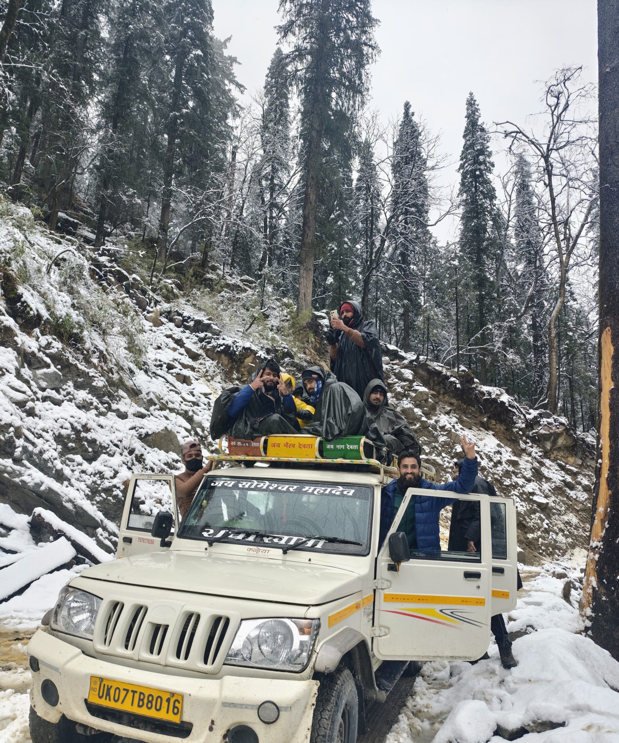
After a restful night in Joshimath, your adventure truly begins on Day 2 of the Pangarchulla Peak Trek. Begin with an early morning drive from Joshimath to Dhak village, which is the starting point of the trek. The short 12 km drive takes around 30–40 minutes and offers stunning early morning views of the surrounding snow-capped peaks and alpine forest.
Dhak village, located at approximately 2,050 meters, is a quaint Himalayan hamlet that serves as the starting point for both the Kuari Pass and Pangarchulla treks. From here, your trek begins through picturesque terrain dotted with small Garhwali villages, terraced fields, and oak–rhododendron forests.
The trail ascends gradually as you pass through Tugasi and Karchi villages, which give you a deep insight into local mountain life. The interaction with locals, children walking to school, and women carrying wood or fodder on mountain paths give a genuine rural Himalayan feel to your experience.
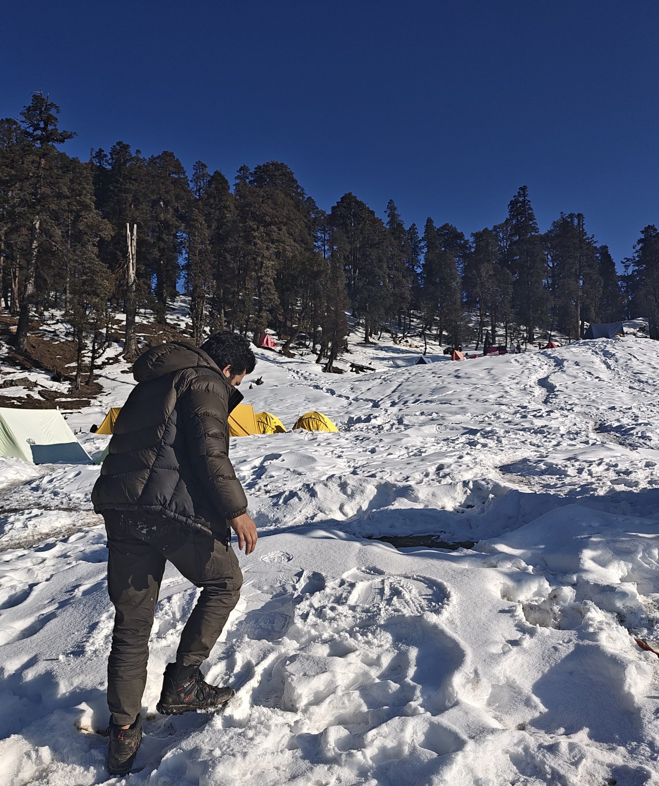
As you climb further, the landscape begins to transform. The thick oak, maple, and rhododendron forest covers welcome you just before reaching Gulling. In spring, this forest section turns vibrant with blooming red and pink rhododendrons, while in winter, the trail may be covered in snow depending on the month of your visit.
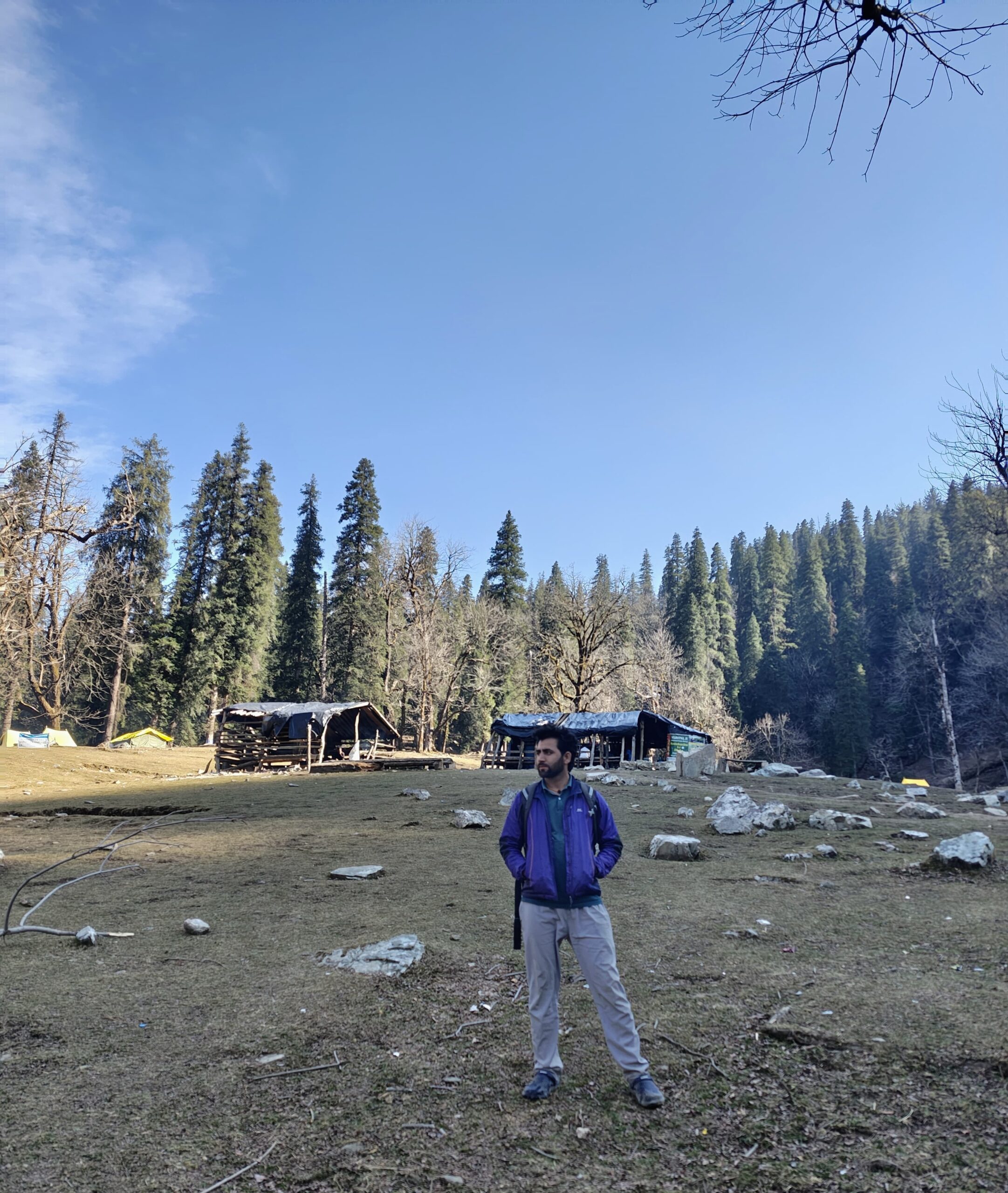
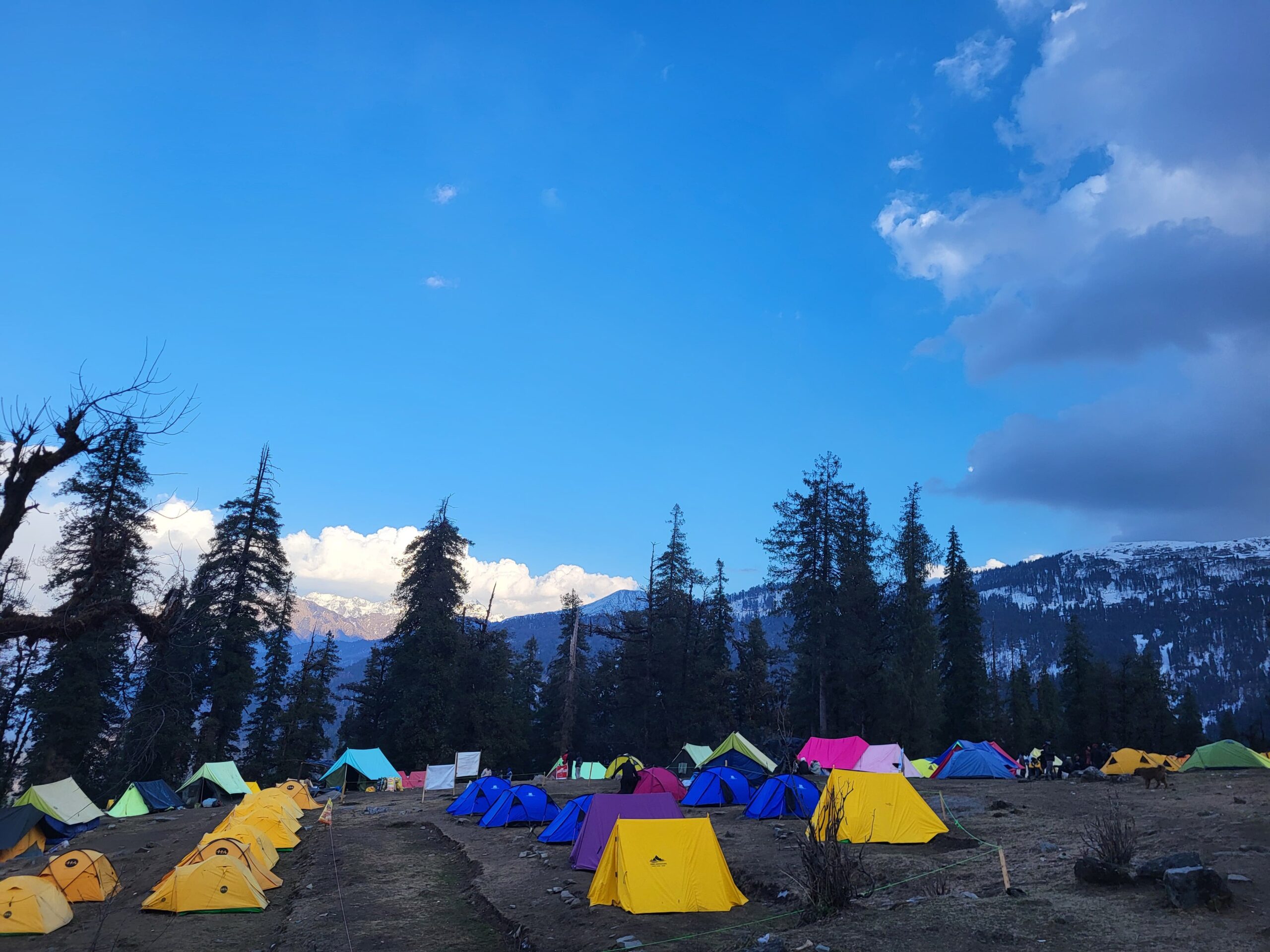
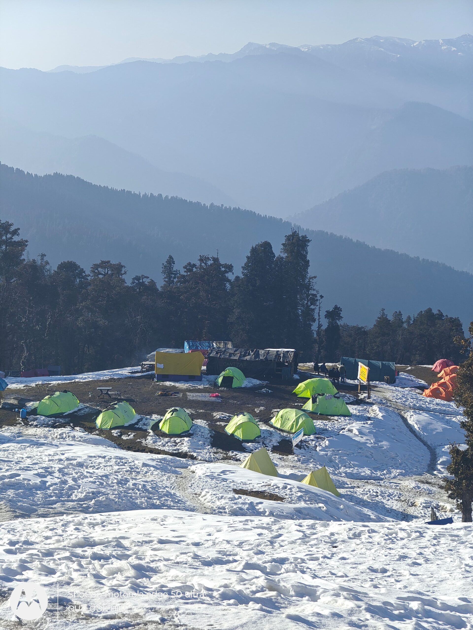
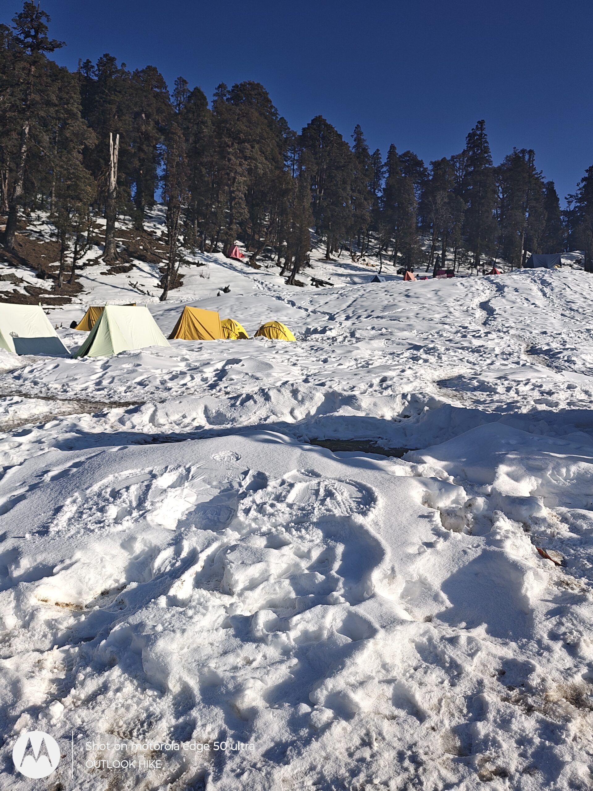
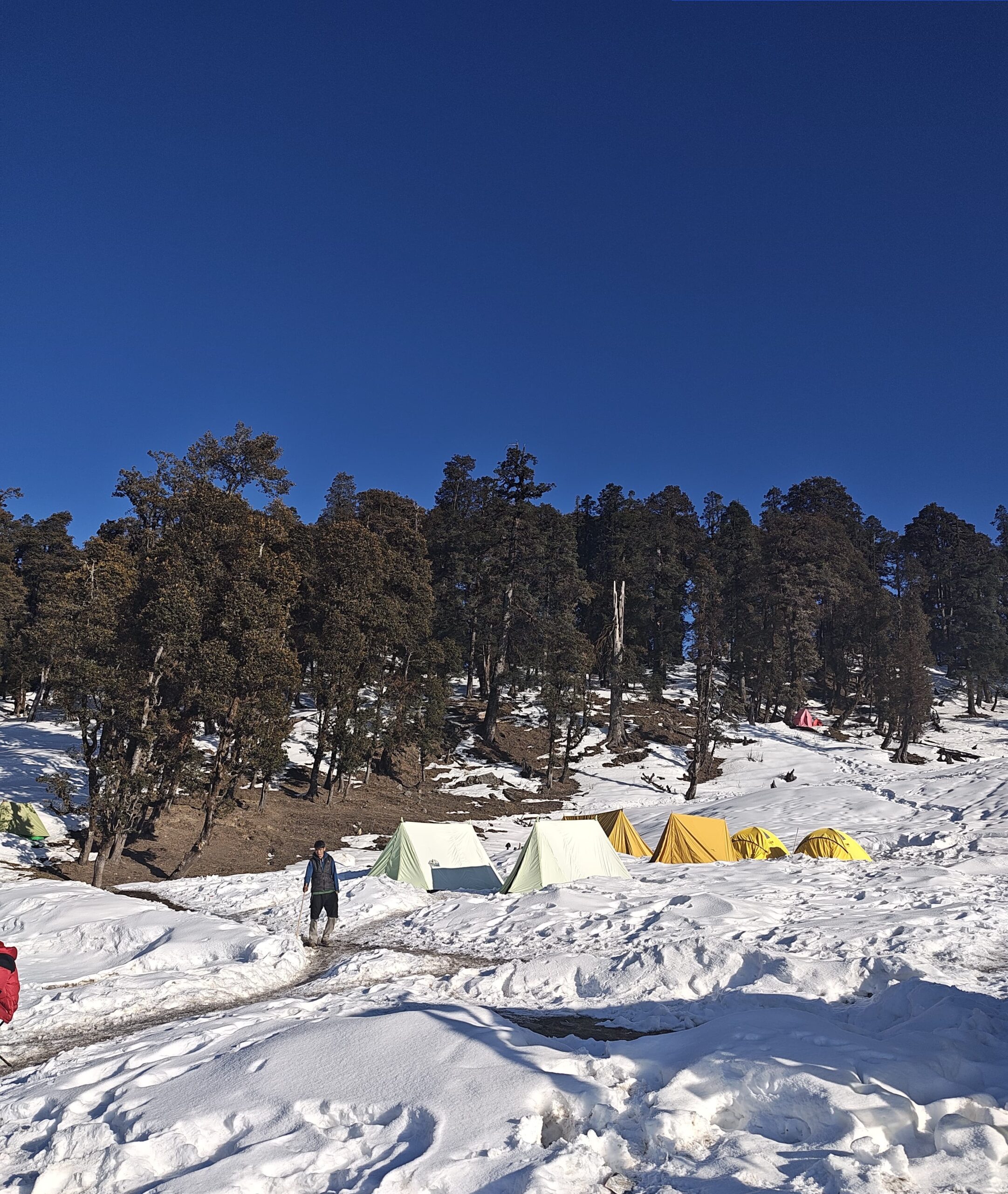
Gulling campsite, located at an altitude of around 2,950 meters, is surrounded by dense woods and offers serene views of the surrounding valleys. You’ll camp here for the night in alpine tents. The location is peaceful, away from any settlements, making it a perfect spot to relax and acclimatize to the higher altitudes.
Distance: ~4.5 km
Time: 3–4 hours
Altitude Gain: 2,950 m (Gulling) → 3,350 m (Khullara)
Route: Gulling → Forest Ridge → Open Meadows → Khullara Campsite
Day 3 of the Pangarchulla Peak Trek is a beautiful high-altitude forest and meadow walk that takes you deeper into the Garhwal Himalayas. After a warm breakfast at the Gulling campsite, you’ll start the gradual ascent to Khullara, the base camp for the Pangarchulla Summit climb.
The trail begins with a dense stretch of oak, rhododendron, and maple forests, often covered in snow between December and early April. As you trek through these silent woods, sunlight filters through the canopy, and if you’re trekking in spring, you’ll witness blooming rhododendrons that light up the forest in red, pink, and white hues.
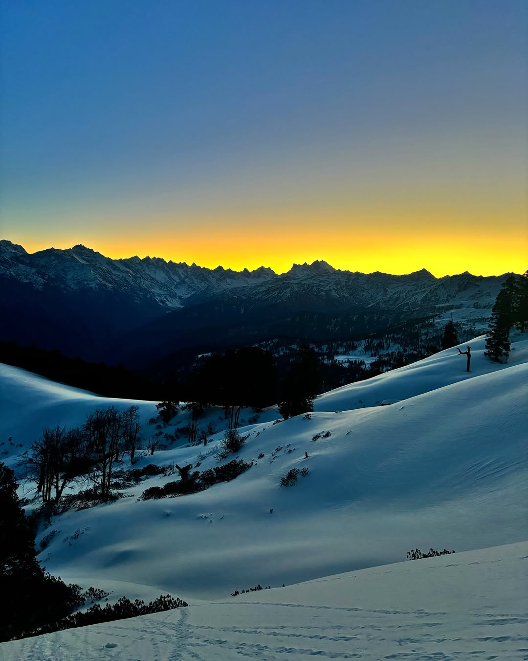
The forest opens up into alpine clearings and grassy ridges that offer your first panoramic views of Himalayan giants like Mount Dronagiri (7,066 m), Hathi Parvat, Ghori Parvat, and Nanda Devi on a clear day. You may also spot shepherd huts or grazing cattle depending on the season.
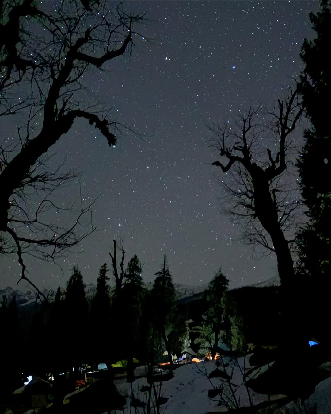
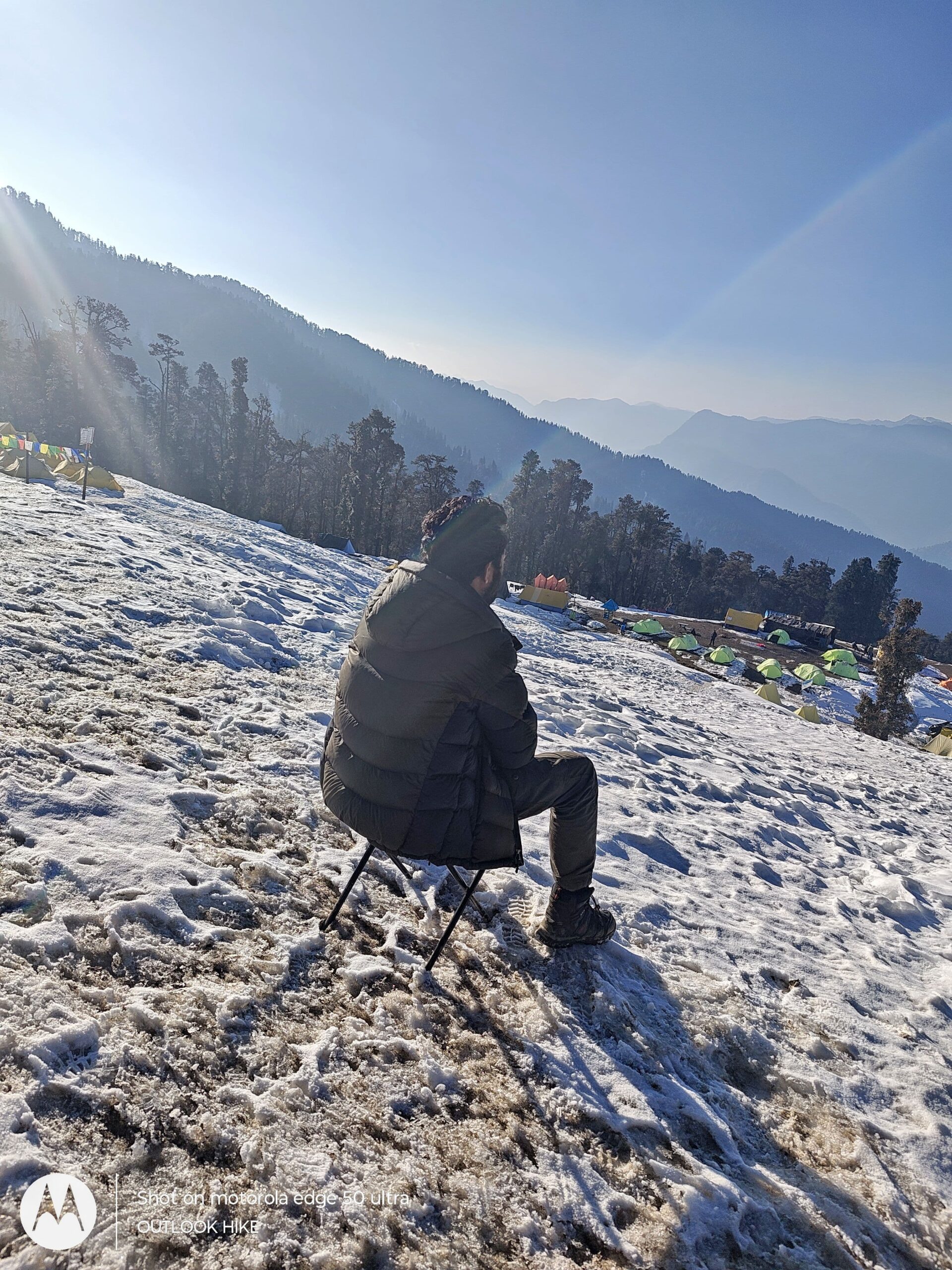
Khullara lies on a broad alpine slope with views of snow-dusted ridgelines and is one of the most scenic campsites in this region. At around 3,350 meters, it is higher than most treks’ base camps, so acclimatization is key. After reaching, you’ll relax with hot soup or tea and soak in the peaceful surroundings, with the possibility of witnessing a fiery sunset over the distant Himalayan summits.
This is the last full rest day before the summit push, so spend the evening staying warm, hydrating well, and preparing mentally and physically for the challenging summit day tomorrow.
Distance (Round Trip): ~12 km
Time: 9–12 hours
Altitude Gain: 3,350 m (Khullara) → 4,590 m (Pangarchulla Summit)
Route: Khullara → Kuari Pass Ridge → Summit Climb → Return via same route
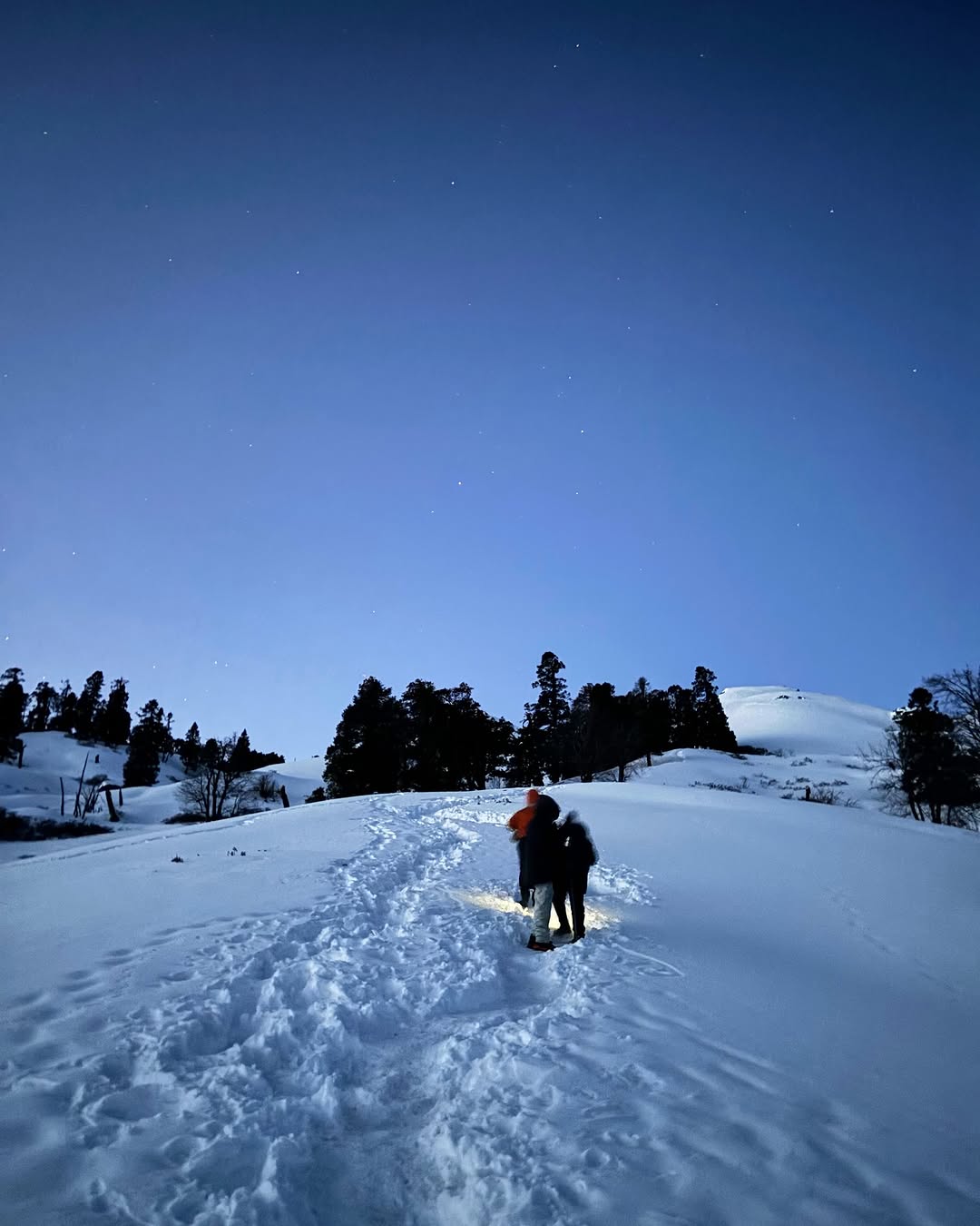
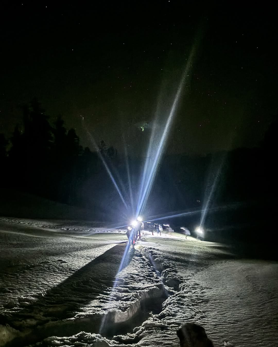
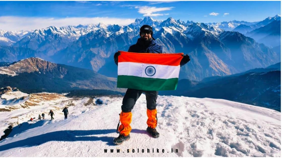
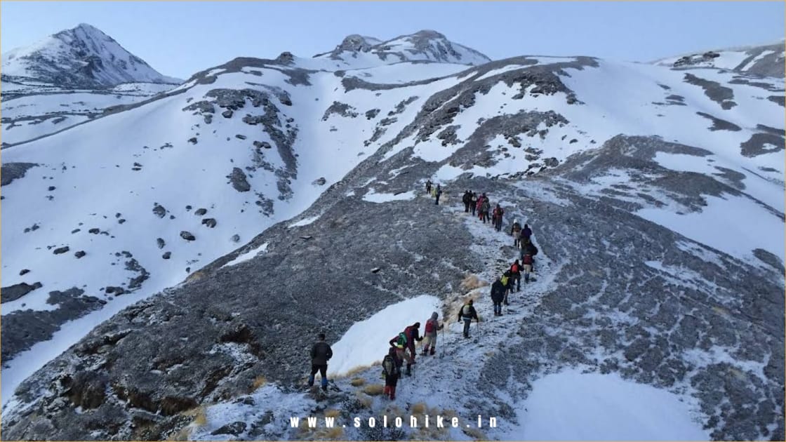
Day 4 is the most challenging and thrilling part of the Pangarchulla Peak Trek — the summit climb day. You’ll begin early in the morning, usually by 4:00–5:00 AM, to ensure you reach the summit before noon when weather conditions are most stable.
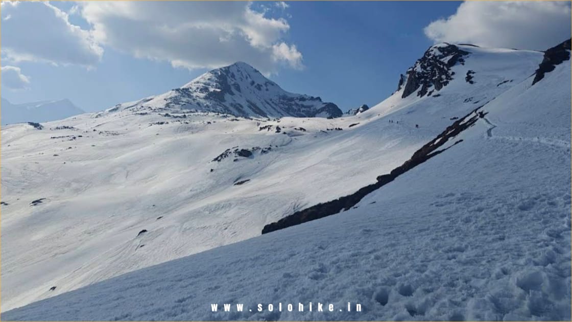
The trail starts from Khullara with a steep but gradual ascent to the Kuari Pass ridge. As you gain height, the surroundings change dramatically — from forested ridges to vast snow-covered slopes (in winter and spring), rocky ridgelines, and exposed alpine terrain.
The final summit push is where the real adventure begins. The ridge walk to Pangarchulla Peak involves technical snow trekking, especially in the winter and early spring months (Dec–May). You’ll traverse snow ridges, navigate boulder sections, and use microspikes or gaiters for grip.
Once you approach the top, you’re rewarded with panoramic 360° views of the Himalayan giants, including:
Nanda Devi (7,816 m)
Dronagiri (7,066 m)
Hathi Parvat, Chaukhamba, Neelkanth, Kamet, Trishul, and more
At 4,590 meters, the Pangarchulla Summit offers one of the best summit experiences in Uttarakhand — perfect for trekkers looking for a real alpine adventure with incredible scenic returns.
After spending 20–30 minutes at the summit (depending on weather), you’ll begin the descent along the same route. Take extreme care while descending, especially on snowy or slippery patches.
You’ll reach Khullara by late afternoon or early evening for a hot meal and well-earned rest after a long but unforgettable summit day.
Distance (Trek): ~7 km
Distance (Drive): ~12 km
Time: 4–5 hours (trek) + 30–40 minutes (drive)
Altitude Loss: 3,350 m (Khullara) → 2,050 m (Dhak) → 1,875 m (Joshimath)
Route: Khullara → Gulling → Tugasi Village → Dhak → Drive to Joshimath
After the thrilling summit day, Day 5 of the Pangarchulla Peak Trek is a pleasant and scenic descent back to civilization. You’ll begin the day with a relaxed breakfast at the Khullara campsite, then retrace your steps down to Dhak village via Gulling and Tugasi.
The descent gives you one last opportunity to appreciate the incredible variety of landscapes — from open alpine meadows and thick rhododendron forests to remote Garhwali hamlets surrounded by terraced fields.
Expect the descent to be gentle but steady, and poles are recommended to ease the impact on knees. You’ll walk through the same trail you ascended earlier but with a different perspective as the valleys open wide and Joshimath slowly comes into view.
Once you reach Dhak village, your transport will be waiting to drive you back to Joshimath, the base town for the Pangarchulla Trek and many other popular Himalayan treks.
You’ll reach Joshimath by early afternoon, where you can check into your guesthouse or hotel, take a hot shower, rest your legs, and celebrate your successful summit over a wholesome meal.
Joshimath is also a popular town with religious significance and serves as a gateway to Badrinath, Auli, and Valley of Flowers, making it a lively hub during the trekking season.
Distance: ~290 km
Time: 10–11 hours
Altitude Loss: 1,875 m (Joshimath) → 640 m (Dehradun)
Route: Joshimath → Chamoli → Karnaprayag → Srinagar → Devprayag → Rishikesh → Dehradun
Day 6 marks the end of your Pangarchulla Peak Trek adventure. After a hearty breakfast in Joshimath, you’ll begin your road journey back to Dehradun via the scenic route along the Alaknanda and Ganga rivers.
The drive is long but visually stunning, taking you through the sacred Panch Prayag (Devprayag, Rudraprayag, Karnaprayag, Nandprayag, and Vishnuprayag) — each a confluence of holy rivers in the Garhwal Himalayas.
You’ll pass through charming hill towns like Chamoli, Karnaprayag, Srinagar, and Rishikesh, giving you a final glimpse of Garhwali life and the Himalayan countryside. Midway, you’ll halt for lunch at a local restaurant and tea breaks at scenic spots.
Expect to reach Dehradun by 7:00–8:00 PM, depending on road and weather conditions. You can either plan an overnight stay in Dehradun or board a late train/flight if your return journey is scheduled.
This marks the end of a challenging, high-altitude Himalayan adventure filled with summit thrills, snow climbs, alpine forests, and jaw-dropping mountain views — making Pangarchulla one of the best summit treks in Uttarakhand.
Pangarchulla Trek Package Cost Includes
Transportation
Internal transportation from Joshimath to trek starting point (Dhak) and return.
Shared vehicles such as Bolero, Sumo, or Tempo Traveller depending on group size.
All local travel as per the fixed itinerary.
Accommodation
Joshimath Stay (Day 1 & Day 5): Guesthouse/lodge stay on twin/triple sharing basis.
Camping during the trek (Day 2 to Day 4): Tented accommodation with sleeping bags and mats.
All accommodations are provided on a sharing basis. Single occupancy available at extra cost.
Meals
All vegetarian meals from Joshimath to Joshimath (starting with Day 1 dinner and ending with Day 5 breakfast).
Includes breakfast, lunch, evening snacks, and dinner each day.
Hot tea/coffee, soups, and high-calorie snacks during trek days.
RO/boiled water for drinking provided throughout the trek.
Trek Guide and Support Staff
Certified and experienced trek leader and mountain guide.
Support staff including local cook, helpers, and camp manager.
Emergency medical support with a first aid kit, pulse oximeter, and oxygen cylinder.
Trekking Equipment
Quality sleeping bags, foam mats, and weatherproof tents.
Toilet tents and basic campsite hygiene supplies.
Microspikes and gaiters for snow conditions if required.
Permits and Entry Fees
All necessary forest entry permits and environment charges.
Local fees and permissions for trekking and camping.
Luggage Transfer
Porter/mule support to carry common group camping gear and kitchen equipment.
Trekkers are required to carry only a daypack with personal essentials.
Pangarchulla Trek Package Cost Excludes
Travel from your city to Joshimath and back (e.g., Delhi/Dehradun to Joshimath)
Meals during travel to and from Joshimath
Stay before Day 1 and after Day 5 in Joshimath (if you arrive early or stay later)
Travel insurance or medical insurance
Personal expenses like tips, laundry, phone, or snacks
Porter to carry your personal backpack (available at extra cost)
Personal trekking gear like jackets, shoes, trekking poles, etc.
Any extra transport or stay due to weather delays or landslides
Costs due to emergency evacuation or early exit from the trek
GST (5%) extra on the total package cost
Pangarchulla Trek Package Cost
Joshimath To Joshimath
₹ 15,500/- PP
₹ 13,999/- PP
- 5 Nights Stay
- Breakfast, Lunch, Dinner
- Forest Fees & Permit
- Trek Guide
- Safety & First Aid
Dehradun To Dehradun
₹ 17,500/- PP
₹ 15,999/- PP
- Pickup/Drop Ex- Dehradun
- 5 Nights Stay
- Breakfast, Lunch, Dinner
- Forest Fees & Permit
- Trek Guide
- Safety & First Aid
Delhi To Delhi
₹ 21,500/- PP
₹ 19,999/- PP
- Pickup/Drop Ex- Delhi
- 7 Nights Stay
- Breakfast, Lunch, Dinner
- Forest Fees & Permit
- Trek Guide
- Safety & First Aid
Pangarchulla Trek Fix Departures
November
10 Nov - 14 Nov
15 Nov - 19 Nov
22 Nov - 27 Nov
25 Nov - 29 Nov
Available
Available
Available
Available
December
1Dec - 5 Dec
5 Dec - 9 Dec
8 Dec - 12 Dec
10 Dec - 14 Dec
15 Dec - 19 Dec
18 Dec - 22 Dec
22 Dec - 26 Dec
25 Dec - 29 Dec
26 Dec - 30 Dec
27 Dec - 31 Dec
28 Dec - 1 Jan
29 Dec - 2 Jan
30 Dec - 3 Jan
31Dec - 4 Jan
Available
Available
Available
Available
Available
Available
Available
Available
Available
Available
Available
Available
Available
Available
January
2 Jan - 7 Jan
5 Jan - 12 Jan
8 Jan - 13 Jan
10 Jan - 15 Jan
13 Jan - 18 Jan
15 Jan - 20 Jan
18 Jan - 23 Jan
20 Jan - 25 Jan
22 Jan - 27 Jan
24 Jan - 29 Jan
25 Jan - 30 Jan
28 Jan - 1 Feb
30 Jan - 4 Feb
Available
Available
Available
Available
Available
Available
Available
Available
Available
Available
Available
Available
Available
February
2 Feb - 7 Feb
5 Feb - 9 Feb
9 Feb - 14 Feb
11 Feb - 18 Feb
15 Feb - 19 Feb
19 Feb - 24 Feb
21 Feb - 26 Feb
25 Feb - 1 Mar
28 Feb - 4 Mar
Available
Available
Available
Available
Available
Available
Available
Available
Available
March
3 Mar - 8 Mar
5 Mar - 10 Mar
9 Mar - 14 Mar
11 Mar - 16 Mar
15 Mar - 20 Mar
18 Mar - 23 Mar
22 Mar - 27 Mar
26 Mar - 1 Apr
30 Mar - 3 Apr
Available
Available
Available
Available
Available
Available
Available
Available
Available
April
1 Apr - 6 Apr
10 Apr - 15 Apr
12 Apr - 17 Apr
18 Apr - 23 Apr
25 Apr - 30 Apr
Available
Available
Available
Available
Available
How To Reach Pangarchulla Trek
Step-by-Step Guide to Reach Pangarchulla Trek
1. Reach Rishikesh/Haridwar/Dehradun – The Nearest Major Cities to Joshimath
By Air:
Jolly Grant Airport (DED), Dehradun is the nearest airport.
Well-connected to Delhi, Mumbai, Bangalore, Hyderabad, Kolkata, and Jaipur.
From the airport, take a taxi/shared cab to Joshimath (270–290 km, 9–10 hours).
By Train:
Nearest railway stations: Haridwar (HW) and Rishikesh (RKSH).
Direct trains available from Delhi, Mumbai, Kolkata, Varanasi, and Lucknow.
Popular trains: Shatabdi Express, Jan Shatabdi, Nanda Devi Express.
By Bus/Car:
Overnight buses run from Delhi to Rishikesh/Haridwar (via ISBT Kashmere Gate).
Travel Time: 6–7 hours.
From Rishikesh, take a shared jeep, taxi, or bus to Joshimath.
2. Rishikesh/Dehradun to Joshimath (Base for Pangarchulla Trek)
Distance: ~270–290 km
Travel Time: 9–10 hours by road
Route: Rishikesh → Devprayag → Srinagar → Rudraprayag → Karnaprayag → Chamoli → Joshimath
Options:
Private taxi (₹6,000–8,000 per vehicle)
Shared jeeps from Rishikesh Taxi Stand (₹600–800/person)
GMOU/UTC buses (early morning departures)
3. Joshimath to Trek Starting Point – Dhak Village
Distance: ~12 km
Travel Time: 30–40 minutes
Local jeeps or cabs can be hired from Joshimath to Dhak village, the starting point of the Pangarchulla Trek.
Some operators include this transport in the trek package.
Summary – How to Reach Pangarchulla Trek
| Route | Mode | Distance & Travel Time |
|---|---|---|
| Delhi to Rishikesh/Dehradun | Train / Flight / Bus | ~250 km – 6 to 8 hours |
| Rishikesh/Dehradun to Joshimath | Road (cab / bus) | ~270–290 km – 9 to 10 hours |
| Joshimath to Dhak | Road | ~12 km – 30–40 minutes |
From Delhi to Pangarchulla Trek:
Delhi → Rishikesh (overnight bus/train) → Joshimath (shared cab/bus) → Dhak
From Mumbai to Pangarchulla Trek:
Mumbai → Dehradun/Haridwar (flight/train) → Joshimath → Dhak
From Bangalore to Pangarchulla Trek:
Bangalore → Dehradun (flight via Delhi) → Joshimath → Dhak
Pangarchulla Trek Booking Policy
- Booking is confirmed only after receiving a minimum 30% advance payment
Balance amount to be paid at pickup time.
Payment Options
Online payment via UPI / Bank Transfer / Net Banking / Debit & Credit Cards
Payment receipt will be shared via email or WhatsApp for confirmation
Pangarchulla Trek Cancellation Policy
- 90% refund if cancelled 30+ days before trek date
- 70% refund if cancelled 15–29 days before trek
- 50% refund if cancelled 7–14 days before trek
- No refund if cancelled less than 7 days before trek or no-show
Pangarchulla Trek Essentials
The Pangarchulla Peak Trek is a thrilling high-altitude adventure in the Garhwal Himalayas, known for its challenging summit climb, deep snow routes (in spring), and breathtaking views of Nanda Devi, Dronagiri, and other Himalayan giants. To fully enjoy this trek and stay safe, it’s essential to be well-prepared with the right trekking gear, fitness, and mindset.
Base Layer (thermal innerwear – top and bottom)
2–3 Full sleeve quick-dry T-shirts (avoid cotton)
2 Insulating Layers (fleece/wool sweaters or light down jacket)
1 Heavy Feather Jacket / Padded Jacket (for summit day)
2 Trek Pants (quick-dry; avoid jeans)
1 Windproof & Waterproof Jacket/Poncho
Thermal Track Pants (for nights)
Warm Innerwear & Undergarments (at least 2–3 pairs)
1 pair of high-ankle trekking shoes (snow/water-resistant)
1 pair of slippers / sandals for campsite use
Optional: Gaiters (for heavy snow)
Trekking backpack (40–50L) with rain cover
Daypack (10–15L) for summit day
Trekking pole (highly recommended)
Headlamp / torch with spare batteries
Water bottles (2 x 1L) or hydration bladder
Sunglasses (UV-protected)
Power bank
Ziplock / dry bags for organizing
Optional: Camera or GoPro
Toothbrush + toothpaste
Biodegradable soap / face wash
Lip balm (essential for cold cracks)
Cold cream / moisturizer
Sunscreen (SPF 50+)
Quick-dry towel
Toilet paper / tissues
Hand sanitizer
Menstrual hygiene products (as required)
Wet wipes (optional but useful)
Paracetamol / Ibuprofen
Diamox (only after doctor’s advice)
Band-aids / blister patches
Antiseptic cream
Crepe bandage
Personal medication
ORS / Glucose / Electrolyte powder
Original Government ID proof (Aadhar, Passport, Voter ID)
Medical fitness certificate (if required by trek operator)
Trek disclaimer form (provided by operator)
Trek booking confirmation / permit copy (if applicable)
Pangarchulla Trek Fitness
Fitness Requirements for Pangarchulla Trek
The Pangarchulla Trek is a moderate to difficult level trek and requires a good level of physical fitness. The summit day involves a steep ascent on snow and can be physically demanding, especially in the pre-summer months (March to May) when the snow is deep. To successfully complete this high-altitude Himalayan trek, trekkers should be physically prepared, mentally determined, and well-acclimatized.
Key Fitness Requirements
Trekking Distance: ~30–35 km (round trip)
Summit Altitude: 15,070 ft (~4,593 m)
Trek Duration: 5–6 days (Joshimath to Joshimath)
Summit Day Duration: 10–12 hours of trekking on snow and rocky terrain
Who Can Do the Pangarchulla Trek?
- Trekkers aged 14 to 55 with good fitness levels
- Beginners who have done at least one moderate trek before
- Anyone who can walk 8–10 km daily for 7–10 days
- Those with no serious medical conditions (especially related to heart or lungs)
How to Prepare for Pangarchulla Trek
Start your fitness routine at least 4–6 weeks before the trek. Here’s what you can do:
1. Cardio Training (5 Days a Week)
Jogging or brisk walking: Start with 3 km and increase to 5–6 km in 35–40 mins
Stair climbing: 3–4 floors up and down, 3–4 repetitions
Cycling, swimming, or dancing for stamina
2. Strength Training (3 Days a Week)
Squats, lunges, and planks for leg and core strength
Pushups and crunches for overall body strength
3. Breathing Exercises
Practice deep breathing and pranayama
Focus on lung capacity and oxygen efficiency
Fitness Test (At Home)
You should be able to:
Jog 5 km in less than 40 minutes
Climb 10 floors without stopping or feeling breathless
Do 15–20 squats and 30-second planks comfortably
Medical Advice
Get a medical check-up if you have asthma, high blood pressure, or heart issues.
Carry prescribed altitude sickness medication like Diamox (consult your doctor first).
Don’t skip acclimatization routines during the trek.
Pangarchulla Trek FAQ's
Where is Pangarchulla Peak located?
Pangarchulla Peak is located in the Chamoli district of Uttarakhand, India. It lies in the Garhwal Himalayas near the town of Joshimath and is part of the Nanda Devi National Park region.
How difficult is the Pangarchulla Trek?
The Pangarchulla Trek is considered a moderate to difficult trek due to its high altitude (15,070 ft), steep summit day, and snow-covered terrain in the spring season.
What is the best time to do the Pangarchulla Trek?
The best time to trek to Pangarchulla Peak is from March to May (for snow and summit climb) and October to early December (for clear skies and views).
Is Pangarchulla Trek safe for beginners?
It’s suitable for beginners who have done at least one moderate trek before and have good fitness. The summit day is long and requires stamina and mental endurance.
How many days are required for the Pangarchulla Trek?
Typically, the Pangarchulla Trek takes 5 to 6 days from Joshimath to Joshimath, including acclimatization and summit day.
What is the maximum altitude of the Pangarchulla Trek?
The summit of Pangarchulla Peak reaches an altitude of 15,070 feet (4,593 meters).
How to reach the base of Pangarchulla Trek?
You need to first reach Joshimath from Dehradun, Rishikesh, or Haridwar by road. From Joshimath, you travel to Dhak village, which is the trek starting point.
What is the total trek distance of Pangarchulla Trek?
The total trekking distance is approximately 30 to 35 km, depending on the route and weather conditions.
Is there snow on the Pangarchulla Trek?
Yes, snow is generally found between March and May, making it an ideal time for a snow summit experience. The summit day includes trekking over snow ridges and icy trails.
What is the cost of the Pangarchulla Trek package?
The trek package usually ranges from ₹8,999 to ₹11,999 per person, depending on the inclusions, season, and group size. Some packages also include transport from Rishikesh or Dehradun.
What kind of accommodation is provided on the trek?
Accommodation includes guesthouses or homestays in Joshimath and tents during the trek on twin or triple sharing basis. Sleeping bags and mattresses are usually provided.
Do I need prior trekking experience for Pangarchulla?
While it’s not mandatory, prior experience in high-altitude trekking will help. The summit climb requires endurance, especially due to snow and long hours of walking.
Is Pangarchulla Peak a good alternative to Kedarkantha or Brahmatal?
Yes, Pangarchulla offers a real summit climb, making it a more adventurous choice compared to Kedarkantha or Brahmatal. It is ideal for trekkers looking to step into serious trekking.
What are the mobile network and electricity conditions on the trek?
Mobile networks are available in Joshimath, but there’s no signal once you leave the base. There is no electricity at the campsites; carry power banks.
Can I rent trekking gear for Pangarchulla Trek?
Yes, trekking poles, jackets, shoes, and crampons are available for rent in Joshimath. It is recommended to carry your personal gear for comfort and fit.
Which is best travel company for Pangarchulla trek?
Solo Hike is Uttarakhand based travel company, providing Pangerchulla trek services since 10 years. Solo Hike help you to get the package from Dehradun and even from Delhi too, with best and affordable prices.
PANGARCHULLA TREK PHOTOS
Read More About Pangarchulla Trek
Best Time To Visit Pangarchulla Trek
Discover the best time to visit Pangarchulla Trek for snow, summit views & safe trekking. Plan your Pangarchulla adventure in spring or autumn for clear skies, scenic beauty & a thrilling summit experience.
Best Time To Visit Pangarchulla Trek
Discover the best time to visit Pangarchulla Trek for snow, summit views & safe trekking. Plan your Pangarchulla adventure in spring or autumn for clear skies, scenic beauty & a thrilling summit experience.
Best Time To Visit Pangarchulla Trek
Discover the best time to visit Pangarchulla Trek for snow, summit views & safe trekking. Plan your Pangarchulla adventure in spring or autumn for clear skies, scenic beauty & a thrilling summit experience.
RELATED TREKS

