Basecamp
Lohajung
Duration
8 Days
Max. Altitude
15,750 ft.
Distance
50 Kms
Grade
Moderate
Pickup/Drop
Kathgodam
Roopkund Trek Overview
Roopkund Trek – Mysterious Lake Trek in Uttarakhand Himalayas
The Roopkund Trek, also known as the Mystery Lake Trek or Skeleton Lake Trek, is one of the most thrilling and fascinating high-altitude treks in the Indian Himalayas. Nestled in the Chamoli district of Uttarakhand, this trek takes you to the glacial Roopkund Lake, famous for hundreds of human skeletons dating back to the 9th century AD. Located at a staggering altitude of 5,029 meters (16,499 ft), Roopkund is a surreal destination surrounded by snow-clad peaks, alpine meadows, and ancient legends.
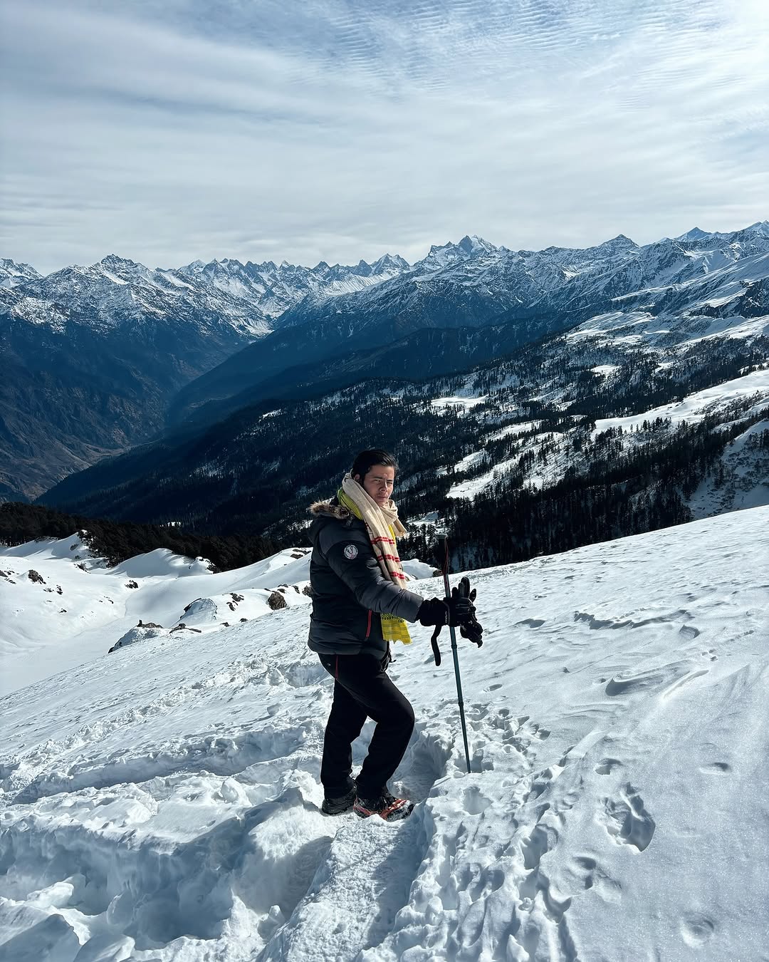
The trail to Roopkund offers everything a trekker dreams of—dense oak and rhododendron forests, lush alpine meadows (Ali and Bedni Bugyal), panoramic views of Trishul and Nanda Ghunti peaks, high-altitude ridgelines, and a dramatic frozen lake with a mysterious past. This makes it one of the best high-altitude treks in Uttarakhand and a bucket-list destination for serious trekkers and adventure seekers alike.
The Roopkund Lake Trek typically starts from Lohajung, a remote village nestled in the Garhwal Himalayas. From here, trekkers pass through picturesque campsites such as Didna, Ali Bugyal, Bedni Bugyal, Patar Nachauni, and Bhagwabasa, each offering breathtaking views and unique Himalayan landscapes. The trek is graded moderate to difficult, ideal for trekkers with some prior high-altitude experience.
This trek is best done during the pre-monsoon (May–June) and post-monsoon (September–October) seasons. During summer, the meadows are lush green with blooming flowers, while autumn offers crisp skies and snow-draped peaks.
Due to its dramatic landscapes, cultural richness, and mysterious history, Roopkund has become one of the most sought-after Himalayan treks in India.
Key Highlights of Roopkund Trek
Altitude: 5,029 m / 16,499 ft – One of the highest lake treks in Uttarakhand
Region: Chamoli district, Garhwal Himalayas, Uttarakhand
Trail Type: Round trail via Lohajung – Didna – Ali Bugyal – Bedni Bugyal – Roopkund – Junargali (optional)
Duration: 8 to 9 days
Difficulty Level: Moderate to Difficult
Best Time to Visit: May to June and September to October
Total Trek Distance: ~53–55 km (round trip)
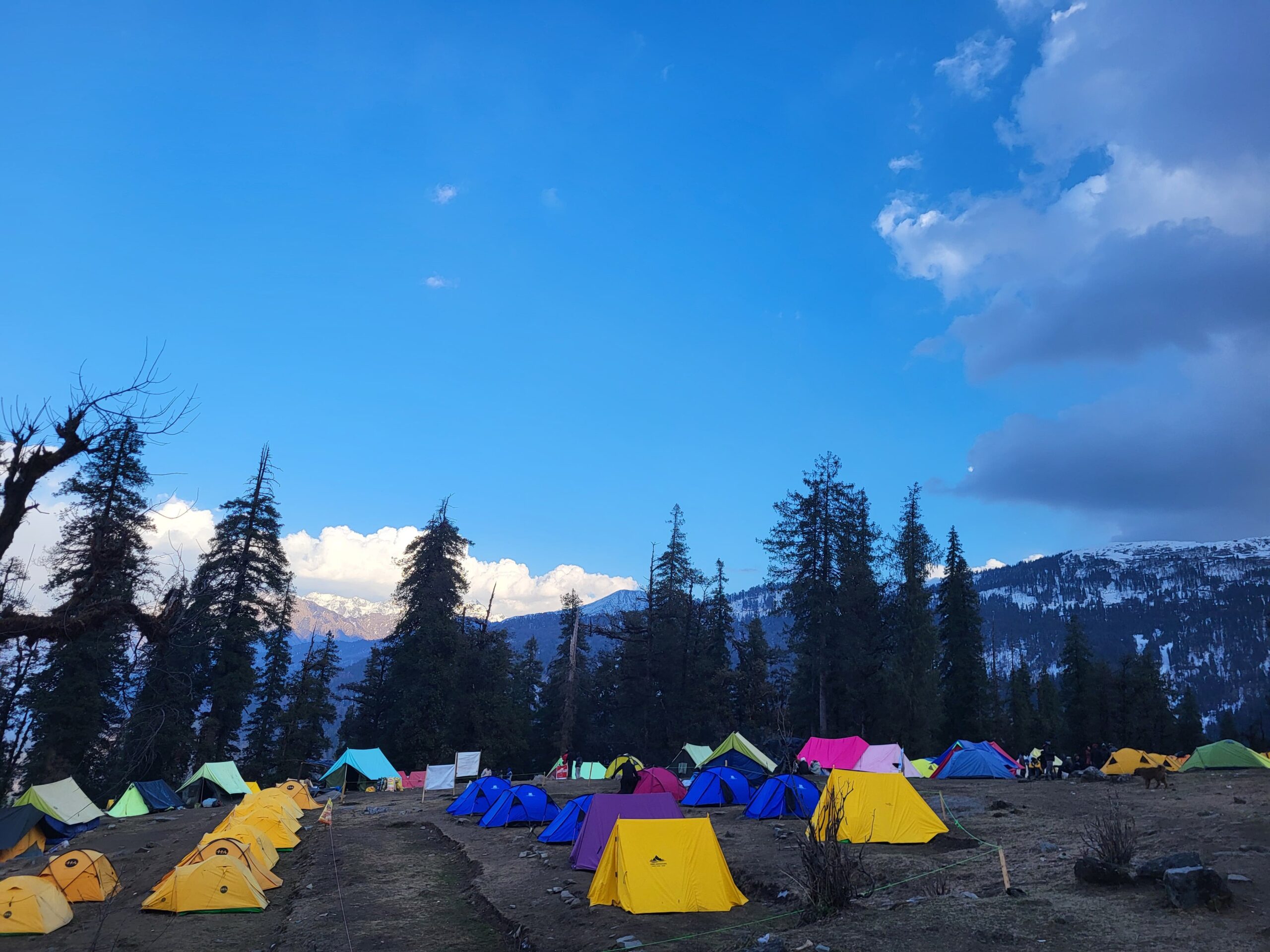
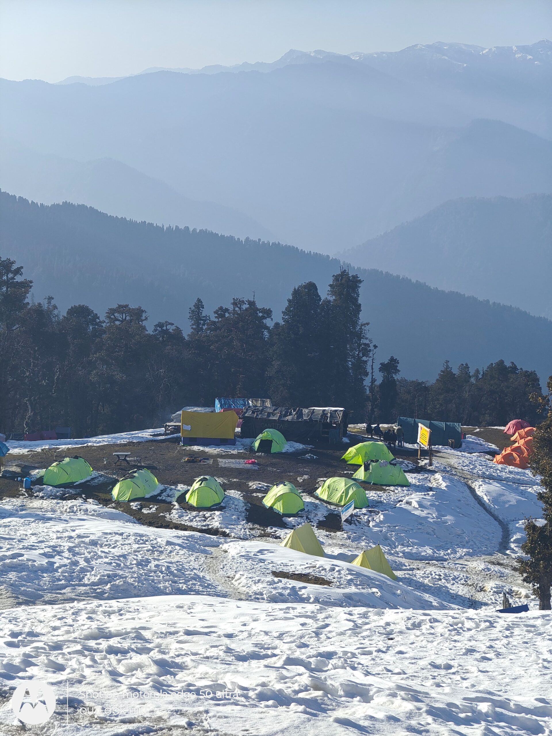
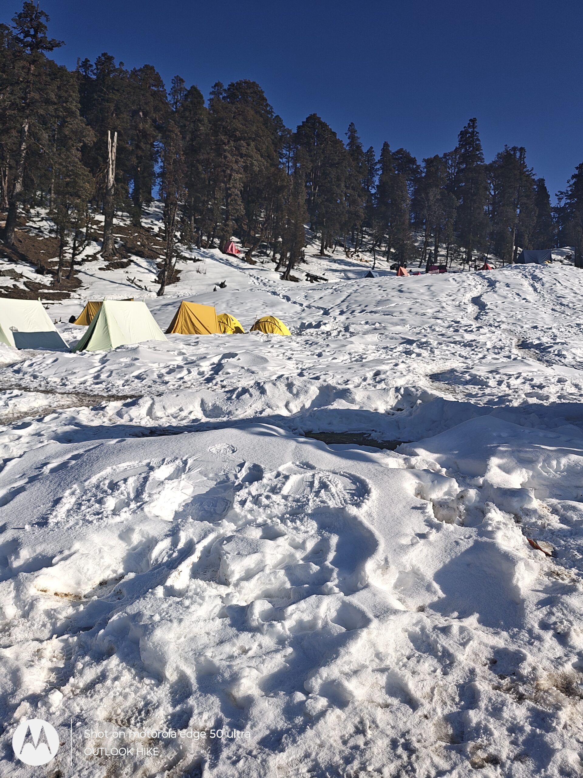
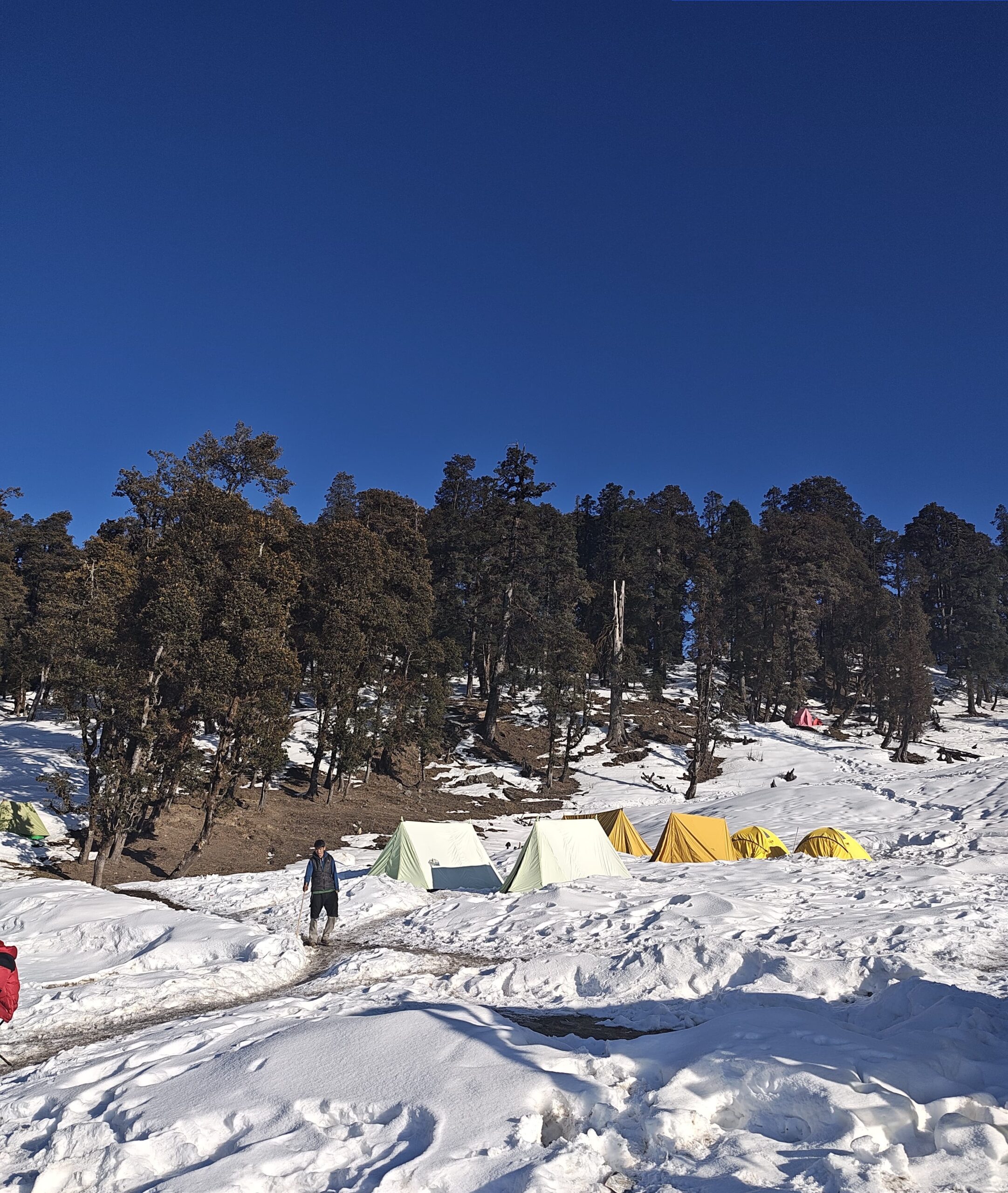
Campsites: Lohajung, Didna, Ali Bugyal, Bedni Bugyal, Patar Nachauni, Bhagwabasa
Famous For: Mystery Lake with human skeletons, vast meadows, alpine views, mythology
Roopkund Mystery and Its Importance
The Roopkund Lake, famously known as the Mystery Lake of India, is one of the most intriguing archaeological and natural enigmas in the Himalayas. Nestled at an altitude of 5,029 meters (16,499 ft) in the Garhwal Himalayas of Uttarakhand, this glacial lake is renowned not only for its breathtaking beauty but also for the hundreds of human skeletons found scattered around and beneath its frozen waters.
The Roopkund Skeleton Mystery
In the 1940s, a British forest ranger discovered an unusual sight: hundreds of skeletons lying around the lake. Over the years, as snow melts during the summer, these skeletons become visible, shocking and fascinating scientists, trekkers, and locals alike. Radiocarbon dating and DNA analysis have revealed that the remains belong to multiple groups from as early as the 9th century, with some theories suggesting a massive hailstorm killed them instantly.
Research published in 2019 suggested that the skeletons were not from one single event. Instead, they belonged to two distinct groups from different periods — one from South Asia (9th century) and another from the eastern Mediterranean (19th century). How and why they all ended up at such a remote and high-altitude location is still largely unexplained.
Mythological Significance
Locally, the lake is tied to the myth of Goddess Nanda Devi. According to folklore, a king and queen once undertook a pilgrimage to the Nanda Devi shrine with dancers and entertainers. This angered the goddess, and she struck them down with a storm, killing everyone. Locals believe the skeletons are the remains of that ill-fated royal procession. Even today, the Nanda Devi Raj Jat Yatra, a once-in-12-years religious pilgrimage, passes through this region, honoring the goddess.
Scientific and Cultural Importance
Archaeological Value: Roopkund provides rare insight into ancient human migration, Himalayan weather patterns, and early pilgrimage practices.
Genetic Diversity Studies: The DNA found at Roopkund has helped scientists understand long-distance ancient travel and ethnic diversity.
Cultural Heritage Site: Considered sacred by locals and connected to Uttarakhand’s spiritual history.
Eco-Historical Hotspot: It’s a unique blend of natural mystery, ancient folklore, and scientific curiosity.
Roopkund Trek Short Itinerary
Day 1: Kathgodam to Lohajung (Base Village)
Distance: ~220 km
Time: 9–10 hours
Altitude Gain: 554 m (Kathgodam – 1,146 m) → 1,950 m (Lohajung)
Route: Kathgodam → Almora → Kausani → Gwaldam → Deval → Lohajung
Day 2: Lohajung to Didna Village (Trek Begins)
Distance: ~6 km (trek)
Time: 4–5 hours
Altitude Gain: 1,950 m → 2,450 m
Route: Lohajung → Kulling → Raun Bagad Bridge → Didna Village
Day 3: Didna to Bedni Bugyal via Ali Bugyal
Distance: ~10–11 km
Time: 6–7 hours
Altitude Gain: 2,450 m → 3,350 m
Route: Didna → Tolpani → Ali Bugyal → Bedni Bugyal
Day 4: Bedni Bugyal to Patar Nachauni
Distance: ~4–5 km
Time: 3–4 hours
Altitude Gain: 3,350 m → 3,800 m
Route: Bedni Bugyal → Ghora Lotani → Patar Nachauni
Day 5: Patar Nachauni to Bhagwabasa via Kalu Vinayak
Distance: ~6 km
Time: 4–5 hours
Altitude Gain: 3,800 m → 4,300 m
Route: Patar Nachauni → Kalu Vinayak Temple → Bhagwabasa
Day 6: Bhagwabasa to Roopkund & Return to Patar Nachauni
Distance: ~10–12 km
Time: 8–9 hours
Altitude Gain: 4,300 m → 5,029 m (Roopkund Lake) → 3,800 m (return)
Route: Bhagwabasa → Roopkund Lake → (Optional: Junargali Pass) → return to Patar Nachauni
Day 7: Patar Nachauni to Wan Village – Drive to Lohajung
Distance: ~12–14 km trek + 10 km drive
Time: 6–7 hours (trek) + 30 mins (drive)
Altitude Loss: 3,800 m → 2,400 m (Wan) → 1,950 m (Lohajung)
Route: Patar Nachauni → Bedni Bugyal → Neel Ganga → Wan → Lohajung
Day 8: Lohajung to Kathgodam
Distance: ~220 km
Time: 9–10 hours
Altitude Loss: 1,950 m → 1,146 m
Route: Lohajung → Deval → Gwaldam → Kausani → Almora → Kathgodam
Roopkund Trek Detailed Itinerary
Distance: ~220 km
Time: 9–10 hours
Altitude Gain: 804 m (Kathgodam – 1,146 m) → 1,950 m (Lohajung)
Route: Kathgodam → Bhimtal → Almora → Kausani → Gwaldam → Deval → Lohajung
The Roopkund Trek begins with a scenic mountain drive from Kathgodam Railway Station, the nearest major railhead in Kumaon. As you leave behind the plains, the road climbs gently through the emerald hills of Bhimtal, eventually joining the winding roads of Almora, a quaint town known for its cultural charm and Himalayan views.
The route then continues to Kausani, often dubbed the ‘Switzerland of India’, where panoramic vistas of Trishul, Nanda Devi, and Panchachuli peaks accompany the journey. From Kausani, the road descends and rises again through Gwaldam and Deval, crossing streams, terraced farms, and dense pine-oak forests.
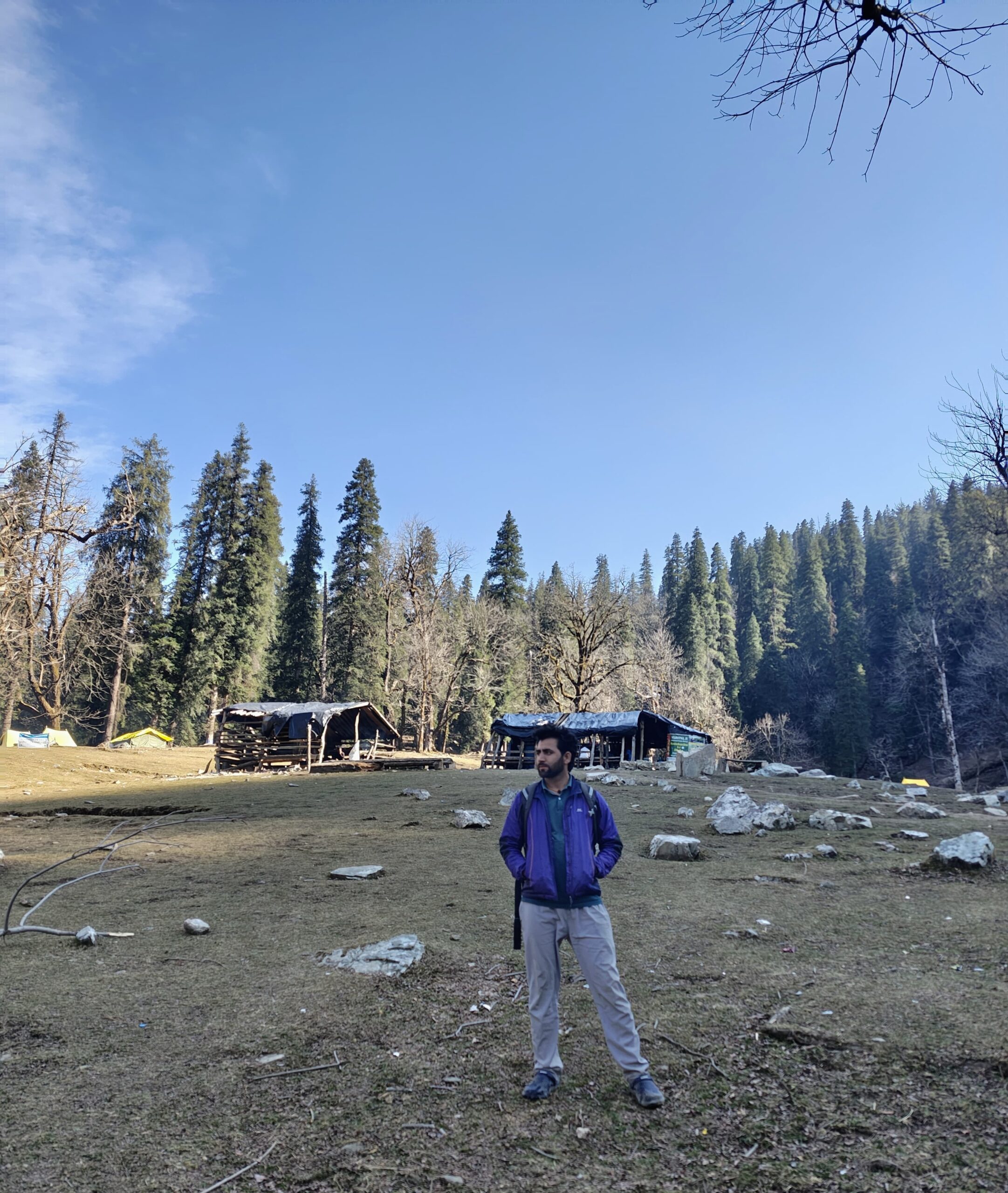
As you approach Lohajung, mobile signals begin to fade, making it a perfect digital detox zone. Nestled at 1,950 meters, Lohajung village marks the basecamp for the Roopkund Trek and other stunning trails like Ali Bedni Bugyal and Brahmatal Trek. The small market here has shops for basic trek gear, cozy guesthouses, and locals ready with folklore about the mysterious Roopkund Lake.
By the time you reach Lohajung, you’re already surrounded by towering Himalayan ridges and a sense of quiet adventure.
Distance: ~7 km
Time: 4–5 hours
Altitude Gain: 1,950 m (Lohajung) → 2,450 m (Didna)
Route: Lohajung → Raun Bagad → Iron Bridge → Didna Village
Your trekking journey begins today as you leave the motorable roads behind and step into the raw beauty of the Himalayas. The trail starts from Lohajung, descending gradually through mixed forests of oak and rhododendron towards Raun Bagad, a riverside rest point.
After crossing a charming iron bridge over the roaring Neel Ganga River, you begin a steady uphill climb. The ascent is shaded, serene, and filled with birdsong — a perfect introduction to Himalayan trekking for beginners.
The trail winds through quiet forest patches and opens up near the traditional Didna Village, a quaint hamlet nestled on a hill slope at an altitude of ~2,450 meters. The village offers panoramic views of nearby ridges, terraced fields, and grazing cattle.
Staying here allows for cultural immersion and gives trekkers time to adjust to the rising altitude. Didna is also a key acclimatization point before ascending to Ali Bugyal, one of the largest high-altitude meadows in India.
Distance: ~10 km
Time: 5–6 hours
Altitude Gain: 2,450 m (Didna) → 3,400 m (Ali Bugyal)
Route: Didna Village → Tolpani → Oak Forest Climb → Ali Bugyal
The trail begins with a steep ascent through terraced farmlands and remote settlements like Tolpani, where you’ll get a glimpse of mountain life at its rawest. As you climb higher, the terrain shifts to dense oak and rhododendron forests. This stretch is filled with silence, mist, and the occasional chirp of Himalayan birds.
After around 2–3 hours of a steady climb, the forest suddenly opens up to reveal one of the trek’s most iconic highlights — Ali Bugyal. This is one of Asia’s largest high-altitude alpine meadows, sitting at around 3,400 meters above sea level.
The lush green expanse stretches as far as the eye can see, framed by snow-capped peaks like Trishul and Nanda Ghunti. Horses and sheep graze freely here, and the cool breeze over the bugyal makes it a surreal Himalayan experience.
Ali Bugyal offers a perfect place to rest, soak in panoramic mountain views, and acclimatize before the next leg of the trek to Bedni Bugyal. It’s a perfect blend of challenge and reward, making this one of the most scenic days on the Roopkund trek.
Distance: ~8 km
Time: 4–5 hours
Altitude Gain: 3,400 m (Ali Bugyal) → 3,650 m (Patar Nachauni)
Route: Ali Bugyal → Bedni Bugyal → Bedni Kund → Patar Nachauni
The trail from Ali Bugyal starts with a gentle walk over rolling alpine meadows. This is one of the most scenic stretches of the Roopkund Trek, where every step feels like walking through a Himalayan dream. As you walk, you’ll be surrounded by 360° views of majestic peaks like Mt. Trishul and Nanda Ghunti, making this part of the route perfect for photography and quiet reflection.
Soon, you reach the famed Bedni Bugyal, another sprawling green meadow that rivals Ali Bugyal in beauty. Here lies Bedni Kund, a small sacred lake believed to be associated with the goddess Nanda Devi. Pilgrims often offer prayers here during the Nanda Devi Raj Jat Yatra, which passes through this very trail once every 12 years.
After a brief stop at Bedni, the trail gradually ascends towards Patar Nachauni, crossing a few shepherd huts and stone-paved paths. The environment starts to change—green meadows give way to more rugged and barren landscapes, signaling your approach to the higher reaches of the trek.
Patar Nachauni sits amidst vast alpine pastures and is known for its mythological backstory. According to local legend, it’s the spot where dancers (nachauni) turned to stone after offending the goddess. The campsite here is breezy and open, offering dramatic views and a good altitude to acclimatize for the steeper climbs ahead.
Distance: ~6 km
Time: 4–5 hours
Altitude Gain: 3,650 m (Patar Nachauni) → 4,300 m (Bhagwabasa)
Route: Patar Nachauni → Kalu Vinayak Temple → Bhagwabasa
This is one of the most challenging and visually dramatic sections of the Roopkund Trek. The trail begins with a steep ascent from Patar Nachauni to Kalu Vinayak Temple, a revered black stone shrine dedicated to Lord Ganesha. The name “Kalu” means black, and “Vinayak” refers to Ganesha—thus, the temple is said to protect trekkers on their way to Roopkund Lake.
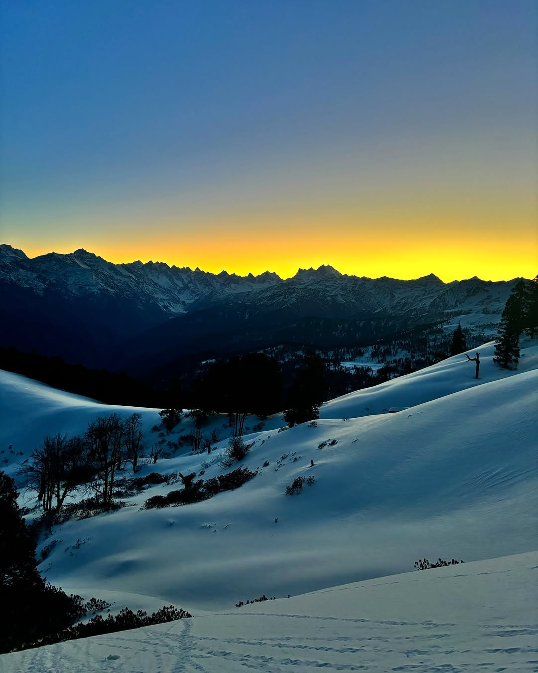
The climb to Kalu Vinayak is steep, zigzagging through rocky terrain with loose gravel underfoot. The air becomes noticeably thinner, and the landscape changes from lush meadows to rugged high-altitude terrain. However, the effort is worth it as the views are breathtaking—Mt. Trishul, Nanda Ghunti, and the entire Garhwal range seem within arm’s reach.
Once you reach Kalu Vinayak (altitude ~4,100 m), take a moment to rest and offer a silent prayer for a safe journey ahead. This spot is also perfect for panoramic photography and a short break to acclimatize.
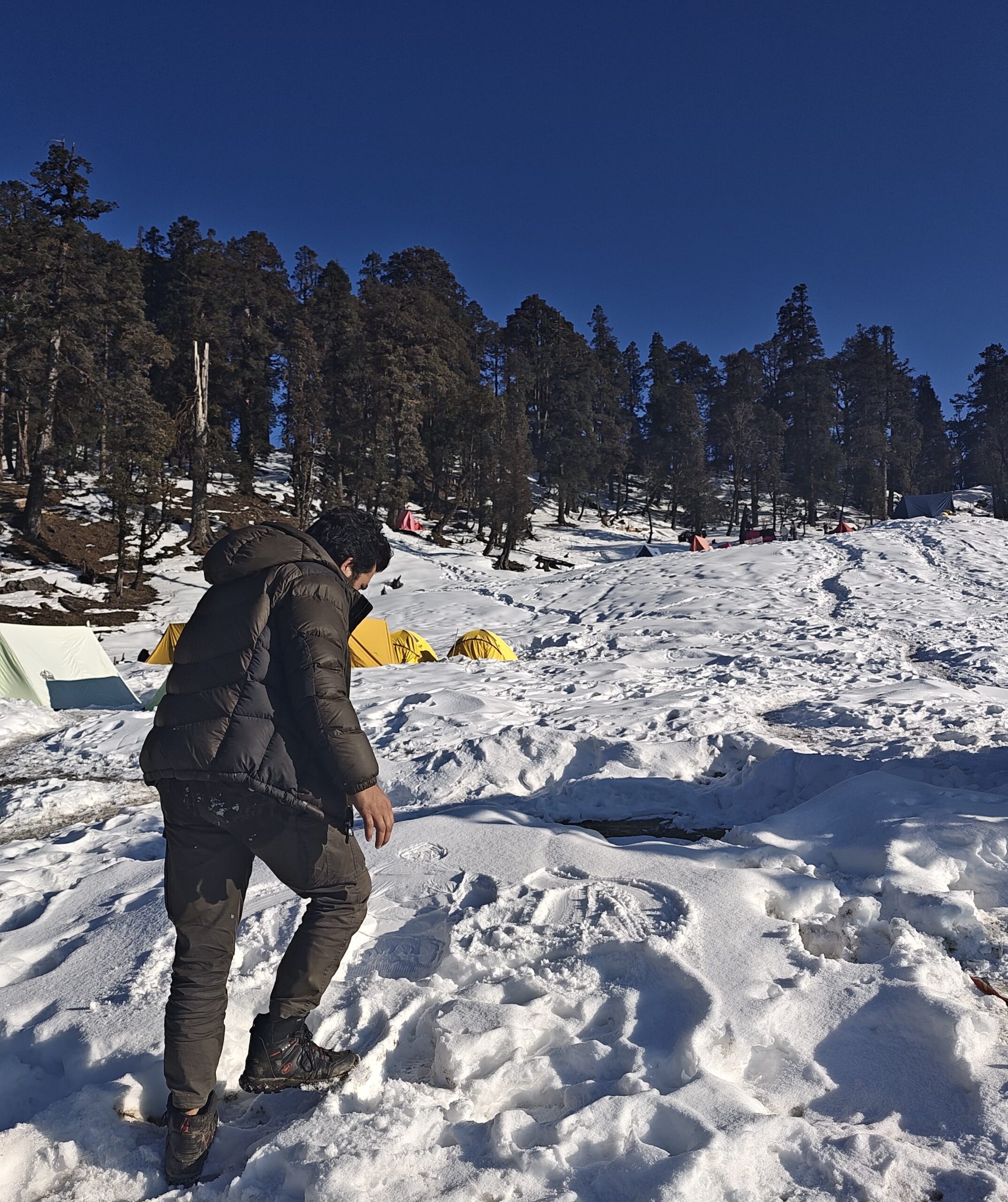
From Kalu Vinayak, the trail eases out a bit as it traverses a high ridge and continues towards Bhagwabasa, the last campsite before the Roopkund summit. The terrain is stark and dramatic—strewn with volcanic rocks, occasional snow patches, and cold mountain winds. You might even spot Bharal (Himalayan Blue Sheep) grazing in the distance.
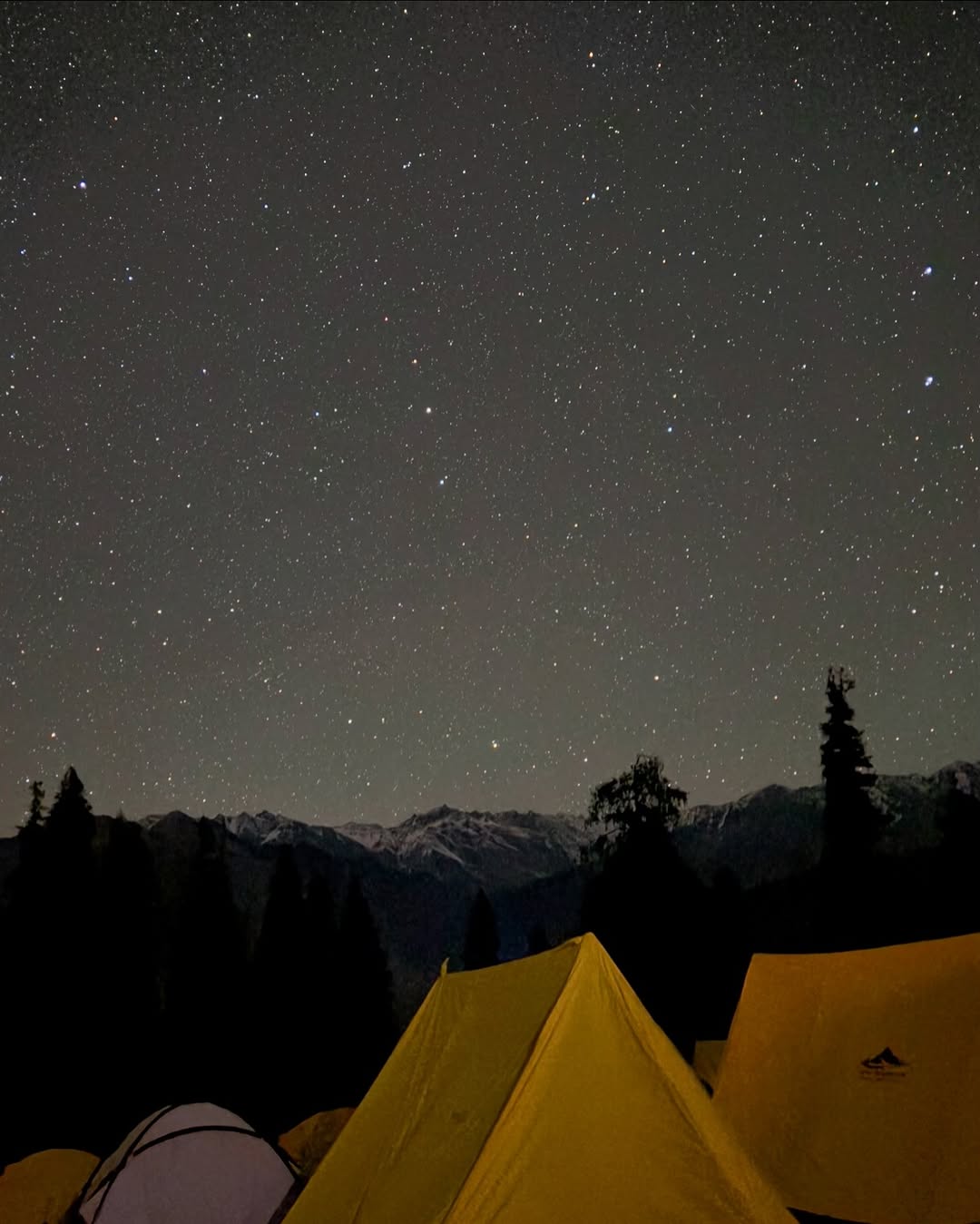
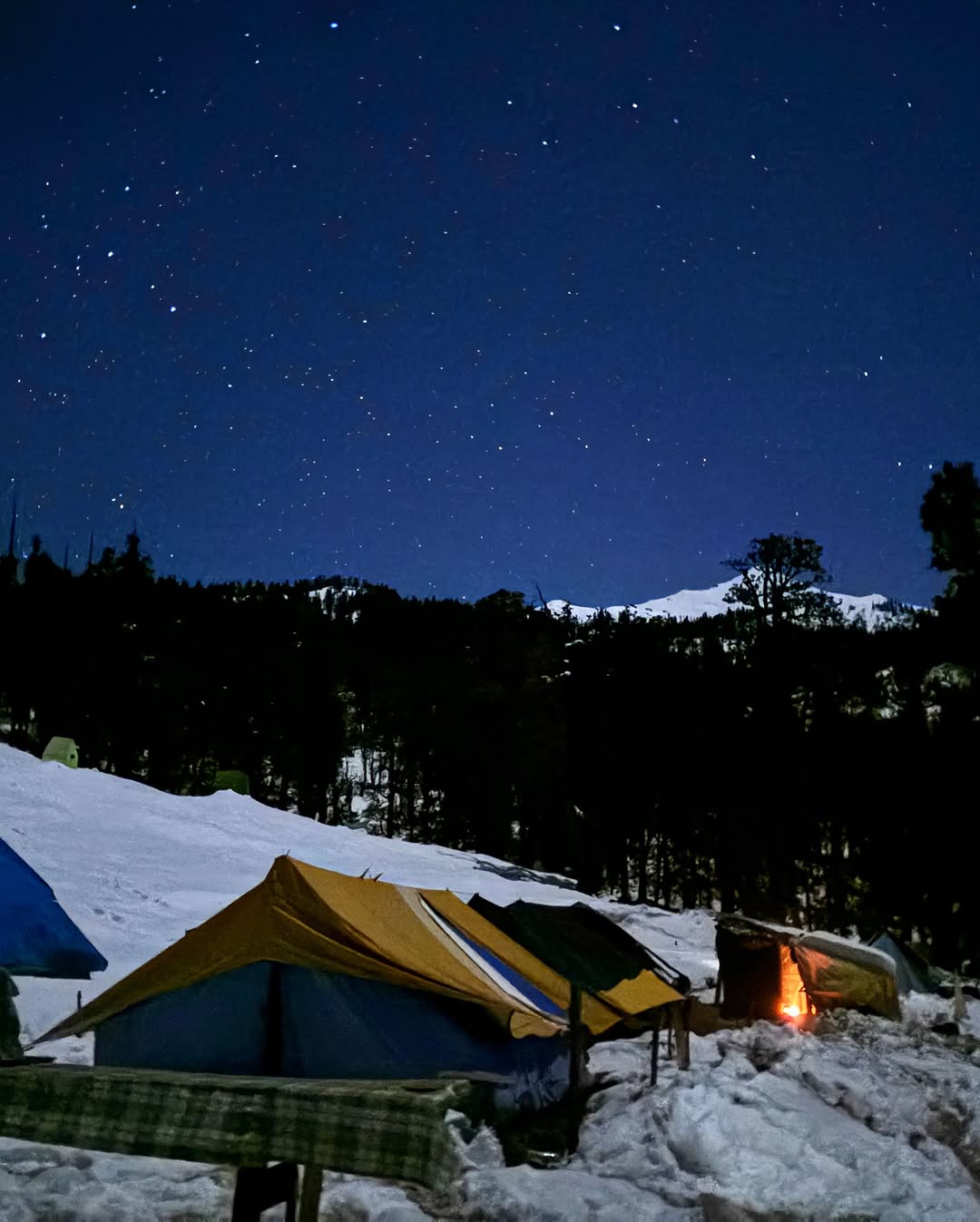
Bhagwabasa, which means “Abode of the Gods,” lies at a staggering altitude of 4,300 m. Accommodation here usually consists of stone shelters or tents depending on the weather. Nights are extremely cold, with temperatures often dropping below freezing—even in summer months.
This day is crucial for high-altitude acclimatization before the early morning push to Roopkund Lake. Hydrate well and rest early to prepare for the most awaited part of the trek.
Distance: ~10 km (round trip)
Time: 7–8 hours
Altitude Gain/Loss: 4,300 m (Bhagwabasa) → 5,029 m (Roopkund) → 3,650 m (Patar Nachauni)
Route: Bhagwabasa → Roopkund Lake → Junargali (optional) → back to Patar Nachauni via Bhagwabasa
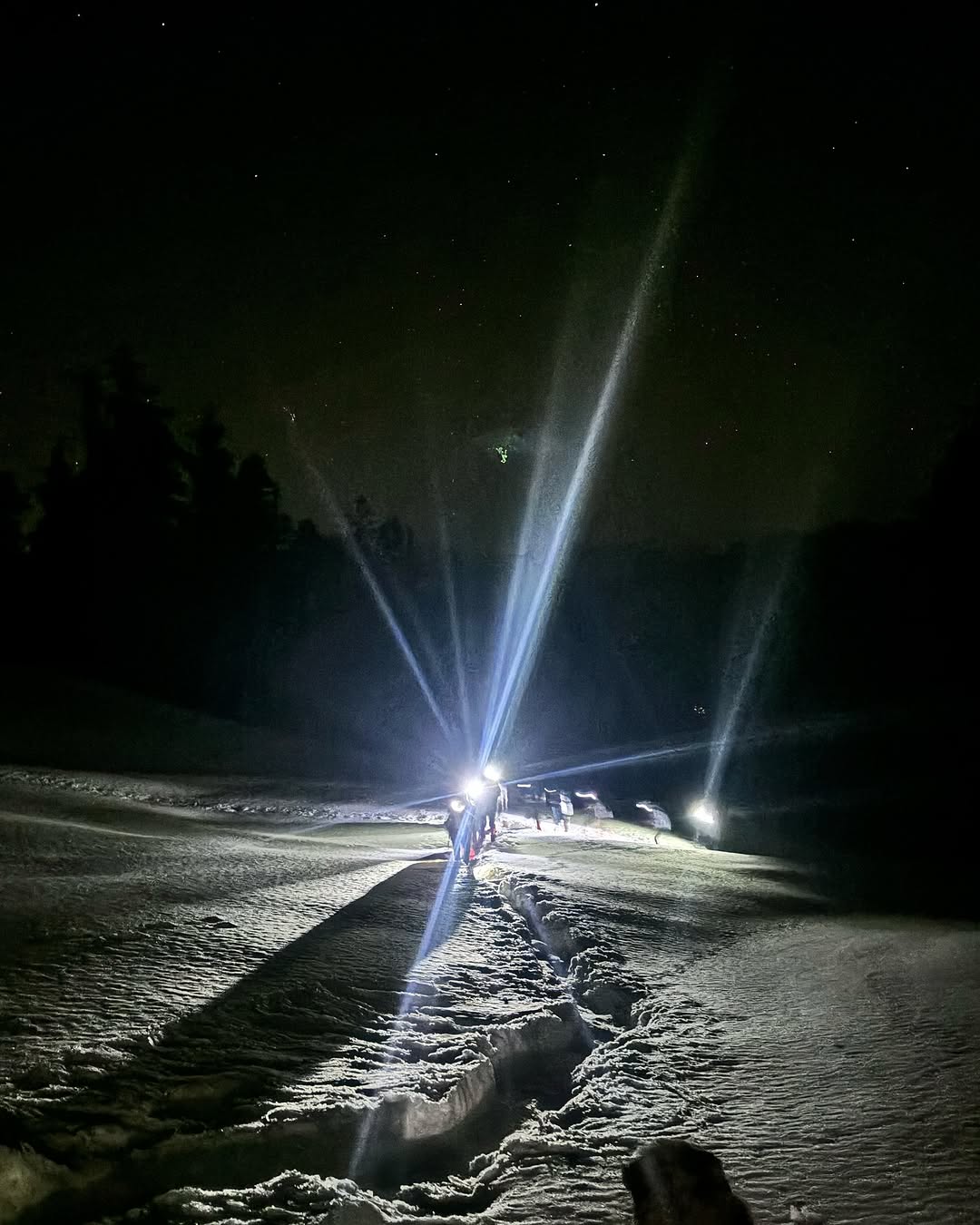
This is the most awaited and thrilling day of the Roopkund Trek, as you finally ascend to the mysterious Roopkund Lake, also known as the Skeleton Lake of India. The trek starts early—around 4 AM—to ensure you reach the lake before the weather turns unstable, which it often does after noon.
The trail from Bhagwabasa to Roopkund Lake is steep, narrow, and mostly over snow, ice, and scree. As you gain altitude, oxygen levels drop and the climb becomes more intense. However, the excitement and sense of anticipation push trekkers forward.
After a challenging 3–4 hour climb, you reach the Roopkund Crater Lake, perched at an incredible altitude of 5,029 meters. The sight is surreal—an alpine glacial lake surrounded by snow-clad peaks and ancient human skeletons visible through the clear, icy waters. These remains, dating back to the 9th century, are still one of the greatest mysteries in Himalayan history. This makes Roopkund not just a trekking destination, but an archaeological wonder.
For fit and experienced trekkers, a short but steep climb of around 300 ft further takes you to Junargali Pass (weather permitting), which offers unmatched panoramic views of Trishul, Nanda Ghunti, and Changabang peaks.
After soaking in the once-in-a-lifetime views and capturing photos, you begin the careful descent back to Bhagwabasa for a short rest and lunch. Post-lunch, the trail continues downward to Patar Nachauni, where you’ll spend the night. The return journey is long and tiring, so pace yourself and stay hydrated.
The day is physically demanding, but it’s also the most rewarding—giving you the ultimate high-altitude trekking experience and the chance to witness one of the most unique and mysterious places in the world.
Distance: ~12 km trek + 10 km drive
Time: 6–7 hours trek + 1–2 hours drive
Altitude Loss: 3,650 m (Patar Nachauni) → 2,400 m (Wan) → 1,950 m (Lohajung)
Route: Patar Nachauni → Bedni Bugyal → Ghaeroli Patal → Neel Ganga → Wan Village (trek) → Lohajung (drive)
The final day of the Roopkund Trek begins with a scenic descent from Patar Nachauni to the lush alpine meadows of Bedni Bugyal, one of the most beautiful high-altitude grasslands in India. The vast rolling green expanse, surrounded by the snow-draped Himalayas, is a treat for your senses. Take time to soak in the last grand views of Mount Trishul and Nanda Ghunti before continuing your descent.
From Bedni, the trail gradually descends through oak and rhododendron forests towards Ghaeroli Patal, a popular rest point. The trail can be slippery during monsoons, so take steady steps. After that, you’ll descend further to Neel Ganga, a small but refreshing mountain stream where many trekkers take a short break or fill up water bottles.
Post Neel Ganga, you ascend slightly to reach Wan Village, a large Himalayan settlement with rich cultural heritage and wooden homes. Vehicles will be waiting here to drive you back to Lohajung, the base village where your journey started.
As you drive down, reflect on the incredible week-long adventure through some of Uttarakhand’s most remote and mystical landscapes. The Roopkund Trek ends here—but the experience and stories stay with you forever.
Distance: ~220 km
Time: 9–10 hours
Altitude Loss: 1,950 m (Lohajung) → 1,146 m (Kathgodam)
Route: Lohajung → Deval → Gwaldam → Kausani → Almora → Kathgodam
Your Roopkund trek concludes with a scenic drive from Lohajung to Kathgodam, winding through the picturesque landscapes of Kumaon. The journey starts early in the morning as you bid farewell to the mountains and descend through terraced fields, pine forests, and charming Pahadi villages.
The road takes you past Deval and Gwaldam, offering final glimpses of distant Himalayan peaks. A brief stop at Kausani, often called the “Switzerland of India,” provides a panoramic view of the snow-covered ranges—perfect for a last photo opportunity.
As you continue through Almora, a culturally rich hill town, and descend towards Kathgodam, you may find yourself already nostalgic about the trek’s mystical beauty—especially the haunting legend of Roopkund Lake and its skeletons.
You’ll reach Kathgodam Railway Station by evening, in time for your return train or bus. From here, trekkers usually head back to Delhi or other major cities. Though the trek has ended, the memories of Roopkund’s mysterious lake, alpine meadows, and Himalayan grandeur will stay with you forever.
Roopkund Trek Package Cost Includes
Transportation
Kathgodam to Lohajung and return in shared private vehicle (Tempo Traveller/Bolero/Sumo)
Pick-up and drop points: Kathgodam Railway Station or Bus Stand
Accommodation
Day 1 and Day 7 (Lohajung): Stay in guesthouse/homestay on twin/triple sharing basis
Day 2 to Day 6 (on trek): Dome tents or alpine tents on twin/triple sharing basis
Includes: High-quality waterproof tents, -10°C sleeping bags, thick foam sleeping mats
Meals (Veg & Nutritious)
All meals from Day 1 Dinner to Day 8 Breakfast
Breakfast, Lunch, Evening Snacks, and Dinner included
Hot soup served every evening
Tea/Coffee served twice daily
Nutritious, hygienic food: dal, roti, rice, vegetables, khichdi, poha, pasta, upma
Trekking Equipment
Waterproof alpine tents
-10°C sleeping bags with thermal liners
Thick foam sleeping mats
Gaiters and crampons (during snow season)
Trekking poles and headlamps (on request, limited availability)
Experienced Trek Team
Certified Trek Leader (trained in Wilderness First Aid)
Local guides experienced with Roopkund terrain
Support staff including kitchen team and porters for common group equipment
Safety and First Aid
Oximeter and basic first-aid kit available throughout the trek
Oxygen cylinder for emergency use
Altitude sickness monitoring and emergency protocols
Backup plan for evacuation (charges apply if used)
Permit and Forest Fees
All required trekking permits and forest entry passes
Entry fees for Roopkund Trail and Nanda Devi Biosphere
Local taxes, camping charges, and environmental fees included
Roopkund Trek Package Cost Excludes
Personal expenses like laundry, phone calls, tips, etc.
Meals during transit (Kathgodam to Lohajung and return)
Offloading charges for personal backpack (if opted)
Porter for personal luggage (can be arranged at extra cost)
Personal trekking gear like trekking shoes, jackets, walking sticks, etc.
Any kind of travel insurance or medical insurance
Emergency evacuation or rescue costs
Costs arising from natural calamities, landslides, roadblocks, or unforeseen circumstances
Stay or transport before Day 1 and after Day 8
Bottled water, cold drinks, snacks, or other beverages during trek
Any expense not specifically mentioned under “Inclusions”
Roopkund Trek Package Cost
Lohajung To Lohagung
₹ 15,500/- PP
₹ 13,999/- PP
- 7 Nights Stay
- Breakfast, Lunch, Dinner
- Forest Fees & Permit
- Trek Guide
- Safety & First Aid
Kathgodam To Kathgodam
₹ 17,500/- PP
₹ 15,999/- PP
- Pickup/Drop Ex- Kathgodam
- 7 Nights Stay
- Breakfast, Lunch, Dinner
- Forest Fees & Permit
- Trek Guide
- Safety & First Aid
Delhi To Delhi
₹ 20,500/- PP
₹ 18,999/- PP
- Pickup/Drop Ex- Delhi
- 7 Nights Stay
- Breakfast, Lunch, Dinner
- Forest Fees & Permit
- Trek Guide
- Safety & First Aid
Roopkund Trek Fix Departures
November
10 Nov - 14 Nov
15 Nov - 19 Nov
22 Nov - 27 Nov
25 Nov - 29 Nov
Available
Available
Available
Available
December
1Dec - 5 Dec
5 Dec - 9 Dec
8 Dec - 12 Dec
10 Dec - 14 Dec
15 Dec - 19 Dec
18 Dec - 22 Dec
22 Dec - 26 Dec
25 Dec - 29 Dec
26 Dec - 30 Dec
27 Dec - 31 Dec
28 Dec - 1 Jan
29 Dec - 2 Jan
30 Dec - 3 Jan
31Dec - 4 Jan
Available
Available
Available
Available
Available
Available
Available
Available
Available
Available
Available
Available
Available
Available
January
2 Jan - 7 Jan
5 Jan - 12 Jan
8 Jan - 13 Jan
10 Jan - 15 Jan
13 Jan - 18 Jan
15 Jan - 20 Jan
18 Jan - 23 Jan
20 Jan - 25 Jan
22 Jan - 27 Jan
24 Jan - 29 Jan
25 Jan - 30 Jan
28 Jan - 1 Feb
30 Jan - 4 Feb
Available
Available
Available
Available
Available
Available
Available
Available
Available
Available
Available
Available
Available
February
2 Feb - 7 Feb
5 Feb - 9 Feb
9 Feb - 14 Feb
11 Feb - 18 Feb
15 Feb - 19 Feb
19 Feb - 24 Feb
21 Feb - 26 Feb
25 Feb - 1 Mar
28 Feb - 4 Mar
Available
Available
Available
Available
Available
Available
Available
Available
Available
March
3 Mar - 8 Mar
5 Mar - 10 Mar
9 Mar - 14 Mar
11 Mar - 16 Mar
15 Mar - 20 Mar
18 Mar - 23 Mar
22 Mar - 27 Mar
26 Mar - 1 Apr
30 Mar - 3 Apr
Available
Available
Available
Available
Available
Available
Available
Available
Available
April
1 Apr - 6 Apr
10 Apr - 15 Apr
12 Apr - 17 Apr
18 Apr - 23 Apr
25 Apr - 30 Apr
Available
Available
Available
Available
Available
How To Reach Roopkund Trek
Step-by-Step Guide to Reach Roopkund Trek
1. Reach Kathgodam (Uttarakhand) – Nearest Railway Station
By Air:
Pantnagar Airport (PGH) is the nearest airport (70 km from Kathgodam).
Limited flights available from Delhi.
From Pantnagar, take a taxi or bus to Kathgodam (2 hours).
By Train:
Kathgodam Railway Station is well-connected to Delhi, Lucknow, Kolkata, and Dehradun.
Popular trains:
Ranikhet Express
Uttar Sampark Kranti Express
Kathgodam Shatabdi (fastest option from Delhi)
By Road:
Overnight Volvo and government buses from Delhi (Anand Vihar ISBT) to Haldwani/Kathgodam.
You can also hire private cabs or shared taxis (7–8 hours from Delhi).
2. Kathgodam to Lohajung (Base Village for Roopkund Trek)
Distance: 220 km
Travel Time: 9–10 hours
Route: Kathgodam → Almora → Kausani → Gwaldam → Deval → Lohajung
Options:
Private cabs (₹6,000–7,000 per vehicle)
Shared taxis available from Haldwani/Kathgodam (₹800–1,000 per person)
Trek operators usually provide pre-booked transport from Kathgodam
3. Final Stretch: Lohajung to Trek Start Point
The Roopkund trek starts from Lohajung itself.
No further travel required after reaching the base village.
Basic accommodations and trekking gear rentals are available in Lohajung.
Summary – How to Reach Roopkund Trek
| Route | Mode | Distance & Travel Time |
|---|---|---|
| Delhi to Kathgodam | Train / Bus / Car | ~300 km – 6 to 8 hours |
| Kathgodam to Lohajung | Road (cab / shared taxi) | ~220 km – 9 to 10 hours |
| Lohajung to Trek Start | On foot | 0 km – Trek begins from Lohajung |
From Delhi to Roopkund:
Delhi → Kathgodam (overnight train/bus) → Lohajung (shared/private cab)
From Mumbai to Roopkund:
Mumbai → Delhi → Kathgodam (train/flight) → Lohajung
From Bangalore to Roopkund:
Bangalore → Delhi (flight) → Kathgodam → Lohajung
Roopkund Trek Booking Policy
- Booking is confirmed only after receiving a minimum 30% advance payment
Balance amount to be paid at pickup time.
Payment Options
Online payment via UPI / Bank Transfer / Net Banking / Debit & Credit Cards
Payment receipt will be shared via email or WhatsApp for confirmation
Roopkund Trek Cancellation Policy
- 90% refund if cancelled 30+ days before trek date
- 70% refund if cancelled 15–29 days before trek
- 50% refund if cancelled 7–14 days before trek
- No refund if cancelled less than 7 days before trek or no-show
Roopkund Trek Essentials
Planning to embark on the Roopkund Trek? Packing the right trek essentials for Roopkund is the key to a safe, comfortable, and successful high-altitude Himalayan experience. Known for its mysterious skeleton lake and challenging trails, Roopkund Trek essentials list must include both basic and technical gear suited for varying terrain and unpredictable mountain weather.
Base Layer (thermal innerwear – top and bottom)
2–3 Full sleeve quick-dry T-shirts (avoid cotton)
2 Insulating Layers (fleece/wool sweaters or light down jacket)
1 Heavy Feather Jacket / Padded Jacket (for summit day)
2 Trek Pants (quick-dry; avoid jeans)
1 Windproof & Waterproof Jacket/Poncho
Thermal Track Pants (for nights)
Warm Innerwear & Undergarments (at least 2–3 pairs)
1 pair of high-ankle trekking shoes (snow/water-resistant)
1 pair of slippers / sandals for campsite use
Optional: Gaiters (for heavy snow)
Trekking backpack (40–50L) with rain cover
Daypack (10–15L) for summit day
Trekking pole (highly recommended)
Headlamp / torch with spare batteries
Water bottles (2 x 1L) or hydration bladder
Sunglasses (UV-protected)
Power bank
Ziplock / dry bags for organizing
Optional: Camera or GoPro
Toothbrush + toothpaste
Biodegradable soap / face wash
Lip balm (essential for cold cracks)
Cold cream / moisturizer
Sunscreen (SPF 50+)
Quick-dry towel
Toilet paper / tissues
Hand sanitizer
Menstrual hygiene products (as required)
Wet wipes (optional but useful)
Paracetamol / Ibuprofen
Diamox (only after doctor’s advice)
Band-aids / blister patches
Antiseptic cream
Crepe bandage
Personal medication
ORS / Glucose / Electrolyte powder
Original Government ID proof (Aadhar, Passport, Voter ID)
Medical fitness certificate (if required by trek operator)
Trek disclaimer form (provided by operator)
Trek booking confirmation / permit copy (if applicable)
Roopkund Trek Fitness
Fitness for Roopkund Trek – Are You Physically Prepared?
The Roopkund Trek is rated moderate to difficult, taking trekkers to an altitude of ~15,750 ft (4,800 m). While it’s a rewarding journey through dense forests, alpine meadows, glacial lakes, and snowfields, it demands excellent physical fitness and stamina. Preparing your body in advance is crucial for enjoying the trek and avoiding altitude-related issues.
Basic Fitness Requirements for Roopkund Trek
To successfully complete the Roopkund Trek, you should be able to:
Walk 8–10 km daily with a backpack (6–8 kg)
Climb steep ascents and descend rocky terrain
Maintain a steady pace for 6–8 hours of trekking each day
Adapt to high altitudes with reduced oxygen levels
Physical Preparation – 4 Weeks Before the Trek
Here’s a preparation plan for Roopkund Trek fitness:
Cardiovascular Endurance
(Build lung capacity and heart health)
Jogging or brisk walking – 5 km daily (at least 5 days/week)
Stair climbing (10–15 floors daily)
Cycling or swimming for 30–45 mins
Strength Training
(Prepare legs, back, and core muscles)
Squats (3 sets x 20 reps)
Lunges (3 sets x 15 reps each leg)
Planks (hold 1–2 minutes)
Push-ups and shoulder presses
Flexibility & Balance
(Prevent injuries and improve agility)
Stretching (hamstrings, calves, hips, lower back)
Yoga or Pilates (20 minutes daily)
Backpack Training
Practice hikes with a loaded backpack (5–7 kg)
Simulate trekking with weight to build endurance
Health Tips for Roopkund High Altitude Fitness
Start hydrating well at least a week before the trek
Avoid alcohol and smoking (they reduce oxygen intake)
Carry ORS, glucose, and keep a slow, steady pace
Don’t rush – acclimatization is key at higher camps like Bhagwabasa and Roopkund Lake
Who Can Do the Roopkund Trek?
The Roopkund trek is best suited for:
Experienced trekkers or fit beginners with prior multi-day hiking experience
Adventure enthusiasts with good stamina and mental strength
Regular exercisers or those who can commit to fitness training
If you have asthma, heart conditions, or high blood pressure, consult a doctor before joining.
Roopkund Trek FAQ's
Is Roopkund Trek open for trekkers now?
Currently, the original Roopkund Trek route is restricted by the Uttarakhand government due to environmental concerns. However, nearby trails like Ali Bedni Bugyal are still open.
Why is Roopkund Trek banned by Uttarakhand government?
The trek passes through the Bugyal (meadow) zone, which has been protected due to over-tourism. The ban aims to preserve the alpine meadows and reduce plastic and footfall impact.
Can I still trek to Roopkund Lake legally?
You cannot trek up to Roopkund Lake without special permission. The route is regulated, and trekking beyond Bedni Bugyal is currently not allowed.
What is the best alternative to Roopkund Trek in Uttarakhand?
Ali Bedni Bugyal, Brahmatal Trek, and Kuari Pass Trek are great alternatives offering similar alpine meadows and Himalayan views.
What is the mystery behind Roopkund Lake skeletons?
Roopkund Lake is known as the “Skeleton Lake” because hundreds of human skeletons were found at its bottom, dating back to the 9th century. It’s believed they died due to a sudden hailstorm.
Is Roopkund Trek suitable for beginners?
Roopkund Trek is considered moderate to difficult. Beginners can do it with proper preparation, but prior high-altitude experience is recommended.
How difficult is the Roopkund Trek compared to Kedarkantha?
Roopkund is more challenging due to higher altitude (over 15,700 ft), steep climbs, and longer trekking days. Kedarkantha is easier and more suitable for first-timers.
How to prepare physically for Roopkund Trek?
Build stamina with cardio exercises like running or cycling for 30–45 minutes daily. Include leg workouts and practice carrying a backpack during weekend hikes.
Which month is best for Roopkund Trek weather and views?
May to June and September to October are the best months. You’ll see clear skies, alpine flowers, and possibly snow near Bhagwabasa in spring.
How cold does it get on Roopkund Trek?
Temperatures can drop to -2°C at higher camps like Bhagwabasa. Days are pleasant, but nights are freezing. Proper layering and a good sleeping bag are essential.
What permits are required for Roopkund Trek?
You need forest permits and local village permissions. These are usually arranged by trek operators and include forest entry, camping, and eco-development fees.
Can I do Roopkund Trek solo without a guide?
It’s not recommended due to remote terrain and changing weather. Also, the trail beyond Bedni is restricted without an authorized guide or permit.
Is there mobile network on Roopkund Trek route?
You may get patchy signals (mostly BSNL) till Didna or Wan. After that, there’s usually no network. Inform your family beforehand.
How to reach Lohajung, the base camp of Roopkund Trek?
Take a train to Kathgodam, then a shared taxi or private cab to Lohajung (220 km). It’s a 9–10 hour journey through scenic towns like Kausani and Gwaldam.
What are the camping sites during Roopkund Trek route?
Main camps include Didna, Ali Bugyal, Bedni Bugyal, Patar Nachauni, and Bhagwabasa. Each offers unique views and a gradual gain in altitude.
Which is best travel company for Roopkund trek?
Solo Hike is Uttarakhand based travel company, providing Roopkund trek services since 10 years. Solo Hike help you to get the package from Lohajung, Kathgodam and even from Delhi too, with best and affordable prices.
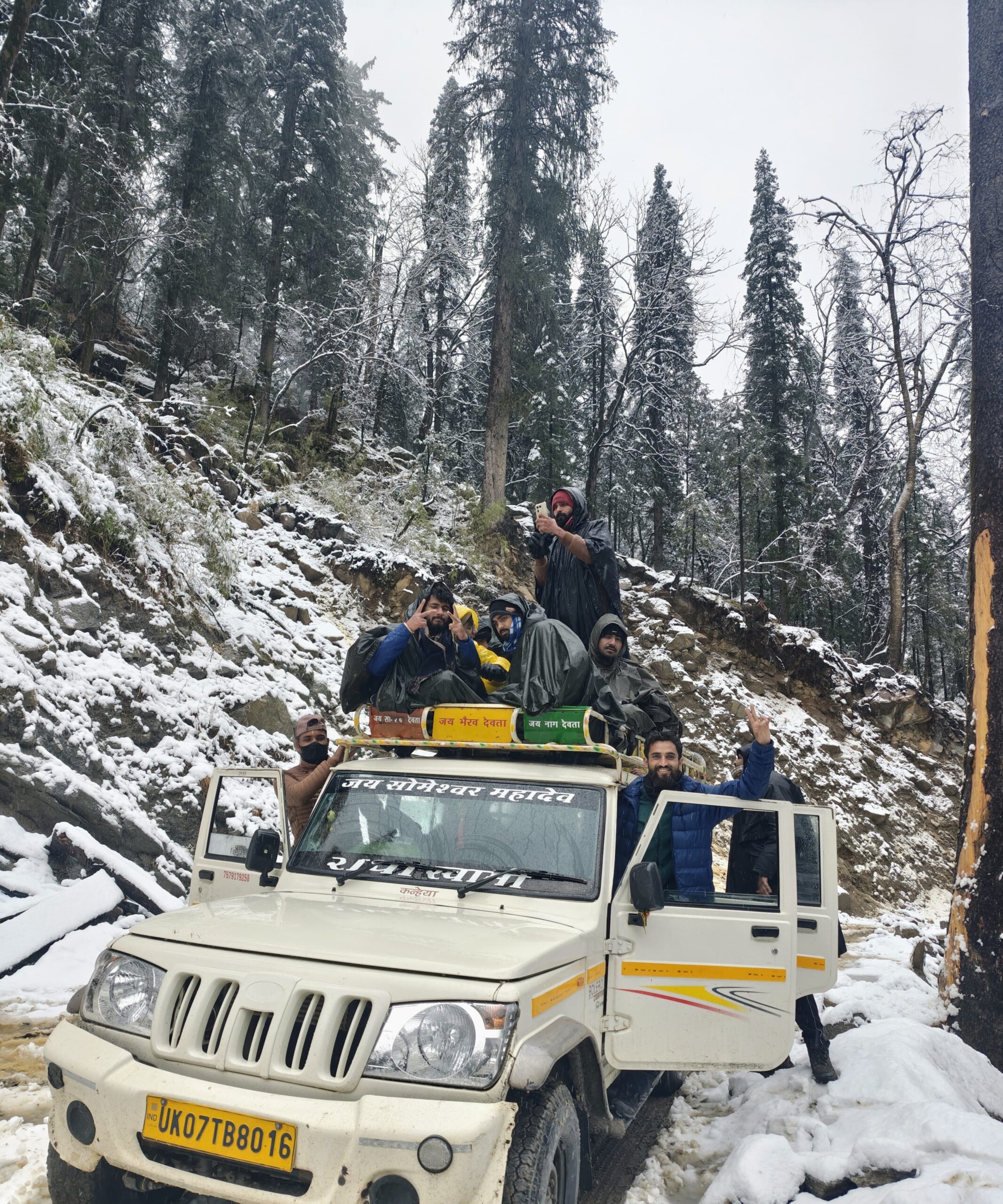
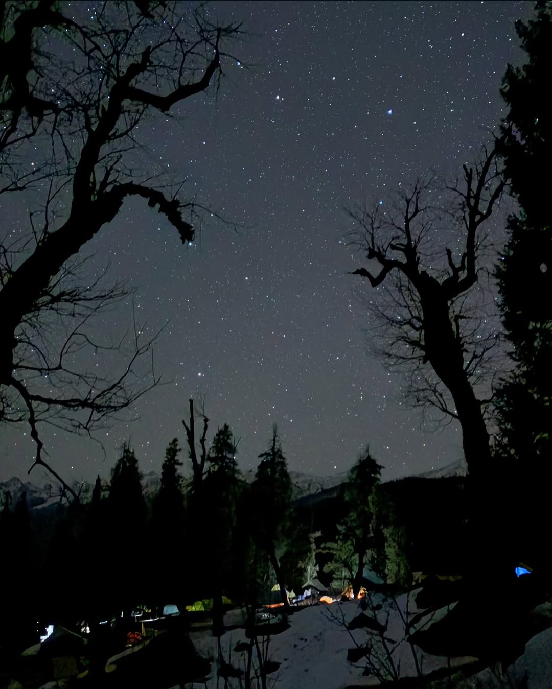
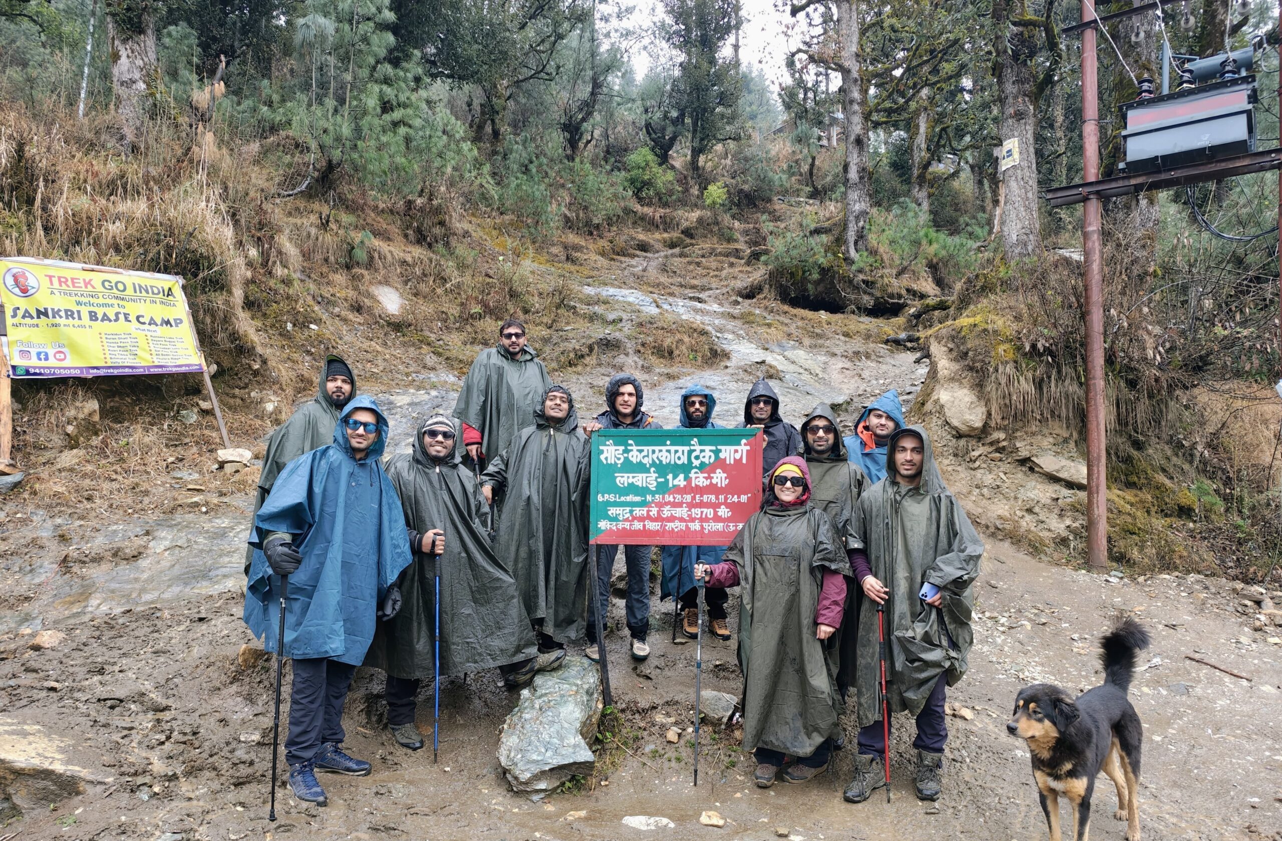
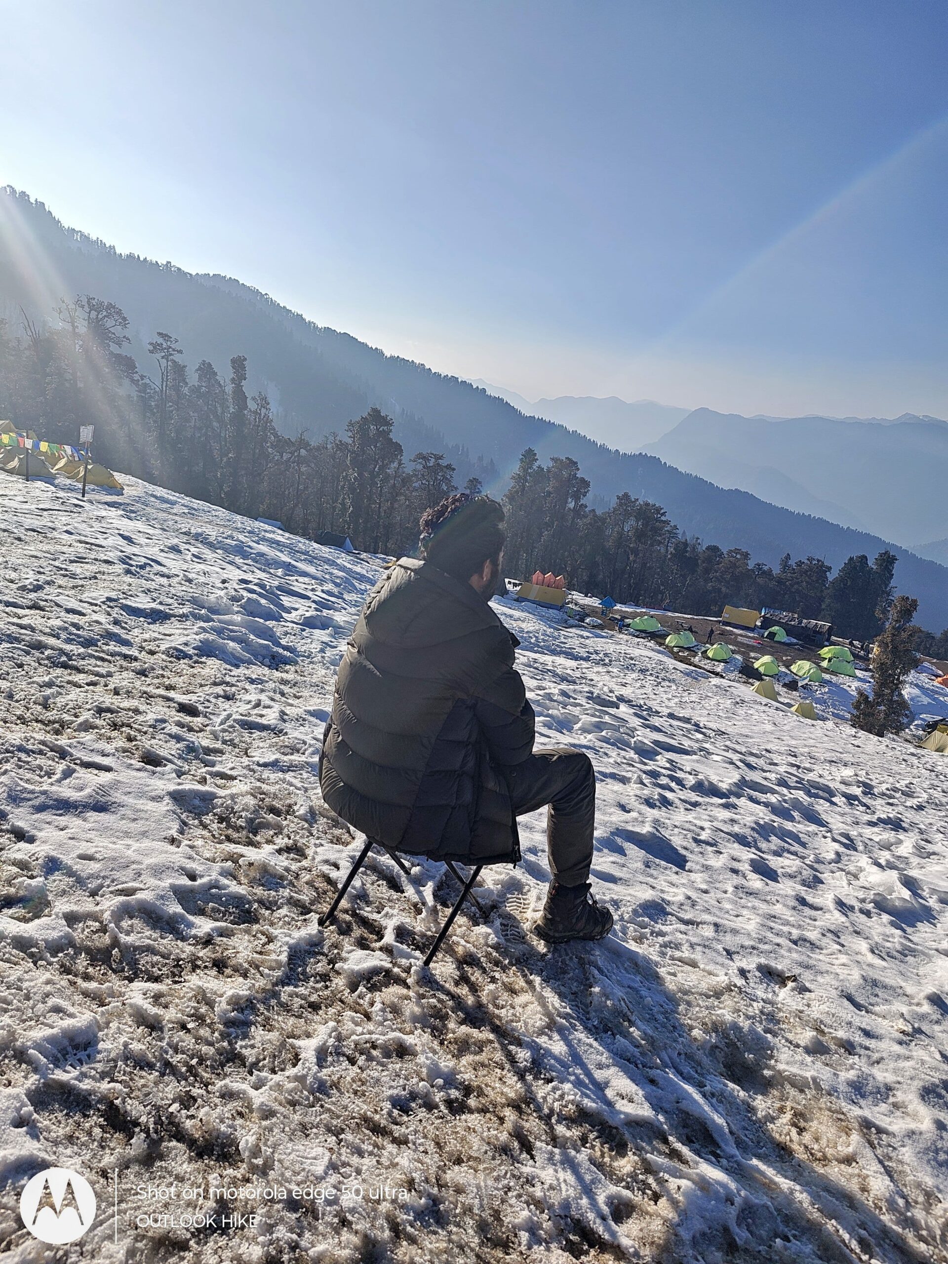
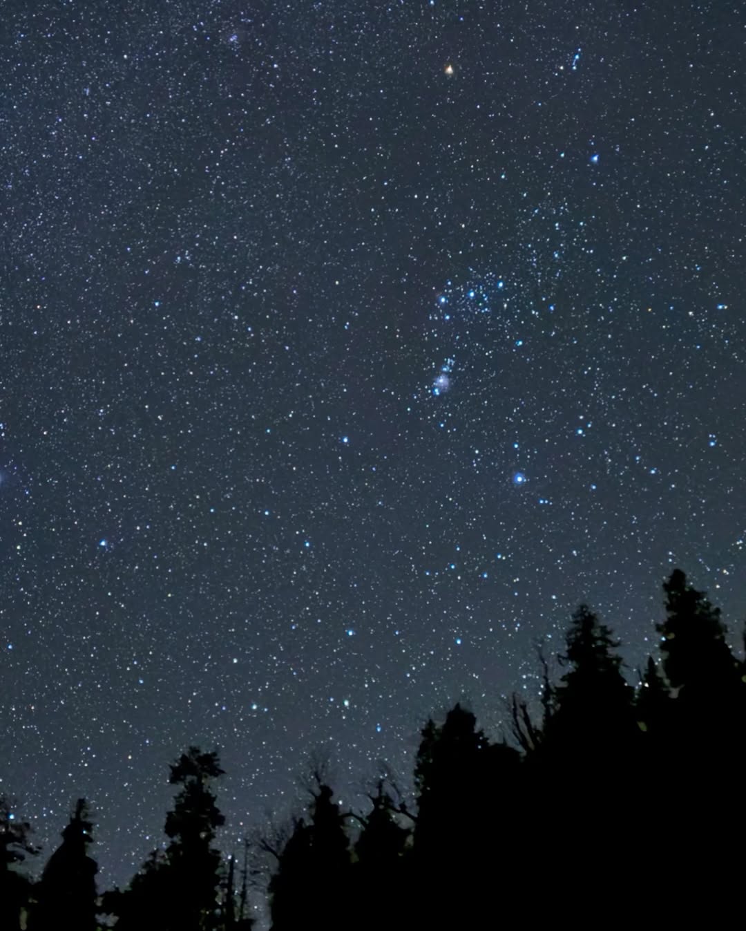
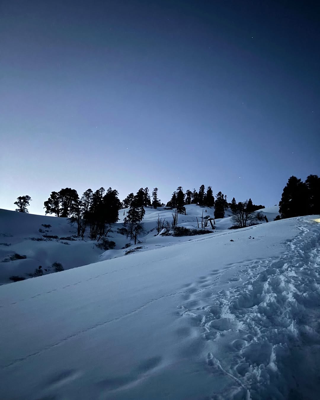
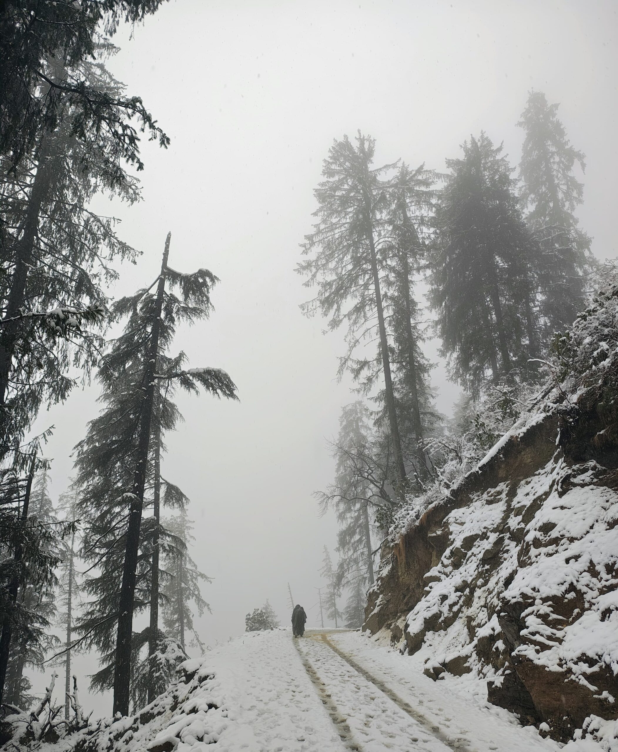
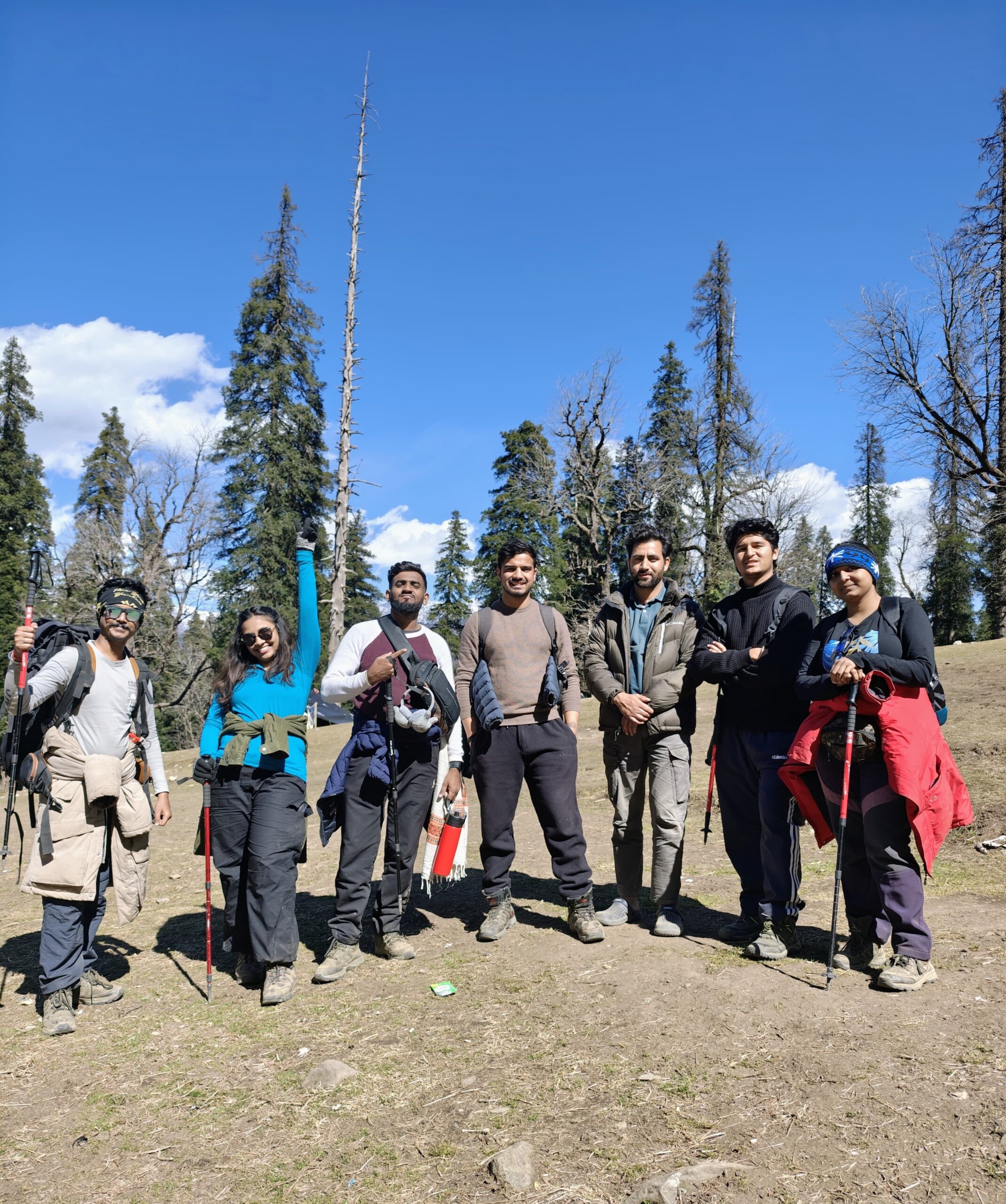
ROOPKUND TREK PHOTOS
Read More About Roopkund Trek
Best Time To Visit Roopkund Trek
Discover the best time to visit Roopkund Trek for clear views, pleasant weather, and safe trails. Ideal months are May–June & September–October for the perfect alpine trekking experience.
Best Time To Visit Roopkund Trek
Discover the best time to visit Roopkund Trek for clear views, pleasant weather, and safe trails. Ideal months are May–June & September–October for the perfect alpine trekking experience.
Best Time To Visit Roopkund Trek
Discover the best time to visit Roopkund Trek for clear views, pleasant weather, and safe trails. Ideal months are May–June & September–October for the perfect alpine trekking experience.
RELATED TREKS

