Basecamp
Jiskun
Duration
7 Days
Max. Altitude
15,350 ft.
Distance
42 Kms
Grade
Moderate
Pickup/Drop
Shimla
Rupin Pass Trek Overview
The Rupin Pass Trek is one of the most thrilling high-altitude treks in India, offering a dramatic crossover from Uttarakhand to Himachal Pradesh. Situated at an altitude of 15,250 ft, this 8-day Himalayan journey is a blend of mesmerizing waterfalls, hanging villages, deep pine forests, glacial valleys, snow bridges, and the iconic Rupin Gully ascent.
Perfect for adventure lovers and seasoned trekkers, the Rupin Pass Trek itinerary begins in the quaint village of Dhaula (Uttarakhand) and ends in Sangla (Himachal Pradesh). Each day presents a new landscape—ranging from lush green meadows to vast snowfields and narrow ridges—with surprises at every turn. This makes Rupin Pass not just a trek but a grand Himalayan expedition.
Whether you’re searching for the best summer trek in India, a moderate to difficult Himalayan trek, or an offbeat trekking trail in Himachal, the Rupin Pass Trek package delivers unmatched beauty and adrenaline.
Rupin Pass Trek Highlights
Trek Altitude: 15,250 ft (4,650 m)
Duration: 8 days / 7 nights
Trek Distance: 52 km approx
Difficulty Level: Moderate to Difficult
Best Time to Visit: May to June & September to October
Region: Uttarakhand to Himachal Pradesh crossover
Starting Point: Dhaula
Ending Point: Sangla
Why Choose Rupin Pass Trek?
One of the best crossover treks in India
Witness the iconic three-stage waterfall of Rupin
Walk through lush deodar forests, hanging villages & wildflower meadows
Experience the thrill of climbing the vertical Rupin Gully
Ideal for trekkers looking for challenging and scenic Himalayan treks
Less crowded than commercial trails like Roopkund or Hampta Pass
Rupin Pass Trek Short Itinerary
Day 1: Shimla to Jiskun by Drive
Distance: ~200 km
Time: 10–11 hours
Altitude Gain: 2,200 m (Shimla – 2,100 m) → 2,650 m (Jiskun)
Route: Shimla → Narkanda → Rohru → Chaupal → Sewa → Jiskun
Note: Long mountain drive with scenic valleys and pine forests. Overnight stay in homestay/campsite.
Day 2: Jiskun to Jakha (Trek)
Distance: ~4 km
Time: 3–4 hours
Altitude Gain: 2,650 m → 2,700 m
Route: Jiskun → Forest trail → Ridge walk → Jakha Village
Note: Short uphill trek through coniferous forests and traditional wooden houses.
Day 3: Jakha to Saruwas Thatch (Trek)
Distance: ~7 km
Time: 4–5 hours
Altitude Gain: 2,700 m → 3,300 m
Route: Jakha → Snow bridges → Rupin River → Saruwas meadow
Note: Gradual ascent through alpine meadows, river crossings, and blossoming rhododendrons.
Day 4: Saruwas Thatch to Dhanderas Thatch (Lower Waterfall Camp)
Distance: ~5 km
Time: 3–4 hours
Altitude Gain: 3,300 m → 3,400 m
Route: Saruwas Thatch → Riverbed trail → Open valley → Dhanderas Thatch
Note: Easy trail with mesmerizing views of the Rupin waterfall and glacier-fed streams.
Day 5: Dhanderas Thatch to Upper Waterfall Camp (Trek)
Distance: ~3 km
Time: 2–3 hours
Altitude Gain: 3,400 m → 3,850 m
Route: Dhanderas → Snow patches → Steep incline near waterfall → Upper Waterfall Camp
Note: Acclimatization and preparation day for pass climb. Spectacular campsite views.
Day 6: Upper Waterfall Camp to Rupin Pass to Ronti Gad (Trek)
Distance: ~11 km
Time: 8–9 hours
Altitude Gain & Loss: 3,850 m → 4,650 m (Rupin Pass) → 3,500 m (Ronti Gad)
Route: Upper Waterfall → Rupin Gully → Rupin Pass → Steep descent to Ronti Gad
Note: Climax of the trek — thrilling snow ascent and panoramic Himalayan views from the pass.
Day 7: Ronti Gad to Sangla (Trek) & Drive Back to Shimla
Trek Distance: ~12 km
Drive Distance: ~225 km
Trek Time: 5–6 hours
Drive Time: 8–10 hours
Altitude Loss: 3,500 m → 2,700 m (Sangla) → 2,100 m (Shimla)
Route: Ronti Gad → Sangla Kanda → Baspa Valley → Sangla → Shimla
Note: Descend through beautiful alpine meadows and drive back via Karcham and Rampur.
Rupin Pass Trek Detailed Itinerary
- Distance: ~210 km
- Time: 10–11 hours
- Altitude Gain: 2,100 m (Shimla) → 2,650 m (Jiskun)
- Route: Shimla → Kufri → Narkanda → Rohru → Chirgaon → Sewa → Jiskun
The journey starts early morning from Shimla, the capital of Himachal Pradesh and a convenient hub for trekkers. As you depart the city, the road winds through Kufri and Narkanda, offering glimpses of apple orchards, pine forests, and snow-dusted Himalayan ridges in the distance.
From Narkanda, the descent toward Rohru begins, introducing you to the serene upper reaches of the Pabbar River Valley. This section is scenic but the roads can be narrow and rugged — adding a bit of adventure even before the trek begins.
Beyond Rohru, the landscape becomes increasingly remote as you pass through charming hamlets like Chirgaon and Sungri, slowly entering the lesser-known regions of Himachal’s tribal belt. You’ll cross Sewa village, marked by traditional Himachali wooden homes and terraced farms.
The final ascent to Jiskun is thrilling — with steep hairpin bends, thick forest cover, and occasional snow patches (depending on the season). As you gain altitude, the air gets crisper and the silence deeper.
By late evening, you’ll reach Jiskun, a quaint high-altitude village nestled on the edge of a deep valley. Wooden cottages, sloped slate roofs, and panoramic views of surrounding mountains greet you warmly. This peaceful village serves as your first overnight halt and an essential acclimatization stop before hitting the trail the next day.
- Distance: ~4 km
- Time: 3–4 hours
- Altitude Gain: 2,650 m (Jiskun) → 2,700 m (Jakha)
- Route: Jiskun → Descend to Wooden Bridge → Steep Ascent through Forest → Jakha Village
Your trek begins after an early breakfast at Jiskun. The trail kicks off with a short descent through the village, leading you to a wooden bridge that crosses a roaring mountain stream. This marks the starting point of the ascent.
The climb is steep yet scenic, weaving through dense conifer and oak forests, where you might spot Himalayan langurs or colorful birds flitting among the branches. As you gain altitude, the trail becomes more rugged, with occasional stone-paved sections and muddy patches, especially during the pre-monsoon season.
After about 2–3 hours of steady uphill trekking, you reach the village of Jakha, often referred to as the “Hanging Village” due to its unique cliff-edge placement. Surrounded by terraced fields and fluttering prayer flags, Jakha offers stunning views of the valleys below and the distant snow ridges above.
This quaint village is your second night halt. It’s the highest and last permanent settlement en route to Rupin Pass. The locals, primarily shepherds and farmers, are welcoming, and you’ll get a chance to experience authentic Himachali hospitality here. Spend your evening exploring the wooden homes, visiting the small temple, or simply soaking in the sunset from the edge of the village.
- Distance: ~7 km
- Time: 4–5 hours
- Altitude Gain: 2,700 m (Jakha) → 3,300 m (Saruwas Thatch)
- Route: Jakha → Dense Forest Trail → Rupin River → Snow Bridges → Saruwas Meadow
Today’s trail is a perfect blend of beauty and gradual adventure. After breakfast in Jakha, you’ll head out on a mildly ascending trail that takes you through thick pine and maple forests, occasionally opening up to valley views that will leave you awe-struck.
The first hour involves a descent through lush greenery, after which you reconnect with the Rupin River, which will stay by your side through most of the day. You’ll cross several wooden and snow bridges, depending on the season, adding a dramatic flair to the trek.
One of the most fascinating parts of today’s journey is the transformation of the trail — from thick forests to wide open meadows, from rocky paths to soft snow patches, and from solitude to the sound of the river crashing down in gushing rapids. You’ll also start to notice the massive cliffs and snowfields in the distance — an early glimpse of what lies ahead.
After about 4–5 hours of trekking, you reach Saruwas Thatch, a picturesque alpine meadow located just below the Lower Waterfall Camp. With green pastures surrounded by snow-covered peaks, this campsite is peaceful and perfect for resting and acclimatizing.
Spend your evening walking around the meadow, filling your lungs with crisp mountain air, and preparing for tomorrow’s trek toward the iconic Rupin Waterfall.
- Distance: ~5 km
- Time: 3–4 hours
- Altitude Gain: 3,300 m (Saruwas Thatch) → 3,400 m (Dhanderas Thatch)
- Route: Saruwas Meadow → Rupin River Bed → Alpine Valleys → Dhanderas Thatch (Below Waterfall)
Today’s trail is short but stunning — one of the most scenic segments of the trek. After breakfast at Saruwas Thatch, you begin walking along the Rupin River, with the trail gently rising through a vast, open alpine valley dotted with wildflowers, streams, and occasional snow patches.
Within an hour, you enter the U-shaped glacial valley that leads to Dhanderas Thatch — often called the Lower Waterfall Camp. The towering cliffs on either side and the cascading three-tiered Rupin Waterfall up ahead create a surreal backdrop that seems straight out of a postcard.
This stretch of the trek feels like walking through a natural amphitheatre, with the roar of the waterfall growing louder as you approach. The trail can get marshy in parts, especially post-snowmelt, so waterproof shoes are a plus.
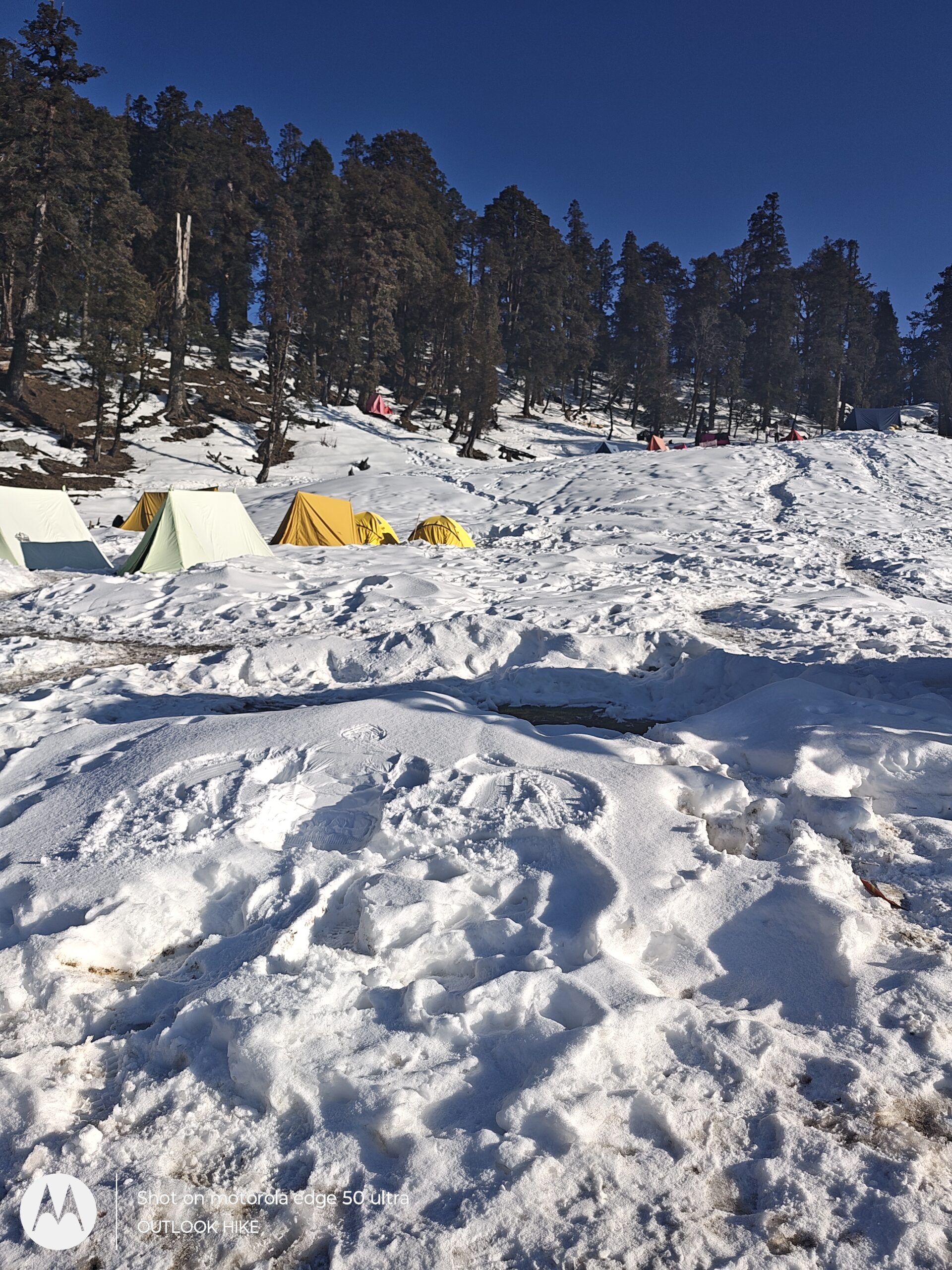
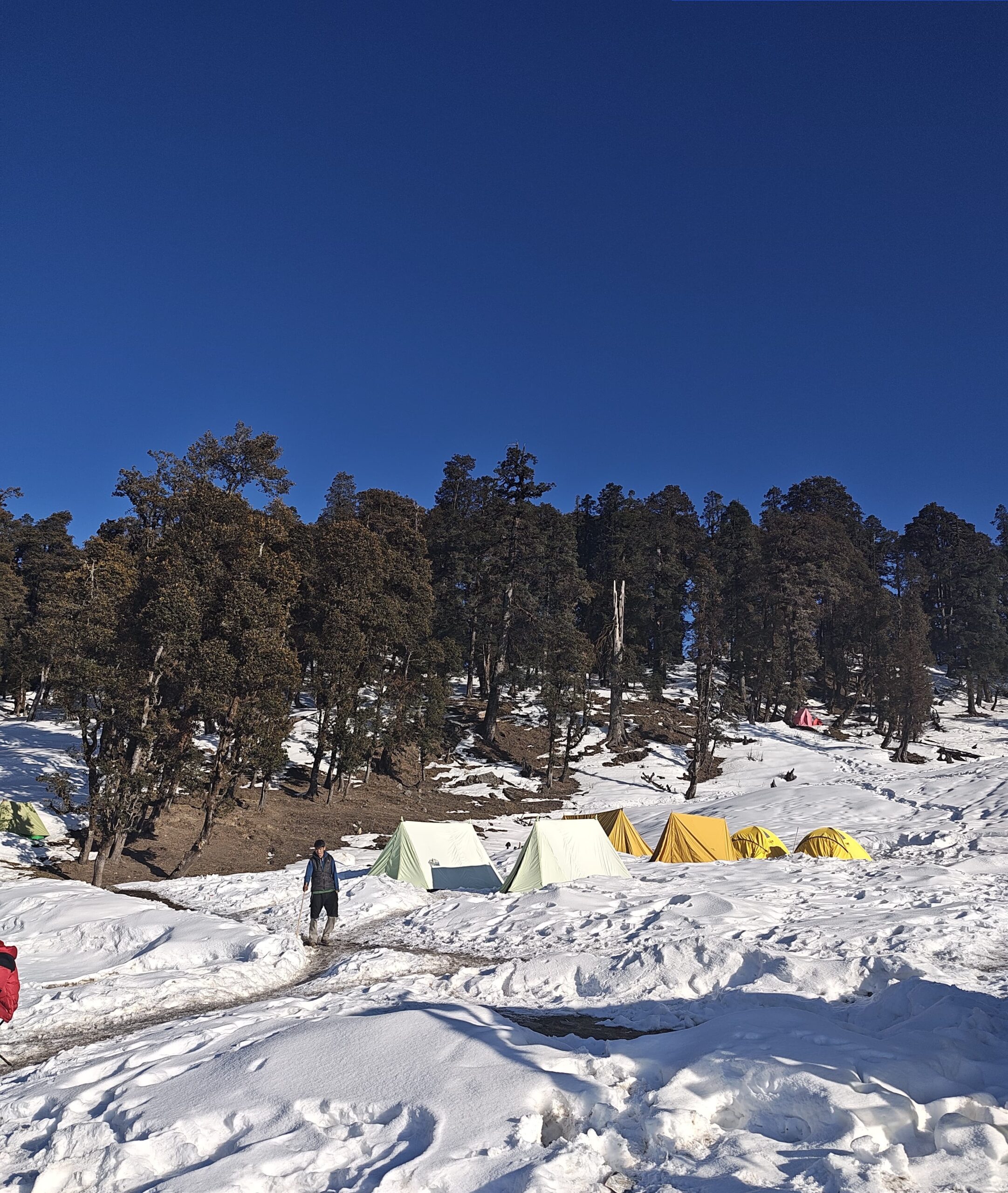
You’ll arrive at Dhanderas Thatch, a massive grassy clearing surrounded by cliffs and snow ridges. This is one of the most iconic campsites in the Indian Himalayas, offering mesmerizing views and space to relax and acclimatize.
After setting up camp, spend the afternoon exploring the area or climbing to nearby ridges for panoramic views. It’s also a crucial acclimatization stop, as you’ll be gaining more altitude tomorrow. Your trek leader might also conduct a short acclimatization hike to prepare your body for the steep ascent ahead.
- Distance: ~3 km
- Time: 2–3 hours
- Altitude Gain: 3,400 m → 3,850 m
- Route: Dhanderas Thatch → Waterfall Base → Snow Patch Ascent → Upper Waterfall Camp
Today is short in distance but demanding in effort and altitude gain. After an early breakfast at Dhanderas Thatch, you begin your climb toward the Upper Waterfall Camp, located just above the mighty Rupin waterfall.
The trail starts with a steep ascent right beside the waterfall, involving rocky patches, snow bridges, and zigzag switchbacks. Depending on the season (May–June), this section may be covered in soft snow, requiring trekking poles and microspikes for safe footing.
You’ll be climbing right alongside the cascading waterfall, which creates a dramatic setting unlike any other. The sound of rushing water, views of the valley below, and cold wind blowing off the snowfields make this ascent visually and physically exhilarating.
After a 2–3 hour effort, you reach Upper Waterfall Camp, a small and exposed campsite located on a narrow ledge just beneath snow gully sections. This is your launchpad for tomorrow’s summit push to Rupin Pass.
Afternoon is reserved for acclimatization and gear checks. Your trek leader may take you for a brief orientation walk on snow, and you’ll be given instructions for tomorrow’s early morning start.
The temperature here drops significantly, and the terrain is more alpine, so layer up and hydrate well.
- Distance: ~11 km
- Time: 8–9 hours
- Altitude Gain & Loss: 3,850 m → 4,650 m (Rupin Pass) → 3,500 m (Ronti Gad)
- Route: Upper Waterfall Camp → Snow Gully Ascent → Rupin Pass → Steep Descent → Ronti Gad
Today is the climax of the Rupin Pass Trek and demands an early start — usually by 4:00–5:00 AM — to cross the pass before weather conditions worsen.
The day begins with a steep snow climb through the infamous Rupin Gully, a narrow funnel-like ascent filled with snow, loose rocks, and boulders. Microspikes, gaiters, and trekking poles are a must for this section. It’s a challenging climb, but the trail is filled with adrenaline as you zigzag your way up through switchbacks carved in snow and scree.
After 2–3 hours of hard climbing, you reach the Rupin Pass at an altitude of 4,650 meters (15,250 ft) — the highest point of the trek. The feeling of standing atop the pass is unmatched: snowfields on all sides, the vastness of the Dhauladhar and Kinnaur ranges, and the sense of crossing from Uttarakhand into Himachal Pradesh by foot. Take time for pictures, hydration, and soaking in the 360° Himalayan views.
After a brief rest, you begin the steep descent toward Ronti Gad, which is long and requires caution. The descent involves navigating snow and loose stones, so pace and control are critical. The trail gradually leads into green meadows once again, where you’ll begin to spot wildflowers and flowing streams.
By afternoon or early evening, you’ll reach Ronti Gad, a beautiful alpine campsite surrounded by jagged ridges and vast open spaces — an ideal place to rest after a rewarding but exhausting day.
- Trek Distance: ~12 km
- Trek Time: 5–6 hours
- Drive Distance: ~225 km
- Drive Time: 8–10 hours
- Altitude Loss: 3,500 m (Ronti Gad) → 2,700 m (Sangla) → 2,100 m (Shimla)
- Route: Ronti Gad → Sangla Kanda → Baspa Valley → Sangla → Karcham → Rampur → Shimla
Today marks the final descent of the trek followed by a long return drive. After an early breakfast at Ronti Gad, begin your trek on a gentle downhill trail through lush alpine meadows, dense pine forests, and the vibrant green expanse of Sangla Kanda.
The views on this stretch are beautiful and distinct from the previous days — with Kinnaur-style houses, grazing herds, and glimpses of the Baspa River Valley opening up as you approach civilization again.
As you descend further, the landscape becomes more populated with apple orchards and traditional homes, eventually bringing you to Sangla, a picturesque town in Himachal’s Kinnaur district.
After lunch at Sangla or nearby, you’ll begin the return drive to Shimla, which takes around 8–10 hours. The road journey passes through Karcham, Rampur, and finally reconnects to National Highway 5.
By late evening or night, you’ll reach Shimla, bringing an end to your 7-day crossover expedition through Rupin Pass — a trek full of waterfalls, snow gullies, ancient villages, and unmatched Himalayan grandeur.
Rupin Pass Trek Package Cost Includes
Transportation
- Shimla to Jiskun and return from Sangla to Shimla in a shared private vehicle (Tempo Traveller/Bolero)
- Pick-up and drop points: Shimla ISBT/Railway Station/Designated Hotel
Accommodation
- Day 1 (Jiskun): Stay in homestay/guesthouse (twin/triple sharing)
- Day 2 (Jakha): Local guesthouse/homestay (twin/triple sharing)
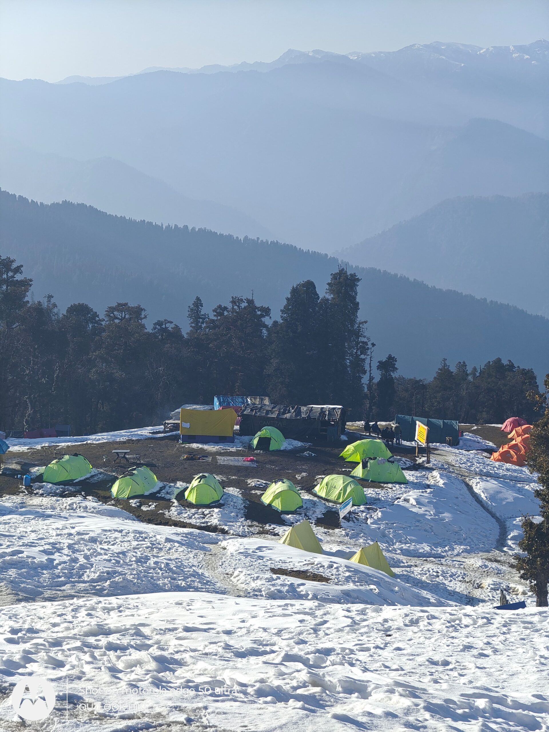
- Day 3 to 6 (Saruwas, Dhanderas, Upper Waterfall, Ronti Gad): Alpine tents (2/3 person sharing)
- High-quality sleeping bags, insulated foam mattresses, and snow/windproof tents provided
Meals (Vegetarian & Nutritious)
- All meals from Day 1 dinner to Day 7 lunch
- Includes: Breakfast, Lunch, Evening Snacks, Dinner + Hot Soup
- Tea/Coffee served twice daily
- Simple, hygienic, and high-energy food such as:
- Dal, rice, roti, seasonal vegetables
- Khichdi, poha, upma, pasta, boiled eggs (on demand)
- Hot soup and dessert on selected days
Trekking Equipment
Waterproof alpine tents
Sub-zero (-10°C) sleeping bags
Thick foam sleeping mats
Gaiters and microspikes (as per snow conditions)
Trekking poles and headlamps (available in limited number on request)
Experienced Trek Team
Certified Trek Leader (Wilderness First Aid trained)
Experienced local mountain guide with terrain knowledge
Trained support staff, cook, helpers, and porter/mule support for common equipment
Safety & First Aid
Daily health check-ups (pulse, oxygen, BP)
Oximeter, basic first-aid kit, and high-altitude sickness protocol
Oxygen cylinder (for emergency use only)
Contingency plan for emergency evacuation (extra cost applicable if used)
Permits & Forest Fees
All required forest entry permits for Himachal Pradesh and Uttarakhand
Camping charges and local panchayat fees
Entry fee for Govind Pashu Vihar National Park
Rupin Pass Trek Package Cost Excludes
Travel from your home city to Shimla and back
Meals during transit between Shimla and Jiskun (Day 1 & Day 7)
Personal trekking gear (shoes, jackets, gloves, headlamps, ponchos, etc.)
Backpack offloading/mule charges (₹300–₹500 per day)
Tips and gratuities for trek leaders, guides, and staff
Bottled water, snacks, energy bars, and personal medicines
Hot water buckets and mobile charging at base camps (if available)
Any extra stay or hotel in Shimla before or after the trek
Travel or trek insurance (not included in package)
Emergency evacuation, medical costs, or ambulance service
Any expenses due to natural calamities, roadblocks, or bad weather
Anything not mentioned under the “Inclusions” section
Rupin Pass Trek Package Cost
Jiskun To Jiskun
₹ 18,500/- PP
₹ 16,500/- PP
- 6 Nights Stay
- Breakfast, Lunch, Dinner
- Forest Fees & Permit
- Trek Guide
- Safety & First Aid
Shimla To Shimla
₹ 22,500/- PP
₹ 20,500/- PP
- Pickup/Drop Ex- Shimla
- 6 Nights Stay
- Breakfast, Lunch, Dinner
- Forest Fees & Permit
- Trek Guide
- Safety & First Aid
Delhi To Delhi
₹ 27,500/- PP
₹ 24,500/- PP
- Pickup/Drop Ex- Delhi
- 6 Nights Stay
- Breakfast, Lunch, Dinner
- Forest Fees & Permit
- Trek Guide
- Safety & First Aid
Rupin Pass Trek Fix Departures
May
10 May - 16 May
15 May - 21 May
18 May - 24 May
24 May - 30 May
Closed
Closed
Closed
Closed
June
5 Jun - 11 Jun
10 Jun - 16 Jun
15 Jun - 21 Jun
22 Jun - 28 Jun
25 Jun - 31 Jun
Closed
Closed
Closed
Closed
Closed
September
9 Sept - 15 Sept
11 Sept - 17 Sept
14 Sept - 20 Sept
17 Sept - 23 Sept
20 Sept - 26 Sept
22 Sept - 28 Sept
25 Sept - 1 Oct
28 Sept - 4 Oct
30 Sept - 6 Oct
Available
Available
Available
Available
Available
Available
Available
Available
Available
October
1 Oct - 6 Oct
5 Oct - 11 Oct
8 Oct - 14 Oct
11 Oct - 16 Oct
15 Oct - 21 Oct
18 Oct - 24 Oct
21 Oct - 27 Oct
22 Oct - 28 Oct
24 Oct - 30 Oct
25 Oct - 31 Oct
Available
Available
Available
Available
Available
Available
Available
Available
Available
Available
How To Reach Rupin Pass Trek
Step-by-Step Guide to Reach Rupin Pass Trek (Shimla to Jiskun Base Village)
1. Reach Shimla – The Nearest Major City (Himachal Pradesh)
By Air:
Jubbarhatti Airport (SLV) is the nearest airport to Shimla (23 km from city)
Connected via Chandigarh and Delhi
From airport, take a taxi to Shimla ISBT or directly hire a cab to Jiskun
By Train:
Nearest major railway station: Kalka (KLK)
Kalka is well-connected to Delhi, Chandigarh, and other northern cities
From Kalka, take the scenic Kalka-Shimla Toy Train or a shared taxi/bus to Shimla
By Bus/Car:
Overnight Volvo and HRTC buses available from Delhi, Chandigarh to Shimla (Kashmere Gate ISBT)
Travel time from Delhi to Shimla: 8–10 hours
Shimla is well-connected by road to major North Indian cities
2. Shimla to Jiskun (Base Village)
Distance: ~200 km
Travel Time: 8–9 hours by road
Route: Shimla → Narkanda → Rampur → Jhakri → Rohru → Kharapathar → Chaupal → Jiskun
Travel Options:
Private taxis available from Shimla (₹6,000–₹8,000 per vehicle)
Shared Bolero/Sumo taxis also run from Shimla to Rohru or nearby villages (then connect to Jiskun)
Roads are mountainous, narrow, and take time—start early in the day
3. Final Stretch: Jiskun to Trek Start
Jiskun is the base village for the Rupin Pass Trek
The trek begins from here—no additional travel required
Basic homestays and accommodations available in Jiskun
Gear check, acclimatization, and briefing will be done here
Summary – How to Reach Rupin Pass Trek
| Route | Mode | Distance & Time |
|---|---|---|
| Delhi to Shimla | Bus / Train / Flight | ~350 km – 8 to 10 hours |
| Shimla to Jiskun | Road (Jeep/Taxi) | ~200 km – 8 to 9 hours |
| Jiskun to Trek Start | On foot | 0 km – Trek starts from Jiskun |
Recommended Route from Major Cities
From Delhi to Rupin Pass:
Delhi → Shimla (overnight bus/train/flight) → Jiskun (shared/private vehicle)
From Mumbai to Rupin Pass:
Mumbai → Chandigarh/Shimla (by flight/train) → Jiskun
From Bangalore to Rupin Pass:
Bangalore → Delhi → Shimla (by flight/train) → Jiskun
Rupin Pass Trek Booking Policy
- Booking is confirmed only after receiving a minimum 30% advance payment
Balance amount to be paid at pickup time.
Payment Options
Online payment via UPI / Bank Transfer / Net Banking / Debit & Credit Cards
Payment receipt will be shared via email or WhatsApp for confirmation
Rupin Pass Trek Cancellation Policy
- 90% refund if cancelled 30+ days before trek date
- 70% refund if cancelled 15–29 days before trek
- 50% refund if cancelled 7–14 days before trek
- No refund if cancelled less than 7 days before trek or no-show
Rupin Pass Trek Essentials
The Rupin Pass Trek is one of the most scenic and adventurous high-altitude treks in India, starting from Jiskun (near Shimla) and ending in Sangla, Himachal Pradesh. This thrilling cross-over trek takes you through dense forests, traditional Himalayan villages, hanging valleys, snow bridges, and the iconic Rupin waterfall, eventually leading to the majestic Rupin Pass at 15,250 ft. With stunning views of the Dhauladhar and Kinnaur ranges, this moderate difficulty trek is perfect for fit beginners and seasoned trekkers. It is best done during May to June and September to October when the trail is clear and the scenery is at its peak.
Whether you’re trekking for adventure, scenic beauty, or high-altitude challenge, the Rupin Pass Trek offers an unforgettable Himalayan experience.
Base Layer (thermal innerwear – top and bottom)
2–3 Full sleeve quick-dry T-shirts (avoid cotton)
2 Insulating Layers (fleece/wool sweaters or light down jacket)
1 Heavy Feather Jacket / Padded Jacket (for summit day)
2 Trek Pants (quick-dry; avoid jeans)
1 Windproof & Waterproof Jacket/Poncho
Thermal Track Pants (for nights)
Warm Innerwear & Undergarments (at least 2–3 pairs)
1 pair of high-ankle trekking shoes (snow/water-resistant)
1 pair of slippers / sandals for campsite use
Optional: Gaiters (for heavy snow)
Trekking backpack (40–50L) with rain cover
Daypack (10–15L) for summit day
Trekking pole (highly recommended)
Headlamp / torch with spare batteries
Water bottles (2 x 1L) or hydration bladder
Sunglasses (UV-protected)
Power bank
Ziplock / dry bags for organizing
Optional: Camera or GoPro
Toothbrush + toothpaste
Biodegradable soap / face wash
Lip balm (essential for cold cracks)
Cold cream / moisturizer
Sunscreen (SPF 50+)
Quick-dry towel
Toilet paper / tissues
Hand sanitizer
Menstrual hygiene products (as required)
Wet wipes (optional but useful)
Paracetamol / Ibuprofen
Diamox (only after doctor’s advice)
Band-aids / blister patches
Antiseptic cream
Crepe bandage
Personal medication
ORS / Glucose / Electrolyte powder
Original Government ID proof (Aadhar, Passport, Voter ID)
Medical fitness certificate (if required by trek operator)
Trek disclaimer form (provided by operator)
Trek booking confirmation / permit copy (if applicable)
Rupin Pass Trek Fitness
Fitness for Rupin Pass Trek – Are You Trek-Ready?
The Rupin Pass Trek is classified as a moderate to difficult high-altitude trek, suitable for experienced beginners and seasoned trekkers. It climbs up to 15,250 ft, with long trekking days, steep climbs, and rapid altitude gain—demanding strong fitness and mental resilience.
Basic Fitness Requirements
Age Group: 15–55 years (active and healthy individuals)
Ability to walk 8–10 km/day on rough terrain with steep gradients
Comfort with 6–9 hours of trekking at high altitude
No major cardiac, asthma, or breathing disorders
Strong mental endurance for snowfields, boulder sections, and glacier crossings
Why Fitness Matters on Rupin Pass Trek
High Altitude: Max altitude is 15,250 ft, where oxygen drops significantly
Tough Terrain: Trail includes steep ascents, river crossings, and slippery paths
Weather Challenges: Sudden rain, snow, and wind can test your stamina
Pass Crossing Day: Longest and most strenuous day (~12–14 km) over snow and scree
Pre-Trek Fitness Plan (Start 4–6 Weeks in Advance)
1. Cardio Endurance (5 days/week)
Jogging or brisk walking – 4–6 km
Stair climbing – 4–5 floors, 4 sets
Optional: Cycling or swimming
2. Strength Training (3–4 days/week)
Squats – 3 sets of 15
Lunges – 3 sets per leg
Planks – Hold for 45–60 seconds
Core & back exercises – Crunches, mountain climbers
3. Flexibility & Recovery
Stretching (legs, hamstrings, back) – 10 mins daily
Light yoga, mobility drills, or foam rolling
Quick Tips for Trek Fitness
Practice walking with a loaded backpack (6–8 kg)
Do short weekend treks to test endurance
Stay hydrated and avoid junk food/alcohol 2 weeks prior
Get medical clearance if unsure about altitude or fitness
Who Should Avoid Rupin Pass Trek
People with severe asthma, heart conditions, epilepsy
Those recovering from recent surgeries or injuries
Trekkers with chronic altitude sickness history
Rupin Pass Trek FAQ's
Is Rupin Pass Trek suitable for first-time trekkers?
Rupin Pass is a moderate to difficult level trek and not ideal for absolute beginners. Prior trekking experience or good physical fitness is recommended due to steep ascents, long walking hours, and high-altitude challenges.
What is the best month to do the Rupin Pass Trek?
The best time to do the Rupin Pass Trek is May to June and September to early October. During these months, the weather is stable, snow bridges are accessible, and meadows are lush.
How difficult is the Rupin Pass Trek for average fitness levels?
The trek is challenging for those with average fitness. Trekkers must be able to walk 7–9 km a day with steep climbs and rough terrain. Pre-trek cardio and leg strength training are essential.
How to prepare for Rupin Pass Trek physically and mentally?
Begin preparing at least 4 weeks in advance. Do regular cardio (jogging, stair climbing), strength training (squats, lunges), and mental conditioning like hiking with a backpack or cold showers to adapt to altitude.
What permits are required for Rupin Pass Trek?
Trekkers need forest entry permits and camping permissions from Govind Pashu Vihar National Park and Himachal authorities. These are generally included in the trek package.
Can Rupin Pass Trek be done solo without a guide?
Technically yes, but it’s not recommended due to remote trails, unclear markings, and risky snow crossings. It’s best to go with an experienced trek operator or local guide.
What is the mobile network availability during Rupin Pass Trek?
Mobile networks are available only till Sangla and Jiskun. Beyond that, there’s no signal throughout the trek. It’s advised to inform family before you begin the hike.
What are the temperature and weather conditions during Rupin Pass Trek?
In summer, daytime temperatures range from 10°C to 18°C, and nights drop to 0°C to -5°C. In post-monsoon, it gets colder with chances of early snowfall at higher camps.
What should I pack for the Rupin Pass Trek?
Essentials include:
Warm layers (down jacket, thermals)
Trekking shoes
Poncho/raincoat
Woollen cap, gloves, and socks
40–60L backpack
Trekking pole, sunglasses, sunscreen
Personal medicines and first aid
What is the total distance covered in Rupin Pass Trek?
The trek spans approximately 52–60 km over 7 days, starting from Jiskun/Sangla in Himachal Pradesh and ending at Sangla or nearby villages in Uttarakhand.
Is it safe to trek Rupin Pass during monsoon?
No, July and August are not safe due to heavy rainfall, slippery trails, landslides, and increased risk of flash floods. Always avoid the monsoon window for this trek.
Where does Rupin Pass Trek start and end?
The trek typically starts from Dhaula or Jiskun (near Shimla, Himachal) and ends in Sangla (Himachal Pradesh), crossing over the high-altitude Rupin Pass at 15,250 ft.
How to reach the starting point of Rupin Pass Trek from Shimla?
Take a local/shared taxi or private cab from Shimla to Dhaula or Jiskun via Rohru and Mori. The journey takes about 9–10 hours (approx. 200–220 km).
What kind of shoes are best for Rupin Pass Trek?
Use high-ankle trekking shoes with good grip and waterproofing. Brands like Quechua, Columbia, or Wildcraft offer affordable options suitable for rocky and snowy terrains.
How much does the Rupin Pass Trek cost from Shimla?
A 7-day Rupin Pass Trek package from Shimla usually costs between ₹11,000 to ₹15,000, depending on inclusions like transportation, meals, guide, camping, and permits.
Which is best travel company for Rupin Pass trek?
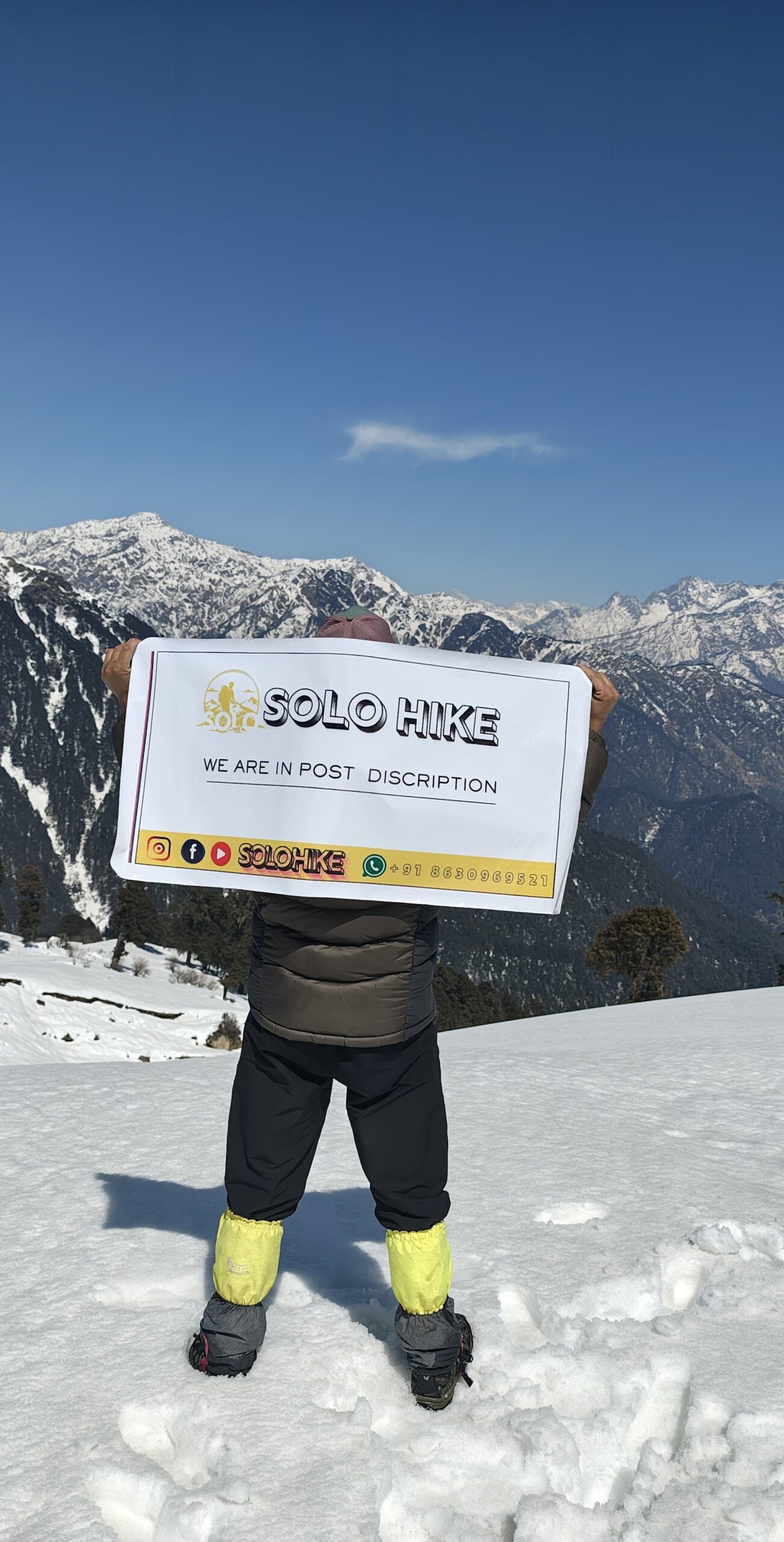
Solo Hike is Uttarakhand based travel company, providing Rupin Pass trek services since 10 years. Solo Hike help you to get the package from Jiskun, Shimla and even from Delhi too, with best and affordable prices.
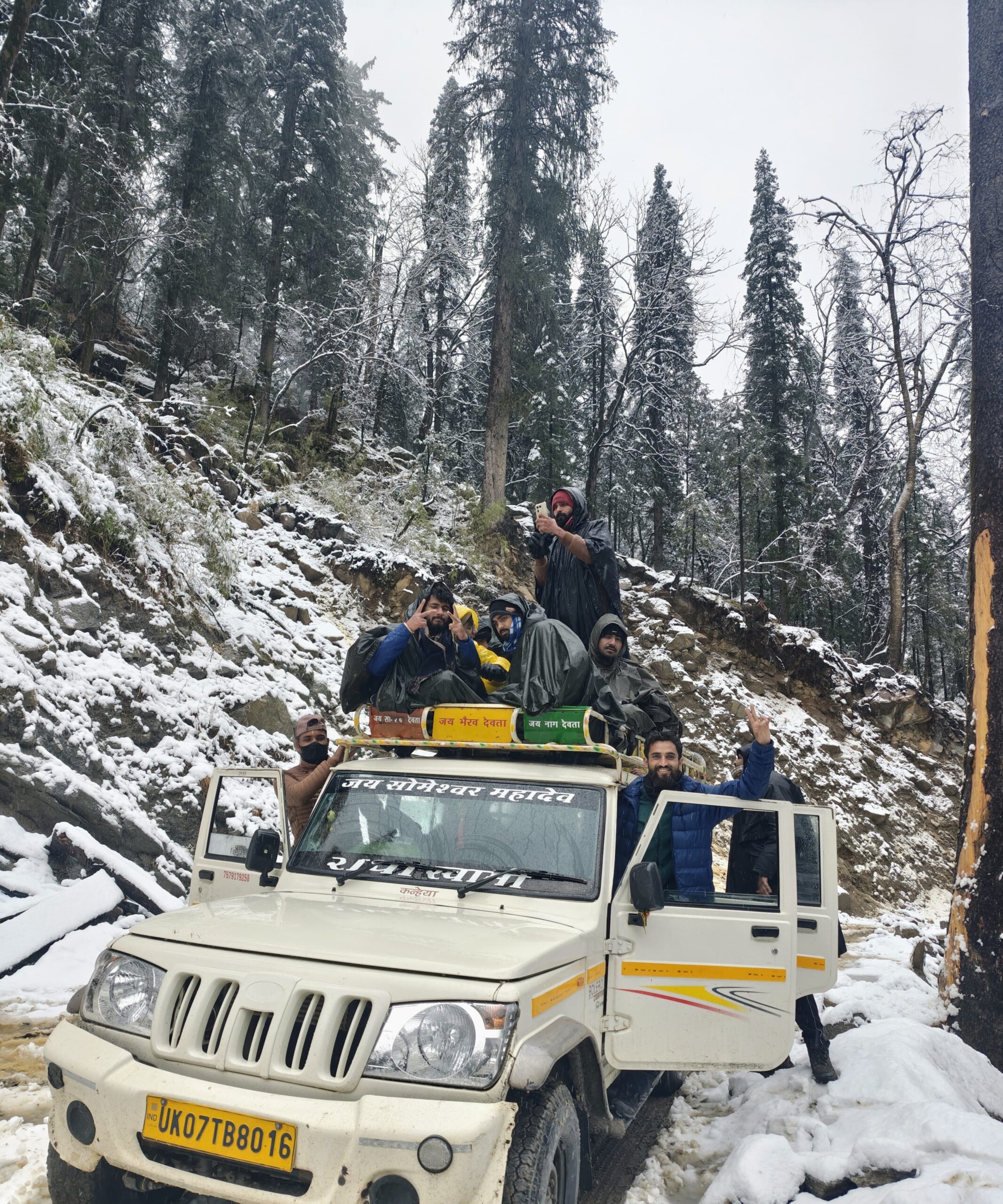
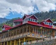
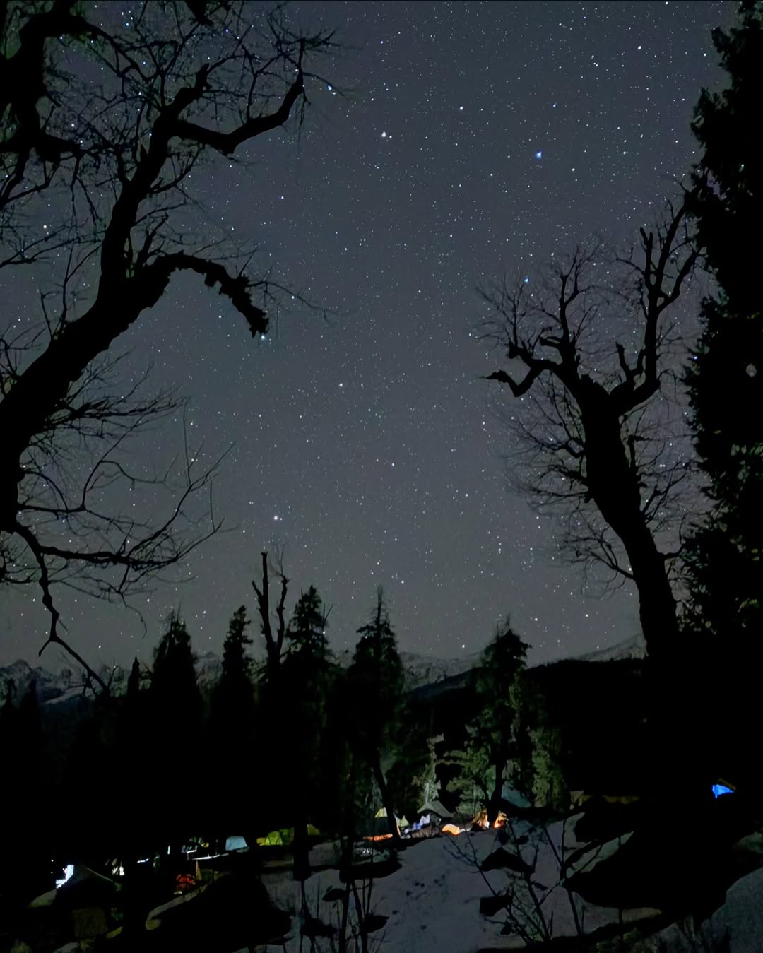
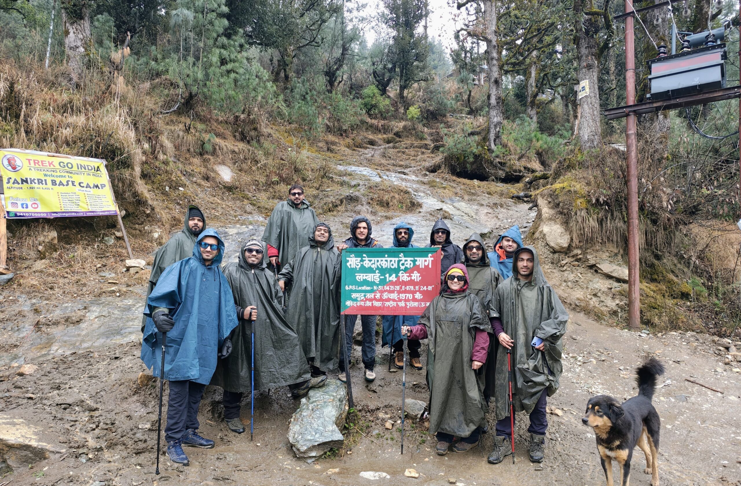
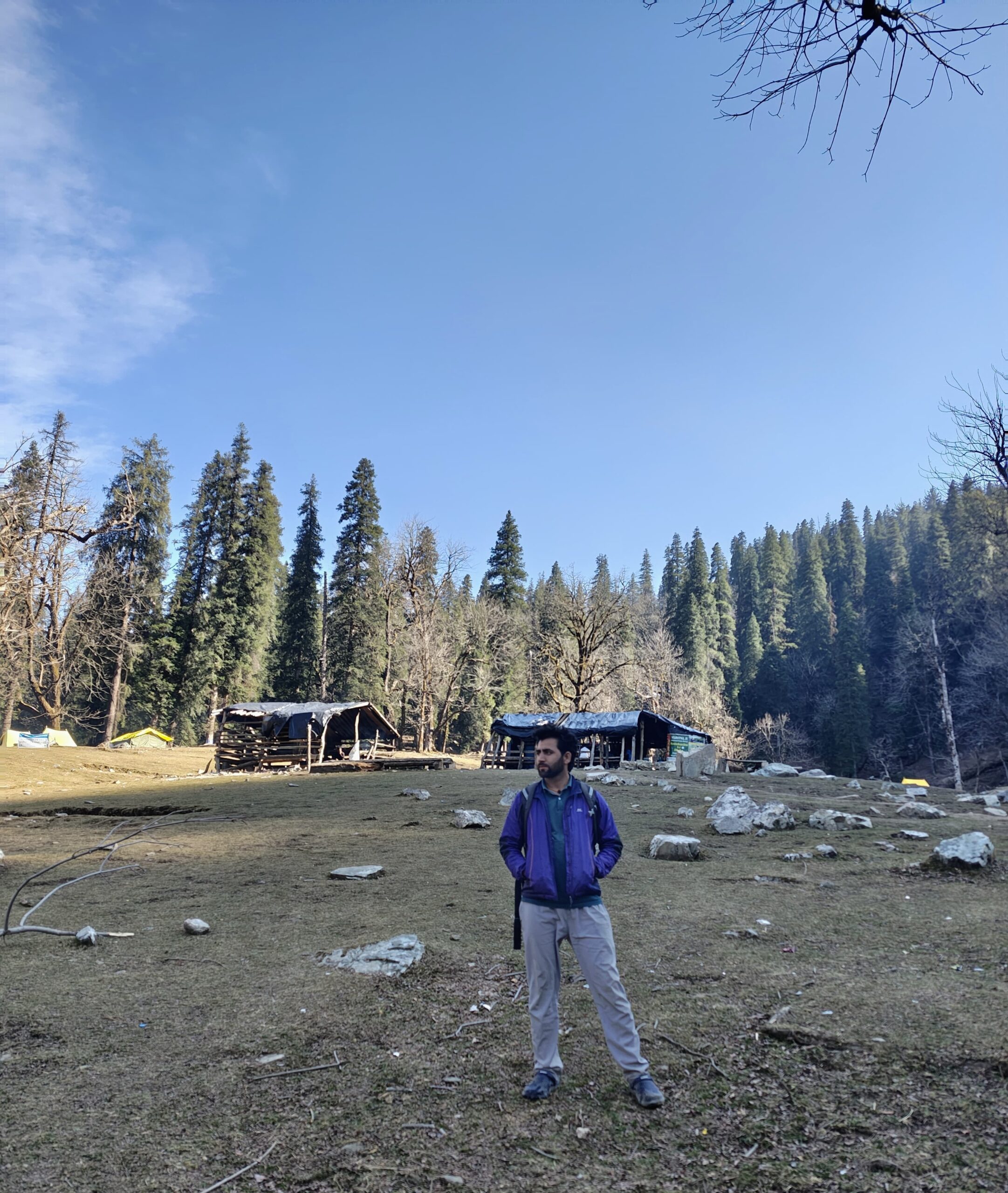
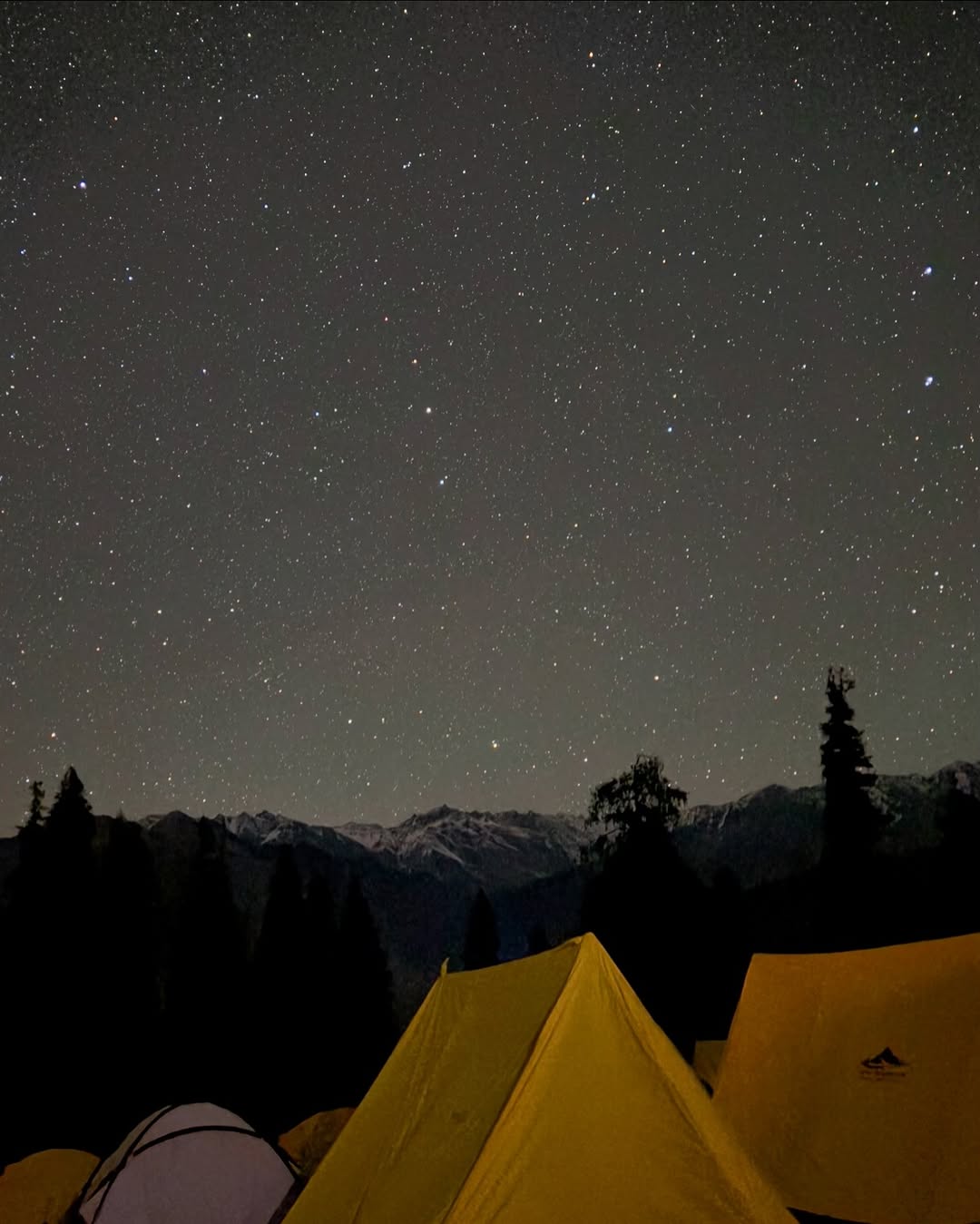
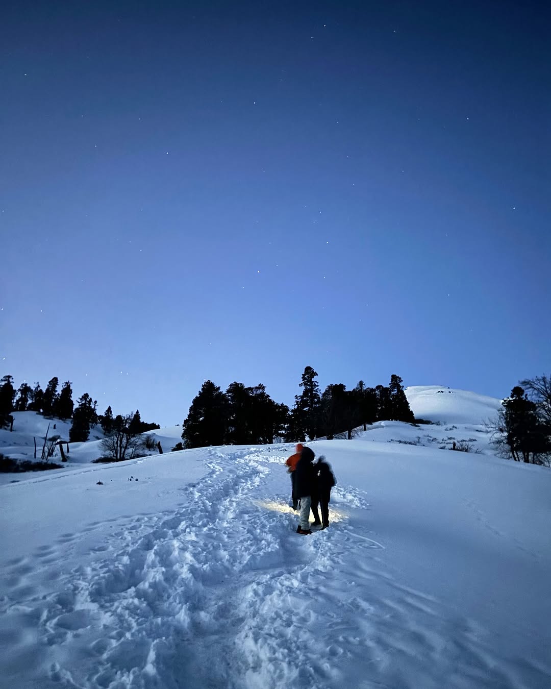
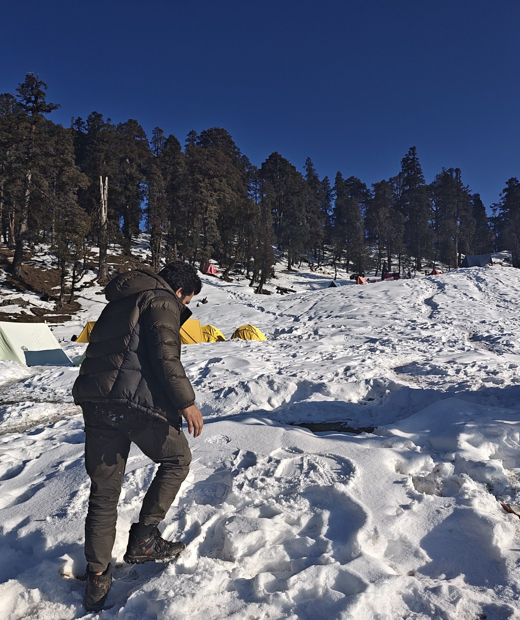
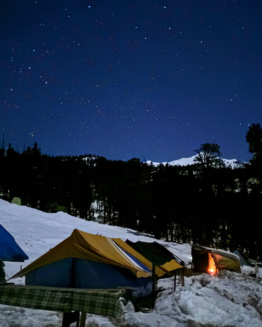
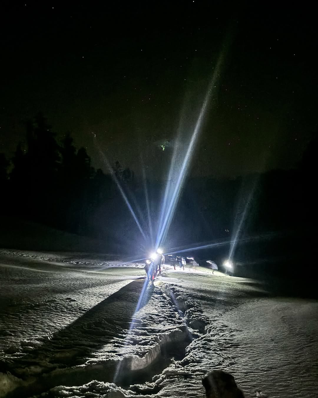
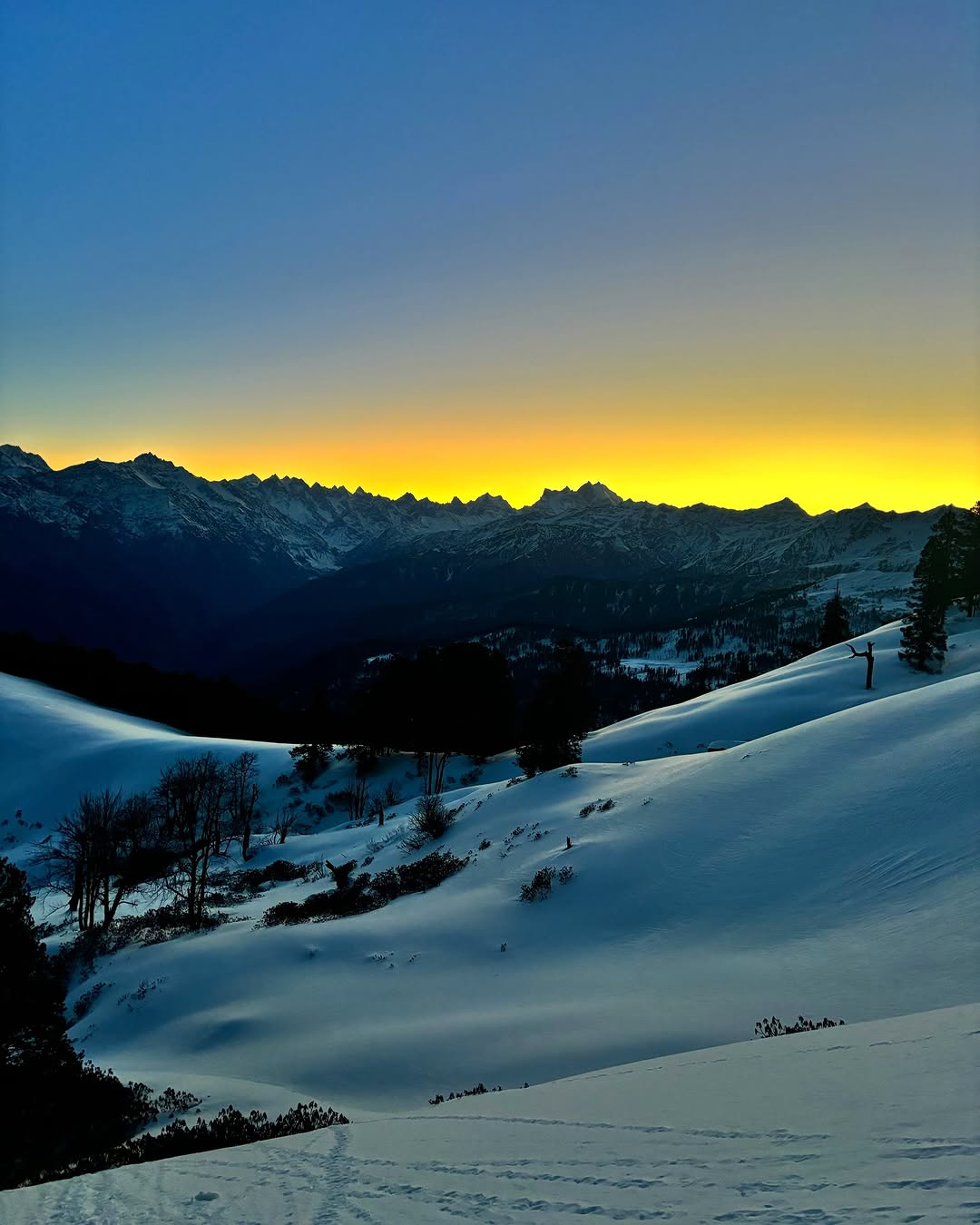
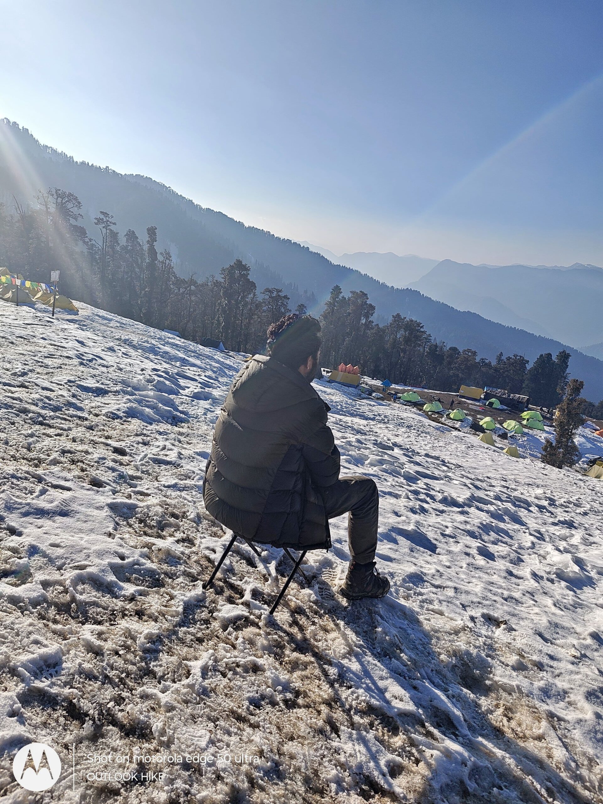
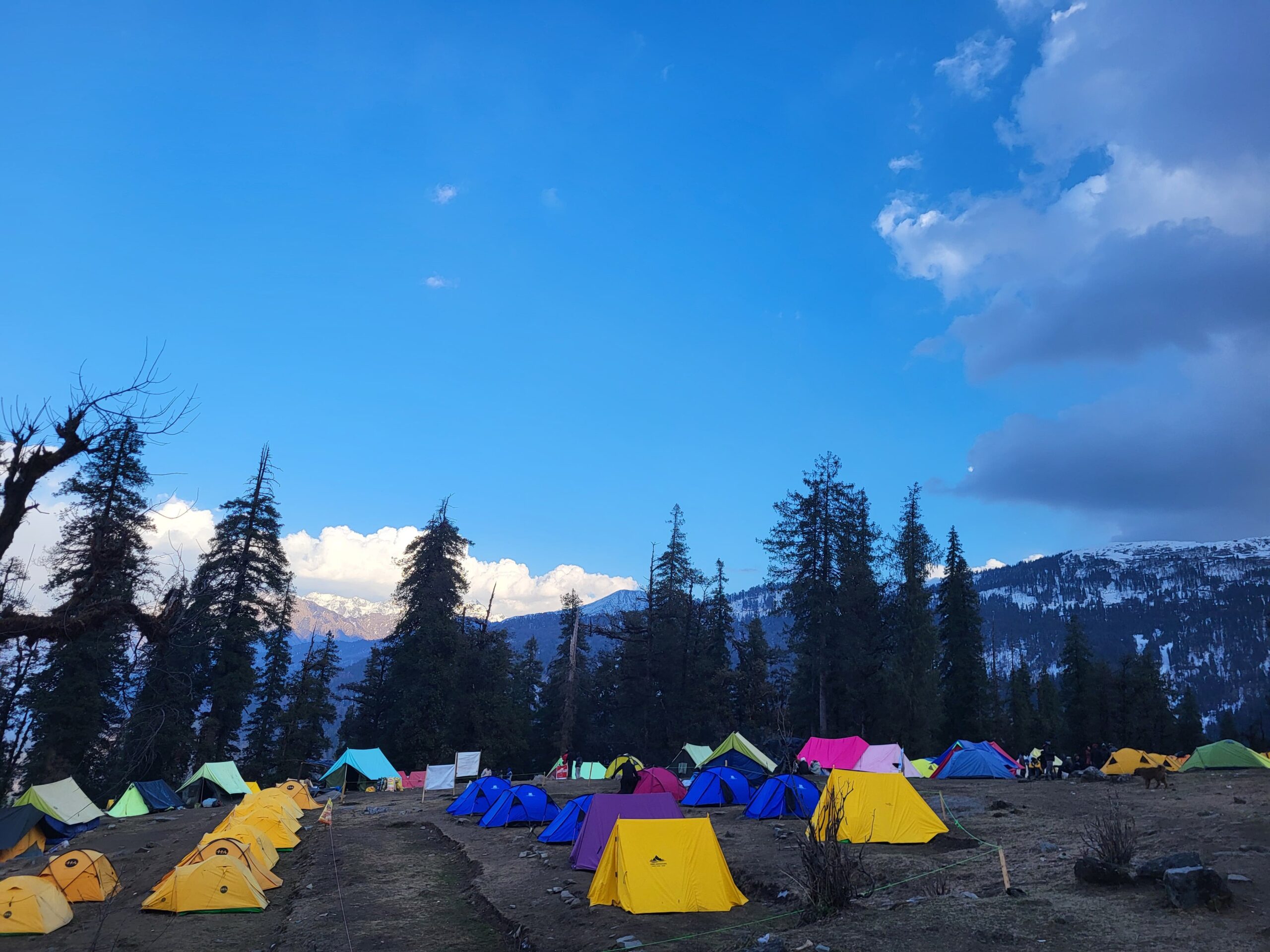
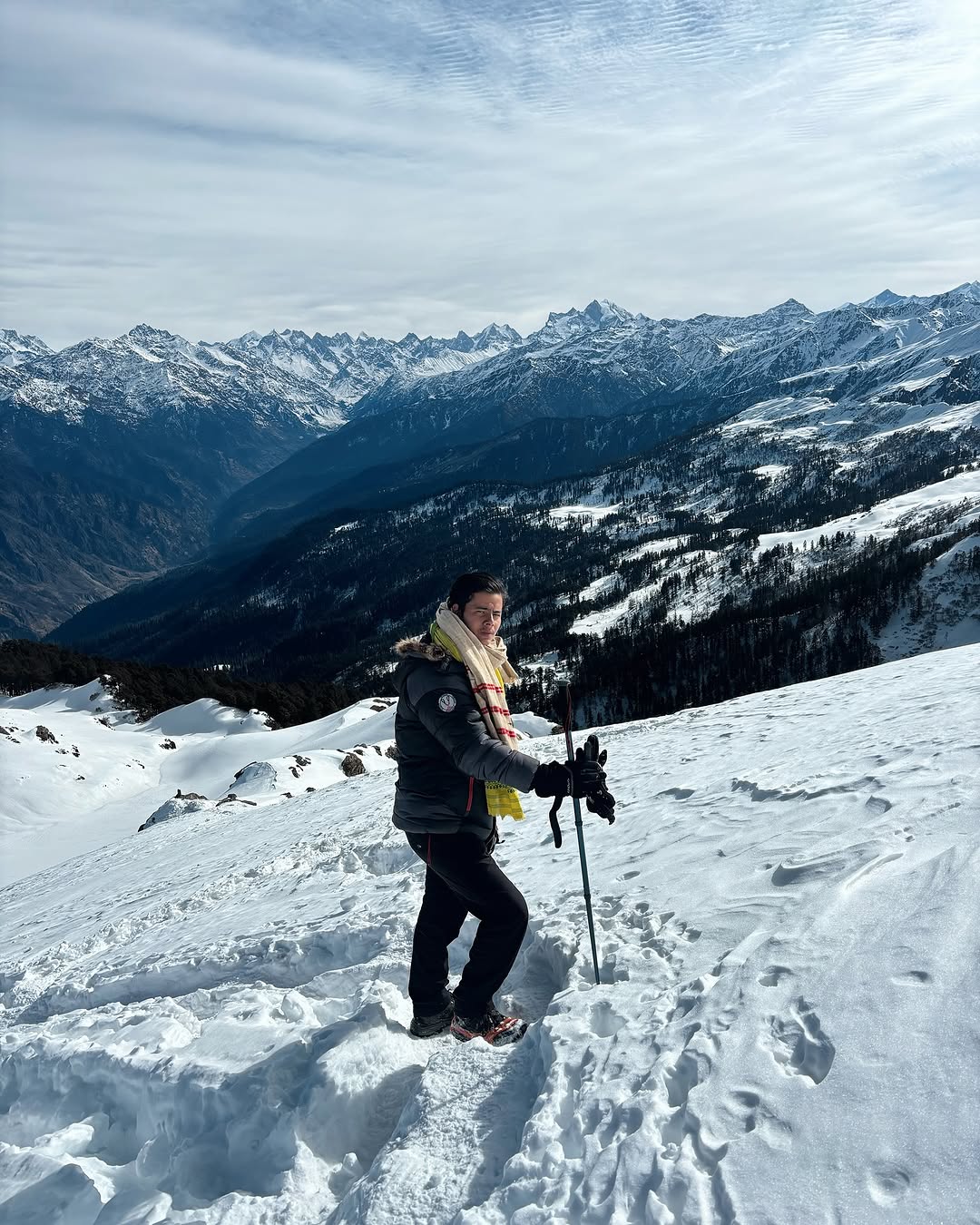
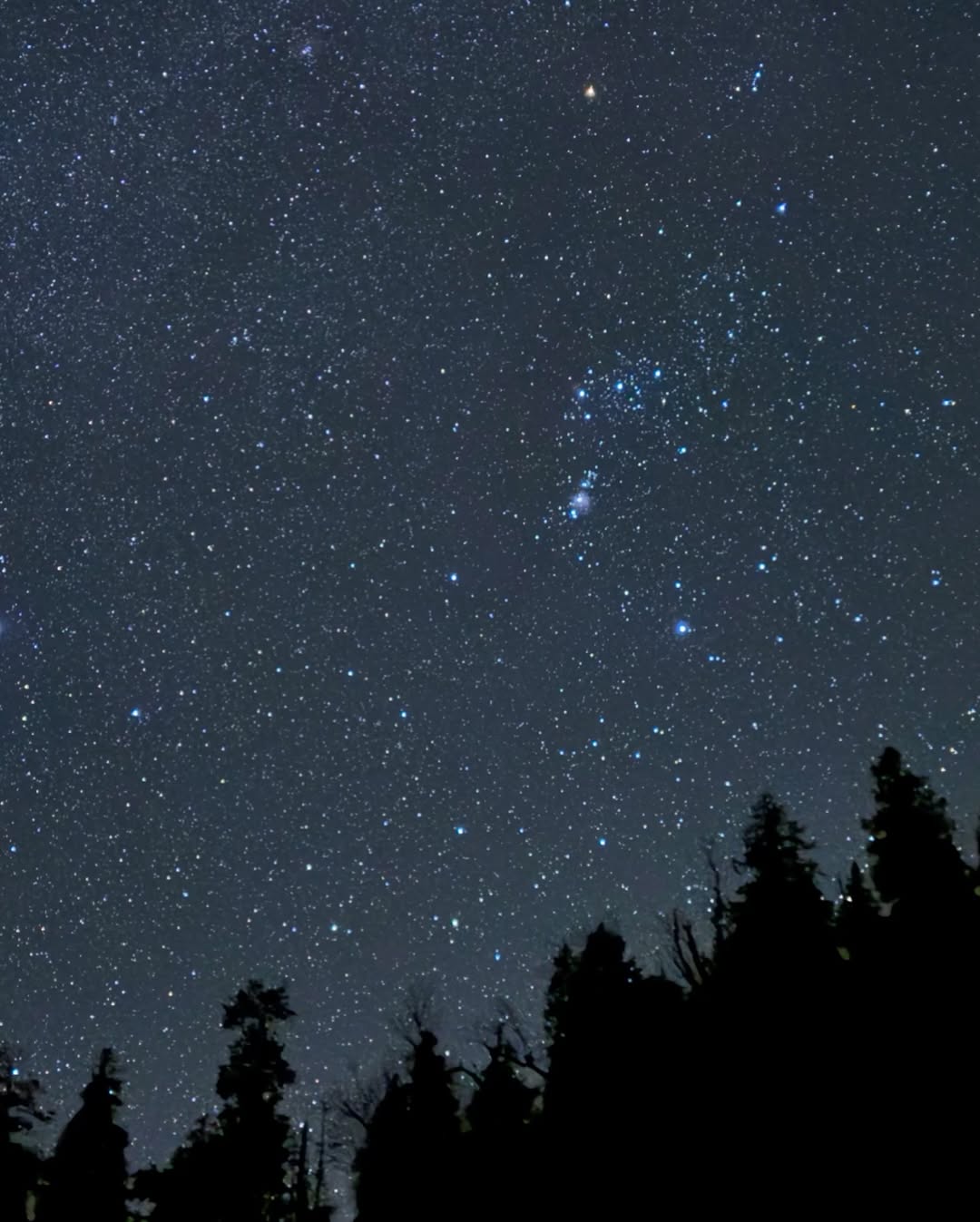
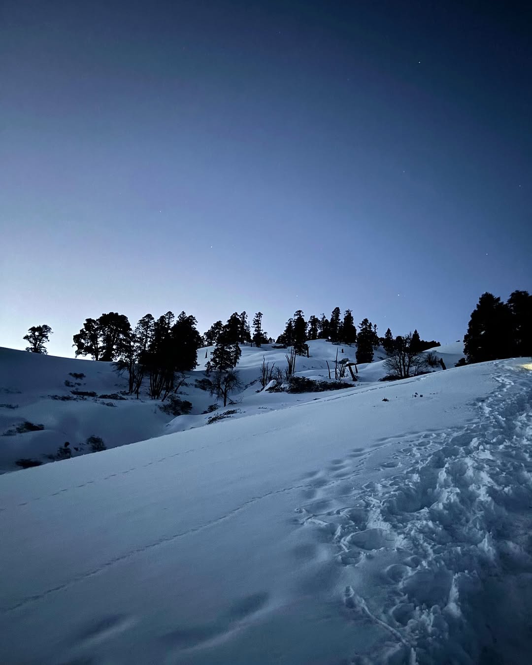
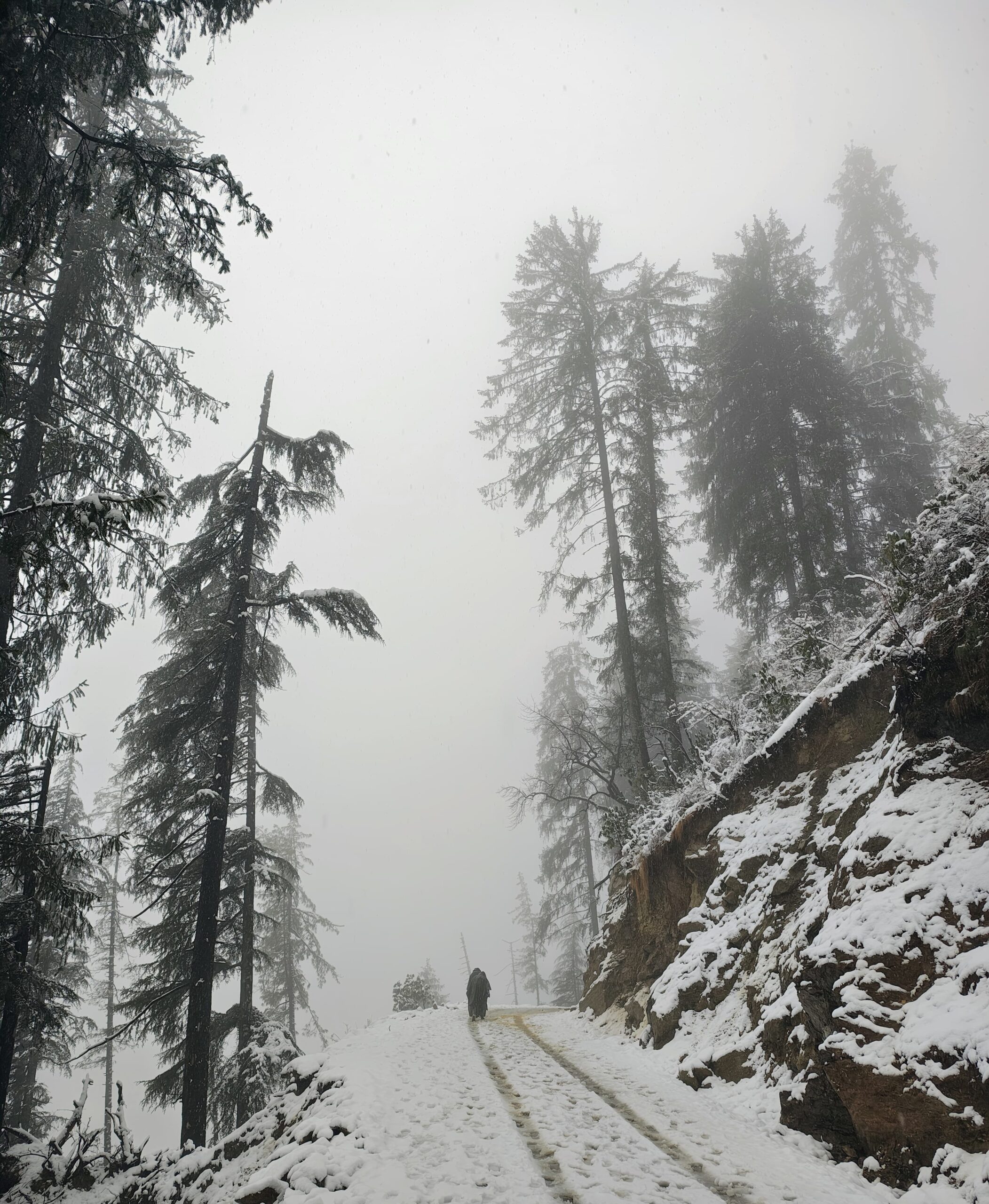
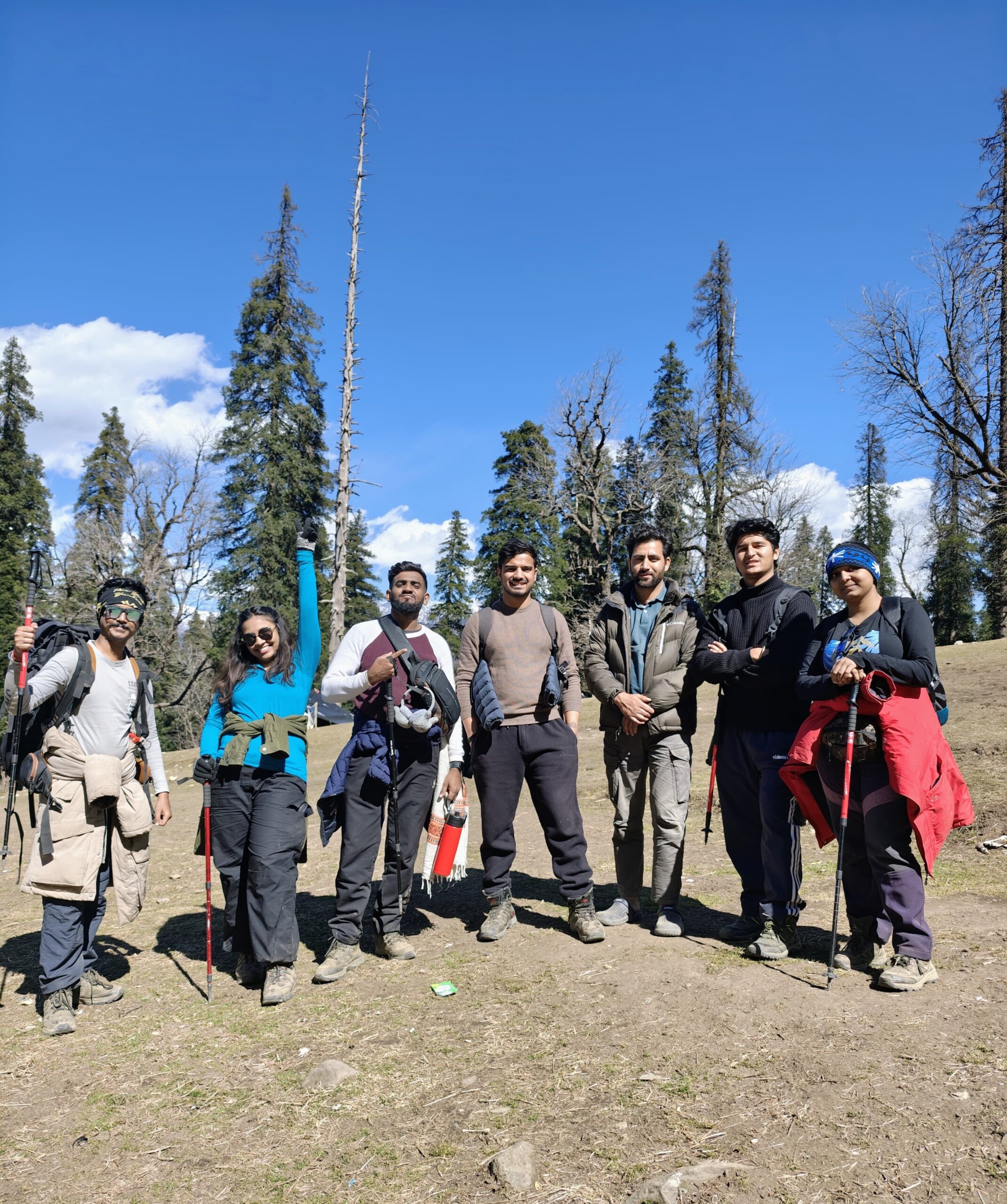
RUPIN PASS TREK PHOTOS
Read More About Rupin Pass Trek
Best Time To Visit Rupin Pass Trek
Discover the best time to visit Rupin Pass Trek for stunning views, snow crossings, and blooming meadows. Plan your trek between May–June or September–October for ideal weather and unforgettable adventure.
Best Time To Visit Rupin Pass Trek
Discover the best time to visit Rupin Pass Trek for stunning views, snow crossings, and blooming meadows. Plan your trek between May–June or September–October for ideal weather and unforgettable adventure.
Best Time To Visit Rupin Pass Trek
Discover the best time to visit Rupin Pass Trek for stunning views, snow crossings, and blooming meadows. Plan your trek between May–June or September–October for ideal weather and unforgettable adventure.
RELATED TREKS

